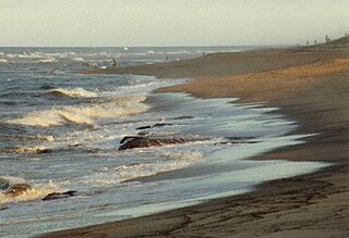
Harwich is a New England town on Cape Cod, in Barnstable County in the state of Massachusetts in the United States. At the 2020 census it had a population of 13,440. Harwich experiences a seasonal increase to roughly 37,000. The town is a popular vacation spot, located near the Cape Cod National Seashore. Harwich's beaches are on the Nantucket Sound side of Cape Cod. Harwich has three active harbors. Saquatucket, Wychmere and Allen Harbors are all in Harwich Port. The town of Harwich includes the villages of Pleasant Lake, West Harwich, East Harwich, Harwich Port, Harwich Center, North Harwich and South Harwich.

Cape Cod is a peninsula extending into the Atlantic Ocean from the southeastern corner of Massachusetts, in the northeastern United States. Its historic, maritime character and ample beaches attract heavy tourism during the summer months. The name Cape Cod, coined in 1602 by Bartholomew Gosnold, is the ninth oldest English place-name in the U.S.

Barnstable County is a county in the U.S. state of Massachusetts. At the 2020 census, the population was 228,996. The county seat is Barnstable. The county consists of Cape Cod and associated islands. Barnstable County was formed as part of the Plymouth Colony on June 2, 1685, including the towns of Falmouth, Sandwich, and others to the east and north on Cape Cod. Plymouth Colony was merged into the Province of Massachusetts Bay in 1691.

Eastham is a town in Barnstable County, Massachusetts, United States, Barnstable County being coextensive with Cape Cod. The population was 5,752 at the 2020 census.

Mashpee is a town in Barnstable County, Massachusetts, United States, on Cape Cod. The population was 15,060 as of 2020. The town is the site of the headquarters and most members of the Mashpee Wampanoag Tribe, one of two federally recognized Wampanoag groups.

Truro is a town in Barnstable County, Massachusetts, United States, comprising two villages: Truro and North Truro. Located slightly more than 100 miles (160 km) by road from Boston, it is a summer vacation community just south of the northern tip of Cape Cod, in an area known as the "Outer Cape". English colonists named it after Truro in Cornwall, United Kingdom.

Bourne is a town in Barnstable County, Massachusetts, United States. The population was 20,452 at the 2020 census.

Brewster is a town in Barnstable County, Massachusetts, United States, Barnstable County being coextensive with Cape Cod. The population of Brewster was 10,318 at the 2020 census.

Chatham is a town in Barnstable County, Massachusetts, United States. Chatham is located at the southeastern tip of Cape Cod and has historically been a fishing community. First settled by the English in 1664, the township was originally called Monomoit based on the indigenous population's term for the region. Chatham was incorporated as a town on June 11, 1712, and has become a summer resort area. The population was 6,594 at the 2020 census and can swell to 25,000 during the summer months. There are four villages that comprise the town, those being Chatham (CDP), South Chatham, North Chatham, and West Chatham. Chatham is home to the Monomoy National Wildlife Refuge and the decommissioned Monomoy Point Light, both located on Monomoy Island. A popular attraction is the Chatham Light, which is an operational lighthouse that is operated by the United States Coast Guard.

Orleans is a town in Barnstable County, Massachusetts, United States, situated along Cape Cod. The population was 6,307 at the 2020 census.

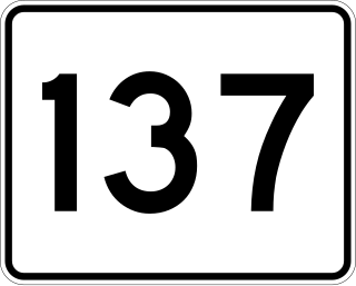
Massachusetts Route 137 is a 6.833-mile-long (10.997 km) north–south state route on Cape Cod in the U.S. state of Massachusetts. The route begins at an intersection with Route 28 in the town of Chatham. The route serves as a connector between Chatham, the town of Harwich and Brewster. In Brewster, Route 137 ends at a junction with Route 6A, a short distance southwest of Route 124.

Nauset Regional High School is an NEASC accredited high school located in Eastham, Massachusetts, United States and a part of Nauset Public Schools. Nauset is inside the Cape Cod National Seashore, making it the only high school on the East Coast located within a National Park. The open campus is situated about a half-mile from Nauset Light. Nauset's colors are Black and Gold and the school's mascot is the Warrior.

Cape Cod Regional Technical High School, also known as Cape Tech, Cape Cod Tech, Lower Cape Tech, and sometimes abbreviated as CCT, is a public vocational and technical high school located in Harwich, Massachusetts, United States.
Harwich High School was a public high school located in Harwich, Massachusetts, United States. Harwich High School was the third smallest public high school on Cape Cod. Harwich High School closed in 2013-2014 due to the towns of Harwich and Chatham deciding to regionalize their school districts and build a regional high school. The new high school is Monomoy Regional High School, which opened in 2014.

Provincetown Public Schools, also known as Provincetown School District, or Provincetown IB Schools, is the school district of Provincetown, Massachusetts, serving grades Kindergarten through 8.
Chatham High School was a public high school located in Chatham, Massachusetts. Chatham served roughly 250 students in grades 9–12. Chatham's mascot was the Blue Devils and the school's colors were Royal Blue and White. In September 2014, Chatham merged with Harwich High School of Harwich to become the new Monomoy Regional High School.

North Harwich is a village in the town of Harwich in Barnstable County, Massachusetts, United States. The village is located within the census-designated place of Northwest Harwich.
Monomoy Regional High School is a regional secondary school located in Harwich, Massachusetts, United States, and within Monomoy Regional School District. Monomoy Regional High School serves approximately 625 students in grades 8-12 from the towns of Chatham and Harwich.
The Monomoy Regional School District is a public school district established in 2014 which serves Chatham and Harwich, Massachusetts. The schools in MRSD include Monomoy Regional High School, Monomoy Regional Middle School, Chatham Elementary School and Harwich Elementary School.

B.F.C. Whitehouse Field, or Whitehouse Field, is a baseball venue in Harwich, Massachusetts, home to the Harwich Mariners of the Cape Cod Baseball League (CCBL).


