Tisbury, Massachusetts

Last updated

Tisbury, Massachusetts
Tisburymassachusettsharbor.jpg
TisburyMA-seal.png
Dukes County Massachusetts incorporated and unincorporated areas Tisbury highlighted.svg
Location in Dukes County in Massachusetts
Coordinates: 41°27′22″N70°36′40″W / 41.45611°N 70.61111°W / 41.45611; -70.61111
CountryUnited States
State Massachusetts
County Dukes
Settled1660
IncorporatedJuly 8, 1671
Government
  Type Open town meeting
Area
  Total19.1 sq mi (49.5 km2)
  Land6.5 sq mi (16.9 km2)
  Water12.6 sq mi (32.6 km2)
Elevation
89 ft (27 m)
Population
 (2020)
  Total4,815
  Density738/sq mi (284.9/km2)
Time zone UTC-5 (Eastern)
  Summer (DST) UTC-4 (Eastern)
ZIP code
02568
Area code 508 / 774
FIPS code 25-69940
GNIS feature ID0619443
Website www.tisburyma.gov

Tisbury is a town located on Martha's Vineyard in Dukes County, Massachusetts, United States. The population was 4,815 at the 2020 census. [1]

Contents

Vineyard Haven is the main village/town center of Tisbury. The two names are used interchangeably. [2] As can be seen in the history section below, the town of Tisbury was incorporated within the Commonwealth of Massachusetts in 1671, and remains the legal name of the town to this day. However, the port and harbor have had varying names. "Holmes Hole" was one of the first names of the port within the town of Tisbury. This name was later changed to "Vineyard Haven", which is the official post office name for the community. To residents of Martha's Vineyard, "Vineyard Haven" is by far the more common usage, although residents recognize Tisbury as the town's legal name.

Vineyard Haven in Tisbury is the main port of entrance to Martha's Vineyard, and is the only operational port on the island during most of the year.

History

Northern view of Holmes Hole, East Tisbury, 1841 Northern view of Holmes Hole, East Tisbury.jpg
Northern view of Holmes Hole, East Tisbury, 1841

The Wampanoag have lived on Martha's Vineyard, which they called Noepe, continuously for approximately 5,000-15,000 years. [3] The first English maritime explorer, Bartholomew Gosnold, came in 1602. Six decades later, in 1660, Tisbury was first settled by James Allen, William Peabody and Lt. Josiah Standish, a son of Captain Myles Standish. It was officially incorporated in 1671 by Francis Lovelace, Governor General of New York. The town, which originally included the lands of West Tisbury, was named for Tisbury, Wiltshire, England, the hometown of Martha's Vineyard Governor Mayhew. Citizens of the island, unhappy with the leadership of Governor Mayhew, petitioned William III and Mary II in 1673 for a change of leadership, and the entire island, including the town, became a part of Massachusetts. [4]

The town was divided into its current boundaries in 1892.

The town has long thrived on the sea, and is now the home of the main ferry docks for the island. The island's first and primary ferry line is the Steamship Authority, which runs to and from Woods Hole, New Bedford, and Nantucket (in the summer months from the Oak Bluffs terminal), all in Massachusetts. There are several other private ferry lines that serve Martha's Vineyard as well, with terminals in the towns of Oak Bluffs and Edgartown. To get an idea of the embarkation in summer of passengers, tourists primarily, and goods, see the early scene in the movie Jaws which shows the debarkation on "Amity Island" of a typical boatload in summer at the Vineyard Haven Steamship Authority facility from the steamship Naushon . At the time of the filming of Jaws in 1975 this was the largest of the ferries, running only in the summer months for its high passenger capacity. It ceased service in 1987 [5] and has been replaced by more modern vessels.

Like the rest of Martha's Vineyard, is a popular summer resort for the rich and famous. Residents of Tisbury have included Art Buchwald, William Styron, Mike Wallace, Lillian Hellman, Carly Simon, Thornton Wilder, Dashiell Hammett, Katharine Cornell, and Diane Sawyer.

Flask, the third mate of the Pequod in Herman Melville's Moby-Dick , hails from Tisbury. [6]

Geography

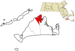
According to the United States Census Bureau, the town of Tisbury has a total area of 19.1 square miles (49.5 km2), of which 6.5 square miles (16.9 km2) is land and 12.6 square miles (32.6 km2), or 65.79%, is water. [7] The town ranks 329th out of the 351 communities in the Commonwealth in terms of land area, and is sixth out of the seven towns of Dukes County (only Aquinnah is smaller). Tisbury is bordered by Vineyard Haven Harbor, Lagoon Pond and Oak Bluffs to the east, West Tisbury to the southwest, and Vineyard Sound to the northwest. The town shares a common corner, along with West Tisbury and Oak Bluffs, with Edgartown. Localities of the town include Vineyard Haven, Makonikey, Pilot Hill, West Chop, and Lambert's Cove.

Measuring from the western shore of Tisbury to Nobska Point at Woods Hole (town of Falmouth), the town is 3.3 miles (5.3 km) from the mainland (Cape Cod), the closest point on the Vineyard. Most of central Tisbury is low-lying and near sea level, with elevations rising to 150 feet (46 m) in places. West Chop is the northernmost point on the Vineyard, tipped by the West Chop Light. The town is also home to Lake Tashmoo, just south of the tip of West Chop.

Demographics

Historical population
YearPop.±%
1850 1,803    
1860 1,631−9.5%
1870 1,536−5.8%
1880 1,518−1.2%
1890 1,506−0.8%
1900 1,149−23.7%
1910 1,196+4.1%
1920 1,275+6.6%
1930 1,541+20.9%
1940 1,966+27.6%
1950 1,930−1.8%
1960 2,169+12.4%
1970 2,257+4.1%
1980 2,972+31.7%
1990 3,120+5.0%
2000 3,755+20.4%
2010 3,949+5.2%
2020 4,815+21.9%
2022*4,886+1.5%
* = population estimate. [8]

As of the census [9] of 2000, there were 3,755 people, 1,646 households, and 902 families residing in the town. The population density was 572.4 inhabitants per square mile (221.0/km2). There were 2,720 housing units at an average density of 414.7 per square mile (160.1/km2). The racial makeup of the town was 90.04% White, 2.96% African American, 1.36% Native American, 0.32% Asian, 0.05% Pacific Islander, 1.33% from other races, and 3.94% from two or more races. Hispanic or Latino of any race were 1.04% of the population.

A large percentage of the white population is of Portuguese descent, and a great number of "Native Islanders" (born on the island) within the community are of mixed ethnicity such as Portuguese, Native American (Wampanoag Indian), and African American families who have been there for generations, primarily tied to maritime ventures of fishing, whaling, and the fitting out of whaleships.

There were 1,646 households, out of which 25.5% had children under the age of 18 living with them, 40.9% were married couples living together, 10.3% had a female householder with no husband present, and 45.2% were non-families. 36.7% of all households were made up of individuals, and 13.5% had someone living alone who was 65 years of age or older. The average household size was 2.21 and the average family size was 2.92.

In the town, the population was spread out, with 21.5% under the age of 18, 5.5% from 18 to 24, 28.6% from 25 to 44, 26.5% from 45 to 64, and 17.9% who were 65 years of age or older. The median age was 42 years. For every 100 females, there were 88.0 males. For every 100 females age 18 and over, there were 83.7 males.

The median income for a household in the town was $37,041, and the median income for a family was $53,051. Males had a median income of $38,452 versus $29,034 for females. The per capita income for the town was $26,783. About 7.7% of families and 12.2% of the population were below the poverty line, including 22.9% of those under age 18 and 6.7% of those age 65 or over.

In terms of population, Tisbury ranks 267th in the Commonwealth and second only to Edgartown in Dukes County in terms of year-round population. The town ranks 167th statewide in terms of population density, below the mean but above the median. It is the most densely populated town in Dukes County.

There is a substantial dichotomy between the wealth of the year-round residents, which is generally below the Massachusetts median, and that of the summer residents, who tend to be quite wealthy.

Government

The Lighthouse of Tisbury (West Chop Light) in 1891 Tisbury Lighthouse 1891.jpg
The Lighthouse of Tisbury (West Chop Light) in 1891

On the national level, Tisbury is a part of Massachusetts's 9th congressional district, and is currently represented by Bill Keating. Massachusetts is currently represented in the United States Senate by senior Senator Elizabeth Warren and junior Senator Ed Markey. On the state level, Tisbury is represented in the Massachusetts House of Representatives as a part of the Barnstable, Dukes and Nantucket district, which includes all of Martha's Vineyard and Nantucket, as well as a portion of Falmouth. The town is represented in the Massachusetts Senate as a portion of the Cape and Islands district, which includes all of Martha's Vineyard, Nantucket and most of Barnstable County (with the exception of Bourne, Sandwich, Falmouth and a portion of Barnstable). [10] All of Dukes County is patrolled by the Fifth (Oak Bluffs) Barracks of Troop D of the Massachusetts State Police. [11]

Tisbury is governed on the local level by the open town meeting form of government, and is led by an executive secretary and a board of selectmen. The town has its own police and fire departments, both located within Vineyard Haven, just blocks from the steamship authority piers. The post office is also nearby. The Vineyard Haven Public Library is located just north of the heart of Vineyard Haven, and is a part of the Cape Libraries Automated Materials Sharing library network.

For 180 years Tisbury was a "Dry" town; alcohol could not be sold or purchased. For a number of years, to encourage dining there, the town and its eating establishments practiced a policy of "BYOB." On April 27, 2012, town voters approved (by a vote of 881–747) a ballot initiative granting the town's selectmen authority to grant licenses for the sale of beer and wine. The first licenses were issued in July 2012. As of August 2012 eight establishments in Tisbury have beer and wine licenses. [12]

Education

Tisbury is part of the Martha's Vineyard Regional School District along with Aquinnah, Chilmark, Edgartown, Oak Bluffs, and West Tisbury. Students in Tisbury attend Tisbury Elementary School, from grades K-8. High School students then attend Martha's Vineyard Regional High School. The MVRHS's teams are nicknamed the Vineyarders, and their colors are violet and white. The school has a longstanding rivalry with Nantucket High School, with both competing for the Island Cup on an annual basis. The Tisbury school is the oldest school on the island. Built in 1929 and has been educating children for over 80 years. The Tisbury school colors are blue and gold, their mascot is a tiger.

Tisbury is also the home of the Vineyard Montessori School, which serves students from pre-kindergarten through third grade.

Notable people

See also

Related Research Articles

<span class="mw-page-title-main">Martha's Vineyard</span> Island south of Cape Cod, Massachusetts, U.S.

Martha's Vineyard, often simply called the Vineyard, is an island in the Northeastern United States, located south of Cape Cod in Dukes County, Massachusetts, known for being a popular, affluent summer colony. Martha's Vineyard includes the smaller adjacent Chappaquiddick Island, which is usually connected to the Vineyard. The two islands have sometimes been separated by storms and hurricanes, which last occurred from 2007 to 2015. It is the 58th largest island in the U.S., with a land area of about 96 square miles (250 km2), and the third-largest on the East Coast, after Long Island and Mount Desert Island. Martha's Vineyard constitutes the bulk of Dukes County, which also includes the Elizabeth Islands and the island of Nomans Land.

<span class="mw-page-title-main">Dukes County, Massachusetts</span> County in Massachusetts, United States

Dukes County is a county located in the U.S. state of Massachusetts. As of the 2020 census, the population was 20,600, making it the second-least populous county in Massachusetts. Its county seat is Edgartown.

<span class="mw-page-title-main">Woods Hole, Massachusetts</span> Census-designated place in Massachusetts, United States

Woods Hole is a census-designated place in the town of Falmouth in Barnstable County, Massachusetts, United States. It lies at the extreme southwest corner of Cape Cod, near Martha's Vineyard and the Elizabeth Islands. The population was 781 at the 2010 census.

<span class="mw-page-title-main">Aquinnah, Massachusetts</span> Town in Massachusetts, United States

Aquinnah is a town located on the western end of Martha's Vineyard island, Massachusetts. From 1870 to 1997, the town was incorporated as Gay Head. At the 2020 U.S. census, the population was 439. Aquinnah is known for its beautiful clay cliffs and natural serenity, as well as its historical importance to the native Wampanoag people. In 1965, Gay Head Cliffs were designated as a National Natural Landmark by the National Park Service.

<span class="mw-page-title-main">Chilmark, Massachusetts</span> Town in Massachusetts, United States

Chilmark is a town located on Martha's Vineyard in Dukes County, Massachusetts, United States. The population was 1,212 at the 2020 census. The fishing village of Menemsha is located on the western side of the town along its border with the town of Aquinnah. Chilmark had the highest median home sale price of any town or city in Massachusetts in 2013.

<span class="mw-page-title-main">Edgartown, Massachusetts</span> Town in Massachusetts, United States

Edgartown is a town on the island of Martha's Vineyard in Dukes County, Massachusetts, United States, for which it is the county seat. The town's population was 5,168 at the 2020 census.

<span class="mw-page-title-main">Gosnold, Massachusetts</span> Town in Massachusetts, United States

Gosnold is a town that encompasses the Elizabeth Islands in Dukes County, Massachusetts, United States. At the 2020 census, the town population was 70, making it the least populous town in Massachusetts. Most of the residents live in the village of Cuttyhunk, while most of the land in the town is owned by the Forbes family.

<span class="mw-page-title-main">Oak Bluffs, Massachusetts</span> Town in Massachusetts, United States

Oak Bluffs is a town located on the island of Martha's Vineyard in Dukes County, Massachusetts, United States. The population was 5,341 at the 2020 United States Census. It is one of the island's principal points of arrival for summer tourists, and is noted for its "gingerbread cottages" and other well-preserved mid- to late-nineteenth-century buildings. The town has been a historically important center of African American culture since the eighteenth century.

<span class="mw-page-title-main">Vineyard Haven, Massachusetts</span> Census-designated place in Massachusetts, United States

Vineyard Haven is a community within the town of Tisbury, Massachusetts on the island of Martha's Vineyard. It is listed as a census-designated place (CDP) by the U.S. Census Bureau with a population of 2,114 as of the 2010 census.

<span class="mw-page-title-main">West Tisbury, Massachusetts</span> Town in Massachusetts, United States

West Tisbury is a town located on Martha's Vineyard in Dukes County, Massachusetts, United States. The population was 3,555 at the 2020 census. Along with Chilmark and Aquinnah, West Tisbury forms "Up-Island" Martha's Vineyard.

<span class="mw-page-title-main">Falmouth, Massachusetts</span> Town in Massachusetts, United States

Falmouth is a town in Barnstable County, Massachusetts, United States. The population was 32,517 at the 2020 census, making Falmouth the second-largest municipality on Cape Cod after Barnstable. The terminal for the Steamship Authority ferries to Martha's Vineyard is located in the village of Woods Hole in Falmouth. Woods Hole also contains several scientific organizations such as the Woods Hole Oceanographic Institution (WHOI), the Marine Biological Laboratory (MBL), the Woodwell Climate Research Center, NOAA's Woods Hole Science Aquarium, and the scientific institutions' various museums.

<span class="mw-page-title-main">Hyannis, Massachusetts</span> Village in Massachusetts, United States

Hyannis is the largest of the seven villages in the town of Barnstable, Massachusetts, in the United States. It is the commercial and transportation hub of Cape Cod and was designated an urban area at the 1990 census. Because of this, many refer to Hyannis as the "Capital of the Cape". It contains a majority of the Barnstable Town offices and two important shopping districts: the historic downtown Main Street and the Route 132 Commercial District, including Cape Cod Mall and Independence Park, headquarters of Cape Cod Potato Chips. Cape Cod Hospital in Hyannis is the largest on Cape Cod.

<span class="mw-page-title-main">Steamship Authority</span> Regulatory body for ferry operations in Massachusetts

The Woods Hole, Martha's Vineyard and Nantucket Steamship Authority, doing business as The Steamship Authority (SSA), is the statutory regulatory body for all ferry operations between mainland Massachusetts and the islands of Martha's Vineyard and Nantucket, as well an operator of ferry services between the mainland and the islands. It is the only ferry operator to carry automobiles to and from the islands. The Authority also operates several freight vessels, thus serving as the main link for shipping any commercial goods that are not transported using the airports on Nantucket or Martha's Vineyard.

<span class="mw-page-title-main">Nantucket (steamboat)</span>

The Nantucket was a sidewheel steamer operating as a ferry serving the islands of Martha's Vineyard and Nantucket during the end of the nineteenth century and the beginning of the twentieth century. On the Vineyard it docked at Cottage City, Vineyard Haven, and the West Chop Wharf.

<i>Monohansett</i> (steamboat)

Monohansett was a sidewheel steamer operating as a ferry serving the island of Martha's Vineyard during the late nineteenth century. She was named after Monohansett Island, a tiny 12-acre (4.9-hectare) island off Naushon Island.

<span class="mw-page-title-main">Barnstable, Massachusetts</span> Town in Massachusetts, United States

Barnstable is a town in the U.S. state of Massachusetts and the county seat of Barnstable County. Barnstable is the largest community, both in land area and population, on Cape Cod, and is one of thirteen Massachusetts municipalities that have been granted city forms of government by the Commonwealth of Massachusetts but wish to retain "the town of" in their official names. At the 2020 census it had a population of 48,916. The town contains several villages within its boundaries. Its largest village, Hyannis, is the central business district of the county and home to Barnstable Municipal Airport, the airline hub of Cape Cod and the islands of Martha's Vineyard and Nantucket. Additionally, Barnstable is a 2007 winner of the All-America City Award.

<span class="mw-page-title-main">Cape Libraries Automated Materials Sharing</span>

The Cape Libraries Automated Materials Sharing (CLAMS) library network is a non-profit consortium of 35 member libraries and 38 locations throughout Cape Cod, Martha's Vineyard, and Nantucket. Since it was founded in 1991, the number of items available has grown from 568,000 in 1991 to over 1.6 million in 2022. Deliveries of materials between member libraries and other library networks in Massachusetts through an interlibrary loan program are made by the Massachusetts Library System located in Waltham . The network uses the Koha Integrated Library System (ILS) for staff function workflows: acquisitions, cataloging, circulation, ILL, and serials and Aspen Discovery for their patron's Online Public Access Catalog (OPAC). The libraries provide access to reference databases, digital libraries, free music online, museum passes, genealogy, workshops, and other free services that vary from each location.

<span class="mw-page-title-main">Martha's Vineyard Transit Authority</span>

Martha's Vineyard Transit Authority(VTA) is a bus transportation system serving Martha's Vineyard, Massachusetts. In addition to diesel buses, it has 12 electric buses charged at several points. The Edgartown facility has 700 kW solar panels and a 1.5 MWh battery adding to the bus power.

<span class="mw-page-title-main">Massachusetts Senate's Cape and Islands district</span> American legislative district

Massachusetts Senate's Cape and Islands district in the United States is one of 40 legislative districts of the Massachusetts Senate. It covers 66.7% of Barnstable County, all of Dukes County, and all of Nantucket County population in 2010. Democrat Julian Cyr of Truro has represented the district since 2017. He is running unopposed for re-election in the 2020 Massachusetts general election.

<span class="mw-page-title-main">Massachusetts House of Representatives' Barnstable, Dukes and Nantucket district</span> American legislative district

Massachusetts House of Representatives' Barnstable, Dukes and Nantucket district in the United States is one of 160 legislative districts included in the lower house of the Massachusetts General Court. It covers Dukes County, Nantucket County, and part of Barnstable County. Since 2017, Dylan A. Fernandes of the Democratic Party has represented the district. Fernandes is running unopposed in the 2020 Massachusetts general election.

References

  1. "Census - Geography Profile: Tisbury town, Dukes County, Massachusetts". U.S. Census Bureau. Retrieved November 7, 2021.
  2. "Martha's Vineyard Villages & Towns". Martha's Vineyard Online. Retrieved October 14, 2008.
  3. "Original Vineyarders - New York Times". archive.nytimes.com. Retrieved May 22, 2019.
  4. "A History of the Town of Tisbury"
  5. Zimmermann, Karl (August 2010). "Final chapter: The Islander and other bygone ferries". Martha's Vineyard Magazine. Retrieved April 9, 2011.
  6. "Moby Dick by Herman Melville: Chapter 27 (continued) - The Literature Page". www.literaturepage.com. Retrieved July 26, 2023.
  7. "Geographic Identifiers: 2010 Demographic Profile Data (G001): Tisbury town, Dukes County, Massachusetts". U.S. Census Bureau, American Factfinder. Archived from the original on February 13, 2020. Retrieved October 29, 2015.
  8. "City and Town Population Totals: 2020-2022". United States Census Bureau . Retrieved October 21, 2023.
  9. "U.S. Census website". United States Census Bureau . Retrieved January 31, 2008.
  10. Index of Legislative Representatives by City and Town
  11. Station D-5, SP Oak Bluffs
  12. "Tisbury uncorks first wine and beer sales". July 15, 2010.
  13. "Brigadier General Asa Bacon Carey (1835–1912)". Sibert Ancestry.org. May 12, 2023. Retrieved November 19, 2023.
  14. Wilson, Scott. Resting Places: The Burial Sites of More Than 14,000 Famous Persons, 3d ed.: 2 (Kindle Location 9894). McFarland & Company, Inc., Publishers. Kindle Edition.
  15. Schuker, Lauren A. E. (July 5, 2012). "Larger Than Life in Martha's Vineyard". The Wall Street Journal . New York, NY.
  16. Rerick, Rowland H. (1902). Fleming, Francis P. (ed.). Memoirs of Florida. Vol. I. Atlanta, GA: Southern Historical Association. p. 714 via Google Books.
  17. "Biography, Benjamin West, 1746-1817". Benjamin West Papers. Hanover, NH: Dartmouth College. Retrieved November 19, 2023.