Ware (CDP), Massachusetts

Last updated
Ware, Massachusetts
WareMA TownHall.jpg
Ware Town Hall
Hampshire County Massachusetts incorporated and unincorporated areas Ware (CDP) highlighted.svg
Location in Hampshire County in Massachusetts
Coordinates: 42°15′36″N72°14′45″W / 42.26000°N 72.24583°W / 42.26000; -72.24583 Coordinates: 42°15′36″N72°14′45″W / 42.26000°N 72.24583°W / 42.26000; -72.24583
Country United States
State Massachusetts
County Hampshire
Town Ware
Area
[1]
  Total6.36 sq mi (16.46 km2)
  Land6.22 sq mi (16.11 km2)
  Water0.14 sq mi (0.35 km2)
Elevation
423 ft (129 m)
Population
 (2020)
  Total6,266
  Density1,007.40/sq mi (388.95/km2)
Time zone UTC-5 (Eastern (EST))
  Summer (DST) UTC-4 (EDT)
ZIP code
01082
Area code(s) 413
FIPS code 25-72845
GNIS feature ID0609762

Ware is a census-designated place (CDP) comprising the main village in the town of Ware in Hampshire County, Massachusetts, United States. The population of the CDP was 6,170 at the 2010 census, [2] out of a total town population of 9,872. It is part of the Springfield, Massachusetts Metropolitan Statistical Area.

Contents

Geography

The Ware CDP is located in the southeast corner of the town of Ware at 42°15′35″N72°14′45″W / 42.25972°N 72.24583°W / 42.25972; -72.24583 (42.259965, -72.245841). [3] The CDP is bordered by the town of West Brookfield to the east, Warren to the southeast, Palmer to the south, and the rest of the town of Ware to the west and north.

According to the United States Census Bureau, the CDP has a total area of 6.3 square miles (16.4 km2), of which 6.2 square miles (16.0 km2) are land and 0.2 square miles (0.4 km2), or 2.15%, are water. [2] The Ware River flows through the center of the village, running southwest to join the Quaboag River in Palmer, forming the Chicopee River.

Massachusetts Route 9 runs through the center of Ware as Main Street, leading east 27 miles (43 km) to Worcester and northwest 19 miles (31 km) to Amherst. Massachusetts Route 32 joins Route 9 through the center of Ware but follows the Ware River valley, leading northeast 15 miles (24 km) to Barre and southwest 9 miles (14 km) to Palmer.

Demographics

Historical population
CensusPop.
2020 6,266
U.S. Decennial Census [4]

As of the census [5] of 2000, there were 6,174 people, 2,685 households, and 1,592 families residing in the CDP. The population density was 386.4/km2 (999.9/mi2). There were 2,906 housing units at an average density of 181.8/km2 (470.6/mi2). The racial makeup of the CDP was 95.59% White, 0.73% Black or African American, 0.24% Native American, 0.81% Asian, 0.02% Pacific Islander, 1.02% from other races, and 1.59% from two or more races. Hispanic or Latino of any race were 2.74% of the population.

There were 2,685 households, out of which 28.0% had children under the age of 18 living with them, 38.5% were married couples living together, 14.9% had a female householder with no husband present, and 40.7% were non-families. 34.1% of all households were made up of individuals, and 15.4% had someone living alone who was 65 years of age or older. The average household size was 2.30 and the average family size was 2.92.

In the CDP, the population was spread out, with 24.9% under the age of 18, 9.2% from 18 to 24, 28.5% from 25 to 44, 20.1% from 45 to 64, and 17.3% who were 65 years of age or older. The median age was 36 years. For every 100 females, there were 91.7 males. For every 100 females age 18 and over, there were 87.8 males.

The median income for a household in the CDP was $31,138, and the median income for a family was $35,805. Males had a median income of $36,348 versus $25,411 for females. The per capita income for the CDP was $17,906. About 11.5% of families and 13.6% of the population were below the poverty line, including 20.0% of those under age 18 and 8.4% of those age 65 or over.

Related Research Articles

South Paris, Maine CDP in Maine, United States

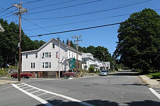
South Paris is a census-designated place (CDP) located within the town of Paris in Oxford County, Maine, in the United States. The population was 2,237 at the 2000 census. While the CDP refers only to the densely settled area in the southern part of the town of Paris, the entire town, outside of Paris Hill, is located within the South Paris ZIP code, resulting in many residents referring to the entire town as South Paris.

Monument Beach, Massachusetts Census-designated place in Massachusetts, United States

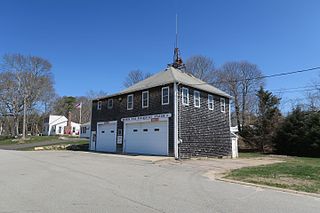
Monument Beach is a census-designated place (CDP) in the town of Bourne in Barnstable County, Massachusetts, United States. The population was 2,790 at the 2010 census.

Millers Falls, Massachusetts Census-designated place in Massachusetts, United States

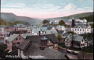
Millers Falls is a census-designated place (CDP) in the town of Montague in Franklin County, Massachusetts, United States. The population was 1,139 at the 2010 census. It is part of the Springfield, Massachusetts metropolitan statistical area.

Monson Center, Massachusetts Census-designated place in Massachusetts, United States

Monson Center is a census-designated place (CDP) in the town of Monson in Hampden County, Massachusetts, United States. The population was 2,107 at the 2010 census, out of a total 8,560 people in the town. It is part of the Springfield, Massachusetts Metropolitan Statistical Area.

Three Rivers, Massachusetts Former CDP in Massachusetts, United States

Three Rivers is a village and former census-designated place (CDP) in the city of Palmer in Hampden County, Massachusetts, United States. It is part of the Springfield, Massachusetts Metropolitan Statistical Area. It is named for the confluence of the Ware and Quaboag rivers, which form the Chicopee River.

Amherst Center, Massachusetts Census-designated place in Massachusetts, United States

Amherst Center is a census-designated place (CDP) in the town of Amherst in Hampshire County, Massachusetts, United States. The CDP covers the primary village in town. The population was 19,065 at the 2010 census, out of a total town population of 37,819. It is part of the Springfield, Massachusetts Metropolitan Statistical Area.

North Amherst, Massachusetts Census-designated place in Massachusetts, United States

North Amherst is a census-designated place (CDP) in the town of Amherst in Hampshire County, Massachusetts, United States. The population was 6,819 at the 2010 census, up from 6,019 at the 2000 census. It is part of the Springfield, Massachusetts Metropolitan Statistical Area.

South Amherst, Massachusetts Census-designated place in Massachusetts, United States

South Amherst is a census-designated place (CDP) in the town of Amherst in Hampshire County, Massachusetts, United States. The population was 4,994 at the 2010 census. The CDP includes the village of South Amherst and residential subdivisions south of the Amherst town center.

North Lakeville, Massachusetts Census-designated place in Massachusetts, United States

North Lakeville is a census-designated place (CDP) in the town of Lakeville in Plymouth County, Massachusetts, United States. The population was 2,630 at the 2010 census.

Baldwinville, Massachusetts CDP in Massachusetts, United States

Baldwinville is an unincorporated village and census-designated place (CDP) in the town of Templeton in Worcester County, Massachusetts, United States. The population was 2,028 at the 2010 census. The name also refers to the local post office or railroad station. Some people, perhaps confusing it with the village in New York state, erroneously call it "Baldwinsville".

Fiskdale, Massachusetts CDP in Sturbridge, Massachusetts, United States

Fiskdale is a census-designated place (CDP) in the town of Sturbridge in Worcester County, Massachusetts, United States. The population was 2,583 at the 2010 census.

Bondsville, Massachusetts

Bondsville is an area and former census-designated place (CDP) located in the town of Palmer in Hampden County in the western part of the U.S. state of Massachusetts. The population of the CDP was 1,876 at the 2000 census. It is part of the Springfield, Massachusetts Metropolitan Statistical Area. The village was named after Emelius Bond who first secured the water rights of the Swift River in 1846 to form the Bond Village Manufacturing Company.

Falmouth (CDP), Massachusetts Census-designated place in Massachusetts, United States

Falmouth is a census-designated place (CDP) consisting of the primary settlement in the town of Falmouth in Barnstable County, Massachusetts, United States. The population of the CDP was 3,799 at the 2010 census, out of 31,532 in the town as a whole. It was named after Falmouth, Cornwall, England.

Great Barrington (CDP), Massachusetts Census-designated place in Massachusetts, United States

Great Barrington is a census-designated place (CDP) located in the town of Great Barrington in Berkshire County, Massachusetts, United States. The population was 2,231 at the 2010 census, out of 7,104 in the entire town of Great Barrington.

Holland (CDP), Massachusetts Census-designated place in Massachusetts, United States

Holland is a census-designated place (CDP) in the town of Holland in Hampden County, Massachusetts, United States, comprising the town center and other populated areas in the eastern part of the town. The population was 1,464 at the 2010 census, out of a total 2,481 people in the town. It is part of the Springfield, Massachusetts Metropolitan Statistical Area.

Palmer (CDP), Massachusetts Former CDP in Massachusetts, United States

Palmer is former census-designated place (CDP) in Hampden County, Massachusetts, United States. The population was 3,900 at the 2000 census. It is part of the Springfield, Massachusetts Metropolitan Statistical Area. The area is more commonly known as Depot Village, named for the ornate train depot built there by famed architect H.H. Richardson

Belchertown (CDP), Massachusetts Census-designated place in Massachusetts, United States

Belchertown is a census-designated place (CDP) comprising the central village in the town of Belchertown in Hampshire County, Massachusetts, United States. The population was 2,899 at the 2010 census, out of a total town population of 14,649. It is part of the Springfield, Massachusetts Metropolitan Statistical Area.

Granby (CDP), Massachusetts Census-designated place in Massachusetts, United States

Granby is a census-designated place (CDP) comprising the main village in the town of Granby in Hampshire County, Massachusetts, United States. The population of the CDP was 1,368 at the 2010 census, out of a total town population of 6,240. It is part of the Springfield, Massachusetts Metropolitan Statistical Area.

Hatfield (CDP), Massachusetts Census-designated place in Massachusetts, United States

Hatfield is a census-designated place (CDP) comprising the main village in the town of Hatfield in Hampshire County, Massachusetts, United States. The population of the CDP was 1,318 at the 2010 census, out of a total town population of 3,279. It is part of the Springfield, Massachusetts Metropolitan Statistical Area.

Milford is a census-designated place (CDP) consisting of the main area of settlement within the town of Milford in Penobscot County, Maine, United States. The population was 2,233 at the 2010 census.

References

  1. "2020 U.S. Gazetteer Files". United States Census Bureau. Retrieved May 21, 2022.
  2. 1 2 "Geographic Identifiers: 2010 Census Summary File 1 (G001): Ware CDP, Massachusetts". American Factfinder. U.S. Census Bureau. Archived from the original on February 13, 2020. Retrieved August 10, 2017.
  3. "US Gazetteer files: 2010, 2000, and 1990". United States Census Bureau. 2011-02-12. Retrieved 2011-04-23.
  4. "Census of Population and Housing". Census.gov. Retrieved June 4, 2016.
  5. "U.S. Census website". United States Census Bureau . Retrieved 2008-01-31.