Plainfield, Massachusetts

Last updated

Plainfield, Massachusetts
Landscape, Plainfield, MA.jpg
A plain field in Plainfield, Massachusetts
Seal of Plainfield, Massachusetts.svg
Hampshire County Massachusetts incorporated and unincorporated areas Plainfield highlighted.svg
Location in Hampshire County in Massachusetts
Coordinates: 42°30′55″N72°55′00″W / 42.51528°N 72.91667°W / 42.51528; -72.91667
Country United States
State Massachusetts
County Hampshire
Settled1770
Incorporated1807
Government
  Type Open town meeting
Area
  Total21.3 sq mi (55.1 km2)
  Land21.1 sq mi (54.5 km2)
  Water0.2 sq mi (0.5 km2)
Elevation
1,676 ft (511 m)
Population
 (2020)
  Total633
  Density30/sq mi (11/km2)
Time zone UTC−5 (Eastern)
  Summer (DST) UTC−4 (Eastern)
ZIP Codes
01070, 01026
Area code 413
FIPS code 25-54030
GNIS feature ID0618206
Website plainfield-ma.us

Plainfield is a town on the northwestern edge of Hampshire County, Massachusetts, United States, about 25 miles east of Pittsfield and 30 miles northwest of Northampton. The population was 633 at the 2020 census. [1] It is part of the Springfield, Massachusetts Metropolitan Statistical Area.

Contents

History

Plainfield Congregational Church Plainfield Congregational Church, MA.jpg
Plainfield Congregational Church

Plainfield was first settled in 1770, primarily by settlers from the town of Bridgewater, and was officially incorporated as a district within the Town of Cummington in 1785, and as a town on June 15, 1807. Plainfield is the youngest town in Hampshire County.

In the 1800s, Plainfield was a thriving agricultural community, primarily producing sheep and leather for tanning. With the widespread adoption of the steamship, and the resultant globalization in the 1870s, the expense of importing both mutton and leather from Australia and New Zealand was greatly reduced. Consequently, the agricultural industries in Plainfield became less profitable, and the population declined substantially over the following decades.

Sixty-one men from Plainfield joined the Union Army late in the Civil War. Six were killed in battle, or died as a consequence of their service, including resident Michael Bashaw, who died of dysentery at the battle of Wilson's Creek. Of those who survived, many settled elsewhere after the war.

After over a century of population decline, modern Plainfield has experienced population growth since 1950.

Geography

The Town of Plainfield is situated in the scenic Berkshire Highlands [2] where Hampshire County merges into neighboring Franklin and Berkshire Counties. Plainfield is part of the Hilltowns of Western Massachusetts.

Plainfield sits 1620′ above sea level, and the peaks of West Mountain (at 2125′) are the highest elevation in Hampshire County.

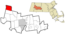
According to the United States Census Bureau, the town has a total area of 21.3 square miles (55 km2), of which 21.0 square miles (54 km2) is land and 0.2 square miles (0.52 km2) (0.99%) is water.

Plainfield's waterways serve as the headwaters of the Westfield and Deerfield rivers.

Plainfield is bordered by the towns of Cummington, Ashfield, Hawley, Savoy, and Windsor.

Demographics

Historical population
YearPop.±%
1850 814    
1860 639−21.5%
1870 521−18.5%
1880 457−12.3%
1890 435−4.8%
1900 404−7.1%
1910 406+0.5%
1920 332−18.2%
1930 300−9.6%
1940 264−12.0%
1950 228−13.6%
1960 237+3.9%
1970 287+21.1%
1980 425+48.1%
1990 571+34.4%
2000 589+3.2%
2010 648+10.0%
2020 633−2.3%
2022629−0.6%

Source: United States census records and Population Estimates Program data. [3] [4] [5] [6] [7] [8] [9] [10] [11] [12] [13]

As of the census [14] of 2000, there were 589 people, 243 households, and 166 families residing in the town. The population density was 28.0 inhabitants per square mile (10.8/km2). There were 311 housing units at an average density of 14.8 per square mile (5.7/km2). The racial makeup of the town was 98.13% White, 0.34% Native American, 0.17% Asian, and 1.36% from two or more races. Hispanic or Latino of any race were 0.68% of the population.

There were 243 households, out of which 31.3% had children under the age of 18 living with them, 60.9% were married couples living together, 4.5% had a female householder with no husband present, and 31.3% were non-families. Of all households, 25.9% were made up of individuals, and 10.3% had someone living alone who was 65 years of age or older. The average household size was 2.42 and the average family size was 2.92.

In the town, the population was spread out, with 24.8% under the age of 18, 4.2% from 18 to 24, 26.1% from 25 to 44, 31.9% from 45 to 64, and 12.9% who were 65 years of age or older. The median age was 42 years. For every 100 females, there were 94.4 males. For every 100 females age 18 and over, there were 99.5 males.

The median income for a household in the town was $37,250, and the median income for a family was $46,042. Males had a median income of $31,625 versus $26,875 for females. The per capita income for the town was $20,785. About 4.8% of families and 8.0% of the population were below the poverty line, including 4.9% of those under age 18 and none of those age 65 or over.

Government

Plainfield is governed by a Town Meeting open to all registered voters in the town. Ongoing town matters are managed by an elected Board of Selectmen and other Boards and Commissions. The town is part of the First Hampshire District in the Massachusetts House of Representatives, represented by Lindsay Sabadosa, and the Berkshire, Franklin, and Hampshire Senate district, represented by Adam G. Hinds.

Notable people

Points of interest

Related Research Articles

<span class="mw-page-title-main">Hampshire County, Massachusetts</span> County in Massachusetts, United States

Hampshire County is a historical and judicial county located in the U.S. state of Massachusetts. As of the 2020 census, the population was 162,308. Its most populous municipality is Amherst, its largest town in terms of landmass is Belchertown, and its traditional county seat is Northampton. The county is named after the county Hampshire, in England. Hampshire County is part of the Springfield, MA Metropolitan Statistical Area. Together with Hampden County, Hampshire County municipalities belong to the Pioneer Valley Planning Commission.

<span class="mw-page-title-main">Clarksburg, Massachusetts</span> Town in Massachusetts, United States

Clarksburg is a town in Berkshire County, Massachusetts, United States. It is part of the Pittsfield, Massachusetts Metropolitan Statistical Area. The population was 1,657 at the 2020 census.

<span class="mw-page-title-main">Egremont, Massachusetts</span> Town in Massachusetts, United States

Egremont is a town in Berkshire County, Massachusetts, United States. It is part of the Pittsfield, Massachusetts Metropolitan Statistical Area. The population was 1,372 at the 2020 census. Egremont consists of two villages, North Egremont and South Egremont, and their outlying areas, which are mostly lightly settled forests and farmland.

<span class="mw-page-title-main">Hancock, Massachusetts</span> Town in Massachusetts, United States

Hancock is a town in Berkshire County, Massachusetts, United States. It is part of the Pittsfield, Massachusetts Metropolitan Statistical Area. The population was 757 at the 2020 census.

<span class="mw-page-title-main">Lanesborough, Massachusetts</span> Town in Massachusetts, United States

Lanesborough is a town in Berkshire County, Massachusetts, United States. It is part of the Pittsfield, Massachusetts Metropolitan Statistical Area. The population was 3,038 at the 2020 census.

<span class="mw-page-title-main">Monterey, Massachusetts</span> Town in Massachusetts, United States

Monterey is a small town in Berkshire County, Massachusetts, United States. It is part of the Pittsfield, Massachusetts Metropolitan Statistical Area. The population was 1,095 at the 2020 census.

<span class="mw-page-title-main">New Ashford, Massachusetts</span> Town in Massachusetts, United States

New Ashford is a town in Berkshire County, Massachusetts, United States. It is part of the Pittsfield, Massachusetts Metropolitan Statistical Area. The population was 250 at the 2020 census.

<span class="mw-page-title-main">New Marlborough, Massachusetts</span> Town in Massachusetts, United States

New Marlborough is a town in Berkshire County, Massachusetts, United States. It is part of the Pittsfield, Massachusetts Metropolitan Statistical Area. The population was 1,528 at the 2020 census. New Marlborough consists of five villages: Clayton, Hartsville, Mill River, New Marlborough Village and Southfield.

<span class="mw-page-title-main">Otis, Massachusetts</span> Town in Massachusetts, United States

Otis is a town in Berkshire County, Massachusetts, United States. It is part of the Pittsfield, Massachusetts, Metropolitan Statistical Area. The population was 1,634 at the 2020 census.

<span class="mw-page-title-main">Peru, Massachusetts</span> Town in Massachusetts, United States

Peru is a town in Berkshire County, Massachusetts, United States. The population was 814 at the 2020 census.

<span class="mw-page-title-main">Sandisfield, Massachusetts</span> Town in Massachusetts, United States

Sandisfield is a town in Berkshire County, Massachusetts, United States. It is part of the Pittsfield, Massachusetts Metropolitan Statistical Area. The population was 989 at the 2020 census.

<span class="mw-page-title-main">Savoy, Massachusetts</span> Town in Massachusetts, United States

Savoy is a town in Berkshire County, Massachusetts, United States. It is part of the Pittsfield, Massachusetts Metropolitan Statistical Area. The population was 645 at the 2020 census.

<span class="mw-page-title-main">Washington, Massachusetts</span> Town in Massachusetts, United States

Washington is a town in Berkshire County, Massachusetts, United States. It is part of the Pittsfield, Massachusetts, Metropolitan Statistical Area. The population was 494 at the 2020 census.

<span class="mw-page-title-main">West Stockbridge, Massachusetts</span> Town in Massachusetts, United States

West Stockbridge is a town in Berkshire County, Massachusetts, United States. The town had a population of 1,343 at the time of the 2020 United States Census. It is part of the Pittsfield, Massachusetts Metropolitan Statistical Area.

<span class="mw-page-title-main">Windsor, Massachusetts</span> Town in Massachusetts, United States

Windsor is a town in Berkshire County, Massachusetts, United States. It is part of the Pittsfield, Massachusetts Metropolitan Statistical Area. The population was 831 at the 2020 census.

<span class="mw-page-title-main">Ashfield, Massachusetts</span> Town in Massachusetts, United States

Ashfield is a town in Franklin County, Massachusetts, United States. The population was 1,695 at the 2020 census. It is part of the Springfield, Massachusetts Metropolitan Statistical Area.

<span class="mw-page-title-main">Hawley, Massachusetts</span> Town in Massachusetts, United States

Hawley is a town in Franklin County, Massachusetts, United States. The population was 353 at the 2020 census. It is part of the Springfield, Massachusetts Metropolitan Statistical Area.

<span class="mw-page-title-main">Monroe, Massachusetts</span> Town in Massachusetts, United States

Monroe is a town in Franklin County, Massachusetts, United States. The population was 118 at the 2020 census. By area, population, and population density, it is the smallest town in the county; and is the second-smallest town by population in the Commonwealth, with only Gosnold having fewer residents.

<span class="mw-page-title-main">Cummington, Massachusetts</span> Town in Massachusetts, United States

Cummington is a town in Hampshire County, Massachusetts, United States. The population was 829 at the 2020 census, a declone from the figure of 872 tabulated in 2010. It is part of the Springfield, Massachusetts Metropolitan Statistical Area.

<span class="mw-page-title-main">Worthington, Massachusetts</span> Town in Massachusetts, United States

Worthington is a town in Hampshire County, Massachusetts, United States. The population was 1,193 at the 2020 census, up from 1,156 at the 2010 census. It is part of the Springfield, Massachusetts Metropolitan Statistical Area.

References

  1. "Census - Geography Profile: Plainfield town, Hampshire County, Massachusetts". United States Census Bureau . Retrieved November 14, 2021.
  2. Egler, F. E. 1940. "Berkshire plateau vegetation, Massachusetts". Ecological Monographs 10:147–192.
  3. "Total Population (P1), 2010 Census Summary File 1". American FactFinder, All County Subdivisions within Massachusetts. United States Census Bureau. 2010.
  4. "Massachusetts by Place and County Subdivision - GCT-T1. Population Estimates". United States Census Bureau. Retrieved July 12, 2011.
  5. "1990 Census of Population, General Population Characteristics: Massachusetts" (PDF). US Census Bureau. December 1990. Table 76: General Characteristics of Persons, Households, and Families: 1990. 1990 CP-1-23. Retrieved July 12, 2011.
  6. "1980 Census of the Population, Number of Inhabitants: Massachusetts" (PDF). US Census Bureau. December 1981. Table 4. Populations of County Subdivisions: 1960 to 1980. PC80-1-A23. Retrieved July 12, 2011.
  7. "1950 Census of Population" (PDF). Bureau of the Census. 1952. Section 6, Pages 21-10 and 21-11, Massachusetts Table 6. Population of Counties by Minor Civil Divisions: 1930 to 1950. Retrieved July 12, 2011.
  8. "1920 Census of Population" (PDF). Bureau of the Census. Number of Inhabitants, by Counties and Minor Civil Divisions. Pages 21-5 through 21-7. Massachusetts Table 2. Population of Counties by Minor Civil Divisions: 1920, 1910, and 1920. Retrieved July 12, 2011.
  9. "1890 Census of the Population" (PDF). Department of the Interior, Census Office. Pages 179 through 182. Massachusetts Table 5. Population of States and Territories by Minor Civil Divisions: 1880 and 1890. Retrieved July 12, 2011.
  10. "1870 Census of the Population" (PDF). Department of the Interior, Census Office. 1872. Pages 217 through 220. Table IX. Population of Minor Civil Divisions, &c. Massachusetts. Retrieved July 12, 2011.
  11. "1860 Census" (PDF). Department of the Interior, Census Office. 1864. Pages 220 through 226. State of Massachusetts Table No. 3. Populations of Cities, Towns, &c. Retrieved July 12, 2011.
  12. "1850 Census" (PDF). Department of the Interior, Census Office. 1854. Pages 338 through 393. Populations of Cities, Towns, &c. Retrieved July 12, 2011.
  13. "City and Town Population Totals: 2020-2022". United States Census Bureau . Retrieved November 23, 2023.
  14. "U.S. Census website". United States Census Bureau . Retrieved January 31, 2008.