Hawley, Massachusetts

Last updated

Hawley, Massachusetts
Hawley Road Sign.jpg
Entering Hawley
HawleyMA Seal.png
Franklin County Massachusetts incorporated and unincorporated areas Hawley highlighted.svg
Location in Franklin County in Massachusetts
Coordinates: 42°34′N72°53′W / 42.567°N 72.883°W / 42.567; -72.883
Country United States
State Massachusetts
County Franklin
Settled1760
Incorporated1792
Government
  Type Open town meeting
Area
  Total30.9 sq mi (80.0 km2)
  Land30.9 sq mi (79.9 km2)
  Water0.0 sq mi (0.1 km2)
Elevation
[1]
1,404 ft (428 m)
Population
 (2020)
  Total353
  Density11/sq mi (4.4/km2)
Time zone UTC-5 (Eastern)
  Summer (DST) UTC-4 (Eastern)
ZIP code
01339
Area code 413
FIPS code 25-29475
GNIS feature ID0619380 [1]
Website www.townofhawley.com

Hawley is a town in Franklin County, Massachusetts, United States. The population was 353 at the 2020 census. [2] It is part of the Springfield, Massachusetts Metropolitan Statistical Area.

Contents

History

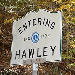
Hawley was first settled in 1760 as Plantation Number 7, by a group from Hatfield. The town was called the "Hatfield Reserve" until it was officially incorporated in 1792. The town was named for Joseph Hawley [3] of Northampton, a local leader in the American Revolution. Hawley's main industries were forestry and, eventually, recreation. The town originally included the land of its neighbor, Plainfield, which split off in the early nineteenth century. [4]

Today, the town has very little industry. There are a few remaining farms, artisans and small businesses, though most people commute from the town, work from home or work for municipalities. The town has no gas stations, convenience stores, or liquor stores. Hawley does not have a police department, but does have a fire department.

Geography

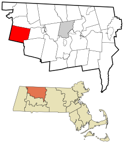
According to the United States Census Bureau, the town has a total area of 30.9 square miles (80 km2), of which 30.9 square miles (80 km2) is land and 0.04 square miles (0.10 km2) (0.06%) is water. The town is located at the southwest corner of Franklin County, with Hampshire County to the south and Berkshire County to the west. The town is bordered by Charlemont to the north, Buckland to the east, Ashfield to the southeast, Plainfield to the south, and Savoy to the west. Hawley is located 22 miles (35 km) west of Greenfield, 45 miles (72 km) north-northwest of Springfield, and 110 miles (180 km) west-northwest of Boston.

Hawley is located among the northern Berkshires, with the northern edge of town falling to the valley of the Deerfield River. Several brooks and the Chickley River flow into the river through town. The town is home to Hawley Bog, one of the few bogs in Massachusetts to be preserved in its natural state. There are several small peaks in town, with the highest being Parker Hill to the south. The hill lies within Kenneth Dubuque Memorial State Forest, which has several recreation sites for all seasons. Mohawk Trail State Forest also extends into the town from Charlemont and Savoy, in the northwest corner of town. Between the two forests lies Stump Sprout Cross-Country Ski Area, which also provides other recreational activities off-season. A portion of Berkshire East Ski Area also lies within town, with the base of the area being in Charlemont.

The main road through town is Massachusetts Route 8A, which connects Route 116 to the south with Route 2 to the north. Route 2, the Mohawk Trail, passes just north of the town line for most of the town border. The nearest interstate, Interstate 91, can be accessed in nearby Greenfield. There is no rail, air or bus service in town. The town is roughly equidistant from the two nearest points for rail and air service, Greenfield and North Adams. The nearest Amtrak service is in Pittsfield, and the nearest national air service is at Bradley International Airport in Windsor Locks, Connecticut.

Climate

Hawley has a humid continental climate (Köppen Dfb).

Climate data for East Hawley, Massachusetts, 1991–2020 normals: 1647ft (502m)
MonthJanFebMarAprMayJunJulAugSepOctNovDecYear
Average high °F (°C)28.2
(−2.1)
31.0
(−0.6)
39.4
(4.1)
51.3
(10.7)
62.6
(17.0)
70.1
(21.2)
74.8
(23.8)
74.1
(23.4)
67.5
(19.7)
55.5
(13.1)
44.6
(7.0)
33.9
(1.1)
52.8
(11.5)
Daily mean °F (°C)18.7
(−7.4)
20.9
(−6.2)
29.0
(−1.7)
40.7
(4.8)
51.3
(10.7)
60.2
(15.7)
64.1
(17.8)
63.1
(17.3)
56.6
(13.7)
45.0
(7.2)
35.8
(2.1)
25.8
(−3.4)
42.6
(5.9)
Average low °F (°C)9.2
(−12.7)
10.7
(−11.8)
18.6
(−7.4)
30.0
(−1.1)
40.0
(4.4)
50.2
(10.1)
53.4
(11.9)
52.1
(11.2)
45.6
(7.6)
34.5
(1.4)
26.9
(−2.8)
17.6
(−8.0)
32.4
(0.2)
Average precipitation inches (mm)3.55
(90)
3.17
(81)
4.02
(102)
4.17
(106)
4.05
(103)
4.55
(116)
3.89
(99)
4.13
(105)
4.73
(120)
4.79
(122)
3.80
(97)
4.71
(120)
49.56
(1,261)
Average snowfall inches (cm)22.30
(56.6)
17.90
(45.5)
18.00
(45.7)
4.40
(11.2)
0.10
(0.25)
0.00
(0.00)
0.00
(0.00)
0.00
(0.00)
0.00
(0.00)
0.40
(1.0)
3.40
(8.6)
18.80
(47.8)
85.3
(216.65)
Source 1: NOAA [5]
Source 2: NOAA (Ashfield precipitation & snowfall) [6]

Demographics

As of the census of 2000, there were 336 people, 137 households, and 99 families residing in the town. By population, Hawley ranks 25th out of the 26 towns in Franklin County, and 347th out of 351 cities and towns in Massachusetts. The population density was 10.9 inhabitants per square mile (4.2/km2), which ranked 25th in the county and 348th in the Commonwealth. There were 192 housing units at an average density of 6.2 per square mile (2.4/km2). The racial makeup of the town was 97.32% White, 0.30% African American, 0.89% Asian, and 1.49% from two or more races. Hispanic or Latino of any race were 0.30% of the population.

There were 137 households, out of which 29.9% had children under the age of 18 living with them, 62.0% were married couples living together, 6.6% had a female householder with no husband present, and 27.7% were non-families. 21.2% of all households were made up of individuals, and 6.6% had someone living alone who was 65 years of age or older. The average household size was 2.45 and the average family size was 2.85.

In the town, the population was spread out, with 23.5% under the age of 18, 3.0% from 18 to 24, 26.5% from 25 to 44, 32.1% from 45 to 64, and 14.9% who were 65 years of age or older. The median age was 44 years. For every 100 females, there were 108.7 males. For every 100 females age 18 and over, there were 100.8 males.

The median income for a household in the town was $38,125, and the median income for a family was $46,875. Males had a median income of $30,833 versus $23,750 for females. The per capita income for the town was $17,333. About 11.8% of families and 14.2% of the population were below the poverty line, including 14.3% of those under age 18 and 6.7% of those age 65 or over.

Government

Hawley Town Hall Hawley-TownHall.JPG
Hawley Town Hall

Hawley employs the open town meeting form of government, and is led by a board of selectmen and an administrative assistant. The town only has two full-time employees with most being part-time or volunteer, as in the case with the fire department and emergency services. There is no library or post office in Hawley; neighboring Charlemont provides these services. The nearest hospitals are in Greenfield and North Adams.

On the state level, Hawley is represented in the Massachusetts House of Representatives as part of the Second Berkshire district, represented by Paul Mark, which covers central Berkshire County, as well as portions of Hampshire and Franklin Counties. In the Massachusetts Senate, the town is part of the Berkshire, Hampshire and Franklin district, represented by Ben Downing, which includes all of Berkshire County and the western portions of Hampshire and Franklin Counties. [18] The town is patrolled by the Second (Shelburne Falls) Station of Troop "B" of the Massachusetts State Police. [19]

On the national level, Hawley is represented in the United States House of Representatives as part of Massachusetts's 1st congressional district, and has been represented by Richard Neal of Springfield since January 2013. Massachusetts is currently represented in the United States Senate by Senators Elizabeth Warren and Ed Markey.

Education

Hawley and neighboring Charlemont make up the Hawlemont Regional School District, a sub-district of the nine-town Mohawk Trail Regional School District, which serves much of western Franklin County. Town students attend the Hawlemont Regional Elementary School in Charlemont from pre-kindergarten through sixth grades, and all students in the district attend Mohawk Trail Regional High School in Buckland. There is a private academy, the Academy at Charlemont, in Charlemont as well, and other private and religious schools are in nearby towns.

David Dunnels White's Tombstone, in Bozrah Cemetery, East Hawley, Massachusetts...Medal of Honor Nominee...Civil War David Dunnels White Tombstone.jpg
David Dunnels White's Tombstone, in Bozrah Cemetery, East Hawley, Massachusetts...Medal of Honor Nominee...Civil War

The nearest community college, Greenfield Community College, is located in Greenfield. The nearest state college is Massachusetts College of Liberal Arts in North Adams, and the nearest state university is the University of Massachusetts Amherst. The nearest private college is Williams College in Williamstown, with several others located southeast in the Northampton area.

Notable people

Related Research Articles

<span class="mw-page-title-main">Franklin County, Massachusetts</span> County in Massachusetts, United States

Franklin County is a nongovernmental county located in the northwestern part of the U.S. state of Massachusetts. As of the 2020 census, the population was 71,029, which makes it the least-populous county on the Massachusetts mainland, and the third-least populous county in the state. Its traditional county seat and most populous city is Greenfield. Its largest town by area is New Salem. Franklin County comprises the Greenfield Town, MA Micropolitan Statistical Area, which is included in the Springfield-Greenfield Town, MA Combined Statistical Area.

<span class="mw-page-title-main">Clarksburg, Massachusetts</span> Town in Massachusetts, United States

Clarksburg is a town in Berkshire County, Massachusetts, United States. It is part of the Pittsfield, Massachusetts Metropolitan Statistical Area. The population was 1,657 at the 2020 census.

<span class="mw-page-title-main">Florida, Massachusetts</span> Town in Massachusetts, United States

Florida is a town in Berkshire County, Massachusetts, United States. It is part of the Pittsfield, Massachusetts Metropolitan Statistical Area. It is home to the east portal of the Hoosac Tunnel, as well as Whitcomb Summit, the highest point of the Mohawk Trail. Florida contains the village of Drury. At the 2020 census the town had a total population of 694. Despite the town’s name, Florida is statistically the coldest and snowiest town in Massachusetts.

<span class="mw-page-title-main">Peru, Massachusetts</span> Town in Massachusetts, United States

Peru is a town in Berkshire County, Massachusetts, United States. The population was 814 at the 2020 census.

<span class="mw-page-title-main">Savoy, Massachusetts</span> Town in Massachusetts, United States

Savoy is a town in Berkshire County, Massachusetts, United States. It is part of the Pittsfield, Massachusetts Metropolitan Statistical Area. The population was 645 at the 2020 census.

<span class="mw-page-title-main">Washington, Massachusetts</span> Town in Massachusetts, United States

Washington is a town in Berkshire County, Massachusetts, United States. It is part of the Pittsfield, Massachusetts, Metropolitan Statistical Area. The population was 494 at the 2020 census.

<span class="mw-page-title-main">West Stockbridge, Massachusetts</span> Town in Massachusetts, United States

West Stockbridge is a town in Berkshire County, Massachusetts, United States. The town had a population of 1,343 at the time of the 2020 United States Census. It is part of the Pittsfield, Massachusetts Metropolitan Statistical Area.

<span class="mw-page-title-main">Windsor, Massachusetts</span> Town in Massachusetts, United States

Windsor is a town in Berkshire County, Massachusetts, United States. It is part of the Pittsfield, Massachusetts Metropolitan Statistical Area. The population was 831 at the 2020 census.

<span class="mw-page-title-main">Ashfield, Massachusetts</span> Town in Massachusetts, United States

Ashfield is a town in Franklin County, Massachusetts, United States. The population was 1,695 at the 2020 census. It is part of the Springfield, Massachusetts Metropolitan Statistical Area.

<span class="mw-page-title-main">Bernardston, Massachusetts</span> Town in Massachusetts, United States

Bernardston is a town in Franklin County, Massachusetts, United States. The population was 2,102 at the 2020 census. It is part of the Springfield, Massachusetts Metropolitan Statistical Area.

<span class="mw-page-title-main">Buckland, Massachusetts</span> Town in Massachusetts, United States

Buckland is a town in Franklin County, Massachusetts, United States. The population was 1,816 at the 2020 census. The town shares the village of Shelburne Falls with neighboring Shelburne. The town center at Shelburne Falls is the western end of the Bridge of Flowers, a local tourist attraction.

<span class="mw-page-title-main">Charlemont, Massachusetts</span> Town in Massachusetts, United States

Charlemont is a town in Franklin County, Massachusetts, United States. The population was 1,185 at the 2020 census. It is part of the Springfield, Massachusetts Metropolitan Statistical Area.

<span class="mw-page-title-main">Colrain, Massachusetts</span> Town in Massachusetts, United States

Colrain is a town in Franklin County, Massachusetts, United States. The population was 1,606 at the 2020 census. It is part of the Springfield, Massachusetts Metropolitan Statistical Area.

<span class="mw-page-title-main">Conway, Massachusetts</span> Town in Massachusetts, United States

Conway is a town in Franklin County, Massachusetts, United States. The population was 1,761 at the 2020 census. It is part of the Springfield, Massachusetts Metropolitan Statistical Area.

<span class="mw-page-title-main">Heath, Massachusetts</span> Town in Massachusetts, United States

Heath is a town in Franklin County, Massachusetts, United States. The population was 723 at the 2020 census. It is part of the Springfield, Massachusetts Metropolitan Statistical Area.

<span class="mw-page-title-main">Leyden, Massachusetts</span> Town in Massachusetts, United States

Leyden is a town in Franklin County, Massachusetts, United States. The population was 734 at the 2020 census. It is part of the Springfield, Massachusetts Metropolitan Statistical Area.

<span class="mw-page-title-main">Monroe, Massachusetts</span> Town in Massachusetts, United States

Monroe is a town in Franklin County, Massachusetts, United States. The population was 118 at the 2020 census. By area, population, and population density, it is the smallest town in the county; and is the second-smallest town by population in the Commonwealth, with only Gosnold having fewer residents.

<span class="mw-page-title-main">Rowe, Massachusetts</span> Town in Massachusetts, United States

Rowe is a town in Franklin County, Massachusetts, United States. The population was 424 at the 2020 census.

<span class="mw-page-title-main">Shelburne, Massachusetts</span> Town in Massachusetts, United States

Shelburne is a town in Franklin County, Massachusetts, United States. The population was 1,884 at the 2020 census. It is part of the Springfield, Massachusetts Metropolitan Statistical Area.

<span class="mw-page-title-main">Whately, Massachusetts</span> Town in Massachusetts, United States

Whately is a town in Franklin County, Massachusetts, United States. The population was 1,607 at the 2020 census. It is part of the Springfield, Massachusetts Metropolitan Statistical Area.

References

  1. 1 2 U.S. Geological Survey Geographic Names Information System: Hawley, Massachusetts
  2. "Census - Geography Profile: Hawley town, Franklin County, Massachusetts". United States Census Bureau . Retrieved November 14, 2021.
  3. Gannett, Henry (1905). The Origin of Certain Place Names in the United States. Govt. Print. Off. pp.  152.
  4. Town of Hawley - Franklin Co. Chamber of Commerce [ permanent dead link ]
  5. "East Hawley, Massachusetts 1991-2020 Monthly Normals" . Retrieved October 24, 2023.
  6. "Ashfield, Massachusetts 1991-2020 Monthly Normals" . Retrieved October 24, 2023.
  7. "Total Population (P1), 2010 Census Summary File 1". American FactFinder, All County Subdivisions within Massachusetts. United States Census Bureau. 2010.
  8. "Massachusetts by Place and County Subdivision - GCT-T1. Population Estimates". United States Census Bureau. Retrieved July 12, 2011.
  9. "1990 Census of Population, General Population Characteristics: Massachusetts" (PDF). US Census Bureau. December 1990. Table 76: General Characteristics of Persons, Households, and Families: 1990. 1990 CP-1-23. Retrieved July 12, 2011.
  10. "1980 Census of the Population, Number of Inhabitants: Massachusetts" (PDF). US Census Bureau. December 1981. Table 4. Populations of County Subdivisions: 1960 to 1980. PC80-1-A23. Retrieved July 12, 2011.
  11. "1950 Census of Population" (PDF). Bureau of the Census. 1952. Section 6, Pages 21-10 and 21-11, Massachusetts Table 6. Population of Counties by Minor Civil Divisions: 1930 to 1950. Retrieved July 12, 2011.
  12. "1920 Census of Population" (PDF). Bureau of the Census. Number of Inhabitants, by Counties and Minor Civil Divisions. Pages 21-5 through 21-7. Massachusetts Table 2. Population of Counties by Minor Civil Divisions: 1920, 1910, and 1920. Retrieved July 12, 2011.
  13. "1890 Census of the Population" (PDF). Department of the Interior, Census Office. Pages 179 through 182. Massachusetts Table 5. Population of States and Territories by Minor Civil Divisions: 1880 and 1890. Retrieved July 12, 2011.
  14. "1870 Census of the Population" (PDF). Department of the Interior, Census Office. 1872. Pages 217 through 220. Table IX. Population of Minor Civil Divisions, &c. Massachusetts. Retrieved July 12, 2011.
  15. "1860 Census" (PDF). Department of the Interior, Census Office. 1864. Pages 220 through 226. State of Massachusetts Table No. 3. Populations of Cities, Towns, &c. Retrieved July 12, 2011.
  16. "1850 Census" (PDF). Department of the Interior, Census Office. 1854. Pages 338 through 393. Populations of Cities, Towns, &c. Retrieved July 12, 2011.
  17. "City and Town Population Totals: 2020-2022". United States Census Bureau . Retrieved November 4, 2023.
  18. List of Massachusetts Legislators by City and Town
  19. Station B-2, SP Shelburne Falls