Monroe is a town in Franklin County, Massachusetts, United States. The population was 118 at the 2020 U.S. census.[2] By area, population, and population density, it is the smallest town in the county; and is the second-smallest town by population in the Commonwealth. This makes it the smallest town by population in mainland Massachusetts. Gosnold is the only town in Massachusetts to be smaller than Monroe by population.
Monroe was first settled in 1800 and was officially incorporated in 1822. The town was named for President James Monroe, who was in office at the time of incorporation. The town was mostly rural, with dairy farming taking up much of the town's economic activity. During the mid-19th century, the town did get some business from the building of the Hoosac Tunnel, just south of town in Florida. In 1885, however, a railroad line was built between neighboring Readsboro, Vermont, and Holyoke, Massachusetts to haul wood pulp to a paper factory. This, in turn, enticed the Ramage family to establish the James Ramage Paper Company in 1887. The company was the main industry well into the 20th century, before closing in 1984.[3]
Monroe is located on the Hoosac Range, the northern end of The Berkshires. Monroe’s eastern town boundaries lies along the Deerfield River where Monroe borders the town of Rowe, which enters the state at this point, heading south and eastward towards the Connecticut River. The river is dammed for part of this length as the southern end of the Sherman Reservoir, which formerly supplied power to the Yankee Rowe Nuclear Power Station. There are also several brooks which run through town. Much of the central and southern part of town is covered by Monroe State Forest, which extends into neighboring town Florida.
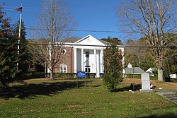
Monroe is an isolated town when it comes to road access. There are no highways or Massachusetts state routes that directly go into the town, the nearest state route being Massachusetts Route 2 and nearest highway Interstate 91. The neighborhood of Monroe Bridge is on the eastern part of the town near the boundaries with Rowe, which both Monroe Bridge and Rowe meet geographically along the Deerfield River. Monroe Bridge accounts for the most urban area of the town, containing a handful of two-story homes and the Monroe Town Hall, centered around Depot Street.
Monroe is the smallest town by population and population density in Franklin County, and second smallest in Massachusetts. As of the census[15] of 2000, there were 93 people, 43 households, and 23 families residing in the town. The population density was 8.7 people per square mile (3.4/km2). There were 67 housing units at an average density of 6.3 per square mile (2.4/km2). The racial makeup of the town was 100.00% White.
There were 43 households, out of which 32.6% had children under the age of 18 living with them, 27.9% were married couples living together, 16.3% had a female householder with no husband present, and 44.2% were non-families. Of all households 37.2% were made up of individuals, and 14.0% had someone living alone who was 65 years of age or older. The average household size was 2.16 and the average family size was 2.83.
In the town, the population was spread out, with 24.7% under the age of 18, 8.6% from 18 to 24, 23.7% from 25 to 44, 25.8% from 45 to 64, and 17.2% who were 65 years of age or older. The median age was 41 years. For every 100 females, there were 86.0 males. For every 100 females age 18 and over, there were 79.5 males.
The median income for a household in the town was $25,500, and the median income for a family was $21,250. Males had a median income of $23,750 versus $28,125 for females. The per capita income for the town was $12,400. There were 37.5% of families and 21.8% of the population living below the poverty line, including 30.8% of under eighteens and 26.7% of those 65 or older. It has the lowest per capita income for any town in Massachusetts.
Government
Monroe employs the open town meeting form of government, and is led by a board of selectmen.[16] The town has no police station, and is patrolled by the Second (Shelburne Falls) Station of Troop "B" of the Massachusetts State Police.[17] There is a fire station, and a library connected to the regional library network. The nearest hospital, North Adams Regional Hospital, is located in North Adams.
On the state level, Monroe is represented in the Massachusetts House of Representatives as part of the First Franklin district, represented by Natalie Blais. In the Massachusetts Senate, the town is part of the Berkshire, Hampden, Franklin and Hampshire district, represented by Paul Mark, which includes all of Berkshire County and western portions of Hampden, Hampshire and Franklin Counties. It is part of the Eighth Massachusetts Governor's Council district, represented by Tara Jacobs.[18][19]
Monroe does not have its own schools. Students attend the Abbott Memorial School in Florida between pre-kindergarten and eighth grades, and Drury High School in North Adams for ninth through twelfth grades. Students also have the option of attending C.H. McCann Technical School for high school, as well as the private and religious schools in the North Adams area for all grades.
↑"1950 Census of Population"(PDF). Bureau of the Census. 1952. Section 6, Pages 21-10 and 21-11, Massachusetts Table 6. Population of Counties by Minor Civil Divisions: 1930 to 1950. Retrieved July 12, 2011.
↑"1920 Census of Population"(PDF). Bureau of the Census. Number of Inhabitants, by Counties and Minor Civil Divisions. Pages 21-5 through 21-7. Massachusetts Table 2. Population of Counties by Minor Civil Divisions: 1920, 1910, and 1920. Retrieved July 12, 2011.
↑"1890 Census of the Population"(PDF). Department of the Interior, Census Office. Pages 179 through 182. Massachusetts Table 5. Population of States and Territories by Minor Civil Divisions: 1880 and 1890. Retrieved July 12, 2011.
↑"1870 Census of the Population"(PDF). Department of the Interior, Census Office. 1872. Pages 217 through 220. Table IX. Population of Minor Civil Divisions, &c. Massachusetts. Retrieved July 12, 2011.
↑"1860 Census"(PDF). Department of the Interior, Census Office. 1864. Pages 220 through 226. State of Massachusetts Table No. 3. Populations of Cities, Towns, &c. Retrieved July 12, 2011.
↑"1850 Census"(PDF). Department of the Interior, Census Office. 1854. Pages 338 through 393. Populations of Cities, Towns, &c. Retrieved July 12, 2011.
This page is based on this Wikipedia article Text is available under the CC BY-SA 4.0 license; additional terms may apply. Images, videos and audio are available under their respective licenses.