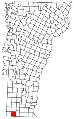
Stamford, Vermont | |
---|---|
Coordinates: 42°46′12″N73°4′48″W / 42.77000°N 73.08000°W | |
Country | United States |
State | Vermont |
County | Bennington |
Area | |
• Total | 39.6 sq mi (102.6 km2) |
• Land | 39.5 sq mi (102.3 km2) |
• Water | 0.1 sq mi (0.3 km2) |
Elevation | 1,804 ft (550 m) |
Population (2020) | |
• Total | 861 |
• Density | 22/sq mi (8.4/km2) |
Time zone | UTC-5 (Eastern (EST)) |
• Summer (DST) | UTC-4 (EDT) |
ZIP code | 05352 |
Area code | 802 |
FIPS code | 50-69775 [1] |
GNIS feature ID | 1462215 [2] |
Website | stamfordvt |
Stamford is a town in Bennington County, Vermont, United States. The population was 861 at the 2020 census. [3]
Stamford is located near the southwestern corner of Vermont, on the Massachusetts state line. To the south of Stamford lie the towns of Clarksburg and Florida, Massachusetts. Stamford is also bordered by the Vermont towns of Pownal to the west, Readsboro to the east, and Woodford to the north. The village of Stamford is in the southern part of town, in the valley of the North Branch of the Hoosic River.
According to the United States Census Bureau, the town has a total area of 39.5 square miles (102.3 km2), of which 39.5 square miles (102.4 km2) is land and 0.12 square miles (0.3 km2), or 0.29%, is water. [4]
Two state-maintained routes share a concurrency through Stamford: Vermont Route 8 and Vermont Route 100. They are the only state highways through town, and the concurrency has its southern terminus at the Massachusetts state line.
Census | Pop. | Note | %± |
---|---|---|---|
1790 | 272 | — | |
1800 | 383 | 40.8% | |
1810 | 378 | −1.3% | |
1820 | 490 | 29.6% | |
1830 | 563 | 14.9% | |
1840 | 662 | 17.6% | |
1850 | 833 | 25.8% | |
1860 | 759 | −8.9% | |
1870 | 633 | −16.6% | |
1880 | 726 | 14.7% | |
1890 | 645 | −11.2% | |
1900 | 677 | 5.0% | |
1910 | 510 | −24.7% | |
1920 | 374 | −26.7% | |
1930 | 370 | −1.1% | |
1940 | 418 | 13.0% | |
1950 | 514 | 23.0% | |
1960 | 600 | 16.7% | |
1970 | 752 | 25.3% | |
1980 | 773 | 2.8% | |
1990 | 773 | 0.0% | |
2000 | 813 | 5.2% | |
2010 | 824 | 1.4% | |
2020 | 861 | 4.5% | |
U.S. Decennial Census [5] |
As of the census [1] of 2000, there were 813 people, 313 households, and 235 families residing in the town. The population density was 20.6 people per square mile (7.9/km2). There were 387 housing units at an average density of 9.8 per square mile (3.8/km2). The racial makeup of the town was 98.52% White, 0.25% Native American, 0.37% Asian, and 0.86% from two or more races. Hispanic or Latino of any race were 0.25% of the population.
There were 313 households, out of which 31.6% had children under the age of 18 living with them, 66.8% were married couples living together, 5.4% had a female householder with no husband present, and 24.9% were non-families. 16.9% of all households were made up of individuals, and 5.4% had someone living alone who was 65 years of age or older. The average household size was 2.60 and the average family size was 2.96.
In the town, the population was spread out, with 25.5% under the age of 18, 5.2% from 18 to 24, 28.4% from 25 to 44, 28.0% from 45 to 64, and 12.9% who were 65 years of age or older. The median age was 41 years. For every 100 females, there were 102.7 males. For every 100 females age 18 and over, there were 96.8 males.
The median income for a household in the town was $48,988, and the median income for a family was $49,345. Males had a median income of $39,196 versus $24,375 for females. The per capita income for the town was $19,575. About 2.4% of families and 3.8% of the population were below the poverty line, including 1.7% of those under age 18 and 11.6% of those age 65 or over.
Windsor County is a county located in the U.S. state of Vermont. As of the 2020 census, the population was 57,753. The shire town is the town of Woodstock. The county's largest municipality is the town of Hartford.
Bennington County is a county in the U.S. state of Vermont. As of the 2020 census, the population was 37,347. The shire towns are jointly Bennington and Manchester, and the largest municipality is Bennington. The county was created in 1778.
Monroe is a town in Franklin County, Massachusetts, United States. The population was 118 at the 2020 census. By area, population, and population density, it is the smallest town in the county; and is the second-smallest town by population in the Commonwealth, with only Gosnold having fewer residents.
Bennington is a city in Douglas County, Nebraska, United States. The population was 2,026 at the 2020 U.S. Census.
Bennington is a town in Hillsborough County, New Hampshire, United States. The population was 1,501 at the 2020 census.
Landgrove is a town in Bennington County, Vermont, United States. The population was 177 at the 2020 census.
North Bennington is an incorporated village in the town of Bennington in Bennington County, Vermont, United States. The population was 1,716 at the 2020 census.
Old Bennington is a village in Bennington County, Vermont, United States. It is located entirely within the town of Bennington. As of the 2020 census, the village had a population of 156.
Peru is a town in Bennington County, Vermont, United States. The population was 531 at the 2020 census. Originally known as Bromley, the town name was changed to "Peru" by the land grantees as a way of attracting land buyers to an area that had been described as 36 square miles (93 km2) of "trees, bears and mountain lions".
Readsboro is a town in Bennington County, Vermont, United States. The town was named after John Reade, a landholder. The population was 702 at the 2020 census. The hamlet of Heartwellville is in the northern part of Readsboro, approximately 5 miles (8 km) north on Route 100 from the hamlet of Readsboro.
Sandgate is a town in Bennington County, Vermont, United States. The population was 387 at the 2020 census.
Shaftsbury is a town in Bennington County, Vermont, United States. The population was 3,598 at the 2020 census.
South Shaftsbury is a census-designated place (CDP) in the town of Shaftsbury in Bennington County, Vermont, United States. The population was 681 at the 2020 census.
Sunderland is a town in Bennington County, Vermont, United States. The population was 1,056 at the 2020 census. It is home to the mail-order company Orvis.
Winhall is a town in Bennington County, Vermont, United States. The population was 1,182 at the 2020 census. In the southeastern corner of the town is the unincorporated village of Bondville. Half of the community of Stratton Mountain, part of Stratton Mountain Resort, is in the southern part of the town.
Woodford is a town in Bennington County, Vermont, United States. As of the 2020 census, the population was 355.
Halifax is a town in Windham County, Vermont, in the United States. As of the 2020 census, the town population was 771.
Bridgewater is a town in Windsor County, Vermont, United States. The population was 903 at the 2020 census. Bridgewater contains the hamlets of Bridgewater Village, Bridgewater Corners, West Bridgewater, and Bridgewater Center.
Sharon is a town in Windsor County, Vermont, United States. It had a population of 1,560 at the 2020 census.
Bennington is a census-designated place (CDP) in Bennington County, Vermont, United States. It is located entirely within the town of Bennington. The population of the CDP was 9,074 at the 2010 census, or 57.6% of the population of the entire town.
Media related to Stamford, Vermont at Wikimedia Commons