Glastenbury, Vermont

Last updated

Glastenbury, Vermont Glastenbury vt highlight.png
Glastenbury, Vermont

Glastenbury is a town in Bennington County, Vermont, United States. The town was unincorporated by an act of the state legislature in 1937. The population was 9 at the 2020 census. [1] Along with Somerset, Glastenbury is one of two Vermont towns where the population levels have dropped so low that the town has been unincorporated. The town has no local government and the town's affairs are handled by a state-appointed supervisor.

Contents

Geography

Glastenbury is located in central Bennington County and is bordered by the town of Sunderland to the north, Shaftsbury to the west, Woodford to the south, and Somerset in Windham County to the east. Most of the town is part of the Green Mountain National Forest. The highest point in town, near the town's geographic center, is 3,748-foot (1,142 m) Glastenbury Mountain. The Long Trail and Appalachian Trail traverse the town from its north to south border, following the crest of the Green Mountains.

According to the United States Census Bureau, the town has a total area of 44.4 square miles (115.1 km2), all land. [2]

History

Glastenbury was first chartered in 1761 by New Hampshire Governor Benning Wentworth, but settlers did not begin trickling into this rocky, forbidding mountainous area for some years after. At the time of Vermont's first census as a new state in 1791, only six families inhabited it. These first settlers found life on Glastenbury Mountain difficult, as would residents ever after, and by 1800 they had been replaced by eight entirely different families. Of these eight, only three would stay on until the next census ten years later, and only one of these would remain in later decades.

Despite the many hardships that greeted Glastenbury settlers, newcomers continued to arrive in small numbers, and the population grew slowly to 76 in 1810. But the years following 1810 were hard ones for all of Vermont, and by 1840 there were only 53 left in Glastenbury. After the Civil War, Glastenbury finally began to experience more rapid growth. Business interests in nearby Bennington were eager to take advantage of the vast timber resources there, and by 1872 had finally begun construction on a railroad (trolley) which ran up the mountain. The line ran along Bolles Brook and terminated at the place where the brook forked. It was an improbable achievement, with some parts of the line climbing as much as 250 feet (76 m) in altitude per mile. Remains of the old trolley tracks can still be seen today.

Meanwhile, the population had grown to 199 in 1870, and to 241 in 1880. This includes only the enumerated population; there were many more transient workers who were drawn to the mountain to work in the then-booming logging business. Two additional sawmills were built in the 1870s, one at the original settlement, called Fayville, and one at the new settlement at the railroad terminus, which became known as South Glastenbury. Dozens of kilns were built at South Glastenbury for converting the lumber to charcoal; at this time Glastenbury was one of the three foremost sites in Vermont for producing the charcoal which was feeding iron production in nearby Shaftsbury and in Troy, New York.

By the late 1880s, however, the mountain had been cleared of nearly all of its mature trees, and the town's economy dipped dramatically. In 1889 the railroad operation ceased. It was revived briefly in 1894 as an electric passenger trolley run by the Bennington & Woodford Railroad, and a brief and initially promising effort was made to convert South Glastenbury to a tourist attraction. A small fortune was spent to convert the area into a mountain resort area which opened in the summer of 1898, but a freshet wiped out the railroad tracks that winter, marking the beginning of the end of Glastenbury as a functioning town. Population dwindled in the early twentieth century, down to only seven in 1937, when the legislature unincorporated the town.

Demographics

Historical population
CensusPop.Note
1790 34
1800 4841.2%
1810 7658.3%
1820 48−36.8%
1830 528.3%
1840 531.9%
1850 52−1.9%
1860 47−9.6%
1870 119153.2%
1880 241102.5%
1890 181−24.9%
1900 48−73.5%
1910 29−39.6%
1920 4037.9%
1930 7−82.5%
1940 4−42.9%
1950 1−75.0%
1980 3
1990 7133.3%
2000 16128.6%
2010 8−50.0%
2020 912.5%
U.S. Decennial Census [3]

As of the census [4] of 2000, there were 16 people, 6 households, and 4 families residing in the town. The population density was 0.4 people per square mile (0.1/km2). There were 11 housing units at an average density of 0.2 per square mile (0.1/km2). The racial makeup of the town was 93.75% White and 6.25% from two or more races.

There were 6 households, out of which 33.3% had children under the age of 18 living with them, 66.7% were married couples living together, 16.7% had a female householder with no husband present, and 16.7% were non-families. No households were made up of individuals. The average household size was 2.67 and the average family size was 2.60.

In the town, the population was spread out, with 25.0% under the age of 18, 6.3% from 18 to 24, 18.8% from 25 to 44, and 50.0% from 45 to 64. The median age was 46 years. For every 100 females, there were 77.8 males. For every 100 females age 18 and over, there were 71.4 males.

The median income for a household in the town was $14,583, and the median income for a family was $14,583. Males had a median income of $56,250 versus $0 for females. The per capita income for the town was $15,436. None of the population was below the poverty line.

Related Research Articles

<span class="mw-page-title-main">Bennington County, Vermont</span> County in Vermont, United States

Bennington County is a county in the U.S. state of Vermont. As of the 2020 census, the population was 37,347. The shire towns are jointly Bennington and Manchester, and the largest municipality is Bennington. The county was created in 1778.

<span class="mw-page-title-main">Bennington Township, Michigan</span> Civil township in Michigan, United States

Bennington Township is a civil township of Shiawassee County in the U.S. state of Michigan. As of the 2010 census, the township population was 3,168. Bennington Township is the center of population of the state of Michigan.

Bennington Township is a township in Mower County, Minnesota, United States. The population was 178 at the 2000 census. All areas and population centers of the township are unincorporated areas. It was named for Bennington, Vermont, the site of a battle in the American Revolutionary War.

<span class="mw-page-title-main">Bennington, New Hampshire</span> Town in New Hampshire, United States

Bennington is a town in Hillsborough County, New Hampshire, United States. The population was 1,501 at the 2020 census.

<span class="mw-page-title-main">Dorset, Vermont</span> Town in Vermont, United States

Dorset is a town in Bennington County, Vermont, United States. The population was 2,133 at the 2020 census. Dorset is famous for being the location of Cephas Kent's Inn, where four meetings of the Convention that signed the Dorset Accords led to the independent Vermont Republic and future statehood. Dorset is the site of America's oldest marble quarry and is the birthplace of Bill W., co-founder of Alcoholics Anonymous. East Dorset is the site of the Wilson House and the Griffith Library. The town is named after the English county of Dorset.

<span class="mw-page-title-main">North Bennington, Vermont</span> Village in Vermont, United States

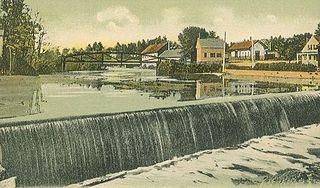
North Bennington is an incorporated village in the town of Bennington in Bennington County, Vermont, United States. The population was 1,716 at the 2020 census.

<span class="mw-page-title-main">Old Bennington, Vermont</span> Village in Vermont, United States

Old Bennington is a village in Bennington County, Vermont, United States. It is located entirely within the town of Bennington. As of the 2020 census, the village had a population of 156.

<span class="mw-page-title-main">Pownal, Vermont</span> Town in Vermont, United States

Pownal is a town in Bennington County, Vermont, United States. As of the 2020 census, the town population was 3,258. The town of Pownal includes the villages of Pownal, North Pownal, and Pownal Center.

<span class="mw-page-title-main">Readsboro, Vermont</span> Town in Vermont, United States

Readsboro is a town in Bennington County, Vermont, United States. The town was named after John Reade, a landholder. The population was 702 at the 2020 census. The hamlet of Heartwellville is in the northern part of Readsboro, approximately 5 miles (8 km) north on Route 100 from the hamlet of Readsboro.

<span class="mw-page-title-main">Sandgate, Vermont</span> Town in Vermont, United States

Sandgate is a town in Bennington County, Vermont, United States. The population was 387 at the 2020 census.

<span class="mw-page-title-main">Shaftsbury, Vermont</span> Town in Vermont, United States

Shaftsbury is a town in Bennington County, Vermont, United States. The population was 3,598 at the 2020 census.

South Shaftsbury is a census-designated place (CDP) in the town of Shaftsbury in Bennington County, Vermont, United States. The population was 681 at the 2020 census.

<span class="mw-page-title-main">Stamford, Vermont</span> Town in Vermont, United States

Stamford is a town in Bennington County, Vermont, United States. The population was 861 at the 2020 census.

<span class="mw-page-title-main">Sunderland, Vermont</span> Town in Vermont, United States

Sunderland is a town in Bennington County, Vermont, United States. The population was 1,056 at the 2020 census. It is home to the mail-order company Orvis.

<span class="mw-page-title-main">Winhall, Vermont</span> Town in Vermont, United States

Winhall is a town in Bennington County, Vermont, United States. The population was 1,182 at the 2020 census. In the southeastern corner of the town is the unincorporated village of Bondville. Half of the community of Stratton Mountain, part of Stratton Mountain Resort, is in the southern part of the town.

<span class="mw-page-title-main">Woodford, Vermont</span> Town in Vermont, United States

Woodford is a town in Bennington County, Vermont, United States. As of the 2020 census, the population was 355.

<span class="mw-page-title-main">Arlington, Vermont</span> Town in Vermont, United States

Arlington is a town in Bennington County, Vermont, United States. The population was 2,457 at the 2020 census.

Bennington is a census-designated place (CDP) in Bennington County, Vermont, United States. It is located entirely within the town of Bennington. The population of the CDP was 9,074 at the 2010 census, or 57.6% of the population of the entire town.

<span class="mw-page-title-main">Bennington, Vermont</span> City in Vermont, United States

Bennington is a town in Bennington County, Vermont, United States. It is one of two shire towns of the county, the other being Manchester. As of the 2020 US Census, the population was 15,333. Bennington is the most populous town in southern Vermont, the second-largest town in Vermont and the sixth-largest municipality in the state.

<span class="mw-page-title-main">Wilmington, Vermont</span> Town in Vermont, United States

Wilmington is a town in Windham County, Vermont, United States. The population was 2,255 at the 2020 census.

References

  1. "Census - Geography Profile: Glastenbury town, Bennington County, Vermont". United States Census Bureau . Retrieved December 30, 2021.
  2. "Geographic Identifiers: 2010 Demographic Profile Data (G001): Glastenbury town, Bennington County, Vermont". U.S. Census Bureau, American Factfinder. Archived from the original on February 12, 2020. Retrieved April 25, 2014.
  3. "U.S. Decennial Census". United States Census Bureau. Retrieved May 16, 2015.
  4. "U.S. Census website". United States Census Bureau . Retrieved January 31, 2008.

Further reading

43°00′01″N73°04′58″W / 43.00028°N 73.08278°W / 43.00028; -73.08278