Arlington (CDP), Vermont

Last updated
Arlington, Vermont
USA Vermont location map.svg
Red pog.svg
Arlington
Coordinates: 43°4′29″N73°9′15″W / 43.07472°N 73.15417°W / 43.07472; -73.15417 Coordinates: 43°4′29″N73°9′15″W / 43.07472°N 73.15417°W / 43.07472; -73.15417
Country United States
State Vermont
County Bennington
Towns Arlington, Sunderland
Area
  Total3.74 sq mi (9.68 km2)
  Land3.68 sq mi (9.53 km2)
  Water0.06 sq mi (0.15 km2)
Elevation
646 ft (197 m)
Population
 (2010)
  Total1,213
  Density330/sq mi (127.3/km2)
Time zone UTC-5 (Eastern (EST))
  Summer (DST) UTC-4 (EDT)
ZIP code
05250
Area code(s) 802
FIPS code 50-01375 [1]
GNIS feature ID1460530 [2]
Arlington Village Historic District
Smith-Canfield House, Arlington.jpg
The Smith-Canfield House, a prominent house in the district
LocationRoughly Main St., School St., E. Arlington Rd., and Battenkill Dr., Arlington, Vermont
Coordinates 43°4′22″N73°9′23″W / 43.07278°N 73.15639°W / 43.07278; -73.15639
Area180 acres (73 ha)
ArchitectWilliam Passman, et al.
Architectural styleColonial Revival, Greek Revival, Federal
NRHP reference No. 89001936 [3]
Added to NRHPNovember 02, 1989

Arlington is a census-designated place (CDP) in the towns of Arlington and Sunderland, Bennington County, Vermont, United States. The population was 1,213 at the 2010 census. [4]

Contents

In 1989, the Arlington Village Historic District was listed on the National Register of Historic Places. The district covers an area of 180 acres (73 ha) and includes 190 contributing buildings and sites in the village center. In addition to historical and architectural significance, the district is also noted for being the place where composer Carl Ruggles spent the later years of his life. The buildings in the district provide examples of Colonial Revival, Greek Revival, and Federal styles. The St. James Episcopal Church (1829–30), the second oldest Gothic Revival church in Vermont, is located in Arlington village. In the early 20th century, the village was an important industrial center with several mills and factories, many of which were washed away by flooding in 1927. The village also has unusual sections of marble sidewalks, laid using stone from nearby quarries. [5]

Geography

The Arlington CDP covers Arlington village, the primary settlement in the town of Arlington, and extends eastward to include the community of East Arlington, reaching partially into the town of Sunderland. Arlington village is located on the south bank of the Batten Kill in the Valley of Vermont, with the Taconic Mountains to the west and the Green Mountains to the east.

Vermont Route 7A is the main road through the village, leading north to Manchester and south to Bennington. Vermont Route 313 leads west from the village center, to West Arlington and the New York state line. U.S. Route 7 bypasses the village to the east, with access from VT 313 south of the village.

According to the United States Census Bureau, the CDP has a total area of 3.7 mi2 (9.6 km2), all land.

Demographics

As of the census [1] of 2000, there were 1,199 people, 516 households, and 327 families residing in the CDP. The population density was 125.5/km2 (324.6/mi2). There were 599 housing units at an average density of 62.7/km2 (162.2/mi2). The racial makeup of the CDP was 97.25% White, 0.50% Black, 0.08% Native American, 0.67% Asian, 0.17% Pacific Islander, 0.08% from other races, and 1.25% from two or more races. Hispanic of any race were 0.25% of the population.

There were 516 households, out of which 26.4% had children under the age of 18 living with them, 49.6% were married couples living together, 10.1% had a female householder with no husband present, and 36.6% were non-families. 31.6% of all households were made up of individuals, and 15.1% had someone living alone who was 65 years of age or older. The average household size was 2.32 and the average family size was 2.92.

In the CDP, the population was spread out, with 22.4% under the age of 18, 7.3% from 18 to 24, 26.5% from 25 to 44, 26.7% from 45 to 64, and 17.1% who were 65 years of age or older. The median age was 41 years. For every 100 females, there were 87.6 males. For every 100 females age 18 and over, there were 84.5 males.

The median income for a household in the CDP was $32,321, and the median income for a family was $41,607. Males had a median income of $26,731 versus $20,000 for females. The per capita income for the CDP was $20,357. About 9.4% of families and 8.9% of the population were below the poverty line, including 13.6% of those under age 18 and 6.5% of those age 65 or over.

See also

Related Research Articles

Bennington County, Vermont County in Vermont, United States

Bennington County is a county in the U.S. state of Vermont. As of the 2020 census, the population was 37,347. The shire towns are jointly Bennington and Manchester, and the largest municipality is Bennington. The county was created in 1778.

Tariffville, Connecticut Census-designated place in Connecticut, United States

Tariffville is a neighborhood and census-designated place (CDP) in the town of Simsbury in Hartford County, Connecticut, United States. The population was 1,324 at the 2010 census. It is a popular location for whitewater paddlers who use the Farmington River.

Marshfield Hills, Massachusetts Census-designated place in Massachusetts, United States

Marshfield Hills is a census-designated place (CDP) in the town of Marshfield in Plymouth County, Massachusetts, United States. The population was 2,356 at the 2010 census. The historic center of the village has been designated a historic district and listed on the National Register of Historic Places.

North Grosvenor Dale, Connecticut United States historic place

North Grosvenordale is a village and census-designated place (CDP) in the town of Thompson in Windham County, Connecticut, United States. The population was 1,530 at the 2010 census. The core of the village is listed as the North Grosvenordale Mill Historic District on the National Register of Historic Places. The historic area around the cotton mill was listed in 1993 and is located on Riverside Drive, Buckley Hill Road, Floral Avenue, Market Lane, and Marshall, Central, River, and Holmes Streets.

Harrisville, Rhode Island Census-designated place in Rhode Island, United States

Harrisville is a census-designated place (CDP) and village in the town of Burrillville in Providence County, Rhode Island, United States. The population was 1,605 at the 2010 census. Much of the community composes a historic district listed on the National Register of Historic Places. The village was named after nineteenth century manufacturer Andrew Harris. Previously, the village was named Rhodesville, after Captain William Rhodes, an eighteenth century privateer.

Manchester Center, Vermont Census-designated place in Vermont, United States

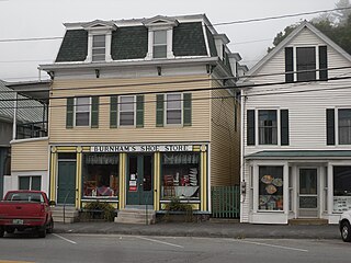
Manchester Center is a census-designated place (CDP) in the town of Manchester in Bennington County, Vermont, United States. As of the 2010 census, the CDP had a population of 2,120, out of 4,391 people in the entire town of Manchester.

North Bennington, Vermont Village in Vermont, United States

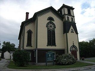
North Bennington is an incorporated village in the town of Bennington in Bennington County, Vermont, United States. The population was 1,716 at the 2020 census.

Old Bennington, Vermont Village in Vermont, United States

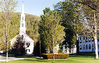
Old Bennington is a village in Bennington County, Vermont, United States. It is located entirely within the town of Bennington. As of the 2020 census, the village had a population of 156.

South Shaftsbury, Vermont Census-designated place in Vermont, United States

South Shaftsbury is a census-designated place (CDP) in the town of Shaftsbury in Bennington County, Vermont, United States. The population was 681 at the 2020 census.

Sunderland, Vermont Town in Vermont, United States

Sunderland is a town in Bennington County, Vermont, United States. The population was 1,056 at the 2020 census. It is home to the mail-order company Orvis.

Wilder, Vermont Census-designated place in Vermont, United States

Wilder is an unincorporated village and census-designated place (CDP) within the town of Hartford in Windsor County, Vermont, United States. It is the location of the Wilder Dam on the Connecticut River. The population of the CDP was 1,690 at the 2010 census. The village center is an early example of a planned mill community, and was listed on the National Register of Historic Places as the Wilder Village Historic District in 1999.

Middlebury (CDP), Vermont Census-designated place in Vermont, United States

Middlebury is the main settlement in the town of Middlebury in Addison County, Vermont, United States, and a census-designated place (CDP). The population was 7,304 at the 2020 census, out of a total population of 9,152 in the town of Middlebury. Most of the village is listed on the National Register of Historic Places as the Middlebury Village Historic District.

Bennington (CDP), Vermont Census-designated place in Vermont, United States

Bennington is a census-designated place (CDP) in Bennington County, Vermont, United States. It is located entirely within the town of Bennington. The population of the CDP was 9,074 at the 2010 census, or 57.6% of the population of the entire town.

Manchester (village), Vermont Village in Vermont, United States

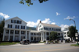
Manchester is an incorporated village in the town of Manchester, Bennington County, Vermont, United States. The population was 783 at the 2020 census.

Bradford (CDP), Vermont Census-designated places in Vermont, United States

Bradford is a census-designated places in the town of Bradford, Orange County, Vermont, United States. The population was 907 at the 2020 census. The village disincorporated on December 1, 2004. The village became a census-designated place in 2008. The central commercial and residential portion of the village is listed on the National Register of Historic Places as the Bradford Village Historic District.

Newbury (village), Vermont Village in Vermont, United States

Newbury is an incorporated village in the town of Newbury in Orange County, Vermont, United States. The population was 447 at the 2020 census.

Brandon (CDP), Vermont CDP in Vermont, United States

Brandon is an unincorporated village and census-designated place (CDP) in the town of Brandon, Rutland County, Vermont, United States. As of the 2020 census, the population was 1,727.

Newfane (village), Vermont Village in Vermont, United States

Newfane is an incorporated village in the town of Newfane in Windham County, Vermont, United States. The population was 87 at the 2020 census.

Center Sandwich, New Hampshire Census-designated place in New Hampshire, United States

Center Sandwich is a census-designated place in the town of Sandwich in Carroll County, New Hampshire, in the United States. It is the primary settlement in the town and had a population of 156 at the 2020 census. The village center and surrounding area are listed on the National Register of Historic Places as the Center Sandwich Historic District.

Canaan (village), Connecticut United States historic place

Canaan is a village and census-designated place (CDP) within the town of North Canaan in Litchfield County, Connecticut, United States. Formerly known as Canaan Depot, the village is more commonly known as Canaan Village to distinguish it from the town of Canaan located to the south of North Canaan. The Canaan Village Historic District is listed on the National Register of Historic Places. As of the 2010 census, the CDP had a population of 1,212, out of a total population of 3,315 in the town of North Canaan.

References

  1. 1 2 "U.S. Census website". United States Census Bureau . Retrieved 2008-01-31.
  2. "US Board on Geographic Names". United States Geological Survey. 2007-10-25. Retrieved 2008-01-31.
  3. "National Register Information System". National Register of Historic Places . National Park Service. March 13, 2009.
  4. "Geographic Identifiers: 2010 Demographic Profile Data (G001): Arlington CDP, Vermont". U.S. Census Bureau, American Factfinder. Archived from the original on February 12, 2020. Retrieved April 30, 2014.
  5. "NRHP nomination for Arlington Village Historic District". National Park Service. Retrieved 2016-01-26.