Sandgate, Vermont

Last updated
Sandgate, Vermont
2020-10-17 14 56 43 View south along Sky Line Drive at about 2100 feet above sea level on Equinox Mountain in Sandgate, Bennington County, Vermont.jpg
Sandgate vt highlight.png
Sandgate, Vermont
Usa edcp location map.svg
Red pog.svg
Sandgate, Vermont
Location in the United States
Coordinates: 43°9′13″N73°11′21″W / 43.15361°N 73.18917°W / 43.15361; -73.18917 Coordinates: 43°9′13″N73°11′21″W / 43.15361°N 73.18917°W / 43.15361; -73.18917
CountryUnited States
State Vermont
County Bennington
CommunitiesSandgate
West Sandgate
Area
  Total42.2 sq mi (109.3 km2)
  Land42.1 sq mi (109.1 km2)
  Water0.08 sq mi (0.2 km2)
Elevation
814 ft (248 m)
Population
 (2020)
  Total387
  Density9/sq mi (3.5/km2)
Time zone UTC-5 (Eastern (EST))
  Summer (DST) UTC-4 (EDT)
ZIP code
05250
Area code 802
FIPS code 50-62875 [1]
GNIS feature ID1462201 [2]
Website www.sandgatevermont.org

Sandgate is a town in Bennington County, Vermont, United States. The population was 387 at the 2020 census. [3]

Contents

Geography

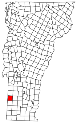
Sandgate is located in northwestern Bennington County and is entirely within the Taconic Mountains. It is bordered to the north by the town of Rupert, to the east by Manchester, to the south by Arlington, and to the west by the town of Salem in Washington County, New York. Bear Mountain, with a summit of 3,301 feet (1,006 m), is the highest point, located in the northern part of the town. The eastern part of town includes the lower slopes of Equinox Mountain, which has its summit in neighboring Manchester.

According to the United States Census Bureau, the town has a total area of 42.2 square miles (109.3 km2), of which 42.1 square miles (109.1 km2) is land and 0.08 square miles (0.2 km2), or 0.16%, is water. [4] The entire town is part of the watershed of the Batten Kill, a tributary of the Hudson River in New York.

Demographics

Historical population
CensusPop.
1790 773
1800 1,02032.0%
1810 1,18716.4%
1820 1,185−0.2%
1830 933−21.3%
1840 777−16.7%
1850 8509.4%
1860 805−5.3%
1870 705−12.4%
1880 681−3.4%
1890 587−13.8%
1900 482−17.9%
1910 401−16.8%
1920 283−29.4%
1930 189−33.2%
1940 187−1.1%
1950 158−15.5%
1960 93−41.1%
1970 12736.6%
1980 23484.3%
1990 27818.8%
2000 35327.0%
2010 40514.7%
2020 387−4.4%
U.S. Decennial Census [5]

As of the census [1] of 2000, there were 353 people, 149 households, and 98 families residing in the town. The population density was 8.4 people per square mile (3.2/km2). There were 268 housing units at an average density of 6.4 per square mile (2.5/km2). The racial makeup of the town was 97.45% White, 0.85% Black, 0.85% Asian, and 0.85% from two or more races. Hispanic of any race were 0.28% of the population.

There were 149 households, out of which 23.5% had children under the age of 18 living with them, 55.7% were married couples living together, 6.7% had a female householder with no husband present, and 34.2% were non-families. 26.8% of all households were made up of individuals, and 8.1% had someone living alone who was 65 years of age or older. The average household size was 2.37 and the average family size was 2.83.

In the town, the age distribution of the population shows 21.5% under the age of 18, 3.7% from 18 to 24, 23.2% from 25 to 44, 34.3% from 45 to 64, and 17.3% who were 65 years of age or older. The median age was 46 years. For every 100 females, there were 115.2 males. For every 100 females age 18 and over, there were 121.6 males.

The median income for a household in the town was $41,250, and the median income for a family was $46,944. Males had a median income of $31,042 versus $24,191 for females. The per capita income for the town was $22,096. About 4.7% of families and 12.7% of the population were below the poverty line, including 20.0% of those under age 18 and 9.9% of those age 65 or over.

Notable people

Related Research Articles

Bennington County, Vermont County in Vermont, United States

Bennington County is a county in the U.S. state of Vermont. As of the 2020 census, the population was 37,347. The shire towns are jointly Bennington and Manchester, and the largest municipality is Bennington. The county was created in 1778.

Bennington, Nebraska City in Nebraska, United States

Bennington is a city in Douglas County, Nebraska, United States. The population was 1,458 at the 2010 U.S. Census.

Bennington, Oklahoma Town in Oklahoma, United States

Bennington is a town in Bryan County, Oklahoma, United States. The population was 334 at the 2010 census.

Landgrove, Vermont Town in Vermont, United States

Landgrove is a town in Bennington County, Vermont, United States. The population was 177 at the 2020 census.

North Bennington, Vermont Village in Vermont, United States

North Bennington is an incorporated village in the town of Bennington in Bennington County, Vermont, United States. The population was 1,716 at the 2020 census.

Old Bennington, Vermont Village in Vermont, United States

Old Bennington is a village in Bennington County, Vermont, United States. It is located entirely within the town of Bennington. As of the 2020 census, the village had a population of 156.

Peru, Vermont Town in Vermont, United States

Peru is a town in Bennington County, Vermont, United States. The population was 531 at the 2020 census. Originally known as Bromley, the town name was changed to "Peru" by the land grantees as a way of attracting land buyers to an area that had been described as 36 square miles (93 km2) of "trees, bears and mountain lions".

Readsboro, Vermont Town in Vermont, United States

Readsboro is a town in Bennington County, Vermont, United States. The town was named after John Reade, a landholder. The population was 702 at the 2020 census. The hamlet of Heartwellville is in the northern part of Readsboro, approximately 5 miles (8 km) north on Route 100 from the hamlet of Readsboro.

Rupert, Vermont Town in Vermont, United States

Rupert is a town in Bennington County, Vermont, United States. The population was 698 at the 2020 census.

Searsburg, Vermont Town in Vermont, United States

Searsburg is a town in Bennington County, Vermont, United States. The population was 126 at the 2020 census.

Shaftsbury, Vermont Town in Vermont, United States

Shaftsbury is a town in Bennington County, Vermont, United States. The population was 3,598 at the 2020 census.

South Shaftsbury is a census-designated place (CDP) in the town of Shaftsbury in Bennington County, Vermont, United States. The population was 681 at the 2020 census.

Stamford, Vermont Town in Vermont, United States

Stamford is a town in Bennington County, Vermont, United States. The population was 861 at the 2020 census.

Sunderland, Vermont Town in Vermont, United States

Sunderland is a town in Bennington County, Vermont, United States. The population was 1,056 at the 2020 census. It is home to the mail-order company Orvis.

Winhall, Vermont Town in Vermont, United States

Winhall is a town in Bennington County, Vermont, United States. The population was 1,182 at the 2020 census. In the southeastern corner of the town is the unincorporated village of Bondville. Half of the community of Stratton Mountain, part of Stratton Mountain Resort, is in the southern part of the town.

Woodford, Vermont Town in Vermont, United States

Woodford is a town in Bennington County, Vermont, United States. As of the 2020 census, the population was 355.

Pawlet, Vermont Town in Vermont, United States

Pawlet is a town in Rutland County, Vermont, United States. The population was 1,424 at the 2020 census.

Halifax, Vermont Town in Vermont, United States

Halifax is a town in Windham County, Vermont, in the United States. As of the 2020 census, the town population was 771.

Bennington is a census-designated place (CDP) in Bennington County, Vermont, United States. It is located entirely within the town of Bennington. The population of the CDP was 9,074 at the 2010 census, or 57.6% of the population of the entire town.

Manchester (village), Vermont Village in Vermont, United States

Manchester is an incorporated village in the town of Manchester, Bennington County, Vermont, United States. The population was 783 at the 2020 census.

References

  1. 1 2 "U.S. Census website". United States Census Bureau . Retrieved 2008-01-31.
  2. "US Board on Geographic Names". United States Geological Survey. 2007-10-25. Retrieved 2008-01-31.
  3. "Census - Geography Profile: Sandgate town, Bennington County, Vermont". United States Census Bureau . Retrieved January 6, 2021.
  4. "Geographic Identifiers: 2010 Demographic Profile Data (G001): Sandgate town, Bennington County, Vermont". U.S. Census Bureau, American Factfinder. Archived from the original on February 12, 2020. Retrieved April 30, 2014.
  5. "U.S. Decennial Census". United States Census Bureau. Retrieved May 16, 2015.