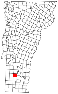
Winhall, Vermont

Last updated

Winhall, Vermont
Winhall Memorial Library, Winhall VT.jpg
Winhall Memorial Library
Winhall vt highlight.png
Winhall, Vermont
Usa edcp location map.svg
Red pog.svg
Winhall, Vermont
Location in the United States
Coordinates: 43°9′22″N72°54′48″W / 43.15611°N 72.91333°W / 43.15611; -72.91333
Country United States
State Vermont
County Bennington
Community Bondville
Area
  Total44.0 sq mi (114.0 km2)
  Land43.6 sq mi (112.8 km2)
  Water0.5 sq mi (1.2 km2)
Elevation
1,798 ft (548 m)
Population
 (2020)
  Total1,182
  Density27/sq mi (10.5/km2)
Time zone UTC-5 (Eastern (EST))
  Summer (DST) UTC-4 (EDT)
ZIP code
05340
Area code 802
FIPS code 50-85075 [1]
GNIS feature ID1462267 [2]
Website www.winhall.org

Winhall is a town in Bennington County, Vermont, United States. The population was 1,182 at the 2020 census. [3] In the southeastern corner of the town is the unincorporated village of Bondville. Half of the community of Stratton Mountain, part of Stratton Mountain Resort, is in the southern part of the town.

Contents

Geography

Winhall is located in northeastern Bennington County and is bordered by Windham County to the east and south. The town is located in the Green Mountains with the crest of the range running from north to south through the western part of the town.

According to the United States Census Bureau, the town has a total area of 44.0 square miles (114.0 km2), of which 43.6 square miles (112.8 km2) are land and 0.46 square miles (1.2 km2), or 1.08%, is water. [4] The majority of the town drains eastward via the Winhall River to the West River, a tributary of the Connecticut River. The western portion of the town drains to the Batten Kill, a tributary of the Hudson River.

Demographics

Historical population
CensusPop.Note
1790 155
1800 20230.3%
1810 429112.4%
1820 428−0.2%
1830 57133.4%
1840 5760.9%
1850 76232.3%
1860 741−2.8%
1870 84213.6%
1880 722−14.3%
1890 523−27.6%
1900 449−14.1%
1910 366−18.5%
1920 336−8.2%
1930 229−31.8%
1940 212−7.4%
1950 25520.3%
1960 245−3.9%
1970 28114.7%
1980 32716.4%
1990 48247.4%
2000 70245.6%
2010 7699.5%
2020 1,18253.7%
U.S. Decennial Census [5]

As of the census [1] of 2000, there were 702 people, 310 households, and 204 families residing in the town. The population density was 16.1 people per square mile (6.2/km2). There were 1,717 housing units at an average density of 39.3 per square mile (15.2/km2). The racial makeup of the town was 98.29% White, 0.43% African American, 0.14% Asian, and 1.14% from two or more races. Hispanic or Latino of any race were 2.71% of the population.

There were 310 households, out of which 24.2% had children under the age of 18 living with them, 56.5% were married couples living together, 5.8% had a female householder with no husband present, and 33.9% were non-families. 24.8% of all households were made up of individuals, and 10.0% had someone living alone who was 65 years of age or older. The average household size was 2.26 and the average family size was 2.66.

In the town, the population was spread out, with 17.2% under the age of 18, 5.8% from 18 to 24, 26.2% from 25 to 44, 30.9% from 45 to 64, and 19.8% who were 65 years of age or older. The median age was 45 years. For every 100 females, there were 97.7 males. For every 100 females age 18 and over, there were 95.0 males.

The median income for a household in the town was $57,750, and the median income for a family was $65,000. Males had a median income of $35,096 versus $22,969 for females. The per capita income for the town was $30,378. About 1.0% of families and 4.0% of the population were below the poverty line, including 4.0% of those under age 18 and none of those age 65 or over.

Notable people

Related Research Articles

<span class="mw-page-title-main">Windham County, Vermont</span> County in Vermont, United States

Windham County is a county located in the U.S. state of Vermont. As of the 2020 census, the population was 45,905. The shire town is Newfane, and the largest municipality is the town of Brattleboro.

<span class="mw-page-title-main">Bennington County, Vermont</span> County in Vermont, United States

Bennington County is a county in the U.S. state of Vermont. As of the 2020 census, the population was 37,347. The shire towns are jointly Bennington and Manchester, and the largest municipality is Bennington. The county was created in 1778.

<span class="mw-page-title-main">Bennington, Nebraska</span> City in Douglas County, Nebraska, United States

Bennington is a city in Douglas County, Nebraska, United States. The population was 2,026 at the 2020 U.S. Census.

<span class="mw-page-title-main">Landgrove, Vermont</span> Town in Vermont, United States

Landgrove is a town in Bennington County, Vermont, United States. The population was 177 at the 2020 census.

<span class="mw-page-title-main">North Bennington, Vermont</span> Village in Vermont, United States

North Bennington is an incorporated village in the town of Bennington in Bennington County, Vermont, United States. The population was 1,716 at the 2020 census.

<span class="mw-page-title-main">Old Bennington, Vermont</span> Village in Vermont, United States

Old Bennington is a village in Bennington County, Vermont, United States. It is located entirely within the town of Bennington. As of the 2020 census, the village had a population of 156.

<span class="mw-page-title-main">Peru, Vermont</span> Town in Vermont, United States

Peru is a town in Bennington County, Vermont, United States. The population was 531 at the 2020 census. Originally known as Bromley, the town name was changed to "Peru" by the land grantees as a way of attracting land buyers to an area that had been described as 36 square miles (93 km2) of "trees, bears and mountain lions".

<span class="mw-page-title-main">Readsboro, Vermont</span> Town in Vermont, United States

Readsboro is a town in Bennington County, Vermont, United States. The town was named after John Reade, a landholder. The population was 702 at the 2020 census. The hamlet of Heartwellville is in the northern part of Readsboro, approximately 5 miles (8 km) north on Route 100 from the hamlet of Readsboro.

<span class="mw-page-title-main">Rupert, Vermont</span> Town in Vermont, United States

Rupert is a town in Bennington County, Vermont, United States. The population was 698 at the 2020 census.

<span class="mw-page-title-main">Sandgate, Vermont</span> Town in Vermont, United States

Sandgate is a town in Bennington County, Vermont, United States. The population was 387 at the 2020 census.

<span class="mw-page-title-main">Searsburg, Vermont</span> Town in Vermont, United States

Searsburg is a town in Bennington County, Vermont, United States. The population was 126 at the 2020 census.

<span class="mw-page-title-main">Shaftsbury, Vermont</span> Town in Vermont, United States

Shaftsbury is a town in Bennington County, Vermont, United States. The population was 3,598 at the 2020 census.

<span class="mw-page-title-main">Stamford, Vermont</span> Town in Vermont, United States

Stamford is a town in Bennington County, Vermont, United States. The population was 861 at the 2020 census.

<span class="mw-page-title-main">Sunderland, Vermont</span> Town in Vermont, United States

Sunderland is a town in Bennington County, Vermont, United States. The population was 1,056 at the 2020 census. It is home to the mail-order company Orvis.

<span class="mw-page-title-main">Woodford, Vermont</span> Town in Vermont, United States

Woodford is a town in Bennington County, Vermont, United States. As of the 2020 census, the population was 355.

<span class="mw-page-title-main">Pawlet, Vermont</span> Town in Vermont, United States

Pawlet is a town in Rutland County, Vermont, United States. The population was 1,424 at the 2020 census.

<span class="mw-page-title-main">Halifax, Vermont</span> Town in Vermont, United States

Halifax is a town in Windham County, Vermont, in the United States. As of the 2020 census, the town population was 771.

<span class="mw-page-title-main">Londonderry, Vermont</span> Town in Vermont, United States

Londonderry is a town in Windham County, Vermont, United States. It is bounded on the north by Landgrove and Weston, on the east by Windham, on the south by Jamaica and on the west by Winhall and Landgrove. The population was 1,919 in the 2020 census. The town contains the villages of Londonderry and South Londonderry.

<span class="mw-page-title-main">Stratton, Vermont</span> Town in Vermont, United States

Stratton is a town in Windham County, Vermont, United States. The population was 440 at the 2020 census.

Bennington is a census-designated place (CDP) in Bennington County, Vermont, United States. It is located entirely within the town of Bennington. The population of the CDP was 9,074 at the 2010 census, or 57.6% of the population of the entire town.

References

  1. 1 2 "U.S. Census website". United States Census Bureau . Retrieved January 31, 2008.
  2. "US Board on Geographic Names". United States Geological Survey. October 25, 2007. Retrieved January 31, 2008.
  3. "Census - Geography Profile: Winhall town, Bennington County, Vermont". United States Census Bureau . Retrieved January 7, 2022.
  4. "Geographic Identifiers: 2010 Demographic Profile Data (G001): Winhall town, Bennington County, Vermont". U.S. Census Bureau, American Factfinder. Archived from the original on February 12, 2020. Retrieved April 30, 2014.
  5. "U.S. Decennial Census". United States Census Bureau. Retrieved May 16, 2015.