Heath, Massachusetts

Last updated

Heath, Massachusetts
Heath-Dell Dam.JPG
Dell Dam in autumn
HeathMA seal.png
Franklin County Massachusetts incorporated and unincorporated areas Heath highlighted.svg
Location in Franklin County in Massachusetts
Coordinates: 42°40′24″N72°49′20″W / 42.67333°N 72.82222°W / 42.67333; -72.82222
Country United States
State Massachusetts
County Franklin
Settled1765
Incorporated1785
Government
  Type Open town meeting
Area
  Total24.9 sq mi (64.5 km2)
  Land24.9 sq mi (64.5 km2)
  Water0.0 sq mi (0.1 km2)
Elevation
[1]
1,729 ft (527 m)
Population
 (2020)
  Total723
  Density29/sq mi (11/km2)
Time zone UTC−5 (Eastern)
  Summer (DST) UTC−4 (Eastern)
ZIP Code
01346
Area code 413
FIPS code 25-29650
GNIS feature ID0618167 [1]
Website www.townofheath.org

Heath is a town in Franklin County, Massachusetts, United States. The population was 723 at the 2020 census. [2] It is part of the Springfield, Massachusetts Metropolitan Statistical Area.

Contents

History

Burnt Hill Stone Circle, a Pre-Columbian site in Heath Steinkreis Burnt Hill Massachusetts gross.jpg
Burnt Hill Stone Circle, a Pre-Columbian site in Heath

Heath was first settled in 1765 as a part of Charlemont. The town, as well as neighboring Rowe, separated, and Heath was officially incorporated in 1785, just a few days after its new neighbor. The town is named after William Heath, Major General of Massachusetts and Brigadier General in the national army during the American Revolution. [3]

General Heath had been the commanding officer and friend of Col. Hugh Maxwell, a local citizen who suggested the town be named in his honor. [4] In 1784 Maxwell, who was severely wounded at the Battle of Bunker Hill by a bullet through his shoulder, was chosen to represent Heath at the General Court in Boston and obtain a division of the town from Charlemont. Accordingly, the new town was incorporated on February 14, 1785. [5]

Chloe Maxwell, daughter of Col. Maxwell, was married to prominent local landowner and state legislator abolitionist Roger Leavitt. [6] Their son was the Congregational minister, lawyer, social reformer, editor and fervent abolitionist Rev. Joshua Leavitt, who after his graduation from Yale College was the first lawyer to practice in Heath. (Rev. Leavitt soon gave up law for the ministry, training at Yale Theological Seminary and settling in Stratford, Connecticut, before decamping for New York City and a career that included the editorship of The Emancipator . [7] ) Members of the Leavitt family of Heath and Charlemont provided stops on the Underground Railroad, and in some cases sheltered slaves like Basil Dorsey who were fleeing the South. [8]

The town had some farming and other small industry in the nineteenth century, but much of it is gone now, leaving the town as a rural area. One of its more distinctive industries was a straw hat business, where palm fronds were imported from the Carolinas to be woven by women and children during their free time. Each year, the Heath Agricultural Society hosts the Heath Fair, a small agriculturally-focused fair held two weekends before Labor Day. [9]

Geography

Heath Union Church Heath Union Church, Heath, Massachusetts.jpg
Heath Union Church

According to the United States Census Bureau, the town has a total area of 24.9 square miles (64 km2), of which 24.9 square miles (64 km2) is land and 0.04 square miles (0.10 km2), or 0.08%, is water. Heath lies along the Vermont border between Franklin and Windham counties. Heath is bordered by Whitingham and Halifax, Vermont, to the north, Colrain to the east, Charlemont to the south and southwest, and Rowe to the west. Heath is located 17 miles (27 km) northwest of Greenfield, 49 miles (79 km) north-northwest of Springfield, and 106 miles (171 km) west-northwest of Boston.

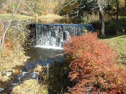
Heath is located in the northeastern portion of the Berkshires, with the highest point being Burnt Hill to the southeast. Heath is fed by the West Branch of the North River, which originates near the state line and heads south-eastward towards Colrain. Several brooks also feed into this and the nearby Deerfield River, and there is a large settlement around Papoose Lake, which drains into the Taylor Brook and eventually the North River.

Massachusetts Route 8A runs from Charlemont towards its terminus at the Vermont border, where it becomes Vermont Route 8A (this route, however, never rejoins Vermont Route 8, but rather joins Vermont Route 112). Route 8A is the main link between Heath and Charlemont, where it meets Massachusetts Route 2 (the Mohawk Trail) and provides access to the region. The nearest expressway, Interstate 91, is accessible in Greenfield. The town has no rail, bus or air service. The nearest bus and small air service is in Greenfield and Turners Falls, respectively, and the nearest Amtrak service is in Greenfield. The nearest national air service can be reached at Albany International Airport in New York.

Demographics

Historical population
YearPop.±%
1850 803    
1860 661−17.7%
1870 613−7.3%
1880 560−8.6%
1890 503−10.2%
1900 441−12.3%
1910 346−21.5%
1920 325−6.1%
1930 331+1.8%
1940 359+8.5%
1950 305−15.0%
1960 304−0.3%
1970 383+26.0%
1980 482+25.8%
1990 716+48.5%
2000 805+12.4%
2010 706−12.3%
2020 723+2.4%
2022721−0.3%

Source: United States census records and Population Estimates Program data. [10] [11] [12] [13] [14] [15] [16] [17] [18] [19] [20]

As of the census [21] of 2000, there were 805 people, 292 households, and one family residing in the town. By population, Heath ranks twenty-first of the twenty-six towns in Franklin County, and 332nd out of the 351 cities and towns in the Commonwealth. The population density was 32.3 inhabitants per square mile (12.5/km2), which ranks twentieth in the county and 327th in the Commonwealth. There were 648 housing units at an average density of 26.0 per square mile (10.0/km2). The racial makeup of the town was 97.76% White, 0.50% Asian, 0.37% from other races, and 1.37% from two or more races. Hispanic or Latino of any race were 0.62% of the population.

There were 292 households, out of which 35.3% had children under the age of 18 living with them, 62.7% were married couples living together, 5.5% had a female householder with no husband present, and 27.1% were non-families. Of all households, 19.9% were made up of individuals, and 6.8% had someone living alone who was 65 years of age or older. The average household size was 2.76 and the average family size was 3.19.

In the town, the population was spread out, with 28.7% under the age of 18, 5.2% from 18 to 24, 26.2% from 25 to 44, 29.6% from 45 to 64, and 10.3% who were 65 years of age or older. The median age was 39 years. For every 100 females, there were 101.3 males. For every 100 females age 18 and over, there were 102.1 males.

The median income for a household in the town was $50,536, and the median income for a family was $55,938. Males had a median income of $32,188 versus $25,000 for females. The per capita income for the town was $24,777. About 6.5% of families and 9.4% of the population were below the poverty line, including 10.3% of those under age 18 and 4.8% of those age 65 or over.

During the 1970s and 1980s, many families from New York, Connecticut, and Maine moved to Heath.[ citation needed ]

Government

Heath Memorial Hall, site of town meetings Heath Memorial Hall.jpg
Heath Memorial Hall, site of town meetings

Heath employs the open town meeting form of government, and is led by a board of selectmen and an administrative assistant. The town has its own police and fire departments, as well as a post office. The town has a library, Heath Free Public Library, which is connected to the regional library network. The nearest hospital is the Franklin Medical Center in Greenfield.

On the state level, Heath is represented in the Massachusetts House of Representatives as part of the Second Berkshire district, represented by Paul Mark, which covers central Berkshire County, as well as portions of Hampshire and Franklin Counties. In the Massachusetts Senate, the town is part of the Berkshire, Hampshire and Franklin district, represented by Ben Downing, which includes all of Berkshire County and the western portions of Hampshire and Franklin Counties. [22] The town is patrolled by the Second (Shelburne Falls) Station of Troop "B" of the Massachusetts State Police. [23]

On the national level, Heath is represented in the United States House of Representatives as part of Massachusetts's 1st congressional district, and is represented by Richard Neal. Massachusetts is represented in the United States Senate by senior Senator Elizabeth Warren and junior Senator Ed Markey.

Education

Heath is a member of the Mohawk Trail Regional School District, which covers six towns on the elementary level and most of western Franklin County on the upper levels of education. Heath Elementary School serves students from pre-kindergarten through sixth grades, and students from grades 7–12 attend Mohawk Trail Regional High School in Buckland. There is a private school, the Academy at Charlemont, in neighboring Charlemont, and several other private and religious schools are located in the region.

The nearest community college, Greenfield Community College, is located in Greenfield. The nearest state college is Massachusetts College of Liberal Arts in North Adams, and the nearest state university is the University of Massachusetts Amherst. The nearest private college is Williams College in Williamstown, with several others located southeast in the Northampton area.

Notable people

Related Research Articles

<span class="mw-page-title-main">Franklin County, Massachusetts</span> County in Massachusetts, United States

Franklin County is a nongovernmental county located in the northwestern part of the U.S. state of Massachusetts. As of the 2020 census, the population was 71,029, which makes it the least-populous county on the Massachusetts mainland, and the third-least populous county in the state. Its traditional county seat and most populous city is Greenfield. Its largest town by area is New Salem. Franklin County comprises the Greenfield Town, MA Micropolitan Statistical Area, which is included in the Springfield-Greenfield Town, MA Combined Statistical Area.

<span class="mw-page-title-main">Clarksburg, Massachusetts</span> Town in Massachusetts, United States

Clarksburg is a town in Berkshire County, Massachusetts, United States. It is part of the Pittsfield, Massachusetts Metropolitan Statistical Area. The population was 1,657 at the 2020 census.

<span class="mw-page-title-main">Florida, Massachusetts</span> Town in Massachusetts, United States

Florida is a town in Berkshire County, Massachusetts, United States. It is part of the Pittsfield, Massachusetts Metropolitan Statistical Area. It is home to the east portal of the Hoosac Tunnel, as well as Whitcomb Summit, the highest point of the Mohawk Trail. Florida contains the village of Drury. At the 2020 census the town had a total population of 694. Despite the town’s name, Florida is statistically the coldest and snowiest town in Massachusetts.

<span class="mw-page-title-main">Otis, Massachusetts</span> Town in Massachusetts, United States

Otis is a town in Berkshire County, Massachusetts, United States. It is part of the Pittsfield, Massachusetts, Metropolitan Statistical Area. The population was 1,634 at the 2020 census.

<span class="mw-page-title-main">Savoy, Massachusetts</span> Town in Massachusetts, United States

Savoy is a town in Berkshire County, Massachusetts, United States. It is part of the Pittsfield, Massachusetts Metropolitan Statistical Area. The population was 645 at the 2020 census.

<span class="mw-page-title-main">Washington, Massachusetts</span> Town in Massachusetts, United States

Washington is a town in Berkshire County, Massachusetts, United States. It is part of the Pittsfield, Massachusetts, Metropolitan Statistical Area. The population was 494 at the 2020 census.

<span class="mw-page-title-main">Windsor, Massachusetts</span> Town in Massachusetts, United States

Windsor is a town in Berkshire County, Massachusetts, United States. It is part of the Pittsfield, Massachusetts Metropolitan Statistical Area. The population was 831 at the 2020 census.

<span class="mw-page-title-main">Ashfield, Massachusetts</span> Town in Massachusetts, United States

Ashfield is a town in Franklin County, Massachusetts, United States. The population was 1,695 at the 2020 census. It is part of the Springfield, Massachusetts Metropolitan Statistical Area.

<span class="mw-page-title-main">Bernardston, Massachusetts</span> Town in Massachusetts, United States

Bernardston is a town in Franklin County, Massachusetts, United States. The population was 2,102 at the 2020 census. It is part of the Springfield, Massachusetts Metropolitan Statistical Area.

<span class="mw-page-title-main">Buckland, Massachusetts</span> Town in Massachusetts, United States

Buckland is a town in Franklin County, Massachusetts, United States. The population was 1,816 at the 2020 census. The town shares the village of Shelburne Falls with neighboring Shelburne. The town center at Shelburne Falls is the western end of the Bridge of Flowers, a local tourist attraction.

<span class="mw-page-title-main">Charlemont, Massachusetts</span> Town in Massachusetts, United States

Charlemont is a town in Franklin County, Massachusetts, United States. The population was 1,185 at the 2020 census. It is part of the Springfield, Massachusetts Metropolitan Statistical Area.

<span class="mw-page-title-main">Colrain, Massachusetts</span> Town in Massachusetts, United States

Colrain is a town in Franklin County, Massachusetts, United States. The population was 1,606 at the 2020 census. It is part of the Springfield, Massachusetts Metropolitan Statistical Area.

<span class="mw-page-title-main">Conway, Massachusetts</span> Town in Massachusetts, United States

Conway is a town in Franklin County, Massachusetts, United States. The population was 1,761 at the 2020 census. It is part of the Springfield, Massachusetts Metropolitan Statistical Area.

<span class="mw-page-title-main">Hawley, Massachusetts</span> Town in Massachusetts, United States

Hawley is a town in Franklin County, Massachusetts, United States. The population was 353 at the 2020 census. It is part of the Springfield, Massachusetts Metropolitan Statistical Area.

<span class="mw-page-title-main">Leyden, Massachusetts</span> Town in Massachusetts, United States

Leyden is a town in Franklin County, Massachusetts, United States. The population was 734 at the 2020 census. It is part of the Springfield, Massachusetts Metropolitan Statistical Area.

<span class="mw-page-title-main">Monroe, Massachusetts</span> Town in Massachusetts, United States

Monroe is a town in Franklin County, Massachusetts, United States. The population was 118 at the 2020 census. By area, population, and population density, it is the smallest town in the county; and is the second-smallest town by population in the Commonwealth, with only Gosnold having fewer residents.

<span class="mw-page-title-main">Rowe, Massachusetts</span> Town in Massachusetts, United States

Rowe is a town in Franklin County, Massachusetts, United States. The population was 424 at the 2020 census.

<span class="mw-page-title-main">Shelburne, Massachusetts</span> Town in Massachusetts, United States

Shelburne is a town in Franklin County, Massachusetts, United States. The population was 1,884 at the 2020 census. It is part of the Springfield, Massachusetts Metropolitan Statistical Area.

<span class="mw-page-title-main">Greenfield, Massachusetts</span> City in Massachusetts, United States

Greenfield is the only city in and the seat of Franklin County, Massachusetts, United States. Greenfield was first settled in 1686. The population was 17,768 at the 2020 census. Greenfield is home to Greenfield Community College, the Pioneer Valley Symphony Orchestra, and the Franklin County Fair. The city has a Main Street Historic District containing fine examples of Federal, Greek Revival, and Victorian architecture.

<span class="mw-page-title-main">Northfield, Massachusetts</span> Town in Massachusetts, United States

Northfield is a town in Franklin County, Massachusetts, United States. Northfield was first settled in 1673. The population was 2,866 at the 2020 census. It is part of the Springfield, Massachusetts Metropolitan Statistical Area. The Connecticut River runs through the town, dividing West Northfield from East Northfield and the village of Northfield, where the town hall is located.

References

  1. 1 2 U.S. Geological Survey Geographic Names Information System: Heath, Massachusetts
  2. "Census - Geography Profile: Heath town, Franklin County, Massachusetts". United States Census Bureau . Retrieved November 14, 2021.
  3. Gannett, Henry (1905). The Origin of Certain Place Names in the United States. Govt. Print. Off. pp.  153.
  4. Letter from William Heath to Hugh Maxwell, 1781, Collections of the Massachusetts Historical Society, Massachusetts Historical Society, Boston, 1905
  5. History of Western Massachusetts, Josiah Gilbert Holland, Springfield, Mass., 1855
  6. Papers and Proceedings of the Connecticut Valley Historical Society, Vol. II, published by the Society, Springfield, 1904
  7. History of Ancient Woodbury, William Cothren, Waterbury, Conn., 1854
  8. National Underground Railroad Network to Freedom, National Park Service, nps.gov
  9. Town of Heath - Franklin County Chamber of Commerce [ permanent dead link ]
  10. "Total Population (P1), 2010 Census Summary File 1". American FactFinder, All County Subdivisions within Massachusetts. United States Census Bureau. 2010.
  11. "Massachusetts by Place and County Subdivision - GCT-T1. Population Estimates". United States Census Bureau. Retrieved July 12, 2011.
  12. "1990 Census of Population, General Population Characteristics: Massachusetts" (PDF). US Census Bureau. December 1990. Table 76: General Characteristics of Persons, Households, and Families: 1990. 1990 CP-1-23. Retrieved July 12, 2011.
  13. "1980 Census of the Population, Number of Inhabitants: Massachusetts" (PDF). US Census Bureau. December 1981. Table 4. Populations of County Subdivisions: 1960 to 1980. PC80-1-A23. Retrieved July 12, 2011.
  14. "1950 Census of Population" (PDF). Bureau of the Census. 1952. Section 6, Pages 21-10 and 21-11, Massachusetts Table 6. Population of Counties by Minor Civil Divisions: 1930 to 1950. Retrieved July 12, 2011.
  15. "1920 Census of Population" (PDF). Bureau of the Census. Number of Inhabitants, by Counties and Minor Civil Divisions. Pages 21-5 through 21-7. Massachusetts Table 2. Population of Counties by Minor Civil Divisions: 1920, 1910, and 1920. Retrieved July 12, 2011.
  16. "1890 Census of the Population" (PDF). Department of the Interior, Census Office. Pages 179 through 182. Massachusetts Table 5. Population of States and Territories by Minor Civil Divisions: 1880 and 1890. Retrieved July 12, 2011.
  17. "1870 Census of the Population" (PDF). Department of the Interior, Census Office. 1872. Pages 217 through 220. Table IX. Population of Minor Civil Divisions, &c. Massachusetts. Retrieved July 12, 2011.
  18. "1860 Census" (PDF). Department of the Interior, Census Office. 1864. Pages 220 through 226. State of Massachusetts Table No. 3. Populations of Cities, Towns, &c. Retrieved July 12, 2011.
  19. "1850 Census" (PDF). Department of the Interior, Census Office. 1854. Pages 338 through 393. Populations of Cities, Towns, &c. Retrieved July 12, 2011.
  20. "City and Town Population Totals: 2020-2022". United States Census Bureau . Retrieved November 10, 2023.
  21. "U.S. Census website". United States Census Bureau . Retrieved January 31, 2008.
  22. List of Massachusetts Legislators by City and Town
  23. Station B-2, SP Shelburne Falls