Windsor, Massachusetts

Last updated

Windsor, Massachusetts
Windsor Welcome Sign.jpg
Entering Windsor
WindsorMA-seal.png
Berkshire County Massachusetts incorporated and unincorporated areas Windsor highlighted.svg
Location in Berkshire County and the state of Massachusetts.
Coordinates: 42°30′42″N73°03′30″W / 42.51167°N 73.05833°W / 42.51167; -73.05833
Country United States
State Massachusetts
County Berkshire
Settled1767
Incorporated1771
Government
  Type Open town meeting
Area
  Total35.2 sq mi (91.1 km2)
  Land35.0 sq mi (90.6 km2)
  Water0.2 sq mi (0.4 km2)
Elevation
2,031 ft (619 m)
Population
 (2020)
  Total899
  Density26/sq mi (9.9/km2)
Time zone UTC-5 (Eastern)
  Summer (DST) UTC-4 (Eastern)
ZIP code
01270
Area code 413
FIPS code 25-80685
GNIS feature ID0619431
Website windsormass.com

Windsor is a town in Berkshire County, Massachusetts, United States. It is part of the Pittsfield, Massachusetts Metropolitan Statistical Area. The population was 831 at the 2020 census. [1]

Contents

History

Windsor was first settled in 1767 and was officially incorporated in 1771. The town was named for Windsor, Connecticut, where many of the settlers emigrated from. Originally, the town was named "Gageborough" in honor of British General Thomas Gage, but was changed due to the general's Revolutionary War affiliation.

Geography

Eugene Moran Wildlife Management Area Eugene Moran WMA, Windsor MA.jpg
Eugene Moran Wildlife Management Area

According to the United States Census Bureau, the town has a total area of 35.2 square miles (91.1 km2), of which 35.0 square miles (90.6 km2) is land and 0.15 square miles (0.4 km2), or 0.49%, is water. [2] Windsor is mostly rectangular-shaped, and lies along the eastern border of Berkshire County with Hampshire County. It is bordered by Savoy to the north, Plainfield to the northeast and east, Cummington to the southeast, Peru and Hinsdale to the south, Dalton to the southwest, and Cheshire to the northwest. Windsor is 12 miles (19 km) northeast of Pittsfield, 45 miles (72 km) northwest of Springfield, and 120 miles (190 km) west-northwest of Boston.

Windsor is located on a plateau in the Berkshire Hills, and lies near the source of the Westfield River. The river runs southward through the northeast part of town, flowing through Windsor State Forest. One of the river's feeder brooks flows through the Windsor Jambs, a series of rocky waterfalls. The town is dotted with wildlife management areas, including all of Eugene Moran Wildlife Management Area, as well as portions of the Chalet, Peru and Savoy Wildlife Management Areas.

Windsor is located at the junction of Massachusetts Route 9 and Route 8A, with the two running concurrently west from the junction. Near the northeast corner of town, Route 8A grazes the border (at which point it is combined with Route 116), with a small neighborhood lying around Windsor Pond.

The town has no bus or rail service, with the nearest access to both being in Pittsfield. The Pittsfield Municipal Airport is the nearest regional airport, and the town is located roughly equidistantly between Albany International Airport and Bradley International Airport, the two nearest airports with national service.

Demographics

Historical population
YearPop.±%
1850 897    
1860 839−6.5%
1870 686−18.2%
1880 644−6.1%
1890 612−5.0%
1900 507−17.2%
1910 404−20.3%
1920 403−0.2%
1930 387−4.0%
1940 314−18.9%
1950 372+18.5%
1960 384+3.2%
1970 468+21.9%
1980 598+27.8%
1990 770+28.8%
2000 875+13.6%
2010 899+2.7%
2020 834−7.2%
2022*818−1.9%
* = population estimate.
Source: United States census records and Population Estimates Program data. [3] [4] [5] [6] [7] [8] [9] [10] [11] [12] [13]
Windsor Congregational Church Windsor Congregational Church.JPG
Windsor Congregational Church

As of the census [14] of 2000, there were 875 people, 328 households, and 248 families residing in the town. By population, Windsor ranks 22nd out of the 32 cities and towns in Berkshire County, and 329th out of 351 cities and towns in Massachusetts. The population density was 25.0 people per square mile (9.7/km2), and ranks 25th in the county and 334th in the commonwealth. There were 474 housing units at an average density of 13.5 per square mile (5.2/km2). The racial makeup of the town was 98.86% White, 0.34% from other races, and 0.80% from two or more races. Hispanic or Latino of any race were 0.11% of the population.

There were 328 households, out of which 35.1% had children under the age of 18 living with them, 67.7% were married couples living together, 5.5% had a female householder with no husband present, and 24.1% were non-families. 19.2% of all households were made up of individuals, and 7.6% had someone living alone who was 65 years of age or older. The average household size was 2.67 and the average family size was 3.05.

In the town, the population was spread out, with 26.6% under the age of 18, 4.2% from 18 to 24, 26.6% from 25 to 44, 32.2% from 45 to 64, and 10.3% who were 65 years of age or older. The median age was 41 years. For every 100 females, there were 101.6 males. For every 100 females age 18 and over, there were 98.1 males.

The median income for a household in the town was $51,389, and the median income for a family was $57,500. Males had a median income of $41,053 versus $24,808 for females. The per capita income for the town was $21,794. About 4.3% of families and 5.1% of the population were below the poverty line, including 6.4% of those under age 18 and 1.2% of those age 65 or over.

Government

Windsor Free Public Library Windsor Library.JPG
Windsor Free Public Library

Windsor employs the open town meeting form of government, and is led by a board of selectmen. The town has its own services, including police, fire and public works departments. The town's public library is located adjacent to the town hall, and is connected to the regional library system. The nearest hospital, Berkshire Medical Center, is located in Pittsfield.

On the state level, Windsor is represented in the Massachusetts House of Representatives as part of the Second Berkshire district, represented by Paul Mark, which covers central Berkshire County, as well as portions of Hampshire and Franklin counties. In the Massachusetts Senate, the town is part of the Berkshire, Hampshire and Franklin district, represented by Ben Downing, which includes all of Berkshire County and western Hampshire and Franklin counties. [15] The town is patrolled by the Fourth (Cheshire) Station of Barracks "B" of the Massachusetts State Police. [16]

On the national level, Windsor is represented in the United States House of Representatives as part of Massachusetts's 1st congressional district, and is represented by Richard Neal of Springfield. Massachusetts is currently represented in the United States Senate by senior Senator Elizabeth Warren and junior Senator Ed Markey.

Education

Windsor is a member town of the Central Berkshire Regional School District. Elementary school students attend Craneville Elementary School in Dalton. (The Berkshire Trail Elementary School in Cummington, which served both towns for more than 20 years, stopped operating as a public school with the close of the academic year during June 2015.) All students in the district attend the Nessacus Regional Middle School for the middle grades, and Wahconah Regional High School for the upper grades. Both schools are located in Dalton. The nearest parochial school is in Dalton, and the nearest private schools are in Pittsfield.

The nearest community college is Berkshire Community College in Pittsfield. The nearest state college is Massachusetts College of Liberal Arts in North Adams, and the nearest state university is the University of Massachusetts Amherst.

Points of interest

Notable people

Related Research Articles

<span class="mw-page-title-main">Berkshire County, Massachusetts</span> County in Massachusetts, United States

Berkshire County is the westernmost county in the U.S. state of Massachusetts. As of the 2020 census, the population was 129,026. Its largest city and traditional county seat is Pittsfield. The county was founded in 1761. The Berkshire Hills are centered on Berkshire County. Residents are known as Berkshirites. It exists today only as a historical geographic region, and has no county government, with the exception of the retirement board for former county workers, and certain offices such as the sheriff and registry of deeds.

<span class="mw-page-title-main">Alford, Massachusetts</span> Town in Massachusetts, United States

Alford is a town in Berkshire County, Massachusetts, United States. It is part of the Pittsfield, Massachusetts Metropolitan Statistical Area. The population was 486 at the 2020 census.

<span class="mw-page-title-main">Becket, Massachusetts</span> Town in Massachusetts, United States

Becket is a town in Berkshire County, Massachusetts, United States. It is part of the Pittsfield, Massachusetts Metropolitan Statistical Area. The population was 1,931 at the 2020 census.

<span class="mw-page-title-main">Cheshire, Massachusetts</span> Town in Massachusetts, United States

Cheshire is a town in Berkshire County, Massachusetts, United States. It is part of the Pittsfield, Massachusetts Metropolitan Statistical Area. The population was 3,258 at the 2020 census.

<span class="mw-page-title-main">Clarksburg, Massachusetts</span> Town in Massachusetts, United States

Clarksburg is a town in Berkshire County, Massachusetts, United States. It is part of the Pittsfield, Massachusetts Metropolitan Statistical Area. The population was 1,657 at the 2020 census.

<span class="mw-page-title-main">Dalton, Massachusetts</span> Town in Massachusetts, United States

Dalton is a town in Berkshire County, Massachusetts. Dalton is a transition town between the urban and rural portions of Berkshire County. It is part of the Pittsfield, Massachusetts Metropolitan Statistical Area. The population was 6,330 at the 2020 census.

<span class="mw-page-title-main">Hancock, Massachusetts</span> Town in Massachusetts, United States

Hancock is a town in Berkshire County, Massachusetts, United States. It is part of the Pittsfield, Massachusetts Metropolitan Statistical Area. The population was 757 at the 2020 census.

<span class="mw-page-title-main">Hinsdale, Massachusetts</span> Town in Massachusetts, United States

Hinsdale is a town in Berkshire County, Massachusetts, United States. It is part of the Metropolitan Statistical Area of Pittsfield, Massachusetts. The population was 1,919 at the 2020 census.

<span class="mw-page-title-main">Lanesborough, Massachusetts</span> Town in Massachusetts, United States

Lanesborough is a town in Berkshire County, Massachusetts, United States. It is part of the Pittsfield, Massachusetts Metropolitan Statistical Area. The population was 3,038 at the 2020 census.

<span class="mw-page-title-main">Monterey, Massachusetts</span> Town in Massachusetts, United States

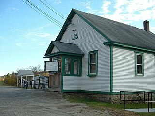
Monterey is a small town in Berkshire County, Massachusetts, United States. It is part of the Pittsfield, Massachusetts Metropolitan Statistical Area. The population was 1,095 at the 2020 census.

<span class="mw-page-title-main">New Ashford, Massachusetts</span> Town in Massachusetts, United States

New Ashford is a town in Berkshire County, Massachusetts, United States. It is part of the Pittsfield, Massachusetts Metropolitan Statistical Area. The population was 250 at the 2020 census.

<span class="mw-page-title-main">New Marlborough, Massachusetts</span> Town in Massachusetts, United States

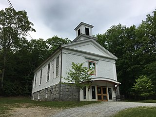
New Marlborough is a town in Berkshire County, Massachusetts, United States. It is part of the Pittsfield, Massachusetts Metropolitan Statistical Area. The population was 1,528 at the 2020 census. New Marlborough consists of five villages: Clayton, Hartsville, Mill River, New Marlborough Village and Southfield.

<span class="mw-page-title-main">Otis, Massachusetts</span> Town in Massachusetts, United States

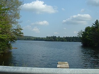
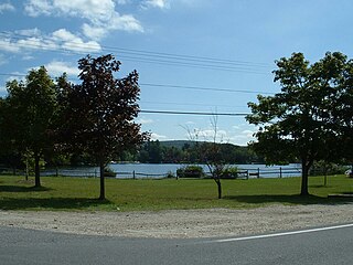
Otis is a town in Berkshire County, Massachusetts, United States. It is part of the Pittsfield, Massachusetts, Metropolitan Statistical Area. The population was 1,634 at the 2020 census.

<span class="mw-page-title-main">Peru, Massachusetts</span> Town in Massachusetts, United States

Peru is a town in Berkshire County, Massachusetts, United States. The population was 814 at the 2020 census.

<span class="mw-page-title-main">Richmond, Massachusetts</span> Town in Massachusetts, United States

Richmond is a town in Berkshire County, Massachusetts, United States. It is part of the Pittsfield, Massachusetts Metropolitan Statistical Area. The population was 1,407 at the 2020 census.

<span class="mw-page-title-main">Sandisfield, Massachusetts</span> Town in Massachusetts, United States

Sandisfield is a town in Berkshire County, Massachusetts, United States. It is part of the Pittsfield, Massachusetts Metropolitan Statistical Area. The population was 989 at the 2020 census.

<span class="mw-page-title-main">Savoy, Massachusetts</span> Town in Massachusetts, United States

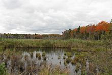
Savoy is a town in Berkshire County, Massachusetts, United States. It is part of the Pittsfield, Massachusetts Metropolitan Statistical Area. The population was 645 at the 2020 census.

<span class="mw-page-title-main">Sheffield, Massachusetts</span> Town in Massachusetts, United States

Sheffield is a town in Berkshire County, Massachusetts, United States. It is part of the Pittsfield, Massachusetts, Metropolitan Statistical Area. The population was 3,327 at the 2020 census. Sheffield is home to Berkshire School, a private preparatory school. The former resort town includes the village of Ashley Falls, and is bordered by various other towns and villages, such as Egremont and Great Barrington. Its southern border is the Massachusetts-Connecticut state line,

<span class="mw-page-title-main">Washington, Massachusetts</span> Town in Massachusetts, United States

Washington is a town in Berkshire County, Massachusetts, United States. It is part of the Pittsfield, Massachusetts, Metropolitan Statistical Area. The population was 494 at the 2020 census.

<span class="mw-page-title-main">Cummington, Massachusetts</span> Town in Massachusetts, United States

Cummington is a town in Hampshire County, Massachusetts, United States. The population was 829 at the 2020 census, down from 872 at the 2010 census. It is part of the Springfield, Massachusetts Metropolitan Statistical Area.

References

  1. "Census - Geography Profile: Windsor town, Berkshire County, Massachusetts". United States Census Bureau . Retrieved November 14, 2021.
  2. "Geographic Identifiers: 2010 Demographic Profile Data (G001): Windsor town, Berkshire County, Massachusetts". U.S. Census Bureau, American Factfinder. Archived from the original on February 12, 2020. Retrieved December 18, 2013.
  3. "Total Population (P1), 2010 Census Summary File 1". American FactFinder, All County Subdivisions within Massachusetts. United States Census Bureau. 2010.
  4. "Massachusetts by Place and County Subdivision - GCT-T1. Population Estimates". United States Census Bureau. Retrieved July 12, 2011.
  5. "1990 Census of Population, General Population Characteristics: Massachusetts" (PDF). US Census Bureau. December 1990. Table 76: General Characteristics of Persons, Households, and Families: 1990. 1990 CP-1-23. Retrieved July 12, 2011.
  6. "1980 Census of the Population, Number of Inhabitants: Massachusetts" (PDF). US Census Bureau. December 1981. Table 4. Populations of County Subdivisions: 1960 to 1980. PC80-1-A23. Retrieved July 12, 2011.
  7. "1950 Census of Population" (PDF). Bureau of the Census. 1952. Section 6, Pages 21-10 and 21-11, Massachusetts Table 6. Population of Counties by Minor Civil Divisions: 1930 to 1950. Retrieved July 12, 2011.
  8. "1920 Census of Population" (PDF). Bureau of the Census. Number of Inhabitants, by Counties and Minor Civil Divisions. Pages 21-5 through 21-7. Massachusetts Table 2. Population of Counties by Minor Civil Divisions: 1920, 1910, and 1920. Retrieved July 12, 2011.
  9. "1890 Census of the Population" (PDF). Department of the Interior, Census Office. Pages 179 through 182. Massachusetts Table 5. Population of States and Territories by Minor Civil Divisions: 1880 and 1890. Retrieved July 12, 2011.
  10. "1870 Census of the Population" (PDF). Department of the Interior, Census Office. 1872. Pages 217 through 220. Table IX. Population of Minor Civil Divisions, &c. Massachusetts. Retrieved July 12, 2011.
  11. "1860 Census" (PDF). Department of the Interior, Census Office. 1864. Pages 220 through 226. State of Massachusetts Table No. 3. Populations of Cities, Towns, &c. Retrieved July 12, 2011.
  12. "1850 Census" (PDF). Department of the Interior, Census Office. 1854. Pages 338 through 393. Populations of Cities, Towns, &c. Retrieved July 12, 2011.
  13. "City and Town Population Totals: 2020−2022". United States Census Bureau . Retrieved November 25, 2023.
  14. "U.S. Census website". United States Census Bureau . Retrieved January 31, 2008.
  15. Senators and Representatives by City and Town
  16. Station B-4, SP Cheshire
  17. Suter, J. L. (1908). American Biographical Directories District of Columbia: Concise Biographies of Its Prominent and Representative Contemporary Citizens. Washington, DC: Potomac Press. p. 27 via Google Books.
  18. "In the Berkshires". New-York Tribune . New York, NY. June 22, 1906. p. 6 via Newspapers.com.