Lee (CDP), Massachusetts

Last updated
Lee, Massachusetts
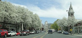
Main Street, Lee MA.jpg
Main Street
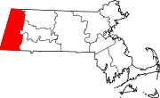
Berkshire County Massachusetts incorporated and unincorporated areas Lee (CDP) highlighted.svg
Location in Berkshire County and the state of Massachusetts.
Coordinates: 42°18′25″N73°14′50″W / 42.30694°N 73.24722°W / 42.30694; -73.24722 Coordinates: 42°18′25″N73°14′50″W / 42.30694°N 73.24722°W / 42.30694; -73.24722
Country United States
State Massachusetts
County Berkshire
Town Lee
Area
[1]
  Total1.36 sq mi (3.53 km2)
  Land1.32 sq mi (3.43 km2)
  Water0.04 sq mi (0.09 km2)
Elevation
883 ft (269 m)
Population
 (2020)
  Total1,880
  Density1,418.87/sq mi (547.95/km2)
Time zone UTC-5 (Eastern (EST))
  Summer (DST) UTC-4 (EDT)
ZIP codes
01238, 01264
Area code(s) 413
FIPS code 25-34620
GNIS feature ID0607508

Lee is a census-designated place (CDP) located in the town of Lee in Berkshire County, Massachusetts, United States. The population was 2,051 at the 2010 census, [2] out of 5,943 in the entire town of Lee.

Contents

Geography

The Lee CDP is located in the center of the town of Lee at 42°18′24″N73°14′50″W / 42.30667°N 73.24722°W / 42.30667; -73.24722 (42.306929, -73.247351). [3] U.S. Route 20 passes through the CDP as Main Street and Housatonic Street, leading north to Lenox and Pittsfield and south to Interstate 90 (the Massachusetts Turnpike), which forms the southern edge of the CDP and accesses it via Turnpike Exit 2. The Housatonic River flows north to south through the center of the CDP.

According to the United States Census Bureau, the CDP has a total area of 1.4 square miles (3.5 km2), of which 1.3 square miles (3.4 km2) is land and 0.04 square miles (0.1 km2), or 2.68%, is water. [2]

Demographics

Historical population
CensusPop.
2020 1,880
U.S. Decennial Census [4]

As of the census [5] of 2000, there were 2,021 people, 901 households, and 500 families residing in the CDP. The population density was 573.8/km2 (1,481.9/mi2). There were 953 housing units at an average density of 270.6/km2 (698.8/mi2). The racial makeup of the CDP was 95.50% White, 1.39% Black or African American, 0.15% Native American, 0.89% Asian, 0.05% Pacific Islander, 1.24% from other races, and 0.79% from two or more races. Hispanic or Latino of any race were 4.50% of the population.

There were 901 households, out of which 27.0% had children under the age of 18 living with them, 41.4% were married couples living together, 10.4% had a female householder with no husband present, and 44.4% were non-families. 38.0% of all households were made up of individuals, and 16.8% had someone living alone who was 65 years of age or older. The average household size was 2.20 and the average family size was 2.88.

In the CDP, the population was spread out, with 21.8% under the age of 18, 9.0% from 18 to 24, 29.4% from 25 to 44, 22.9% from 45 to 64, and 17.0% who were 65 years of age or older. The median age was 39 years. For every 100 females, there were 89.4 males. For every 100 females age 18 and over, there were 89.8 males.

The median income for a household in the CDP was $32,183, and the median income for a family was $41,588. Males had a median income of $32,188 versus $25,741 for females. The per capita income for the CDP was $18,069. About 7.0% of families and 13.3% of the population were below the poverty line, including 9.7% of those under age 18 and 4.1% of those age 65 or over.

Related Research Articles

Derby Acres, California Census-designated place in California, United States

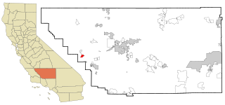
Derby Acres is a census-designated place (CDP) in Kern County, California, United States. Derby Acres is located 5.5 miles (8.9 km) north-northwest of Fellows, at an elevation of 1,375 feet (419 m). The population was 322 at the 2010 census, down from 376 at the 2000 census. The town is on State Route 33 at the northern extremity of the Midway-Sunset Oil Field, about five miles (8 km)five miles southeast of McKittrick.

Mashpee Neck, Massachusetts Census-designated place in Massachusetts, United States

Mashpee Neck is a census-designated place (CDP) in the town of Mashpee in Barnstable County, Massachusetts, United States. The population was 1,000 at the 2010 census. It is the most populous of the seven CDPs in Mashpee.

Housatonic, Massachusetts Census-designated place in Massachusetts, United States

Housatonic is a census-designated place (CDP) in the town of Great Barrington in Berkshire County, Massachusetts. It is part of the Pittsfield, Massachusetts Metropolitan Statistical Area. The population was 1,109 at the 2010 census. It was named after the Housatonic River.

Marshfield Hills, Massachusetts Census-designated place in Massachusetts, United States

Marshfield Hills is a census-designated place (CDP) in the town of Marshfield in Plymouth County, Massachusetts, United States. The population was 2,356 at the 2010 census. The historic center of the village has been designated a historic district and listed on the National Register of Historic Places.

North Scituate, Massachusetts Census-designated place in Massachusetts, United States

North Scituate is a census-designated place (CDP) in the town of Scituate in Plymouth County, Massachusetts, United States. The population was 5,077 at the 2010 census. It was formerly known as Gannet Corner.

Baldwinville, Massachusetts CDP in Massachusetts, United States

Baldwinville is an unincorporated village and census-designated place (CDP) in the town of Templeton in Worcester County, Massachusetts, United States. The population was 2,028 at the 2010 census. The name also refers to the local post office or railroad station. Some people, perhaps confusing it with the village in New York state, erroneously call it "Baldwinsville".
Canaan, New York Town in New York, United States

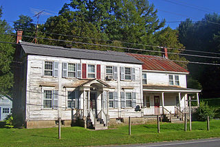
Canaan is a town in Columbia County, New York, United States. The population was 1,710 at the 2010 census. The town is in the northeastern part of the county.
West Hills, New York Hamlet and census-designated place in New York, United States

West Hills is a hamlet and census-designated place (CDP) in the Town of Huntington, Suffolk County, New York, United States. The population was 5,592 at the 2010 census. Residents share a post office with the hamlet of Huntington but much earlier in its history, West Hills had its own post office, located on Jericho Turnpike. Also, it is adjacent to the hamlet of Woodbury.

Glasco, New York CDP in New York, United States

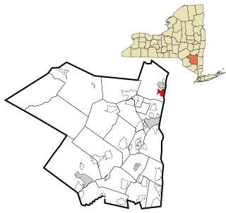
Glasco is a hamlet in Ulster County, New York, United States. The population was 2,099 at the 2010 census.

Redwood, Texas Unincorporated community in Texas, United States

Redwood is an unincorporated community and census-designated place (CDP) in Guadalupe County, Texas, United States. The population was 4,003 at the 2020 census, down from 4,338 at the 2010 census. It is part of the San Antonio Metropolitan Statistical Area.

Adams (CDP), Massachusetts Census-designated place in Massachusetts, United States

Adams is a census-designated place (CDP) located in the town of Adams in Berkshire County, Massachusetts, United States. The population was 5,515 at the 2010 census, out of 8,485 in the entire town of Adams.
Great Barrington (CDP), Massachusetts Census-designated place in Massachusetts, United States

Great Barrington is a census-designated place (CDP) located in the town of Great Barrington in Berkshire County, Massachusetts, United States. The population was 2,231 at the 2010 census, out of 7,104 in the entire town of Great Barrington.

Lee, Massachusetts Town in Massachusetts, United States

Lee is a town in Berkshire County, Massachusetts, United States. It is part of the Pittsfield, Massachusetts, metropolitan statistical area. The population was 5,788 at the 2020 census. Lee, which includes the villages of South and East Lee, is part of the Berkshires resort area.

Lenox (CDP), Massachusetts Census-designated place in Massachusetts, United States

Lenox, also known as Lenox Center, is a census-designated place (CDP) in the town of Lenox in Berkshire County, Massachusetts, United States. The population was 1,675 at the 2010 census, out of 5,025 in the entire town of Lenox.

Williamstown (CDP), Massachusetts Census-designated place in Massachusetts, United States

Williamstown is a census-designated place (CDP) in the town of Williamstown in Berkshire County, Massachusetts, United States. The population of the CDP was 4,325 at the 2010 census, out of 7,754 in the entire town.

Rowley (CDP), Massachusetts Census-designated place in Massachusetts, United States

Rowley is a census-designated place (CDP) in the town of Rowley in Essex County, Massachusetts, United States. The population was 1,416 at the 2010 census.

Palmer (CDP), Massachusetts Former CDP in Massachusetts, United States

Palmer is former census-designated place (CDP) in Hampden County, Massachusetts, United States. The population was 3,900 at the 2000 census. It is part of the Springfield, Massachusetts Metropolitan Statistical Area. The area is more commonly known as Depot Village, named for the ornate train depot built there by famed architect H.H. Richardson

Walpole (CDP), Massachusetts CDP in Massachusetts, United States

Walpole is a small census-designated place (CDP) located within the much larger town of Walpole in Norfolk County, Massachusetts, United States. Walpole Town as it is called by the US Census Bureau, also includes a much larger population. The population of the Census Designated Place was 5,918 at the 2010 census.

Buena Ventura Lakes, more commonly known as BVL, is a census-designated place (CDP) in northern Osceola County, Florida, United States, near Kissimmee. Its population was 26,079 at the 2010 census. It is part of the Orlando–Kissimmee–Sanford, Florida Metropolitan Statistical Area. The community is served by the Osceola Library System.

Canaan (village), Connecticut United States historic place

Canaan is a village and census-designated place (CDP) within the town of North Canaan in Litchfield County, Connecticut, United States. Formerly known as Canaan Depot, the village is more commonly known as Canaan Village to distinguish it from the town of Canaan located to the south of North Canaan. The Canaan Village Historic District is listed on the National Register of Historic Places. As of the 2010 census, the CDP had a population of 1,212, out of a total population of 3,315 in the town of North Canaan.
References

  1. "2020 U.S. Gazetteer Files". United States Census Bureau. Retrieved May 21, 2022.
  2. 1 2 "Geographic Identifiers: 2010 Demographic Profile Data (G001): Lee CDP, Massachusetts". U.S. Census Bureau, American Factfinder. Archived from the original on February 12, 2020. Retrieved December 20, 2013.
  3. "US Gazetteer files: 2010, 2000, and 1990". United States Census Bureau. 2011-02-12. Retrieved 2011-04-23.
  4. "Census of Population and Housing". Census.gov. Retrieved June 4, 2016.
  5. "U.S. Census website". United States Census Bureau . Retrieved 2008-01-31.