Great Barrington (CDP), Massachusetts

Last updated
Great Barrington, Massachusetts
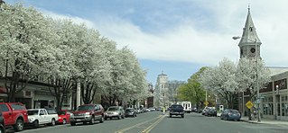
Great Barrington 2.jpg
Main Street
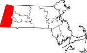
Berkshire County Massachusetts incorporated and unincorporated areas Great Barrington (CDP) highlighted.svg
Location in Berkshire County and the state of Massachusetts.
Coordinates: 42°11′43″N73°21′46″W / 42.19528°N 73.36278°W / 42.19528; -73.36278
Country United States
State Massachusetts
County Berkshire
Town Great Barrington
Area
[1]
  Total1.49 sq mi (3.85 km2)
  Land1.44 sq mi (3.73 km2)
  Water0.05 sq mi (0.12 km2)
Elevation
705 ft (215 m)
Population
 (2020)
  Total2,234
  Density1,550.31/sq mi (598.52/km2)
Time zone UTC-5 (Eastern (EST))
  Summer (DST) UTC-4 (EDT)
ZIP code
01230
Area code 413
FIPS code 25-26780
GNIS feature ID0607441

Great Barrington is a census-designated place (CDP) located in the town of Great Barrington in Berkshire County, Massachusetts, United States. The population was 2,231 at the 2010 census, [2] out of 7,104 in the entire town of Great Barrington.

Contents

Geography

The Great Barrington CDP is located near the center of the town of Great Barrington at 42°11′43″N73°21′45″W / 42.19528°N 73.36250°W / 42.19528; -73.36250 (42.19532, -73.362645), [3] along the Housatonic River. U.S. Route 7 (Main Street) passes through the center of the CDP, leading north to Stockbridge, Lenox, and Pittsfield, and south to Sheffield then into Connecticut. Massachusetts Route 23 also passes through CDP on Main Street but leads east to Monterey, Otis, and beyond, and west to Egremont and then into New York. Massachusetts Route 41 also uses Main Street in Great Barrington and leads north to West Stockbridge and southwest through South Egremont towards Connecticut.

According to the United States Census Bureau, the Great Barrington CDP has a total area of 1.4 square miles (3.7 km2), of which 1.4 square miles (3.5 km2) is land and 0.039 square miles (0.1 km2), or 3.30%, is water. [2]

Demographics

Historical population
CensusPop.Note
2020 2,234
U.S. Decennial Census [4]

As of the census [5] of 2000, there were 2,459 people, 1,184 households, and 590 families residing in the CDP. The population density was 668.6/km2 (1,737.7/mi2). There were 1,282 housing units at an average density of 348.6/km2 (906.0/mi2). The racial makeup of the CDP was 92.84% White, 3.09% Black or African American, 0.33% Native American, 1.02% Asian, 0.04% Pacific Islander, 1.26% from other races, and 1.42% from two or more races. Hispanic or Latino of any race were 2.97% of the population.

There were 1,184 households, out of which 24.0% had children under the age of 18 living with them, 34.6% were married couples living together, 11.7% had a female householder with no husband present, and 50.1% were non-families. 42.2% of all households were made up of individuals, and 14.5% had someone living alone who was 65 years of age or older. The average household size was 2.06 and the average family size was 2.84.

In the CDP, the population was spread out, with 21.5% under the age of 18, 8.6% from 18 to 24, 27.7% from 25 to 44, 25.9% from 45 to 64, and 16.3% who were 65 years of age or older. The median age was 40 years. For every 100 females, there were 87.4 males. For every 100 females age 18 and over, there were 84.2 males.

The median income for a household in the CDP was $35,077, and the median income for a family was $53,542. Males had a median income of $31,653 versus $28,846 for females. The per capita income for the CDP was $23,390. About 2.5% of families and 8.9% of the population were below the poverty line, including 3.7% of those under age 18 and 5.9% of those age 65 or over.

Related Research Articles

<span class="mw-page-title-main">Berkshire County, Massachusetts</span> County in Massachusetts, United States

Berkshire County is the westernmost county in the U.S. state of Massachusetts. As of the 2020 census, the population was 129,026. Its largest city and traditional county seat is Pittsfield. The county was founded in 1761. The Berkshire Hills are centered on Berkshire County. Residents are known as Berkshirites. It exists today only as a historical geographic region, and has no county government, with the exception of the retirement board for former county workers, and certain offices such as the sheriff and registry of deeds.

St. George was a census-designated place (CDP) in Broward County, Florida, United States. The population was 2,450 at the 2000 census. It now serves as a neighborhood of Lauderhill, Florida.

<span class="mw-page-title-main">Alford, Massachusetts</span> Town in Massachusetts, United States

Alford is a town in Berkshire County, Massachusetts, United States. It is part of the Pittsfield, Massachusetts Metropolitan Statistical Area. The population was 486 at the 2020 census.

<span class="mw-page-title-main">Egremont, Massachusetts</span> Town in Massachusetts, United States

Egremont is a town in Berkshire County, Massachusetts, United States. It is part of the Pittsfield, Massachusetts Metropolitan Statistical Area. The population was 1,372 at the 2020 census. Egremont consists of two villages, North Egremont and South Egremont, and their outlying areas, which are mostly lightly settled forests and farmland.

<span class="mw-page-title-main">Housatonic, Massachusetts</span> Census-designated place in Massachusetts, United States

Housatonic is a census-designated place (CDP) in the town of Great Barrington in Berkshire County, Massachusetts. It is part of the Pittsfield, Massachusetts Metropolitan Statistical Area. The population was 1,109 at the 2010 census. It was named after the Housatonic River.

<span class="mw-page-title-main">Mount Washington, Massachusetts</span> Town in Massachusetts, United States

Mount Washington is a town in Berkshire County, Massachusetts, United States. It is part of the Pittsfield, Massachusetts Metropolitan Statistical Area. The population was 160 at the 2020 census, making it the least populous town in Berkshire County and, after Gosnold and Monroe, the third least populous in Massachusetts. The name of the town is a tribute to George Washington, who at the time of incorporation was Commander-in-Chief of the Continental Army during the American Revolutionary War.

<span class="mw-page-title-main">New Marlborough, Massachusetts</span> Town in Massachusetts, United States

New Marlborough is a town in Berkshire County, Massachusetts, United States. It is part of the Pittsfield, Massachusetts Metropolitan Statistical Area. The population was 1,528 at the 2020 census. New Marlborough consists of five villages: Clayton, Hartsville, Mill River, New Marlborough Village and Southfield.

<span class="mw-page-title-main">Sheffield, Massachusetts</span> Town in Massachusetts, United States

Sheffield is a town in Berkshire County, Massachusetts, United States. It is part of the Pittsfield, Massachusetts, Metropolitan Statistical Area. The population was 3,327 at the 2020 census. Sheffield is home to Berkshire School, a private preparatory school. The former resort town includes the village of Ashley Falls, and is bordered by various other towns and villages, such as Egremont and Great Barrington. Its southern border is the Massachusetts-Connecticut state line,

<span class="mw-page-title-main">Stockbridge, Massachusetts</span> Town in Massachusetts, United States

Stockbridge is a town in Berkshire County in Western Massachusetts, United States. It is part of the Pittsfield, Massachusetts, Metropolitan Statistical Area. The population was 2,018 at the 2020 census. A year-round resort area, Stockbridge is home to the Norman Rockwell Museum, the Austen Riggs Center, and Chesterwood, home and studio of sculptor Daniel Chester French.

<span class="mw-page-title-main">West Stockbridge, Massachusetts</span> Town in Massachusetts, United States

West Stockbridge is a town in Berkshire County, Massachusetts, United States. The town had a population of 1,343 at the time of the 2020 United States Census. It is part of the Pittsfield, Massachusetts Metropolitan Statistical Area.

<span class="mw-page-title-main">Marshfield Hills, Massachusetts</span> Census-designated place in Massachusetts, United States

Marshfield Hills is a census-designated place (CDP) in the town of Marshfield in Plymouth County, Massachusetts, United States. The population was 2,356 at the 2010 census. The historic center of the village has been designated a historic district and listed on the National Register of Historic Places.

<span class="mw-page-title-main">North Pembroke, Massachusetts</span> Census-designated place in Massachusetts, United States

North Pembroke is a census-designated place (CDP) in the town of Pembroke in Plymouth County, Massachusetts, United States. The population was 3,292 at the 2010 census.

<span class="mw-page-title-main">Mountville, South Carolina</span> Census-designated place in South Carolina, United States

Mountville is an unincorporated community and census-designated place (CDP) in Laurens County, South Carolina, United States. The population was 108 at the 2010 census, down from 130 at the 2000 census. It is part of the Greenville–Mauldin–Easley Metropolitan Statistical Area.

<span class="mw-page-title-main">Burbank, Washington</span> CDP in Washington, United States

Burbank is a census-designated place (CDP) in Walla Walla County, Washington, United States, where the Snake River meets the Columbia. The population was 3,291 at the 2010 census. Named for Luther Burbank, the city is located just east of Pasco and Kennewick, across the Snake and Columbia Rivers, respectively. Burbank is part of the Tri-Cities, WA urban area, despite being located in the Walla Walla metropolitan area.

<span class="mw-page-title-main">Adams (CDP), Massachusetts</span> Census-designated place in Massachusetts, United States

Adams is a census-designated place (CDP) located in the town of Adams in Berkshire County, Massachusetts, United States. The population was 5,515 at the 2010 census, out of 8,485 in the entire town of Adams.

<span class="mw-page-title-main">Lee (CDP), Massachusetts</span> Census-designated place in Massachusetts, United States

Lee is a census-designated place (CDP) located in the town of Lee in Berkshire County, Massachusetts, United States. The population was 2,051 at the 2010 census, out of 5,943 in the entire town of Lee.

<span class="mw-page-title-main">Lenox (CDP), Massachusetts</span> Census-designated place in Massachusetts, United States

Lenox, also known as Lenox Center, is a census-designated place (CDP) in the town of Lenox in Berkshire County, Massachusetts, United States. The population was 1,675 at the 2010 census, out of 5,025 in the entire town of Lenox.

<span class="mw-page-title-main">Williamstown (CDP), Massachusetts</span> Census-designated place in Massachusetts, United States

Williamstown is a census-designated place (CDP) in the town of Williamstown in Berkshire County, Massachusetts, United States. The population of the CDP was 4,325 at the 2010 census, out of 7,754 in the entire town.
<span class="mw-page-title-main">Great Barrington, Massachusetts</span> Town in Massachusetts, United States

Great Barrington is a town in Berkshire County, Massachusetts, United States. It is part of the Pittsfield, Massachusetts, Metropolitan Statistical Area. The population was 7,172 at the 2020 census. Both a summer resort and home to Ski Butternut, a ski resort, Great Barrington includes the villages of Van Deusenville and Housatonic.

<span class="mw-page-title-main">Townsend (CDP), Massachusetts</span> Census-designated place in Massachusetts, United States

Townsend is a census-designated place (CDP) comprising the main village in the town of Townsend in Middlesex County, Massachusetts, United States. The population was 1,213 at the 2020 census, out of 9,127 in the entire town.

References

  1. "2020 U.S. Gazetteer Files". United States Census Bureau. Retrieved May 21, 2022.
  2. 1 2 "Geographic Identifiers: 2010 Demographic Profile Data (G001): Great Barrington CDP, Massachusetts". U.S. Census Bureau, American Factfinder. Archived from the original on February 12, 2020. Retrieved December 20, 2013.
  3. "US Gazetteer files: 2010, 2000, and 1990". United States Census Bureau. 2011-02-12. Retrieved 2011-04-23.
  4. "Census of Population and Housing". Census.gov. Retrieved June 4, 2016.
  5. "U.S. Census website". United States Census Bureau . Retrieved 2008-01-31.