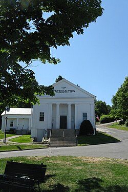
Westhampton, Massachusetts

Last updated

Westhampton, Massachusetts
Westhampton Town Hall, MA.jpg
Westhampton Town Hall
Flag of Westhampton, Massachusetts.jpg
Seal of Westhampton, Massachusetts.png
Hampshire County Massachusetts incorporated and unincorporated areas Westhampton highlighted.svg
Location in Hampshire County in Massachusetts
Coordinates: 42°18′10″N72°46′30″W / 42.30278°N 72.77500°W / 42.30278; -72.77500
Country United States
State Massachusetts
County Hampshire
Settled1762
Incorporated1778
Government
  Type Open town meeting
Area
  Total27.4 sq mi (70.9 km2)
  Land27.2 sq mi (70.4 km2)
  Water0.2 sq mi (0.5 km2)
Elevation
730 ft (223 m)
Population
 (2020)
  Total1,622
  Density59/sq mi (23/km2)
Time zone UTC-5 (Eastern)
  Summer (DST) UTC-4 (Eastern)
ZIP Code
01027
Area code 413
FIPS code 25-76380
GNIS feature ID0618210
Website www.westhampton-ma.com

Westhampton is a town in Hampshire County, Massachusetts, United States. The population was 1,622 at the 2020 census. [1] It is part of the Springfield, Massachusetts Metropolitan Statistical Area.

Contents

History

Westhampton was first settled in 1762. Originally part of Northampton, Westhampton was officially incorporated on September 29, 1778. The first town meeting was held on November 19, 1778, at which the Reverend Enoch Hale, brother of American spy Nathan Hale, was chosen to be the town's first minister. [2]

Westhampton is one of 8 "dry" towns in the Commonwealth, meaning that the sale of alcoholic beverages is prohibited within its boundaries. [3]

The town is home to the five-town Hampshire Regional High School which serves the towns of Westhampton, Southampton, Williamsburg, Goshen, and Chesterfield.

Geography

According to the United States Census Bureau the town has a total area of 27.4 square miles (70.9 km2), of which 27.2 square miles (70.4 km2) are land and 0.19 square miles (0.5 km2), or 0.68%, are water. [4] Westhampton is bordered by Southampton to the south, Huntington to the west, Chesterfield to the northwest, Williamsburg to the northeast, Northampton to the east, and Easthampton to the southeast.

Massachusetts Route 66 is the sole state highway through the town, leading east 9 miles (14 km) to Northampton and west 5 miles (8 km) to Knightville in the town of Huntington.

Demographics

As of the census [14] of 2000, there were 1,468 people, 542 households, and 422 families residing in the town. The population density was 54.1 inhabitants per square mile (20.9/km2). There were 623 housing units at an average density of 23.0 per square mile (8.9/km2). The racial makeup of the town was 98.50% White, 0.34% Native American, 0.14% Asian, 0.27% from other races, and 0.75% from two or more races. Hispanic or Latino of any race were 0.54% of the population.

There were 542 households, out of which 34.3% had children under the age of 18 living with them, 69.0% were married couples living together, 5.9% had a female householder with no husband present, and 22.1% were non-families. 15.9% of all households were made up of individuals, and 5.2% had someone living alone who was 65 years of age or older. The average household size was 2.71 and the average family size was 3.07.

In the town, the population was spread out, with 25.4% under the age of 18, 5.0% from 18 to 24, 31.0% from 25 to 44, 29.4% from 45 to 64, and 9.2% who were 65 years of age or older. The median age was 40 years. For every 100 females, there were 98.4 males. For every 100 females age 18 and over, there were 97.3 males.

The median income for a household in the town was $60,089, and the median income for a family was $66,625. Males had a median income of $42,200 versus $35,809 for females. The per capita income for the town was $25,360. About 1.9% of families and 3.5% of the population were below the poverty line, including 4.0% of those under age 18 and 4.3% of those age 65 or over.

Voting in the 2008 presidential election was held at the Westhampton Town Hall. Of the 1,095 votes cast, 62% were for Sen. Barack Obama, in contrast to the 37% of votes that were cast for Sen. John McCain. [15]

Notable people

Notes

  1. "Census - Geography Profile: Westhampton town, Hampshire County, Massachusetts". United States Census Bureau . Retrieved November 14, 2021.
  2. LaFrance, et al. "Local Color: Stories of Westhampton's First 225 Years". Gazette Printing Company (2003)
  3. "Home".
  4. "Geographic Identifiers: 2010 Census Summary File 1 (G001): Westhampton town, Hampshire County, Massachusetts". American Factfinder. U.S. Census Bureau. Archived from the original on February 13, 2020. Retrieved August 9, 2017.
  5. "TOTAL POPULATION (P1), 2010 Census Summary File 1, All County Subdivisions within Massachusetts". United States Census Bureau. Archived from the original on February 12, 2020. Retrieved September 13, 2011.
  6. "Massachusetts by Place and County Subdivision – GCT-T1. Population Estimates". United States Census Bureau. Archived from the original on February 12, 2020. Retrieved July 12, 2011.
  7. "1990 Census of Population, General Population Characteristics: Massachusetts" (PDF). US Census Bureau. December 1990. Table 76: General Characteristics of Persons, Households, and Families: 1990. 1990 CP-1-23. Retrieved July 12, 2011.
  8. "1980 Census of the Population, Number of Inhabitants: Massachusetts" (PDF). US Census Bureau. December 1981. Table 4. Populations of County Subdivisions: 1960 to 1980. PC80-1-A23. Retrieved July 12, 2011.
  9. "1950 Census of Population" (PDF). 1: Number of Inhabitants. Bureau of the Census. 1952. Section 6, Pages 21-10 and 21-11, Massachusetts Table 6. Population of Counties by Minor Civil Divisions: 1930 to 1950. Retrieved July 12, 2011.{{cite journal}}: Cite journal requires |journal= (help)
  10. "1920 Census of Population" (PDF). Bureau of the Census. Number of Inhabitants, by Counties and Minor Civil Divisions. Pages 21-5 through 21-7. Massachusetts Table 2. Population of Counties by Minor Civil Divisions: 1920, 1910, and 1920. Retrieved July 12, 2011.
  11. "1890 Census of the Population" (PDF). Department of the Interior, Census Office. Pages 179 through 182. Massachusetts Table 5. Population of States and Territories by Minor Civil Divisions: 1880 and 1890. Retrieved July 12, 2011.
  12. "1870 Census of the Population" (PDF). Department of the Interior, Census Office. 1872. Pages 217 through 220. Table IX. Population of Minor Civil Divisions, &c. Massachusetts. Retrieved July 12, 2011.
  13. "City and Town Population Totals: 2020-2022". United States Census Bureau . Retrieved November 10, 2023.
  14. "U.S. Census website". United States Census Bureau . Retrieved January 31, 2008.
  15. "Results". Election Center 2008. CNN.

Related Research Articles

<span class="mw-page-title-main">Hampshire County, Massachusetts</span> County in Massachusetts, United States

Hampshire County is a historical and judicial county located in the U.S. state of Massachusetts. As of the 2020 census, the population was 162,308. Its most populous municipality is Amherst, its largest town in terms of landmass is Belchertown, and its traditional county seat is Northampton. The county is named after the county Hampshire, in England. Hampshire County is part of the Springfield, MA Metropolitan Statistical Area. Together with Hampden County, Hampshire County municipalities belong to the Pioneer Valley Planning Commission.

<span class="mw-page-title-main">Peru, Massachusetts</span> Town in Massachusetts, United States

Peru is a town in Berkshire County, Massachusetts, United States. The population was 814 at the 2020 census.

<span class="mw-page-title-main">Savoy, Massachusetts</span> Town in Massachusetts, United States

Savoy is a town in Berkshire County, Massachusetts, United States. It is part of the Pittsfield, Massachusetts Metropolitan Statistical Area. The population was 645 at the 2020 census.

<span class="mw-page-title-main">Washington, Massachusetts</span> Town in Massachusetts, United States

Washington is a town in Berkshire County, Massachusetts, United States. It is part of the Pittsfield, Massachusetts, Metropolitan Statistical Area. The population was 494 at the 2020 census.

<span class="mw-page-title-main">Windsor, Massachusetts</span> Town in Massachusetts, United States

Windsor is a town in Berkshire County, Massachusetts, United States. It is part of the Pittsfield, Massachusetts Metropolitan Statistical Area. The population was 831 at the 2020 census.

<span class="mw-page-title-main">Buckland, Massachusetts</span> Town in Massachusetts, United States

Buckland is a town in Franklin County, Massachusetts, United States. The population was 1,816 at the 2020 census. The town shares the village of Shelburne Falls with neighboring Shelburne. The town center at Shelburne Falls is the western end of the Bridge of Flowers, a local tourist attraction.

<span class="mw-page-title-main">Conway, Massachusetts</span> Town in Massachusetts, United States

Conway is a town in Franklin County, Massachusetts, United States. The population was 1,761 at the 2020 census. It is part of the Springfield, Massachusetts Metropolitan Statistical Area.

<span class="mw-page-title-main">Hawley, Massachusetts</span> Town in Massachusetts, United States

Hawley is a town in Franklin County, Massachusetts, United States. The population was 353 at the 2020 census. It is part of the Springfield, Massachusetts Metropolitan Statistical Area.

<span class="mw-page-title-main">Shelburne, Massachusetts</span> Town in Massachusetts, United States

Shelburne is a town in Franklin County, Massachusetts, United States. The population was 1,884 at the 2020 census. It is part of the Springfield, Massachusetts Metropolitan Statistical Area.

<span class="mw-page-title-main">Whately, Massachusetts</span> Town in Massachusetts, United States

Whately is a town in Franklin County, Massachusetts, United States. The population was 1,607 at the 2020 census. It is part of the Springfield, Massachusetts Metropolitan Statistical Area.

<span class="mw-page-title-main">Brimfield, Massachusetts</span> Town in Massachusetts, United States

Brimfield is a town in Hampden County, Massachusetts, United States. The population was 3,694 at the 2020 census. It is part of the Springfield, Massachusetts Metropolitan Statistical Area.

<span class="mw-page-title-main">Cummington, Massachusetts</span> Town in Massachusetts, United States

Cummington is a town in Hampshire County, Massachusetts, United States. The population was 829 at the 2020 census, down from 872 at the 2010 census. It is part of the Springfield, Massachusetts Metropolitan Statistical Area.

<span class="mw-page-title-main">Easthampton, Massachusetts</span> City in Massachusetts, United States

Easthampton is a city in Hampshire County, Massachusetts, United States. The city is in the Pioneer Valley near the five colleges in the college towns of Northampton and Amherst. The population was 16,211 at the 2020 census.

<span class="mw-page-title-main">Huntington, Massachusetts</span> Town in Massachusetts, United States

Huntington is a town in Hampshire County, Massachusetts, United States. The population was 2,094 at the 2020 census. It is part of the Springfield, Massachusetts Metropolitan Statistical Area.

<span class="mw-page-title-main">Pelham, Massachusetts</span> Town in Massachusetts, United States

Pelham is a town in Hampshire County, Massachusetts, United States. The population was 1,280 at the 2020 census. Its ZIP Code is shared with Amherst.

<span class="mw-page-title-main">Plainfield, Massachusetts</span> Town in Massachusetts, United States

Plainfield is a town on the northwestern edge of Hampshire County, Massachusetts, United States, about 25 miles east of Pittsfield and 30 miles northwest of Northampton. The population was 633 at the 2020 census. It is part of the Springfield, Massachusetts Metropolitan Statistical Area.

<span class="mw-page-title-main">Williamsburg, Massachusetts</span> Town in Massachusetts, United States

Williamsburg is a town in Hampshire County, Massachusetts, United States. The population was 2,504 at the 2020 census. It is part of the Springfield, Massachusetts Metropolitan Statistical Area.

<span class="mw-page-title-main">Worthington, Massachusetts</span> Town in Massachusetts, United States

Worthington is a town in Hampshire County, Massachusetts, United States. The population was 1,193 at the 2020 census, up from 1,156 at the 2010 census. It is part of the Springfield, Massachusetts Metropolitan Statistical Area.

<span class="mw-page-title-main">Sherborn, Massachusetts</span> Town in Massachusetts, United States

Sherborn is a town in Middlesex County, Massachusetts, United States. Located in Boston's MetroWest region, is in area code 508 and has the ZIP code 01770. As of the 2020 U.S. Census, the town population was 4,401.

<span class="mw-page-title-main">Townsend, Massachusetts</span> Town in Massachusetts, United States

Townsend is a town in Middlesex County, Massachusetts, United States. The population was 9,127 at the 2020 census.