Belchertown (CDP), Massachusetts

Last updated

Belchertown, Massachusetts
Tractor show on the Common, Belchertown MA.jpg
Tractor show on the Common
Hampshire County Massachusetts incorporated and unincorporated areas Belchertown (CDP) highlighted.svg
Location in Hampshire County in Massachusetts
Coordinates: 42°16′42″N72°24′6″W / 42.27833°N 72.40167°W / 42.27833; -72.40167
Country United States
State Massachusetts
County Hampshire
Town Belchertown
Area
[1]
  Total5.03 sq mi (13.04 km2)
  Land5.03 sq mi (13.03 km2)
  Water0.00 sq mi (0.01 km2)
Elevation
607 ft (185 m)
Population
 (2020)
  Total3,129
  Density621.94/sq mi (240.13/km2)
Time zone UTC-5 (Eastern (EST))
  Summer (DST) UTC-4 (EDT)
ZIP code
01007
Area code 413
FIPS code 25-04790
GNIS feature ID0609121

Belchertown is a census-designated place (CDP) comprising the central village in the town of Belchertown in Hampshire County, Massachusetts, United States. The population was 2,899 at the 2010 census, [2] out of a total town population of 14,649. It is part of the Springfield, Massachusetts Metropolitan Statistical Area.

Contents

Geography

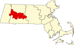
The Belchertown CDP is located in the center of the town of Belchertown at 42°16′42″N72°24′6″W / 42.27833°N 72.40167°W / 42.27833; -72.40167 (42.278451, -72.401804). [3] It is bordered to the north by Bay Road and Massachusetts Route 9 (Federal Street and Sargent Street), to the east by Jabish Brook and Jabish Canal, to the west by Broad Brook and Old Springfield Road, to the south by State Street (U.S. Route 202), and to the west by Weston Brook, Lampson Brook, George Hannum Street, and Hamilton Street. [4]

Route 9 leads east 10 miles (16 km) to Ware and northwest 9 miles (14 km) to Amherst, while US 202 leads north 26 miles (42 km) to Athol and southwest 13 miles (21 km) to Holyoke. Massachusetts Route 181 leaves US 202 in the center of town, leading south 10 miles (16 km) to Palmer. Massachusetts Route 21 leaves US 202 at the western edge of the CDP, leading southwest 10 miles to Ludlow. Springfield, the largest city in the region, is 18 miles (29 km) southwest of Belchertown.

According to the United States Census Bureau, the CDP has a total area of 5.0 square miles (13.0 km2), of which 1.4 acres (5,582 m2), or 0.04%, are water. [2]

Demographics

Historical population
CensusPop.Note
2020 3,129
U.S. Decennial Census [5]

As of the census [6] of 2000, there were 2,626 people, 1,094 households, and 717 families residing in the CDP. The population density was 201.2/km2 (520.6/mi2). There were 1,111 housing units at an average density of 85.1/km2 (220.3/mi2). The racial makeup of the CDP was 94.14% White, 1.26% Black or African American, 0.23% Native American, 1.79% Asian, 0.04% Pacific Islander, 0.84% from other races, and 1.71% from two or more races. Hispanic or Latino of any race were 2.13% of the population.

There were 1,094 households, out of which 37.7% had children under the age of 18 living with them, 43.9% were married couples living together, 18.4% had a female householder with no husband present, and 34.4% were non-families. 27.6% of all households were made up of individuals, and 11.1% had someone living alone who was 65 years of age or older. The average household size was 2.40 and the average family size was 2.91.

In the CDP, the population was spread out, with 27.1% under the age of 18, 8.5% from 18 to 24, 33.3% from 25 to 44, 20.5% from 45 to 64, and 10.6% who were 65 years of age or older. The median age was 34 years. For every 100 females, there were 82.6 males. For every 100 females age 18 and over, there were 77.9 males.

The median income for a household in the CDP was $40,250, and the median income for a family was $44,286. Males had a median income of $31,377 versus $31,130 for females. The per capita income for the CDP was $18,485. About 16.8% of families and 15.1% of the population were below the poverty line, including 18.0% of those under age 18 and 10.6% of those age 65 or over.

Related Research Articles

<span class="mw-page-title-main">Thompsonville, Connecticut</span> Census-designated place in Connecticut, United States

Thompsonville is a census-designated place (CDP) in the town of Enfield in Hartford County, Connecticut, United States. The population of the CDP was 8,577 at the 2010 census.

<span class="mw-page-title-main">South Deerfield, Massachusetts</span> Census-designated place in Massachusetts, United States

South Deerfield is a census-designated place (CDP) in Deerfield, Franklin County, Massachusetts, United States. It is home to the Yankee Candle Company. At the 2010 census, the population of South Deerfield was 1,880.

<span class="mw-page-title-main">Amherst Center, Massachusetts</span> Census-designated place in Massachusetts, United States

Amherst Center is a census-designated place (CDP) in the town of Amherst in Hampshire County, Massachusetts, United States. The CDP covers the primary village in town. The population was 19,065 at the 2010 census, out of a total town population of 37,819. It is part of the Springfield, Massachusetts Metropolitan Statistical Area.

<span class="mw-page-title-main">North Amherst, Massachusetts</span> Census-designated place in Massachusetts, United States

North Amherst is a census-designated place (CDP) in the city of Amherst in Hampshire County, Massachusetts, United States. The population was 6,819 at the 2010 census, up from 6,019 at the 2000 census. It is part of the Springfield, Massachusetts Metropolitan Statistical Area.

<span class="mw-page-title-main">Pelham, Massachusetts</span> Town in Massachusetts, United States

Pelham is a town in Hampshire County, Massachusetts, United States. The population was 1,280 at the 2020 census. Its ZIP Code is shared with Amherst.

<span class="mw-page-title-main">Littleton Common, Massachusetts</span> Census-designated place in Massachusetts, United States

Littleton Common is a census-designated place (CDP) in the town of Littleton in Middlesex County, Massachusetts, United States. The population was 3,065 at the 2020 census, up from 2,789 in 2010.

<span class="mw-page-title-main">Pinehurst, Massachusetts</span> Census-designated place in Massachusetts, United States

Pinehurst is an unincorporated village and census-designated place (CDP) in the town of Billerica, Middlesex County, Massachusetts, United States. The population was 7,368 at the 2020 census. It is in the southeastern part of town along Massachusetts Route 3A.

<span class="mw-page-title-main">West Concord, Massachusetts</span> Census-designated place in Massachusetts, United States

West Concord is an unincorporated village and census-designated place (CDP) in the town of Concord in Middlesex County, Massachusetts, United States. The population was 6,320 at the 2020 census.

Simsbury Center is a census-designated place (CDP) that consists of the central settlement, and the neighborhoods immediately surrounding it, in the town of Simsbury, Connecticut, in the United States. As of the 2010 census, the CDP had a population of 5,836. The core area of the CDP is listed as the Simsbury Center Historic District on the National Register of Historic Places.

<span class="mw-page-title-main">Northridge, Clark County, Ohio</span> Census-designated place in Ohio, United States

Northridge is a census-designated place (CDP) in Clark County, Ohio, United States. The population was 7,518 at the 2020 census. It is part of the Springfield, Ohio Metropolitan Statistical Area.

Campbelltown is an unincorporated community and census-designated place (CDP) in Lebanon County, Pennsylvania, United States. The population was 3,616 at the 2010 census. It is located east of Hershey at the intersection of U.S. Route 322 and Pennsylvania Route 117 and is located in the Harrisburg metropolitan area.

<span class="mw-page-title-main">Bondsville, Massachusetts</span>

Bondsville is an area and former census-designated place (CDP) located in the town of Palmer in Hampden County in the western part of the U.S. state of Massachusetts. The population of the CDP was 1,876 at the 2000 census. It is part of the Springfield, Massachusetts Metropolitan Statistical Area. The village was named after Emelius Bond who first secured the water rights of the Swift River in 1846 to form the Bond Village Manufacturing Company.

<span class="mw-page-title-main">Holland (CDP), Massachusetts</span> Census-designated place in Massachusetts, United States

Holland is a census-designated place (CDP) in the town of Holland in Hampden County, Massachusetts, United States, comprising the town center and other populated areas in the eastern part of the town. The population was 1,464 at the 2010 census, out of a total 2,481 people in the town. It is part of the Springfield, Massachusetts Metropolitan Statistical Area.

<span class="mw-page-title-main">Belchertown, Massachusetts</span> Town in Massachusetts, United States

Belchertown is a town in Hampshire County, Massachusetts, United States. It is part of the Springfield, Massachusetts Metropolitan Statistical Area. The population was 15,350 at the 2020 census. The town includes the census-designated place of Belchertown. Belchertown was formerly the home of the Belchertown State School. The land on which the school sat is, as of 2016, being redeveloped for mixed uses including residential, commercial and recreational. This includes the 385-acre (156 ha) Lampson Brook Farm, used for community and sustainable agriculture, outdoor recreation, and wildlife preservation.

<span class="mw-page-title-main">Granby (CDP), Massachusetts</span> Census-designated place in Massachusetts, United States

Granby is a census-designated place (CDP) comprising the main village in the town of Granby in Hampshire County, Massachusetts, United States. The population of the CDP was 1,368 at the 2010 census, out of a total town population of 6,240. It is part of the Springfield, Massachusetts Metropolitan Statistical Area.

<span class="mw-page-title-main">Hatfield (CDP), Massachusetts</span> Census-designated place in Massachusetts, United States

Hatfield is a census-designated place (CDP) comprising the main village in the town of Hatfield in Hampshire County, Massachusetts, United States. The population of the CDP was 1,318 at the 2010 census, out of a total town population of 3,279. It is part of the Springfield, Massachusetts Metropolitan Statistical Area.

<span class="mw-page-title-main">Ware (CDP), Massachusetts</span> Census-designated place in Massachusetts, United States

Ware is a census-designated place (CDP) comprising the main village in the town of Ware in Hampshire County, Massachusetts, United States. The population of the CDP was 6,170 at the 2010 census, out of a total town population of 9,872. It is part of the Springfield, Massachusetts Metropolitan Statistical Area.

<span class="mw-page-title-main">Jaffrey (CDP), New Hampshire</span> Census-designated place in New Hampshire, United States

Jaffrey is a census-designated place (CDP) and the main village in the town of Jaffrey in Cheshire County, New Hampshire, United States. The population of the CDP was 3,058 at the 2020 census, out of 5,320 in the entire town of Jaffrey.

<span class="mw-page-title-main">Bennington (CDP), New Hampshire</span> Census-designated place in New Hampshire, United States

Bennington is a census-designated place (CDP) and the main village in the town of Bennington in Hillsborough County, New Hampshire, United States. The population of the CDP was 338 at the 2020 census, out of 1,501 in the entire town.

<span class="mw-page-title-main">Winthrop (CDP), Maine</span> Census-designated place in Maine, United States

Winthrop is a census-designated place (CDP) comprising the primary settlement in the town of Winthrop in Kennebec County, Maine, United States. The population was 2,650 at the 2010 census, out of 6,092 in the town of Winthrop as a whole.

References

  1. "2020 U.S. Gazetteer Files". United States Census Bureau. Retrieved May 21, 2022.
  2. 1 2 "Geographic Identifiers: 2010 Census Summary File 1 (G001): Belchertown CDP, Massachusetts". American Factfinder. U.S. Census Bureau. Archived from the original on February 13, 2020. Retrieved August 10, 2017.
  3. "US Gazetteer files: 2010, 2000, and 1990". United States Census Bureau. February 12, 2011. Retrieved April 23, 2011.
  4. "TIGERweb: Belchertown CDP, Massachusetts". Geography Division, U.S. Census Bureau. Retrieved August 10, 2017.
  5. "Census of Population and Housing". Census.gov. Retrieved June 4, 2016.
  6. "U.S. Census website". United States Census Bureau . Retrieved January 31, 2008.