This is a list of the National Register of Historic Places listings in Barnstable County, Massachusetts.

This is a list of the National Register of Historic Places listings in Berkshire County, Massachusetts.
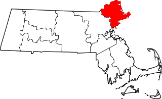
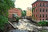
This list is of that portion of the National Register of Historic Places (NRHP) designated in Essex County, Massachusetts. The locations of these properties and districts for which the latitude and longitude coordinates are included below, may be seen in a map.

This is a list of the National Register of Historic Places listings in Hampden County, Massachusetts.

This is a list of the National Register of Historic Places listings in Plymouth County, Massachusetts.

This is a list of the National Register of Historic Places listings in Franklin County, Massachusetts.

This is a list of properties on the National Register of Historic Places in Hampshire County, Massachusetts.

This is a list of the National Register of Historic Places listings in Nantucket County, Massachusetts.

This is a list of the National Register of Historic Places listings in Dukes County, Massachusetts.

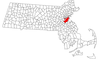
This is a list of sites listed on the National Register of Historic Places in Cambridge, Massachusetts. This is intended to be a complete list of the properties and districts on the National Register of Historic Places in Cambridge, Massachusetts, United States. Latitude and longitude coordinates are provided for many National Register properties and districts; these locations may be seen together in an online map.

This is a list of the National Register of Historic Places listings in Andover, Massachusetts.

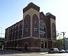
The following properties are listed on the National Register of Historic Places in Lawrence, Massachusetts.

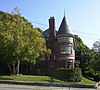
This is a list of the National Register of Historic Places listings in Salem, Massachusetts.

This is a list of the National Register of Historic Places listings in Lynn, Massachusetts.
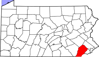
This is a list of the National Register of Historic Places listings in southern Chester County, Pennsylvania.
This is a list of the National Register of Historic Places listings in southern New Castle County, Delaware.
Boston, Massachusetts is home to many listings on the National Register of Historic Places. This list encompasses those locations that are located north of the Massachusetts Turnpike. See National Register of Historic Places listings in southern Boston for listings south of the Turnpike. Properties and districts located elsewhere in Suffolk County's other three municipalities are also listed separately.
Boston, Massachusetts is home to many listings on the National Register of Historic Places. This list encompasses those locations that are located south of the Massachusetts Turnpike. See National Register of Historic Places listings in northern Boston for listings north of the Turnpike. Properties and districts located elsewhere in Suffolk County's other three municipalities are also listed separately.
There are 98 properties and historic districts on the National Register of Historic Places in Worcester, Massachusetts, east of I-190 and the north-south section of I-290, which are listed below. Two listings overlap into other parts of Worcester: one of the 1767 Milestones is located in northwestern Worcester, and the Blackstone Canal Historic District traverses all three sections of the city.
There are 112 properties and historic districts on the National Register of Historic Places in Worcester, Massachusetts, west of I-190 and the north–south section of I-290 and north of Massachusetts Route 122, which are listed here. Two listings overlap into other parts of Worcester: one of the 1767 Milestones is located in eastern Worcester, and the Blackstone Canal Historic District traverses all three sections of the city.