
Brookline is a town in Norfolk County, Massachusetts, in the United States, and part of the Boston metropolitan area. Brookline borders six of Boston's neighborhoods: Brighton, Allston, Fenway–Kenmore, Mission Hill, Jamaica Plain, and West Roxbury. The city of Newton lies to the west of Brookline. Brookline was first settled in 1638 as a hamlet in Boston, known as Muddy River; it was incorporated as a separate town in 1705.

The Back Bay Fens, often called The Fens, is a parkland and urban wild in Boston, Massachusetts, in the United States. It was established in 1879. Designed by Frederick Law Olmsted to serve as a link in the Emerald Necklace park system, the Fens gives its name to the Fenway-Kenmore neighborhood.
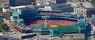
Fenway–Kenmore is an officially recognized neighborhood of Boston, Massachusetts. While it is considered one neighborhood for administrative purposes, it is composed of numerous distinct sections that, in casual conversation, are almost always referred to as "Fenway", "the Fenway", "Kenmore Square", or "Kenmore". Furthermore, the Fenway neighborhood is divided into two sub-neighborhoods commonly referred to as East Fenway/Symphony and West Fenway.

Chestnut Hill is an affluent New England village located six miles (9.7 km) west of downtown Boston, Massachusetts, United States. Like all Massachusetts villages, Chestnut Hill is located within one or more incorporated municipal entities. It is located partially in Brookline in Norfolk County; partially in the Brighton neighborhood of the city of Boston in Suffolk County; partially in the West Roxbury neighborhood of the city of Boston in Suffolk County, and partially in the city of Newton in Middlesex County. Chestnut Hill's borders are defined by the 02467 ZIP Code. The name refers to several small hills that overlook the 135-acre Chestnut Hill Reservoir rather than one particular hill. Chestnut Hill is best known as the home of Boston College and as part of the Boston Marathon route.

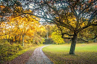
The Emerald Necklace consists of a 1,100-acre chain of parks linked by parkways and waterways in Boston and Brookline, Massachusetts. It was designed by landscape architect Frederick Law Olmsted, and gets its name from the way the planned chain appears to hang from the "neck" of the Boston peninsula. In 1989, the Emerald Necklace was designated as a Boston Landmark by the Boston Landmarks Commission.

Jamaica Pond is a kettle lake, part of the Emerald Necklace of parks in Boston designed by Frederick Law Olmsted. The pond and park are in the Jamaica Plain neighborhood of Boston, close to the border of Brookline. It is the source of the Muddy River, which drains into the lower Charles River.USGS 2005
Franklin Park, a partially wooded 527-acre (2.13 km2) parkland in the Jamaica Plain, Roxbury, and Dorchester neighborhoods of Boston, Massachusetts, is maintained by the City of Boston Parks and Recreation Department. It is Boston's biggest park and the site of Franklin Park Zoo. It was designated a Boston Landmark by the Boston Landmarks Commission in 1980.
Jamaicaway is a four-lane, undivided parkway in the Jamaica Plain neighborhood of Boston, Massachusetts near the border of Brookline.

Arborway consists of a four-lane, divided parkway and a two lane residential street in the Jamaica Plain neighborhood of Boston, Massachusetts. It was designed by Frederick Law Olmsted in the 1890s as the south most carriage road in a series of parkways connecting parks from Boston Common in downtown Boston to Franklin Park in Roxbury. This park system has since become known as the Emerald Necklace of Boston.

Riverway, also referred to as "the Riverway," is a parkway in Boston, Massachusetts. The parkway is a link in the Emerald Necklace system of parks and parkways designed by Frederick Law Olmsted in the 1890s. Starting at the Landmark Center end of the Back Bay Fens, the parkway follows the path of the Muddy River south to Olmsted Park across a stone bridge over Route 9 near Brookline Village. The road and its associated park form Boston's western border with neighboring Brookline and is popular with local nearby residents in both municipalities.

Fenway, commonly referred to as The Fenway, is a mostly one-way, one- to three-lane parkway that runs along the southern and eastern edges of the Back Bay Fens in the Fenway–Kenmore neighborhood of Boston, in the east-central part of the U.S. state of Massachusetts. As part of the Emerald Necklace park system mainly designed by Frederick Law Olmsted in the late 19th century, the Fenway, along with the Back Bay Fens and Park Drive, connects the Commonwealth Avenue Mall to the Riverway. For its entire length, the parkway travels along the Muddy River and is part of the Metropolitan Park System of Greater Boston. Like others in the park system, it is maintained by the Massachusetts Department of Conservation and Recreation.

A linear park is a type of park that is significantly longer than it is wide. These linear parks are strips of public land running along canals, rivers, streams, defensive walls, electrical lines, or highways and shorelines. Examples of linear parks include everything from wildlife corridors to riverways to trails, capturing the broadest sense of the word. Other examples include rail trails, which are disused railroad beds converted for recreational use by removing existing structures. Commonly, these linear parks result from the public and private sectors acting on the dense urban need for open green space. Linear parks stretch through urban areas, coming through as a solution for the lack of space and need for urban greenery. They also effectively connect different neighborhoods in dense urban areas as a result, and create places that are ideal for activities such as jogging or walking. Linear parks may also be categorized as greenways. In Australia, a linear park along the coast is known as a foreshoreway. When being designed, linear parks appear unique as they are planned around the public's opinion of how the space will affect them.

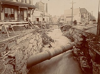
The Muddy River is a series of brooks and ponds that runs through sections of Boston's Emerald Necklace, including along the south boundary of Brookline, Massachusetts. The river, which is narrower than most waterways designated as rivers in the United States, is a protected public recreation area surrounded by parks and hiking trails, managed by the Massachusetts Department of Conservation and Recreation.
The Dorchesterway was a parkway planned by 19th century landscape designer Frederick Law Olmsted to be a continuation of the Emerald Necklace park network in Boston, Massachusetts. This plan, however, was never implemented.

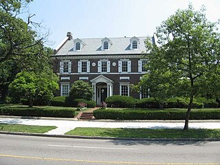
Pill Hill, also known as "High Street Hill," is a neighborhood of Brookline, Massachusetts, United States, and part of Greater Boston.

Hammond Pond Parkway is a historic parkway in Chestnut Hill, Massachusetts. The road, built in 1932, extends 2 miles (3.2 km) from Hobart Road in Newton to Horace James Circle in Brookline, where it joins the West Roxbury Parkway. It was designed by Charles Eliot and the Olmsted Brothers to provide a parkway setting that provided access from Brookline, Newton, and the western portions of Boston to the southern parks of the Emerald Necklace. The parkway was listed on the National Register of Historic Places in 2004.

The Old Harbor Reservation Parkways are three historic roads in the Old Harbor area of Boston. They are part of the Boston parkway system designed by Frederick Law Olmsted. They include

Park Drive is a mostly one-way, two-lane parkway in the Fenway-Kenmore neighborhood of Boston that runs along the northern and western edges of the Back Bay Fens before ending at Mountfort Street. As part of the Emerald Necklace park system mainly designed by Frederick Law Olmsted in the late 19th century, Park Drive, along with the Back Bay Fens and the Fenway, connects the Commonwealth Avenue Mall and Boylston Street to Beacon Street and the Riverway. For a portion of its length, the parkway runs along the Muddy River and is part of the Metropolitan Park System of Greater Boston's Muddy River Reservation. Like others in the park system, it is maintained by the Massachusetts Department of Conservation and Recreation.
Stony Brook is a 8.5-mile (13.7 km)-long subterranean river in Boston. The largest tributary stream of the lower Charles River, it runs mostly through conduits. Stony Brook originates at Turtle Pond in the Stony Brook Reservation and flows through Hyde Park, Roslindale, Jamaica Plain, and Roxbury. It empties into the Charles River Basin just upstream of the Harvard Bridge. Stony Brook is fed by four tributaries, all of which are partially or entirely in conduits as well.

Tibbetts Brook, originally Tippett's Brook or Tibbitt's Brook, is a stream in the southern portion of mainland New York, flowing north to south from the city of Yonkers in Westchester County into the borough of the Bronx within New York City. Originally emptying into Spuyten Duyvil Creek as part of the Harlem River system, the stream is now partially subterranean, ending above ground at the south end of Van Cortlandt Lake within Van Cortlandt Park. There it proceeds into city sewers, draining into either the northern end of the Harlem River or the Wards Island Water Pollution Control Plant. The brook provides significant watershed to both Van Cortlandt Park at its south end and Tibbetts Brook Park at its north end. There have been modern proposals to daylight the southern portion of the brook back onto the surface.


