| Mary Ellen Welch Greenway | |
|---|---|
 Section of the shared use path on the Greenway | |
 | |
| Type | Urban park |
| Location | East Boston, Boston, Massachusetts |
| Area | 15 acres (61,000 m2)/1.5 miles (2.4 km) |
| Operated by | Massachusetts Port Authority |
| Status | Open all year |
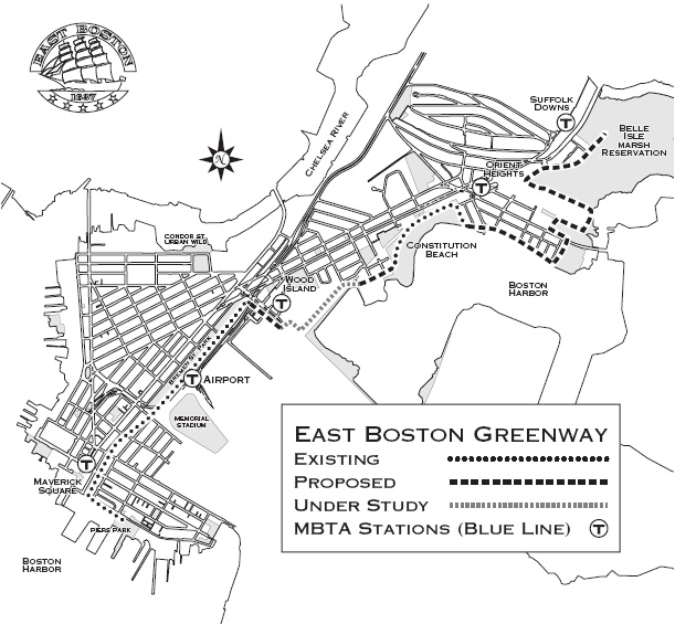
| Public transit access | Maverick Station, Airport Station and Wood Island Station via the MBTA Blue Line |
The Mary Ellen Welch Greenway (formerly the East Boston Greenway) is a rail trail and park in East Boston that is located along the path of a former Conrail line. The greenway connects several significant open space areas in East Boston, including Piers Park, Memorial Stadium, Bremen Street Park, Wood Island Bay Marsh and Belle Isle Marsh. When completed, the line is expected to be 3.3 miles in length. [1]
