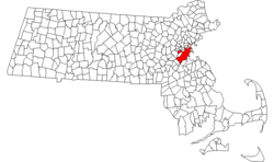
[ 2] Name on the Register [ 3] Image Date listed [ 4] Location City or town Description 1 1767 Milestones 1767 Milestones April 7, 1971 (# 71000084 Between Boston and Springfield along Old Post Rd. 42°21′42″N 71°07′48″W / 42.361556°N 71.129998°W / 42.361556; -71.129998 (1767 Milestones ) Allston Includes markers in Roxbury and Mission Hill, and markers in Hampden , Middlesex , and Worcester counties 2 John Adams Courthouse John Adams Courthouse May 8, 1974 (# 74000391 Pemberton Sq. 42°21′33″N 71°03′42″W / 42.359167°N 71.061667°W / 42.359167; -71.061667 (John Adams Courthouse ) Downtown Contains the nation's oldest law library, the Social Law Library 3 African Meetinghouse African Meetinghouse October 7, 1971 (# 71000087 8 Smith Ct. 42°21′35″N 71°03′57″W / 42.359722°N 71.065833°W / 42.359722; -71.065833 (African Meetinghouse ) Beacon Hill This is the nation's longest standing black church edifice; it also hosts the Museum of African American History , open to the public. 4 Ames Building Ames Building April 26, 1974 (# 74000382 1 Court St. 42°21′32″N 71°03′31″W / 42.358889°N 71.058611°W / 42.358889; -71.058611 (Ames Building ) Downtown Considered Boston's first skyscraper. 5 Nathan Appleton Residence Nathan Appleton Residence December 22, 1977 (# 77001541 39–40 Beacon St. 42°21′25″N 71°04′01″W / 42.356944°N 71.066944°W / 42.356944; -71.066944 (Nathan Appleton Residence ) Beacon Hill 6 Arlington Street Church Arlington Street Church May 4, 1973 (# 73000313 Arlington and Boylston Sts. 42°21′07″N 71°04′16″W / 42.352028°N 71.071139°W / 42.352028; -71.071139 (Arlington Street Church ) Back Bay 7 Armory of the First Corps of Cadets Armory of the First Corps of Cadets May 22, 1973 (# 73000314 97–105 Arlington St. and 130 Columbus Ave. 42°20′59″N 71°04′14″W / 42.349722°N 71.070556°W / 42.349722; -71.070556 (Armory of the First Corps of Cadets ) Bay Village 8 Francis B. Austin House Francis B. Austin House October 21, 1988 (# 87001478 58 High St. 42°22′34″N 71°04′37″W / 42.376111°N 71.076944°W / 42.376111; -71.076944 (Francis B. Austin House ) Charlestown 9 Frederick Ayer Mansion Frederick Ayer Mansion April 5, 2005 (# 05000459 395 Commonwealth Ave. 42°20′57″N 71°05′25″W / 42.349256°N 71.090317°W / 42.349256; -71.090317 (Frederick Ayer Mansion ) Back Bay 10 Back Bay Historic District Back Bay Historic District August 14, 1973 (# 73001948 Roughly bounded by the Charles River , Arlington, Providence, Boylston, and Newbury Sts., and Charlesgate East 42°21′04″N 71°04′50″W / 42.3512°N 71.0806°W / 42.3512; -71.0806 (Back Bay Historic District ) Back Bay 11 Baker Congregational Church Baker Congregational Church November 19, 1998 (# 98001381 760 Saratoga St. 42°23′02″N 71°01′04″W / 42.383889°N 71.017778°W / 42.383889; -71.017778 (Baker Congregational Church ) East Boston 12 Beach-Knapp District Beach-Knapp District December 9, 1980 (# 80000462 Roughly bounded by Harrison Ave., Washington, Kneeland, and Beach Sts. 42°21′04″N 71°03′44″W / 42.351111°N 71.062222°W / 42.351111; -71.062222 (Beach-Knapp District ) Chinatown 13 Beacon Hill Historic District Beacon Hill Historic District October 15, 1966 (# 66000130 Bounded by Beacon St., the Charles River Embankment, and Pinckney, Revere, and Hancock Sts. 42°21′33″N 71°04′05″W / 42.359072°N 71.068117°W / 42.359072; -71.068117 (Beacon Hill Historic District ) Beacon Hill 14 Bedford Building Bedford Building August 21, 1979 (# 79000368 89–103 Bedford St. 42°21′10″N 71°03′32″W / 42.352778°N 71.058889°W / 42.352778; -71.058889 (Bedford Building ) Downtown 15 Bennington Street Burying Ground Bennington Street Burying Ground May 22, 2002 (# 02000548 Bennington St., between Swift and Harmony Sts. 42°22′50″N 71°01′19″W / 42.380556°N 71.021944°W / 42.380556; -71.021944 (Bennington Street Burying Ground ) East Boston 16 Blackstone Block Historic District Blackstone Block Historic District May 26, 1973 (# 73000315 Area bound by Union, Hanover, Blackstone, and North Sts. 42°21′40″N 71°03′25″W / 42.361111°N 71.056944°W / 42.361111; -71.056944 (Blackstone Block Historic District ) Downtown 17 Blake and Amory Building Blake and Amory Building June 2, 2014 (# 14000272 59 Temple Pl. 42°21′17″N 71°03′41″W / 42.3547°N 71.0615°W / 42.3547; -71.0615 (Blake and Amory Building ) Downtown 18 Boston African American National Historic Site Boston African American National Historic Site October 10, 1980 (# 80004396 Joy St. 42°21′36″N 71°03′55″W / 42.359986°N 71.065217°W / 42.359986; -71.065217 (Boston African American National Historic Site ) Beacon Hill 19 Boston Athenæum Boston Athenæum October 15, 1966 (# 66000132 10½ Beacon St. 42°21′28″N 71°03′45″W / 42.357778°N 71.0625°W / 42.357778; -71.0625 (Boston Athenæum ) Beacon Hill 20 Boston Common Boston Common February 27, 1987 (# 87000760 Beacon, Park, Tremont, Boylston, and Charles Sts. 42°21′16″N 71°03′54″W / 42.354444°N 71.065°W / 42.354444; -71.065 (Boston Common ) multiple 21 Boston Common and Public Garden Boston Common and Public Garden July 12, 1972 (# 72000144 Beacon, Park, Tremont, Boylston, and Arlington Sts. 42°21′15″N 71°04′12″W / 42.3541°N 71.07°W / 42.3541; -71.07 (Boston Common and Public Garden ) multiple 22 Boston Edison Electric Illuminating Company Boston Edison Electric Illuminating Company December 9, 1980 (# 80000453 25–39 Boylston St. 42°21′08″N 71°03′51″W / 42.352222°N 71.064167°W / 42.352222; -71.064167 (Boston Edison Electric Illuminating Company ) Chinatown 23 Boston Fish Pier Historic District Boston Fish Pier Historic District July 13, 2017 (# 100001314 212–234 Northern Ave. 42°21′06″N 71°02′15″W / 42.351665°N 71.037621°W / 42.351665; -71.037621 (Boston Fish Pier Historic District ) South Boston 24 Boston National Historical Park Boston National Historical Park October 26, 1974 (# 74002222 Inner harbor at the mouth of the Charles River 42°22′12″N 71°03′20″W / 42.37°N 71.055556°W / 42.37; -71.055556 (Boston National Historical Park ) Boston Harbor 25 Boston Naval Shipyard Boston Naval Shipyard November 15, 1966 (# 66000134 East of Chelsea St., Charlestown 42°22′30″N 71°03′09″W / 42.375°N 71.0525°W / 42.375; -71.0525 (Boston Naval Shipyard ) Charlestown Updated listing May 5, 2015 as "Boston National Historical Park/Charlestown Navy Yard". 26 Boston Police Station Number One-Traffic Tunnel Administration Building Boston Police Station Number One-Traffic Tunnel Administration Building March 3, 2015 (# 15000048 128, 150 North & 130–140 Richmond St. 42°21′45″N 71°03′17″W / 42.3626°N 71.0547°W / 42.3626; -71.0547 (Boston Police Station Number One-Traffic Tunnel Administration Building ) North End 27 Boston Public Garden Boston Public Garden February 27, 1987 (# 87000761 Beacon, Charles, Boylston, and Arlington Sts. 42°21′15″N 71°04′12″W / 42.3541°N 71.07°W / 42.3541; -71.07 (Boston Public Garden ) Back Bay 28 Boston Public Library Boston Public Library May 6, 1973 (# 73000317 Copley Sq. 42°20′57″N 71°04′43″W / 42.349167°N 71.078611°W / 42.349167; -71.078611 (Boston Public Library ) Back Bay 29 Boston Transit Commission Building Boston Transit Commission Building August 31, 2007 (# 07000861 15 Beacon St. 42°21′30″N 71°03′46″W / 42.358333°N 71.062778°W / 42.358333; -71.062778 (Boston Transit Commission Building ) Beacon Hill 30 Boston Young Men's Christian Union Boston Young Men's Christian Union December 9, 1980 (# 80000451 48 Boylston St. 42°21′07″N 71°03′53″W / 42.351944°N 71.064722°W / 42.351944; -71.064722 (Boston Young Men's Christian Union ) Chinatown 31 Boylston Building Boylston Building December 9, 1980 (# 80000450 2–22 Boylston St. 42°21′07″N 71°03′49″W / 42.351944°N 71.063611°W / 42.351944; -71.063611 (Boylston Building ) Chinatown 32 Building at 138–142 Portland Street Building at 138–142 Portland Street September 5, 1985 (# 85002015 138–142 Portland St. 42°21′51″N 71°03′43″W / 42.364167°N 71.061944°W / 42.364167; -71.061944 (Building at 138–142 Portland Street ) Downtown 33 Bulfinch Triangle Historic District Bulfinch Triangle Historic District February 27, 1986 (# 86000274 Roughly bounded by Canal, Market, Merrimac, and Causeway Sts. 42°21′50″N 71°03′41″W / 42.363889°N 71.061389°W / 42.363889; -71.061389 (Bulfinch Triangle Historic District ) Downtown 34 Bunker Hill Monument Bunker Hill Monument October 15, 1966 (# 66000138 Breed's Hill 42°22′35″N 71°03′41″W / 42.376389°N 71.061389°W / 42.376389; -71.061389 (Bunker Hill Monument ) Charlestown 35 Bunker Hill School Bunker Hill School October 15, 1987 (# 87001771 68 Baldwin St. 42°22′56″N 71°04′15″W / 42.382222°N 71.070833°W / 42.382222; -71.070833 (Bunker Hill School ) Charlestown 36 Central Congregational Church Central Congregational Church October 16, 2012 (# 12001012 67 Newbury St. 42°21′08″N 71°04′27″W / 42.3521°N 71.0741°W / 42.3521; -71.0741 (Central Congregational Church ) Back Bay This church has the largest intact Tiffany -designed ecclesiastical interior in its original location in America. The congregation is now known as the Church of the Covenant. 37 Charles Playhouse Charles Playhouse June 16, 1980 (# 80000676 74–78 Warenton St. 42°20′58″N 71°03′59″W / 42.349444°N 71.066389°W / 42.349444; -71.066389 (Charles Playhouse ) Theatre District 38 Charles River Basin Historic District Charles River Basin Historic District December 22, 1978 (# 78000436 Both banks of the Charles River from Eliot Bridge to Charles River Dam 42°21′46″N 71°06′28″W / 42.362778°N 71.107778°W / 42.362778; -71.107778 (Charles River Basin Historic District ) Back Bay 39 Charles River Reservation Parkways Charles River Reservation Parkways January 18, 2006 (# 05001530 Soldiers Field, Nonantum, Leo Birmingham, Arsenal, Greenough, N. Beacon, Charles River , Norumbega, Recreation 42°21′42″N 71°09′31″W / 42.361667°N 71.158611°W / 42.361667; -71.158611 (Charles River Reservation Parkways ) Allston /Brighton Extends into Cambridge , Newton , Waltham , and Watertown and Weston in Middlesex County 40 Charles River Reservation (Speedway)-Upper Basin Headquarters Charles River Reservation (Speedway)-Upper Basin Headquarters July 19, 2010 (# 10000506 1420–1440 Soldiers Field Rd. 42°21′41″N 71°08′47″W / 42.361389°N 71.146389°W / 42.361389; -71.146389 (Charles River Reservation (Speedway)-Upper Basin Headquarters ) Brighton 41 Charlestown Heights Charlestown Heights January 8, 1998 (# 97000969 Roughly bounded by St. Martin, Bunker Hill, Medford, and Sackville Sts. 42°22′56″N 71°04′05″W / 42.382222°N 71.068056°W / 42.382222; -71.068056 (Charlestown Heights ) Charlestown 42 Church Green Buildings Historic District Church Green Buildings Historic District December 30, 1999 (# 99001614 101–113 Summer St. 42°21′12″N 71°03′30″W / 42.353333°N 71.058333°W / 42.353333; -71.058333 (Church Green Buildings Historic District ) Downtown 43 Codman Building Codman Building October 19, 1983 (# 83004097 55 Kilby St. 42°21′28″N 71°03′23″W / 42.357778°N 71.056389°W / 42.357778; -71.056389 (Codman Building ) Downtown 44 Compton Building Compton Building December 31, 2008 (# 08001284 159, 161–175 Devonshire Street, 18–20 Arch Street 42°21′21″N 71°03′27″W / 42.355833°N 71.0575°W / 42.355833; -71.0575 (Compton Building ) Downtown 45 Congress Street Fire Station Congress Street Fire Station September 3, 1987 (# 87001396 344 Congress St. 42°20′58″N 71°02′56″W / 42.349444°N 71.048889°W / 42.349444; -71.048889 (Congress Street Fire Station ) South Boston 46 Copp's Hill Burying Ground Copp's Hill Burying Ground April 18, 1974 (# 74000385 Charter, Snowhill, and Hull Sts. 42°22′02″N 71°03′23″W / 42.367222°N 71.056389°W / 42.367222; -71.056389 (Copp's Hill Burying Ground ) North End 47 Copp's Hill Terrace Copp's Hill Terrace April 19, 1990 (# 90000631 Between Commercial and Charter Sts. west of Jackson Place 42°22′04″N 71°03′22″W / 42.367778°N 71.056111°W / 42.367778; -71.056111 (Copp's Hill Terrace ) North End 48 Crowninshield House Crowninshield House February 23, 1972 (# 72000145 164 Marlborough St. 42°21′09″N 71°04′45″W / 42.3525°N 71.079167°W / 42.3525; -71.079167 (Crowninshield House ) Back Bay 49 Custom House District Custom House District May 11, 1973 (# 73000321 Between the J.F.K. Expressway and Kirby St. and S. Market and High and Batterymarch Sts. 42°21′28″N 71°03′12″W / 42.357778°N 71.053333°W / 42.357778; -71.053333 (Custom House District ) Downtown 50 Dill Building Dill Building December 9, 1980 (# 80000448 11–25 Stuart St. 42°21′04″N 71°03′50″W / 42.351111°N 71.063889°W / 42.351111; -71.063889 (Dill Building ) Theatre District 51 Eagle Hill Historic District Eagle Hill Historic District February 26, 1998 (# 98000149 Roughly bounded by Border, Lexington, Trenton, and Falcon Sts. 42°22′51″N 71°02′05″W / 42.380897°N 71.034815°W / 42.380897; -71.034815 (Eagle Hill Historic District ) East Boston 52 Old East Boston High School Old East Boston High School March 15, 2006 (# 06000127 127 Marion St. 42°22′41″N 71°02′16″W / 42.378056°N 71.037778°W / 42.378056; -71.037778 (Old East Boston High School ) East Boston 53 Engine House No. 34 Engine House No. 34 October 24, 1985 (# 85003375 444 Western Ave. 42°21′43″N 71°08′30″W / 42.361944°N 71.141667°W / 42.361944; -71.141667 (Engine House No. 34 ) Brighton 54 Ether Dome Ether Dome October 15, 1966 (# 66000366 Fruit St. 42°21′48″N 71°04′07″W / 42.363333°N 71.068611°W / 42.363333; -71.068611 (Ether Dome ) West End Part of Massachusetts General Hospital, Bulfinch Building 55 Faneuil Hall Faneuil Hall October 15, 1966 (# 66000368 Dock Sq. 42°21′36″N 71°03′24″W / 42.36°N 71.056667°W / 42.36; -71.056667 (Faneuil Hall ) Downtown 56 Peter Faneuil School Peter Faneuil School December 16, 1994 (# 94001492 60 Joy St. 42°21′37″N 71°03′58″W / 42.360278°N 71.066111°W / 42.360278; -71.066111 (Peter Faneuil School ) Beacon Hill 57 Filene's Department Store Filene's Department Store July 24, 1986 (# 86001909 426 Washington St. 42°21′18″N 71°03′39″W / 42.355°N 71.060833°W / 42.355; -71.060833 (Filene's Department Store ) Downtown Partially demolished by investors in 2008, irrespective of its historical significance. Historic Burnham Building (Beaux-Arts) remains, now part of Millennium Tower development. 58 First Baptist Church First Baptist Church February 23, 1972 (# 72000146 Commonwealth Ave. and Clarendon St. 42°21′06″N 71°04′36″W / 42.351667°N 71.076667°W / 42.351667; -71.076667 (First Baptist Church ) Back Bay 59 Fort Point Channel Historic District Fort Point Channel Historic District September 10, 2004 (# 04000959 Necco Court, Thomson Place, and A, Binford, Congress, Farnsworth, Melcher, Midway, Sleeper, Stillings, and Summer Sts. 42°20′59″N 71°03′05″W / 42.349722°N 71.051389°W / 42.349722; -71.051389 (Fort Point Channel Historic District ) South Boston 60 I.J. Fox Building I.J. Fox Building December 29, 2015 (# 15000942 407 Washington St. 42°21′21″N 71°03′36″W / 42.355918°N 71.060050°W / 42.355918; -71.060050 (I.J. Fox Building ) Downtown Crossing 61 Fulton-Commercial Streets District Fulton-Commercial Streets District March 21, 1973 (# 73000319 Fulton, Commercial, Mercantile, Lewis, and Richmond Sts.; also 81–95 Richmond St. 42°21′43″N 71°03′12″W / 42.361944°N 71.053333°W / 42.361944; -71.053333 (Fulton-Commercial Streets District ) North End 81-95 Richmond St. represent a boundary increase 62 Gibson House Gibson House August 7, 2001 (# 01001048 137 Beacon St. 42°21′17″N 71°04′27″W / 42.354608°N 71.074114°W / 42.354608; -71.074114 (Gibson House ) Back Bay 63 Ozias Goodwin House Ozias Goodwin House June 23, 1988 (# 88000908 7 Jackson Ave. 42°22′03″N 71°03′19″W / 42.3675°N 71.055278°W / 42.3675; -71.055278 (Ozias Goodwin House ) North End 64 Gridley Street Historic District Gridley Street Historic District December 3, 2014 (# 14000974 Bounded by Congress, High, Pearl & Purchase Sts. 42°21′17″N 71°03′15″W / 42.3547°N 71.0541°W / 42.3547; -71.0541 (Gridley Street Historic District ) Financial District 65 Chester Harding House Chester Harding House October 15, 1966 (# 66000764 16 Beacon St. 42°21′28″N 71°03′47″W / 42.357778°N 71.063056°W / 42.357778; -71.063056 (Chester Harding House ) Beacon Hill 66 Harvard Stadium Harvard Stadium February 27, 1987 (# 87000757 60 N. Harvard St. 42°22′01″N 71°07′36″W / 42.366864°N 71.126586°W / 42.366864; -71.126586 (Harvard Stadium ) Allston 67 Hayden Building Hayden Building December 9, 1980 (# 80000446 681–683 Washington St. 42°21′05″N 71°03′50″W / 42.351389°N 71.063889°W / 42.351389; -71.063889 (Hayden Building ) Downtown 68 Headquarters House Headquarters House October 15, 1966 (# 66000765 55 Beacon St. 42°21′23″N 71°04′08″W / 42.356389°N 71.068889°W / 42.356389; -71.068889 (Headquarters House ) Beacon Hill 69 Hoosac Stores 1 & 2-Hoosac Stores 3 Hoosac Stores 1 & 2-Hoosac Stores 3 August 14, 1985 (# 85002339 115 Constitution St. 42°22′16″N 71°03′40″W / 42.371111°N 71.061111°W / 42.371111; -71.061111 (Hoosac Stores 1 & 2-Hoosac Stores 3 ) Charlestown Hoosac Stores 3 was demolished in 2000. 70 House at 1 Bay Street House at 1 Bay Street February 9, 1994 (# 93001573 1 Bay St. 42°20′53″N 71°04′07″W / 42.348056°N 71.068611°W / 42.348056; -71.068611 (House at 1 Bay Street ) Bay Village 71 Samuel Gridley and Julia Ward Howe House Samuel Gridley and Julia Ward Howe House September 13, 1974 (# 74002044 13 Chestnut St. 42°21′27″N 71°04′03″W / 42.3575°N 71.0675°W / 42.3575; -71.0675 (Samuel Gridley and Julia Ward Howe House ) Beacon Hill 72 International Trust Company Building International Trust Company Building September 10, 1979 (# 79000369 39–47 Milk St. 42°21′23″N 71°03′29″W / 42.356389°N 71.058056°W / 42.356389; -71.058056 (International Trust Company Building ) Downtown 73 John F. Kennedy Federal Building John F. Kennedy Federal Building November 15, 2021 (# 100007130 15 New Sudbury St. 42°21′41″N 71°03′34″W / 42.36144°N 71.05936°W / 42.36144; -71.05936 (John F. Kennedy Federal Building ) Government Center 74 King's Chapel King's Chapel May 2, 1974 (# 74002045 Tremont and School Sts. 42°21′28″N 71°03′38″W / 42.357778°N 71.060556°W / 42.357778; -71.060556 (King's Chapel ) Downtown 75 Leather District Leather District December 21, 1983 (# 83004098 Roughly bounded by Atlantic Ave., Kneeland, Lincoln, and Essex Sts. 42°21′03″N 71°03′30″W / 42.350833°N 71.058333°W / 42.350833; -71.058333 (Leather District ) Leather District 76 Liberty Tree District Liberty Tree District December 9, 1980 (# 80000460 Roughly bounded by Harrison Ave., Washington, Essex and Beach Sts. 42°21′07″N 71°03′47″W / 42.351944°N 71.063056°W / 42.351944; -71.063056 (Liberty Tree District ) Downtown 77 Locke-Ober Restaurant Locke-Ober Restaurant July 24, 1986 (# 86001911 3–4 Winter Pl. 42°21′20″N 71°03′46″W / 42.355556°N 71.062778°W / 42.355556; -71.062778 (Locke-Ober Restaurant ) Downtown 78 Long Wharf and Customhouse Block Long Wharf and Customhouse Block November 13, 1966 (# 66000768 Foot of State St. 42°21′37″N 71°02′59″W / 42.360278°N 71.049722°W / 42.360278; -71.049722 (Long Wharf and Customhouse Block ) Downtown 79 Theodore Lyman School Theodore Lyman School December 2, 2014 (# 14000975 30 Gove St. 42°22′19″N 71°02′16″W / 42.3720°N 71.0378°W / 42.3720; -71.0378 (Theodore Lyman School ) East Boston 80 Mariner's House Mariner's House November 12, 1999 (# 99001302 11 North Square 42°21′50″N 71°03′13″W / 42.363889°N 71.053611°W / 42.363889; -71.053611 (Mariner's House ) North End 81 Massachusetts General Hospital Massachusetts General Hospital December 30, 1970 (# 70000682 Fruit Street 42°21′48″N 71°04′08″W / 42.363333°N 71.068889°W / 42.363333; -71.068889 (Massachusetts General Hospital ) West End 1820s hospital building by Charles Bulfinch 82 Massachusetts Statehouse Massachusetts Statehouse October 15, 1966 (# 66000771 Beacon Hill 42°21′31″N 71°03′52″W / 42.358611°N 71.064444°W / 42.358611; -71.064444 (Massachusetts Statehouse ) Beacon Hill 83 Donald McKay House Donald McKay House June 2, 1982 (# 82004450 78–80 White St. 42°22′49″N 71°02′14″W / 42.380278°N 71.037222°W / 42.380278; -71.037222 (Donald McKay House ) East Boston 84 Metropolitan Theatre Metropolitan Theatre December 9, 1980 (# 80000445 252–272 Tremont St. 42°21′01″N 71°03′56″W / 42.350278°N 71.065556°W / 42.350278; -71.065556 (Metropolitan Theatre ) Theatre District 85 Monument Square Historic District Monument Square Historic District June 2, 1987 (# 87001128 Monument Square 42°22′35″N 71°03′38″W / 42.3763°N 71.0605°W / 42.3763; -71.0605 (Monument Square Historic District ) Charlestown Not to be confused with the Monument Square Historic District (Jamaica Plain, Boston, Massachusetts) . 86 Middlesex Canal Historic and Archaeological District Middlesex Canal Historic and Archaeological District November 19, 2009 (# 09000936 Numerous locations along the historic route of the Middlesex Canal Charlestown Extends into Middlesex County . [ 5] 87 Lightship No. 112, Nantucket Lightship No. 112, Nantucket December 20, 1989 (# 89002464 Boston Harbor Shipyard and Marina 42°21′40″N 71°02′07″W / 42.361098°N 71.035178°W / 42.361098; -71.035178 (Lightship No. 112, Nantucket ) East Boston Largest lightship ever built. Listed in Portland, Maine. Arrived in Boston May 11, 2010 88 William C. Nell House William C. Nell House May 11, 1976 (# 76001979 3 Smith Ct. 42°21′28″N 71°03′53″W / 42.357778°N 71.064722°W / 42.357778; -71.064722 (William C. Nell House ) Beacon Hill 89 Newspaper Row Newspaper Row July 7, 1983 (# 83000607 322–328 Washington St., 5–23 Milk St., and 11 Hawley St. 42°21′24″N 71°03′33″W / 42.356667°N 71.059167°W / 42.356667; -71.059167 (Newspaper Row ) Downtown 90 North Terminal Garage North Terminal Garage September 11, 1997 (# 97000971 600 Commercial St. 42°22′01″N 71°03′28″W / 42.366944°N 71.057778°W / 42.366944; -71.057778 (North Terminal Garage ) North End 91 Ohabei Shalom Cemetery Ohabei Shalom Cemetery August 19, 2008 (# 08000795 147 Wordsworth St. 42°22′59″N 71°00′52″W / 42.382973°N 71.014466°W / 42.382973; -71.014466 (Ohabei Shalom Cemetery ) East Boston 92 Old City Hall Old City Hall December 30, 1970 (# 70000687 School and Providence Sts. 42°21′29″N 71°03′35″W / 42.358056°N 71.059722°W / 42.358056; -71.059722 (Old City Hall ) Downtown 93 Old Corner Bookstore Old Corner Bookstore April 11, 1973 (# 73000322 Northwestern corner of Washington and School Sts. 42°21′27″N 71°03′32″W / 42.3575°N 71.058889°W / 42.3575; -71.058889 (Old Corner Bookstore ) Downtown 94 Old North Church Old North Church October 15, 1966 (# 66000776 193 Salem St. 42°21′58″N 71°03′18″W / 42.366111°N 71.055°W / 42.366111; -71.055 (Old North Church ) North End 95 Old South Church in Boston Old South Church in Boston December 30, 1970 (# 70000690 645 Boylston St. 42°21′01″N 71°04′43″W / 42.350278°N 71.078611°W / 42.350278; -71.078611 (Old South Church in Boston ) Back Bay 96 Old South Meetinghouse Old South Meetinghouse October 15, 1966 (# 66000778 Milk and Washington Sts. 42°21′25″N 71°03′31″W / 42.356944°N 71.058611°W / 42.356944; -71.058611 (Old South Meetinghouse ) Downtown 97 Old State House Old State House October 15, 1966 (# 66000779 Washington and State Sts. 42°21′32″N 71°03′28″W / 42.358889°N 71.057778°W / 42.358889; -71.057778 (Old State House ) Downtown 98 Old West Church Old West Church December 30, 1970 (# 70000691 131 Cambridge St. 42°21′41″N 71°03′55″W / 42.361389°N 71.065278°W / 42.361389; -71.065278 (Old West Church ) West End 99 Olmsted Park System Olmsted Park System December 8, 1971 (# 71000086 Encompassing the Back Bay Fens, Muddy River, Olmsted (Leverett Park), Jamaica Park, Arborway, and Franklin Park 42°20′43″N 71°05′45″W / 42.345278°N 71.095833°W / 42.345278; -71.095833 (Olmsted Park System ) Jamaica Plain and Fenway-Kenmore 100 (First) Harrison Gray Otis House (First) Harrison Gray Otis House December 30, 1970 (# 70000539 141 Cambridge St. 42°21′41″N 71°03′57″W / 42.361389°N 71.065833°W / 42.361389; -71.065833 ((First) Harrison Gray Otis House ) West End 101 (Second) Harrison Gray Otis House (Second) Harrison Gray Otis House July 27, 1973 (# 73001955 85 Mt. Vernon St. 42°21′29″N 71°04′05″W / 42.358056°N 71.068056°W / 42.358056; -71.068056 ((Second) Harrison Gray Otis House ) Beacon Hill 102 Paine Furniture Building Paine Furniture Building September 12, 2002 (# 02001039 75–81 Arlington St. 42°21′04″N 71°04′17″W / 42.351111°N 71.071389°W / 42.351111; -71.071389 (Paine Furniture Building ) Back Bay 103 Park Street District Park Street District May 1, 1974 (# 74000390 Tremont, Park, and Beacon Sts. 42°21′26″N 71°03′44″W / 42.357222°N 71.062222°W / 42.357222; -71.062222 (Park Street District ) Beacon Hill 104 Parker House Parker House December 26, 2023 (# 86003804 56-62 School St. and 60-68 Tremont St. 42°21′25″N 71°04′09″W / 42.356944°N 71.069167°W / 42.356944; -71.069167 (Parker House ) Financial District The Omni Parker House Hotel. 104 Francis Parkman House Francis Parkman House October 15, 1966 (# 66000782 50 Chestnut St. 42°21′25″N 71°04′09″W / 42.356944°N 71.069167°W / 42.356944; -71.069167 (Francis Parkman House ) Beacon Hill 105 Phipps Street Burying Ground Phipps Street Burying Ground May 14, 1974 (# 74000907 Phipps St. 42°22′34″N 71°04′13″W / 42.376111°N 71.070278°W / 42.376111; -71.070278 (Phipps Street Burying Ground ) Charlestown 106 Piano Row District Piano Row District December 9, 1980 (# 80000458 Boston Common, Park Sq., Boylston Pl. and Tremont St. 42°21′08″N 71°03′55″W / 42.352222°N 71.065278°W / 42.352222; -71.065278 (Piano Row District ) Downtown 107 Pierce–Hichborn House Pierce–Hichborn House November 24, 1968 (# 68000042 29 North Sq. 42°21′48″N 71°03′16″W / 42.363333°N 71.054444°W / 42.363333; -71.054444 (Pierce–Hichborn House ) North End 108 Publicity Building Publicity Building August 20, 2003 (# 03000781 40–44 Bromfield St. 42°21′23″N 71°03′41″W / 42.356389°N 71.061389°W / 42.356389; -71.061389 (Publicity Building ) Downtown 109 Quincy Grammar School Quincy Grammar School August 1, 2017 (# 100001458 88-90 Tyler St. 42°20′56″N 71°03′41″W / 42.348853°N 71.061311°W / 42.348853; -71.061311 (Quincy Grammar School ) Chinatown 110 Quincy Market Quincy Market November 13, 1966 (# 66000784 S. Market St. 42°21′36″N 71°03′18″W / 42.36°N 71.055°W / 42.36; -71.055 (Quincy Market ) Downtown 111 Paul Revere House Paul Revere House October 15, 1966 (# 66000785 19 North Sq. 42°21′49″N 71°03′16″W / 42.363611°N 71.054444°W / 42.363611; -71.054444 (Paul Revere House ) North End 112 Richardson Block Richardson Block August 9, 1986 (# 86001504 113–151 Pearl and 109–119 High Sts. 42°21′18″N 71°03′17″W / 42.355°N 71.054722°W / 42.355; -71.054722 (Richardson Block ) Downtown 113 ROSEWAY (schooner) ROSEWAY (schooner) September 25, 1997 (# 97001278 Boston Harbor 44°12′38″N 69°03′46″W / 44.210556°N 69.062778°W / 44.210556; -69.062778 (ROSEWAY (schooner) Boston Harbor National Historic Landmark 114 Roughan Hall Roughan Hall April 15, 1982 (# 82004448 15–18 City Sq. 42°22′20″N 71°03′44″W / 42.372222°N 71.062222°W / 42.372222; -71.062222 (Roughan Hall ) Charlestown 115 Russia Wharf Buildings Russia Wharf Buildings December 2, 1980 (# 80000463 518–540 Atlantic Ave., 270 Congress St. and 276–290 Congress St. 42°21′12″N 71°03′11″W / 42.353333°N 71.053056°W / 42.353333; -71.053056 (Russia Wharf Buildings ) Downtown 116 St. Paul's Church St. Paul's Church December 30, 1970 (# 70000730 136 Tremont St. 42°21′21″N 71°03′46″W / 42.355833°N 71.062778°W / 42.355833; -71.062778 (St. Paul's Church ) Downtown 117 St. Stephen's Church St. Stephen's Church April 14, 1975 (# 75000300 Hanover St. between Clark and Harris Sts. 42°21′56″N 71°03′10″W / 42.365556°N 71.052778°W / 42.365556; -71.052778 (St. Stephen's Church ) North End 118 Sears' Crescent and Sears' Block Sears' Crescent and Sears' Block August 9, 1986 (# 86001486 38–68 and 70–72 Cornhill 42°21′34″N 71°03′34″W / 42.359444°N 71.059444°W / 42.359444; -71.059444 (Sears' Crescent and Sears' Block ) Downtown 119 David Sears House David Sears House December 30, 1970 (# 70000731 42 Beacon St. 42°21′25″N 71°04′03″W / 42.356944°N 71.0675°W / 42.356944; -71.0675 (David Sears House ) Beacon Hill 120 Second Brazer Building Second Brazer Building July 24, 1986 (# 86001913 25–29 State St. 42°21′30″N 71°03′28″W / 42.358333°N 71.057778°W / 42.358333; -71.057778 (Second Brazer Building ) Downtown 121 Sam S. Shubert Theatre Sam S. Shubert Theatre December 9, 1980 (# 80000444 263–265 Tremont St. 42°21′00″N 71°03′58″W / 42.35°N 71.066111°W / 42.35; -71.066111 (Sam S. Shubert Theatre ) Theatre District 122 South Station Headhouse South Station Headhouse February 13, 1975 (# 75000299 Atlantic Ave. and Summer St. 42°21′07″N 71°03′21″W / 42.351944°N 71.055833°W / 42.351944; -71.055833 (South Station Headhouse ) Downtown 123 R.H. Stearns House R.H. Stearns House June 16, 1980 (# 80000671 140 Tremont St. 42°21′20″N 71°03′47″W / 42.355556°N 71.063056°W / 42.355556; -71.063056 (R.H. Stearns House ) Downtown Although the site is named the "R.H. Stearns House", it is the former main building of the R.H. Stearns Department Store company. 124 Suffolk County Jail Suffolk County Jail April 23, 1980 (# 80000670 215 Charles St. 42°21′43″N 71°04′13″W / 42.361944°N 71.070278°W / 42.361944; -71.070278 (Suffolk County Jail ) West End 125 Charles Sumner House Charles Sumner House November 7, 1973 (# 73001953 20 Hancock St. 42°21′36″N 71°03′56″W / 42.36°N 71.065556°W / 42.36; -71.065556 (Charles Sumner House ) Beacon Hill 126 Temple Place Historic District Temple Place Historic District July 26, 1988 (# 88000427 11–55, 26–58 Temple Pl. 42°21′18″N 71°03′40″W / 42.355°N 71.061111°W / 42.355; -71.061111 (Temple Place Historic District ) Downtown 127 Terminal Storage Warehouse District Terminal Storage Warehouse District March 12, 2012 (# 12000099 267–281 Medford St., 40 & 50 Terminal St. 42°22′51″N 71°03′42″W / 42.380913°N 71.061741°W / 42.380913; -71.061741 (Terminal Storage Warehouse District ) Charlestown 128 Textile District Textile District November 29, 1990 (# 90001757 Roughly Essex St. from Phillips Sq. to Columbia St. and Chauncy St. from Phillips Sq. to Rowe Pl. 42°20′52″N 71°03′17″W / 42.347778°N 71.054722°W / 42.347778; -71.054722 (Textile District ) Downtown 129 Town Hill District Town Hill District May 11, 1973 (# 73000850 Bounded roughly by Rutherford Ave. and Main and Warren Sts. 42°22′21″N 71°03′44″W / 42.3725°N 71.062222°W / 42.3725; -71.062222 (Town Hill District ) Charlestown 130 Tremont Street Subway Tremont Street Subway October 15, 1966 (# 66000788 Beneath Tremont, Boylston, and Washington Sts. 42°21′23″N 71°03′47″W / 42.356389°N 71.063056°W / 42.356389; -71.063056 (Tremont Street Subway ) Downtown First subway in the Western Hemisphere; still operating (as part of the MBTA 's Green Line ) 131 Trinity Church Trinity Church July 1, 1970 (# 70000733 Copley Sq. 42°21′07″N 71°04′28″W / 42.351944°N 71.074444°W / 42.351944; -71.074444 (Trinity Church ) Back Bay 132 Trinity Neighborhood House Trinity Neighborhood House April 14, 1992 (# 92000356 406 Meridian St. 42°22′49″N 71°02′23″W / 42.380278°N 71.039611°W / 42.380278; -71.039611 (Trinity Neighborhood House ) East Boston 133 Trinity Rectory Trinity Rectory February 23, 1972 (# 72000150 Clarendon and Newbury Sts. 42°21′06″N 71°04′34″W / 42.351667°N 71.076111°W / 42.351667; -71.076111 (Trinity Rectory ) Back Bay 134 Union Oyster House Union Oyster House May 27, 2003 (# 03000645 41–43 Union Street 42°21′46″N 71°03′38″W / 42.362778°N 71.060556°W / 42.362778; -71.060556 (Union Oyster House ) Downtown 135 Union Wharf Union Wharf June 22, 1980 (# 80000669 295–353 Commercial St. 42°21′56″N 71°03′03″W / 42.365556°N 71.050833°W / 42.365556; -71.050833 (Union Wharf ) North End 136 United Shoe Machinery Corporation Building United Shoe Machinery Corporation Building August 19, 1980 (# 80000668 138–164 Federal St. 42°21′14″N 71°03′23″W / 42.353889°N 71.056389°W / 42.353889; -71.056389 (United Shoe Machinery Corporation Building ) Downtown 137 United States Post Office, Courthouse, and Federal Building United States Post Office, Courthouse, and Federal Building April 8, 2011 (# 11000160 5 Post Office Square 42°21′26″N 71°03′25″W / 42.357222°N 71.056944°W / 42.357222; -71.056944 (United States Post Office, Courthouse, and Federal Building ) Downtown 138 USS Cassin Young (destroyer) USS Cassin Young (destroyer) January 14, 1986 (# 86000084 Charlestown Navy Yard 42°22′17″N 71°03′18″W / 42.371389°N 71.055°W / 42.371389; -71.055 (USS Cassin Young (destroyer) ) Charlestown 139 U.S.S. Constitution U.S.S. Constitution October 15, 1966 (# 66000789 Boston Naval Shipyard 42°22′21″N 71°03′25″W / 42.3725°N 71.056944°W / 42.3725; -71.056944 (U.S.S. Constitution ) Charlestown 140 Vermont Building Vermont Building November 13, 1984 (# 84000421 6–12 Thacher St. 42°21′56″N 71°03′28″W / 42.365556°N 71.057778°W / 42.365556; -71.057778 (Vermont Building ) North End 141 Washington Street Theatre District Washington Street Theatre District March 19, 1979 (# 79000370 511–559 Washington St. 42°21′14″N 71°03′46″W / 42.353889°N 71.062778°W / 42.353889; -71.062778 (Washington Street Theatre District ) Theatre District 142 West Street District West Street District December 9, 1980 (# 80000455 West St. 42°21′18″N 71°03′49″W / 42.355°N 71.063611°W / 42.355; -71.063611 (West Street District ) Downtown 143 Wigglesworth Building Wigglesworth Building October 21, 1982 (# 82000486 89-83 Franklin St. 42°21′18″N 71°03′29″W / 42.355°N 71.058056°W / 42.355; -71.058056 (Wigglesworth Building ) Downtown 144 Wilbur Theatre Wilbur Theatre December 9, 1980 (# 80000443 244–250 Tremont St. 42°21′02″N 71°03′56″W / 42.350556°N 71.065556°W / 42.350556; -71.065556 (Wilbur Theatre ) Theatre District 145 Winthrop Building Winthrop Building April 18, 1974 (# 74000392 7 Water St. 42°21′27″N 71°03′29″W / 42.3575°N 71.058056°W / 42.3575; -71.058056 (Winthrop Building ) Downtown 147 Youth's Companion Building Youth's Companion Building May 2, 1974 (# 74000393 209 Columbus Ave. 42°20′54″N 71°04′22″W / 42.348333°N 71.072778°W / 42.348333; -71.072778 (Youth's Companion Building ) Back Bay 148 YWCA Boston YWCA Boston March 3, 2004 (# 04000119 140 Clarendon St. 42°21′01″N 71°04′33″W / 42.350278°N 71.075833°W / 42.350278; -71.075833 (YWCA Boston ) Back Bay Neoclassical building of YWCA Boston .