Charlestown Heights

Last updated
Charlestown Heights
Commonwealth 8k71p237t image primary.tif
South side park prior to 20th century modifications
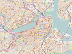
Map of Boston and Cambridge.png
Red pog.svg
USA Massachusetts location map.svg
Red pog.svg
Usa edcp location map.svg
Red pog.svg
Location Boston, Massachusetts
Coordinates 42°22′54.7″N71°3′58.6″W / 42.381861°N 71.066278°W / 42.381861; -71.066278 Coordinates: 42°22′54.7″N71°3′58.6″W / 42.381861°N 71.066278°W / 42.381861; -71.066278
Area3.8 acres (1.5 ha)
Built1891
Architect F.L. Olmsted & Co.
Architectural styleModerne, urban designed landscape
NRHP reference No. 97000969 [1]
Added to NRHPJanuary 8, 1998

Charlestown Heights later known as Ensign John J. Doherty Park, is an urban park in Charlestown, a neighborhood of Boston, Massachusetts. It is one of five small urban parks designed by Frederick Law Olmsted for the city. These parks were designed to provide greenspaces in densely populated neighborhoods. Charlestown Heights was laid out on the North side of Bunker Hill, sloping down the hill from Bunker Hill Street to Medford Street, between St. Martin Street and North Mead Street. [2]

The land on which the park would be built was once part of the vast estate of the Harris family. This parcel, which originally extended across Medford Street into unfilled Mystic River flats, was sold and mortgaged to William Dehon of Boston by Harris heirs in 1849 and remained in Dehon's estate until purchased by the City.

The park was purchased by the City of Boston in July 1891, laid out shortly thereafter, and opened in 1895. It is divided into three sections. The uppermost section abutting Bunker Hill Street is a flat promenade with a central grassy area and lined with trees, paths, and benches. A monument commemorating the 1775 Battle of Bunker Hill terminates the East end of the promenade. [2]

South side park prior to 20th century modifications Commonwealth 8k71p237t image primary.tif
South side park prior to 20th century modifications
North slope looking North toward Mystic River Commonwealth 8k71p239c image primary.tif
North slope looking North toward Mystic River
Looking South toward North side of park, Medford Street in foreground Commonwealth 8k71pb013 image primary.tif
Looking South toward North side of park, Medford Street in foreground

A large central area of the park contains active recreation facilities, and is the portion of the park which has been most altered from the original 19th-century Olmsted design. The Clougherty Pool complex includes a swimming pool and Moderne-style bathhouse designed by John M. Gray. The central portion of the park also includes basketball courts, a playground, and a wading pool.

The lowest level of the park, abutting Medford Street, is a sloping meadow with naturalistic pathways meandering through it. Stairs in this section have granite risers, with cheeks of native Roxbury Puddingstone. The sinuous path has flares of granite pavers toward the top for drainage. [2]

The park was listed on the National Register of Historic Places in 1998. [1]
See also

Related Research Articles

Charlestown, Boston Neighborhood of Boston in Massachusetts, United States

Charlestown is the oldest neighborhood in Boston, Massachusetts, in the United States. Originally called Mishawum by the Massachusett tribe, it is located on a peninsula north of the Charles River, across from downtown Boston, and also adjoins the Mystic River and Boston Harbor waterways. Charlestown was laid out in 1629 by engineer Thomas Graves, one of its earliest settlers, in the reign of Charles I of England. It was originally a separate town and the first capital of the Massachusetts Bay Colony.

Bunker Hill Monument United States historic place

The Bunker Hill Monument is a monument erected at the site of the Battle of Bunker Hill in Boston, Massachusetts, which was among the first major battles between the Red Coats and Patriots in the American Revolutionary War. The 221-foot granite obelisk was erected between 1825 and 1843 in Charlestown, Massachusetts, with granite from nearby Quincy conveyed to the site via the purpose-built Granite Railway, followed by a trip by barge. There are 294 steps to the top.

Winter Hill is a neighborhood in Somerville, Massachusetts. It gets its name from the 120-foot hill that occupies its landscape, the name of which dates back to the 18th century. Winter Hill is located roughly north of Medford Street, west of McGrath Highway, and east of Magoun Square.

Boston National Historical Park National Historical Park of the United States

The Boston National Historical Park is an association of sites that showcase Boston's role in the American Revolution. It was designated a national park on October 1, 1974. Seven of the eight sites are connected by the Freedom Trail, a walking tour of downtown Boston. All eight properties are National Historic Landmarks.

Neighborhoods in Boston

Boston's diverse neighborhoods serve as a political and cultural organizing mechanism. The City of Boston's Office of Neighborhood Services has designated 23 Neighborhoods in the city:

National Register of Historic Places listings in Massachusetts

This is a list of properties and districts in Massachusetts listed on the National Register of Historic Places. There are over 4,300 listings in the state, representing about 5% of all NRHP listings nationwide and the second-most of any U.S. state, behind only New York. Listings appear in all 14 Massachusetts counties.

Charles River Reservation

The Charles River Reservation is a 17-mile-long (27 km) urban preserve and public recreation area located along the banks of the Charles River in Boston, Cambridge, Watertown, and Newton, Massachusetts. The reservation is managed by the Massachusetts Department of Conservation and Recreation.

Copps Hill Terrace United States historic place

Copp's Hill Terrace is an historic terrace and park between Commercial and Charter Streets west of Jackson Avenue on Copp's Hill in the North End of Boston, Massachusetts near Copp's Hill Burying Ground.

Bunker Hill School United States historic place

The Bunker Hill School is a historic school at 68 Baldwin Street in the Charlestown neighborhood of Boston, Massachusetts. Built in 1866, it is a prominent local example of Second Empire architecture, and a surviving example of the city's school planning in the post-Civil War period. Now housing residential condominiums, it was listed on the National Register of Historic Places in 1987.

Town Hill District United States historic place

The Town Hill District is a historic district bounded roughly by Rutherford Avenue and Main and Warren Streets in the Charlestown neighborhood of Boston, Massachusetts.

Pulaski Park (Holyoke, Massachusetts) United States historic place

Pulaski Park is a city park along the Connecticut River in Holyoke, Massachusetts. Originally called Prospect Park when it was laid out in 1884, it was given its present name in 1939 in honor of American Revolutionary War hero Casimir Pulaski, for whom there is a memorial in the park's center. The original 5.1-acre (2.1 ha) park was designed by the Olmsted Brothers landscape design firm.

Furnace Brook Parkway

Furnace Brook Parkway is a historic parkway in Quincy, Massachusetts. Part of the Metropolitan Park System of Greater Boston, it serves as a connector between the Blue Hills Reservation and Quincy Shore Reservation at Quincy Bay. First conceived in the late nineteenth century, the state parkway is owned and maintained by the Massachusetts Department of Conservation and Recreation (DCR) and travels through land formerly owned by the families of John Adams and John Quincy Adams, passing several historic sites. It ends in the Merrymount neighborhood, where Quincy was first settled by Europeans in 1625 by Captain Richard Wollaston. The road was started in 1904, completed in 1916 and added to the National Register of Historic Places (NRHP) in 2004.

Blue Hills Parkway United States historic place

Blue Hills Parkway is a historic parkway that runs in a straight line from a crossing of the Neponset River, at the south border of Boston to the north edge of the Blue Hills Reservation in Milton, Massachusetts. It was built in 1893 to a design by the noted landscape architect, Charles Eliot, who is perhaps best known for the esplanades along the Charles River. The parkway is a connecting road between the Blue Hills Reservation and the Neponset River Reservation, and was listed on the National Register of Historic Places in 2003.

Walnut Hills Cemetery (Brookline, Massachusetts) United States historic place

Walnut Hills Cemetery is a historic cemetery on Grove Street and Allandale Road in Brookline, Massachusetts. It encompasses 45.26 acres (18.32 ha), with mature trees and puddingstone outcrops, and was laid out in 1875 in the then-fashionable rural cemetery style. Many past prominent citizens of the town, including architect H.H. Richardson, are buried here. The cemetery was listed on the National Register of Historic Places in 1985.

Stony Brook Reservation

Stony Brook Reservation is a woodland park in Boston and Dedham, Massachusetts, a unit of the Metropolitan Park System of Greater Boston, part of the state park system of Massachusetts. It was established in 1894 as one of the five original reservations created by the Metropolitan Park Commission. The park is served by the Stony Brook Reservation Parkways, a road system that was entered into the National Register of Historic Places in 2006.

Eastern Promenade United States historic place

The Eastern Promenade is a historic promenade, 68.2-acre (27.6 ha) public park and recreation area in Portland, Maine. Construction of the Promenade began in 1836 and continued periodically until 1934. The 1.5-mile (2.4 km) park was designed by the Olmsted Brothers design firm and experienced its greatest expansion from the 1880s to the 1910s. The Promenade rings around the Munjoy Hill neighborhood and occupies the farthest eastern portion of Portland's peninsula. The Promenade is home to many historical sites, including a mass grave and the mast of USS Portland.

Western Promenade United States historic place

The Western Promenade is a historic promenade, an 18.1-acre (7.3 ha) public park and recreation area in the West End neighborhood of Portland, Maine. Developed between 1836 and the early 20th century, it is one Portland's oldest preserved spaces, with landscaping by the Olmsted Brothers, who included it in their master plan for the city's parks. The promenade was listed on the National Register of Historic Places in 1989.

Forest Park, Springfield, Massachusetts United States historic place

Forest Park is a Victorian garden district located in Springfield, Massachusetts, developed between 1880 and 1920. It is the city's most populous neighborhood, and surrounds the 735-acre Frederick Law Olmsted–designed Forest Park, for which the neighborhood is named. The Forest Park neighborhood has nature and recreation within walking distance. To the west, I-91 separates Forest Park from the Connecticut River. A 195-acre section of the neighborhood was listed on the National Register of Historic Places in 1982 as the Forest Park Heights Historic District.

Monument Square Historic District (Charlestown, Boston, Massachusetts) United States historic place

The Monument Square Historic District encompasses a city park and its surrounding buildings at the top of Breed's Hill in the Charlestown neighborhood of Boston, Massachusetts. The location is notable as the site of the 1775 Battle of Bunker Hill, early in the American Revolutionary War. Monument Square was laid out in the 19th century, when the Bunker Hill Monument was erected there. The park is framed by predominantly residential buildings built in the mid-19th century.

Piers Park Park in Boston, Massachusetts, U.S.

Piers Park is a public park owned by Massport located on the southwest side of East Boston, overlooking Boston Harbor and downtown Boston. Designed by Pressley Associates Landscape Architects of Boston, the 6.5-acre (2.6 ha) park was conceived to reclaim a condemned industrial pier for recreational use, allowing residents and visitors direct access to the waterfront.

References

  1. 1 2 "National Register Information System". National Register of Historic Places . National Park Service. March 13, 2009.
  2. 1 2 3 "NRHP nomination for Charlestown Heights". Commonwealth of Massachusetts. Retrieved 2014-08-01.