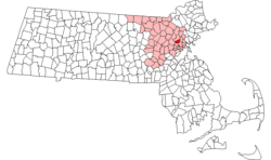
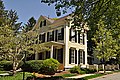
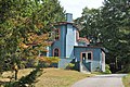
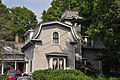
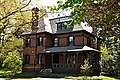
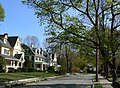
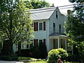
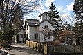
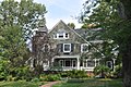
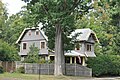
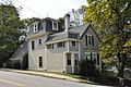
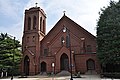
[ 3] Name on the Register Image Date listed [ 4] Location City or town Description 1 Albert Ayer House Albert Ayer House July 5, 1989 (# 89000635 8 Brooks St. 42°26′31″N 71°08′15″W / 42.441830°N 71.137637°W / 42.441830; -71.137637 (Albert Ayer House ) 2 Thomas Ayer House Thomas Ayer House July 5, 1989 (# 89000630 8 Grove St. 42°26′32″N 71°08′14″W / 42.442317°N 71.137165°W / 42.442317; -71.137165 (Thomas Ayer House ) 3 Robert Bacon House Robert Bacon House July 5, 1989 (# 89000611 6 Mystic Valley Parkway 42°26′36″N 71°08′34″W / 42.443333°N 71.142778°W / 42.443333; -71.142778 (Robert Bacon House ) 4 Kenelum Baker House Kenelum Baker House July 5, 1989 (# 89000632 4 Norwood St. 42°26′58″N 71°08′41″W / 42.449476°N 71.144703°W / 42.449476; -71.144703 (Kenelum Baker House ) 5 Edward A. Brackett House Edward A. Brackett House July 5, 1989 (# 89000626 290 Highland Ave. 42°27′00″N 71°07′45″W / 42.45°N 71.129167°W / 42.45; -71.129167 (Edward A. Brackett House ) 6 Edward Braddock House Edward Braddock House July 5, 1989 (# 89000651 112 Highland Ave. 42°27′41″N 71°07′27″W / 42.461389°N 71.124167°W / 42.461389; -71.124167 (Edward Braddock House ) 7 George Brine House George Brine House July 5, 1989 (# 89000638 219 Washington St. 42°27′22″N 71°07′51″W / 42.456111°N 71.130833°W / 42.456111; -71.130833 (George Brine House ) 8 Carr-Jeeves House Carr-Jeeves House August 2, 1989 (# 89000639 57 Lake St. 42°27′23″N 71°08′30″W / 42.456389°N 71.141667°W / 42.456389; -71.141667 (Carr-Jeeves House ) 9 Webster Childs House Webster Childs House July 5, 1989 (# 89000644 9 Meadowcroft Rd. 42°26′49″N 71°08′27″W / 42.446944°N 71.140833°W / 42.446944; -71.140833 (Webster Childs House ) 10 Cole House Cole House July 5, 1989 (# 89000646 Highland Ave. 42°27′00″N 71°07′46″W / 42.450109°N 71.129324°W / 42.450109; -71.129324 (Cole House ) Listed as demolished; [ 5] house has actually been moved a short distance to a new foundation. 11 DeRochmont House DeRochmont House July 5, 1989 (# 89000642 2–4 Rangeley Rd. 42°27′03″N 71°08′23″W / 42.450833°N 71.139722°W / 42.450833; -71.139722 (DeRochmont House ) 12 Dike-Orne House Dike-Orne House July 5, 1989 (# 89000621 257 Forest St. 42°28′23″N 71°06′47″W / 42.473056°N 71.113056°W / 42.473056; -71.113056 (Dike-Orne House ) Demolished. [ 6] 13 Edmund Dwight House Edmund Dwight House July 5, 1989 (# 89000633 5 Cambridge St. 42°26′10″N 71°09′15″W / 42.436111°N 71.154167°W / 42.436111; -71.154167 (Edmund Dwight House ) Property straddles the town line with Arlington 14 Samuel Elder House Samuel Elder House July 5, 1989 (# 89000643 38 Rangeley Rd. 42°26′51″N 71°08′30″W / 42.4475°N 71.141667°W / 42.4475; -71.141667 (Samuel Elder House ) 15 Everett Avenue-Sheffield Road Historic District Everett Avenue-Sheffield Road Historic District July 5, 1989 (# 89000661 Roughly bounded by Bacon St., Mystic Valley Parkway, Mystic Lake, Niles Ln., Everett Ave., Sheffield Rd., and Church St. 42°26′43″N 71°08′49″W / 42.445278°N 71.146944°W / 42.445278; -71.146944 (Everett Avenue-Sheffield Road Historic District ) 16 Firth-Glengarry Historic District Firth-Glengarry Historic District July 5, 1989 (# 89000662 Roughly bounded by Pine St., Grassmere Ave., Dix St., and Wildwood St. 42°27′05″N 71°08′38″W / 42.451389°N 71.143889°W / 42.451389; -71.143889 (Firth-Glengarry Historic District ) 17 Edward Gardner House Edward Gardner House July 5, 1989 (# 89000605 Zero Gardner Place 42°26′39″N 71°09′08″W / 42.444167°N 71.152222°W / 42.444167; -71.152222 (Edward Gardner House ) 18 O. W. Gardner House O. W. Gardner House July 5, 1989 (# 89000791 5 Myrtle St. 42°27′08″N 71°07′59″W / 42.452222°N 71.133056°W / 42.452222; -71.133056 (O. W. Gardner House ) 19 Patience and Sarah Gardner House Patience and Sarah Gardner House July 5, 1989 (# 89000608 103–105 Cambridge St. 42°26′40″N 71°09′08″W / 42.444444°N 71.152222°W / 42.444444; -71.152222 (Patience and Sarah Gardner House ) 20 Ginn Carriage House Ginn Carriage House July 5, 1989 (# 89000655 24 Ginn Rd. 42°26′48″N 71°08′28″W / 42.446667°N 71.141111°W / 42.446667; -71.141111 (Ginn Carriage House ) 21 Ginn Gardener's House Ginn Gardener's House July 5, 1989 (# 89000654 22 Ginn Rd. 42°26′47″N 71°08′26″W / 42.446389°N 71.140556°W / 42.446389; -71.140556 (Ginn Gardener's House ) 22 Henry Grover House Henry Grover House July 5, 1989 (# 89000641 223–225 Cambridge St. 42°27′13″N 71°09′31″W / 42.453611°N 71.158611°W / 42.453611; -71.158611 (Henry Grover House ) 23 Horace Hatch House Horace Hatch House July 5, 1989 (# 89000612 26 Grove St. 42°26′27″N 71°08′27″W / 42.440833°N 71.140833°W / 42.440833; -71.140833 (Horace Hatch House ) 24 Hovey-Winn House Hovey-Winn House July 5, 1989 (# 89000616 384 Main St. 42°26′51″N 71°08′06″W / 42.4475°N 71.135°W / 42.4475; -71.135 (Hovey-Winn House ) 25 Hutchinson-Blood House Hutchinson-Blood House July 5, 1989 (# 89000615 394-396 Main St. 42°26′54″N 71°08′07″W / 42.448333°N 71.135278°W / 42.448333; -71.135278 (Hutchinson-Blood House ) 26 Johnson-Thompson House Johnson-Thompson House July 5, 1989 (# 89000604 201 Ridge St. 42°26′54″N 71°10′36″W / 42.448333°N 71.176667°W / 42.448333; -71.176667 (Johnson-Thompson House ) 27 Marshall W. Jones House Marshall W. Jones House July 5, 1989 (# 89000649 326 Highland Ave. 42°26′53″N 71°07′46″W / 42.448056°N 71.129444°W / 42.448056; -71.129444 (Marshall W. Jones House ) 28 Asa Locke House Asa Locke House July 5, 1989 (# 89000631 68 High St. 42°26′36″N 71°09′37″W / 42.443333°N 71.160278°W / 42.443333; -71.160278 (Asa Locke House ) 29 Capt. Josiah Locke House Capt. Josiah Locke House March 2, 1979 (# 79000356 195 High St. 42°26′37″N 71°10′24″W / 42.443611°N 71.173333°W / 42.443611; -71.173333 (Capt. Josiah Locke House ) 30 James H. Mann House James H. Mann House July 5, 1989 (# 89000624 23 Hancock St. 42°27′24″N 71°07′44″W / 42.456667°N 71.128889°W / 42.456667; -71.128889 (James H. Mann House ) 31 John Mason House John Mason House July 5, 1989 (# 89000634 10 Hillside Ave. 42°26′59″N 71°07′57″W / 42.449722°N 71.1325°W / 42.449722; -71.1325 (John Mason House ) 32 Louis N. Maxwell House Louis N. Maxwell House July 5, 1989 (# 89000650 16 Herrick St. 42°26′47″N 71°07′57″W / 42.446389°N 71.1325°W / 42.446389; -71.1325 (Louis N. Maxwell House ) 33 Samuel W. McCall House Upload image July 5, 1989 (# 89000657 4 McCall Rd. 42°26′27″N 71°09′13″W / 42.44072°N 71.1535°W / 42.44072; -71.1535 (Samuel W. McCall House ) NARA ID# 63792305 34 Middlesex Canal Historic and Archaeological District Middlesex Canal Historic and Archaeological District November 19, 2009 (# 09000936 Numerous locations along the historic route of the Middlesex Canal 42°26′29″N 71°08′55″W / 42.4413°N 71.1486°W / 42.4413; -71.1486 (Middlesex Canal Historic and Archaeological District ) Extends into other Middlesex County communities and Boston in Suffolk County ; encompasses entire Middlesex Canal route. 35 Middlesex Fells Reservation Parkways Middlesex Fells Reservation Parkways February 4, 2003 (# 02001749 E Border Rd., Fellsway E., Fellsway W., Hillcrest Parkway, South St., Pond St., S. Border Rd., Ravine Rd., and Woodland Rd. 42°26′43″N 71°06′10″W / 42.445278°N 71.102778°W / 42.445278; -71.102778 (Middlesex Fells Reservation Parkways ) 36 Amy B. Mitchell House Amy B. Mitchell House July 5, 1989 (# 89000653 237 Highland Ave. 42°27′12″N 71°07′47″W / 42.453333°N 71.129722°W / 42.453333; -71.129722 (Amy B. Mitchell House ) 37 Moore House Moore House July 5, 1989 (# 89000620 85 Walnut St. 42°27′04″N 71°07′49″W / 42.451111°N 71.130278°W / 42.451111; -71.130278 (Moore House ) 38 Mystic Valley Parkway, Metropolitan Park System of Greater Boston MPS Mystic Valley Parkway, Metropolitan Park System of Greater Boston MPS January 18, 2006 (# 05001529 Mystic Valley Parkway 42°25′47″N 71°07′49″W / 42.429722°N 71.130278°W / 42.429722; -71.130278 (Mystic Valley Parkway, Metropolitan Park System of Greater Boston MPS ) Extends from Winchester 39 Oak Knoll Oak Knoll July 5, 1989 (# 89000648 17 Brooks Street 42°26′25″N 71°08′21″W / 42.440278°N 71.139167°W / 42.440278; -71.139167 (Oak Knoll ) 40 Parker House Parker House July 5, 1989 (# 89000628 180 Mystic Valley Parkway 42°26′56″N 71°07′59″W / 42.448889°N 71.133056°W / 42.448889; -71.133056 (Parker House ) 41 Edmund Parker Jr. House Edmund Parker Jr. House July 5, 1989 (# 89000610 287 Cambridge St. 42°27′22″N 71°09′35″W / 42.456111°N 71.159722°W / 42.456111; -71.159722 (Edmund Parker Jr. House ) 42 Harrison Parker Sr. House Harrison Parker Sr. House July 5, 1989 (# 89000627 60 Lloyd St. 42°26′50″N 71°08′18″W / 42.447222°N 71.138333°W / 42.447222; -71.138333 (Harrison Parker Sr. House ) 43 Pressey-Eustis House Pressey-Eustis House July 5, 1989 (# 89000623 14 Stevens St. 42°27′13″N 71°07′51″W / 42.453611°N 71.130833°W / 42.453611; -71.130833 (Pressey-Eustis House ) 44 Joseph Remick House Joseph Remick House July 5, 1989 (# 89000656 84 Cambridge St./4 Swan Rd. 42°26′37″N 71°09′11″W / 42.443611°N 71.153056°W / 42.443611; -71.153056 (Joseph Remick House ) 45 Zachariah Richardson House Zachariah Richardson House July 5, 1989 (# 89000618 597 Washington St. 42°28′08″N 71°07′31″W / 42.468889°N 71.125278°W / 42.468889; -71.125278 (Zachariah Richardson House ) 46 Arthur H. Russell House Arthur H. Russell House July 5, 1989 (# 89000652 10 Mt. Pleasant St. 42°26′53″N 71°08′29″W / 42.448056°N 71.141389°W / 42.448056; -71.141389 (Arthur H. Russell House ) 47 Charles Russell House Charles Russell House July 5, 1989 (# 89000617 993 Main St. 42°27′52″N 71°08′43″W / 42.464444°N 71.145278°W / 42.464444; -71.145278 (Charles Russell House ) 48 St. Mary's Catholic Church St. Mary's Catholic Church July 5, 1989 (# 89000625 159 Washington St. 42°27′15″N 71°07′57″W / 42.454167°N 71.1325°W / 42.454167; -71.1325 (St. Mary's Catholic Church ) 49 Sanborn House Sanborn House December 14, 1981 (# 81000286 21 High St. 42°26′44″N 71°09′24″W / 42.445556°N 71.156667°W / 42.445556; -71.156667 (Sanborn House ) 50 Sharon House Sharon House July 5, 1989 (# 89000613 403 Main St. 42°26′53″N 71°08′04″W / 42.448056°N 71.134444°W / 42.448056; -71.134444 (Sharon House ) 51 William Simonds House William Simonds House July 5, 1989 (# 89000640 420 Main St. 42°26′56″N 71°08′07″W / 42.448889°N 71.135278°W / 42.448889; -71.135278 (William Simonds House ) 52 Skillings Estate House Skillings Estate House July 5, 1989 (# 89000645 37 Rangeley Rd. 42°26′53″N 71°08′29″W / 42.448056°N 71.141389°W / 42.448056; -71.141389 (Skillings Estate House ) 53 Jacob Stanton House Jacob Stanton House July 5, 1989 (# 89000614 21 Washington St. 42°26′59″N 71°08′04″W / 42.449722°N 71.134444°W / 42.449722; -71.134444 (Jacob Stanton House ) 54 Edward Sullivan House Edward Sullivan House July 5, 1989 (# 89000636 9 Kendall St. 42°27′10″N 71°07′55″W / 42.452778°N 71.131944°W / 42.452778; -71.131944 (Edward Sullivan House ) 55 Deacon John Symmes House Deacon John Symmes House July 5, 1989 (# 89000606 212 Main St. 42°26′29″N 71°08′11″W / 42.441389°N 71.136389°W / 42.441389; -71.136389 (Deacon John Symmes House ) 56 Marshall Symmes House Marshall Symmes House July 5, 1989 (# 89000607 230 Main St. 42°26′33″N 71°08′12″W / 42.4425°N 71.136667°W / 42.4425; -71.136667 (Marshall Symmes House ) 57 Marshall Symmes Tenant House Marshall Symmes Tenant House July 5, 1989 (# 89000637 233 Main St. 42°26′35″N 71°08′11″W / 42.443056°N 71.136389°W / 42.443056; -71.136389 (Marshall Symmes Tenant House ) 58 Abijah Thompson House Abijah Thompson House July 5, 1989 (# 89000619 81 Walnut St. 42°27′03″N 71°08′19″W / 42.450833°N 71.138611°W / 42.450833; -71.138611 (Abijah Thompson House ) 59 Trowbridge-Badger House Trowbridge-Badger House July 5, 1989 (# 89000647 12 Prospect St. 42°26′49″N 71°08′00″W / 42.446944°N 71.133333°W / 42.446944; -71.133333 (Trowbridge-Badger House ) 60 US Post Office-Winchester Main US Post Office-Winchester Main October 19, 1987 (# 87001773 48 Waterfield Rd. 42°27′04″N 71°08′13″W / 42.45117°N 71.13706°W / 42.45117; -71.13706 (US Post Office-Winchester Main ) 61 Alfred Vinton House Alfred Vinton House July 5, 1989 (# 89000629 417 Main St. 42°26′55″N 71°08′04″W / 42.448611°N 71.134444°W / 42.448611; -71.134444 (Alfred Vinton House ) 62 Wedgemere Historic District Wedgemere Historic District July 5, 1989 (# 89000659 Roughly bounded by Foxcroft, Fletcher, Church, and Cambridge 42°27′08″N 71°09′02″W / 42.452222°N 71.150556°W / 42.452222; -71.150556 (Wedgemere Historic District ) 63 S. B. White House S. B. White House July 5, 1989 (# 89000622 8 Stevens St. 42°27′12″N 71°07′51″W / 42.453333°N 71.130833°W / 42.453333; -71.130833 (S. B. White House ) 64 Wildwood Cemetery Wildwood Cemetery July 5, 1989 (# 89000658 34 Palmer St. 42°27′17″N 71°08′48″W / 42.454722°N 71.146667°W / 42.454722; -71.146667 (Wildwood Cemetery ) 65 Winchester Center Historic District Winchester Center Historic District November 21, 1986 (# 86002943 Roughly bounded by Mt. Vernon and Washington Sts., Waterfield Rd., Church and Main Sts. 42°27′07″N 71°08′13″W / 42.451944°N 71.136944°W / 42.451944; -71.136944 (Winchester Center Historic District ) 66 Winchester Savings Bank Winchester Savings Bank June 19, 1979 (# 79000361 26 Mt. Vernon St. 42°27′12″N 71°08′08″W / 42.453333°N 71.135556°W / 42.453333; -71.135556 (Winchester Savings Bank ) 67 Winchester Town Hall Winchester Town Hall March 31, 1983 (# 83000837 71 Mount Vernon St. 42°27′09″N 71°08′06″W / 42.4525°N 71.135°W / 42.4525; -71.135 (Winchester Town Hall ) 68 Philemon Wright/Asa Locke Farm Philemon Wright/Asa Locke Farm March 10, 1983 (# 83000838 78 Ridge St. 42°26′29″N 71°10′35″W / 42.441389°N 71.176389°W / 42.441389; -71.176389 (Philemon Wright/Asa Locke Farm ) 69 George Wyman House George Wyman House July 5, 1989 (# 89000609 195 Cambridge St. 42°27′09″N 71°09′29″W / 42.4525°N 71.158056°W / 42.4525; -71.158056 (George Wyman House )