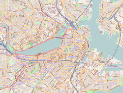
Central Square is an area in Cambridge, Massachusetts centered on the junction of Massachusetts Avenue, Prospect Street and Western Avenue. Lafayette Square, formed by the junction of Massachusetts Avenue, Columbia Street, Sidney Street and Main Street, is also considered a part of the Central Square area. Harvard Square is to the northwest along Massachusetts Avenue, Inman Square is to the north along Prospect Street and Kendall Square is to the east along Main Street. The section of Central Square along Massachusetts Avenue between Clinton Street and Main Street is designated the Central Square Historic District, and was added to the National Register of Historic Places in 1990.
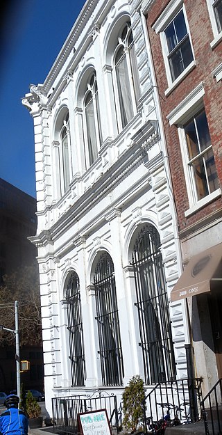
Fulton Ferry is a small area adjacent to Dumbo in the New York City borough of Brooklyn. The neighborhood is named for the Fulton Ferry, a prominent ferry line that crossed the East River between Manhattan and Brooklyn, and is also the name of the ferry slip on the Brooklyn side. The neighborhood is part of Brooklyn Community District 2.

The Leather District is a neighborhood of Boston near South Street, between the Financial District and Chinatown. The Leather District is a tightly defined area bounded by Kneeland Street to the south, Essex Street to the north, Atlantic Avenue to the east and Lincoln Street to the west. It is so named due to the dominance of the leather industry in the late 19th century.

The Harvard Avenue Historic District is a historic district roughly bounded by Linden Street, Commonwealth Avenue, Harvard Avenue, and Park Vale Avenue in the Allston neighborhood of Boston, Massachusetts. Its spine is Harvard Avenue, a major north–south thoroughfare connecting Allston to points north, and south toward Brookline. The area underwent a population explosion in the early 20th century, and Harvard Avenue was developed roughly between 1905 and 1925 as a commercial and residential spine. Notable buildings in the district include the Allston Station building, designed by Shepley, Rutan and Coolidge, and the Harvard Avenue Fire Station.

The Lower Roxbury Historic District is a historic district encompassing an isolated pocket of 1890s mixed residential-commercial property in the lower Roxbury neighborhood of Boston, Massachusetts. Bounded by Tremont, Columbus, and Burke Streets and St. Cyprian's Place, the area contains a well-kept collection of architect designed buildings that survived late 20th-century urban redevelopment. The district was added to the National Register of Historic Places in 1994.
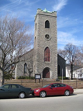
Monument Square Historic District is a predominantly residential historic district north of Monument Square in Jamaica Plain, a neighborhood of Boston, Massachusetts. The 43 acres (17 ha) district is bounded on the northwest by Pond Street, the northeast by Myrtle and Pond Streets, the southeast by Centre Street, and Holbrook and Eliot Streets to the west. This area, originally developed as country estates, was developed as a residential area in the late 19th and early 20th centuries, with its architecture reflecting a diversity of styles. Prominent non-residential buildings including the First Church of Jamaica Plain, Eliot Hall, and the Eliot School. Also included in the district is Jamaica Plain's Gothic Soldier's Monument, at the junction of South and Centre Streets.

Morton Street is a street in southern Boston, Massachusetts, United States. It extends from the southeastern end of the Arborway in Jamaica Plain to Washington Street in the Lower Mills Village of Dorchester. Most of the road is a connecting parkway, signed as part of Massachusetts Route 203, that provides access to Boston's Emerald Necklace of parks. That portion of the road was listed on the National Register of Historic Places in 2005.

The Neponset Valley Parkway is a historic parkway in southern Boston and Milton, Massachusetts, United States. It is a connecting parkway in the Greater Boston area's network, providing a connection between the Blue Hills Reservation, Neponset River Reservation, and the Stony Brook Reservation. The parkway was constructed between 1898 and 1929 with design assistance from Charles Eliot and the Olmsted Brothers. It was listed on the National Register of Historic Places in 2005.

The Truman Parkway is a historic parkway in Milton and southern Boston, Massachusetts. It runs along the southern boundary of a portion of the Neponset River Reservation and serves as a connection between the Neponset Valley Parkway and the Blue Hills Parkway. The parkway was built in 1931 and added to the National Register of Historic Places in 2005.

The North Attleborough Town Center Historic District encompasses the most historic elements of the central business district of North Attleborough, Massachusetts. The area was developed between about 1860 and 1830 as a center serving the community and the surrounding jewelry manufacturing businesses for which the town was well known. The district, extending along Washington Street between Fisher Street and Bruce Avenue, was added to the National Register of Historic Places in 1985.

The Springfield Street Historic District is a predominantly residential historic district south of the downtown area of Chicopee, Massachusetts. It encompasses a significant number of Queen Anne style houses built in the second half of the 19th century by wealthy residents of Chicopee, as well as housing for skilled workers at the nearby textile mills. It is centered where Springfield Street and Fairview Avenue meet. The district was listed on the National Register of Historic Places in 1991.

The North High Street Historic District is a historic district encompassing part of the downtown area of Holyoke, Massachusetts. When first added to the National Register of Historic Places in 1986, the district encompassed North High Street, between Dwight and Lyman Streets. This part of High Street was built between 1850 and 1885, and is lined with masonry buildings in Italianate and Second Empire styles. In 1992 the district was extended southward, adding three blocks of High Street between Dwight and Essex Streets. This expansions encompasses the growth of Holyoke during the height of its commercial success, between 1880 and 1930; it also includes the separately-listed Holyoke City Hall. The district was extended a third time, in 2008, adding a complex of three buildings at Dwight and Maple Streets that now houses the Holyoke Health Center.
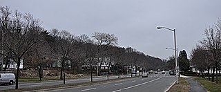
The Fells Connector Parkways are a group of historic parkways in the cities of Malden and Medford, Massachusetts, suburbs north of the city of Boston. The three parkways, The Fellsway, Fellsway West, and Fellsway East serve to provide access from the lower portion of the Mystic River Reservation to the Middlesex Fells Reservation. The latter two parkways continue northward, providing access to the interior of the Fells and providing a further connection to Lynn Fells Parkway. Significant portions of these parkways south of the Fells, which were among the first connecting parkways designed to be part of the Metropolitan Park System of Greater Boston by Charles Eliot, were listed on the National Register of Historic Places in 2003.

The Marlborough Center Historic District is a historic district encompassing the civic and commercial heart of Marlborough, Massachusetts. It is centered on a stretch of Main Street between Mechanic Street to the west and Bolton Street to the east, and includes properties on adjacent streets. The center is reflective of the city's prosperity as an industrial center from the mid-19th century to the mid-20th century. The district was listed on the National Register of Historic Places in 1998.

The Central Square Historic District is a historic district encompassing much of the central business district of Stoneham, Massachusetts. It includes the town's largest concentration of 19th and early-20th century commercial architecture, in an area that developed in importance as a commercial center after the construction of the Andover-Medford Turnpike. The district was added to the National Register of Historic Places in 1990.

Brookline Village is one of the major commercial and retail centers of the town of Brookline, Massachusetts, United States. Located just north of Massachusetts Route 9 and west of the Muddy River, it is the historic center of the town and includes its major civic buildings, including town hall and the public library. The commercial spine of the village, extending along Washington Street from Route 9 to the library, is a historic district listed on the National Register of Historic Places as the Brookline Village Commercial District.

White River Junction Historic District is a historic district in the unincorporated village of White River Junction, within the town of Hartford, Vermont. It was first listed on the National Register of Historic Places in 1980, and its boundaries were increased in 2002 and 2019. It originally encompassed the central portion of the village's business district, and was then expanded to include a broader array of resources.
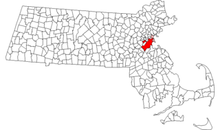
Boston, Massachusetts is home to many listings on the National Register of Historic Places. This list encompasses those locations that are located north of the Massachusetts Turnpike. See National Register of Historic Places listings in southern Boston for listings south of the Turnpike. Properties and districts located elsewhere in Suffolk County's other three municipalities are also listed separately.

Boston, Massachusetts is home to many listings on the National Register of Historic Places. This list encompasses those locations that are located south of the Massachusetts Turnpike. See National Register of Historic Places listings in northern Boston for listings north of the Turnpike. Properties and districts located elsewhere in Suffolk County's other three municipalities are also listed separately.

The Exeter Waterfront Commercial Historic District encompasses the historic commercial and residential waterfront areas of Exeter, New Hampshire. The district extends along the north side of Water Street, roughly from Main Street to Front Street, and then along both sides of Water and High streets to the latter's junction with Portsmouth Street. It also includes properties on Chestnut Street on the north side of the Squamscott River. This area was where the early settlement of Exeter took place in 1638, and soon developed as a shipbuilding center. The district was listed on the National Register of Historic Places in 1980. It was enlarged in 1986 to include the mill complex of the Exeter Manufacturing Company on Chestnut Street.

