The Boston Common is a public park in downtown Boston, Massachusetts. It is the oldest city park in the United States. Boston Common consists of 50 acres (20 ha) of land bounded by five major Boston streets: Tremont Street, Park Street, Beacon Street, Charles Street, and Boylston Street.
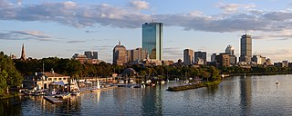
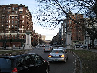
Back Bay is an officially recognized neighborhood of Boston, Massachusetts, built on reclaimed land in the Charles River basin. Construction began in 1859, as the demand for luxury housing exceeded the availability in the city at the time, and the area was fully built by around 1900. It is most famous for its rows of Victorian brownstone homes—considered one of the best preserved examples of 19th-century urban design in the United States—as well as numerous architecturally significant individual buildings, and cultural institutions such as the Boston Public Library, and Boston Architectural College. Initially conceived as a residential-only area, commercial buildings were permitted from around 1890, and Back Bay now features many office buildings, including the John Hancock Tower, Boston's tallest skyscraper. It is also considered a fashionable shopping destination and home to several major hotels.

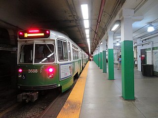
Boylston station is a light rail station on the MBTA Green Line in downtown Boston, Massachusetts, located on the southeast corner of Boston Common at the intersection of Boylston Street and Tremont Street. A southbound street-level stop for the SL5 route of the bus rapid transit Silver Line is outside fare control. The station has two island platforms; each has one disused track, making them effectively side platforms. Boylston is not accessible for Green Line trains.

The Cutler Majestic Theatre at Emerson College, in Boston, Massachusetts, is a 1903 Beaux Arts style theater, designed by the architect John Galen Howard. Originally built for theatre, it was one of three theaters commissioned in Boston by Eben Dyer Jordan, son of the founder of Jordan Marsh, a Boston-based chain of department stores. The Majestic was converted to accommodate vaudeville shows in the 1920s and eventually into a movie house in 1956 by Sack Cinemas. The change to film came with renovations that transformed the lobby and covered up much of John Galen Howard's original Beaux-Arts architecture.

The Tremont Street subway in Boston's MBTA subway system is the oldest subway tunnel in North America and the third-oldest still in use worldwide to exclusively use electric traction, opening on September 1, 1897. It was originally built, under the supervision of Howard A. Carson as chief engineer, to get streetcar lines off the traffic-clogged streets, instead of as a true rapid transit line. It now forms the central part of the Green Line, connecting Boylston Street to Park Street and Government Center stations.
Copley station is an underground light rail station on the MBTA Green Line, located in the Back Bay section of Boston, Massachusetts. Located in and named after Copley Square, the station has entrances and exits along Boylston Street and Dartmouth Street.

The Massachusetts Historical Society (MHS) is a major historical archive specializing in early American, Massachusetts, and New England history. The Massachusetts Historical Society was established in 1791 and is located at 1154 Boylston Street in Boston, Massachusetts, and is the oldest historical society in the United States.

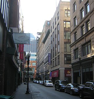
Tremont Street is a major thoroughfare in Boston, Massachusetts.

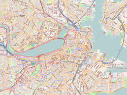
Boylston Street is a major east–west thoroughfare in the city of Boston, Massachusetts and its western suburbs. The street begins in Boston's Chinatown neighborhood, forms the southern border of the Boston Public Garden and Boston Common, runs through Back Bay and Boston's Fenway neighborhood, merges into Brookline Ave and then Washington Street, emerging again contiguous with Route 9 out to where it crosses Route 128, after which it becomes Worcester Street.

The Frederick Douglass Square Historic District is a historic district roughly bounded by Hammond Street, Cabot Street, Windsor Street, and Westminster Street, in the Lower Roxbury area of Boston, Massachusetts. It covers a 5-acre (2.0 ha) that is a remarkably well-preserved and cohesive residential development created as the result of one of Boston's many land-reclamation projects in the 19th century. This area, originally salt marshes that flooded at high tide, was at first gradually filled in as the Boston Neck was widened with the construction of Tremont Street and railroad lines. The Tremont Improvement Company acquired a remnant portion of the salt marshes by the early 1860s, and built a series of single-family row houses on the land that resulted from filling it in. The district includes most of the residential properties on Warwick, Greenwich, and Sussex Streets, as well as clusters of properties on adjacent streets.
The Fenway-Boylston Street District is a historic district encompassing a series of predominantly residential buildings lining The Fenway in the Fenway–Kenmore of Boston, Massachusetts. Developed beginning in the 1890s, the area is emblematic of Boston's upper-class residential development of the period, with architect-designed houses built for some of the city's leading families. The district was listed on the National Register of Historic Places in 1984.

The Lower Roxbury Historic District is a historic district encompassing an isolated pocket of 1890s mixed residential-commercial property in the lower Roxbury neighborhood of Boston, Massachusetts. Bounded by Tremont, Columbus, and Burke Streets and St. Cyprian's Place, the area contains a well-kept collection of architect designed buildings that survived late 20th-century urban redevelopment. The district was added to the National Register of Historic Places in 1994.

The Shubert Theatre is a theatre in Boston, Massachusetts, at 263-265 Tremont Street in the Boston Theater District. It opened on January 24, 1910, with a production of Shakespeare's The Taming of the Shrew starring E. H. Sothern and Julia Marlowe. Architect Thomas M. James designed the building, which seats approximately 1,600 people. Originally conceived as The Lyric Theatre by developer Charles H. Bond, it was taken over by The Shubert Organization in 1908 after Bond's death.
The West Street District is a historic district on West Street in Boston, Massachusetts, one of the city's "ladder districts" that runs between Tremont Street and Washington Street in the Downtown Crossing commercial/retail area. The district includes four buildings located near the corner of Tremont and West Streets, all built in the early 20th century. The two buildings at 148-150 Tremont Street were once occupied by Chandler and Company, an exclusive department store. Number 148 is a Renaissance Revival structure built as an office building in 1912, and number 150 was built in 1903 to house the Oliver Ditson Company, a music publisher. The Fabyan building at 26-30 West Street was designed by Coolidge, Shepley, Bulfinch & Abbott, and built in 1926. The Schraffts Building at 16-24 West Street was built in 1922, and housed a flagship candy store and restaurant for more than fifty years.
Carl Fehmer was a prominent German-American Boston architect during the 19th century.
Chickering Hall (est.1883) was a concert auditorium in Boston, Massachusetts, in the late 19th century. It occupied the second floor of Chickering and Sons showrooms on Tremont Street, near the corner of West Street. "Bradlee, Winslow and Wetherell were the architects, and Mr. E.P. Treadwell, the decorator. The hall [was] lighted by the Edison electric light." By 1895: "Tremont St., towards Boylston, for some years has been called Piano Row, for a long row of piano agencies occupied a good portion of the block; but of late most of these have migrated to Boylston St. Chickering Hall, at 152 Tremont St., was for many years a favorite place for fashionable musicales, and the headquarters of the musical profession."
Hotel Touraine (1897-1966) in Boston, Massachusetts, was a residential hotel on the corner of Tremont Street and Boylston Street, near the Boston Common. The architecture firm of Winslow and Wetherell designed the 11-story building in the Jacobethan style, constructed of "brick and limestone;" its "baronial" appearance was "patterned inside and out after a 16th-century chateau of the dukes of Touraine." It had dining rooms and a circulating library. Owners included Joseph Reed Whipple and George A. Turain.

Steinert Hall of Boston, Massachusetts, stands at 162 Boylston Street on what was called Boston's "piano row", opposite the Common in the Boston Theater District.

The Boston Theater District is the center of Boston's theater scene. Many of its theaters are on Washington Street, Tremont Street, Boylston Street, and Huntington Avenue.

Fort Hill is a 0.4 square mile neighborhood and historic district of Roxbury, in Boston, Massachusetts. The approximate boundaries of Fort Hill are Malcolm X Boulevard on the north, Washington Street on the southeast, and Columbus Avenue on the southwest.