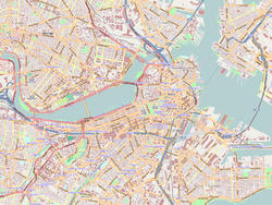
Somerville is a city located directly to the northwest of Boston, and north of Cambridge, in Middlesex County, Massachusetts, United States. As of the 2020 United States Census, the city had a total population of 81,045 people. With an area of 4.12 square miles (10.7 km2), the city has a density of 19,671/sq mi (7,595/km2), making it the most densely populated municipality in New England and the 19th most densely populated incorporated municipality in the country. Somerville was established as a town in 1842, when it was separated from Charlestown. In 2006, the city was named the best-run city in Massachusetts by The Boston Globe. In 1972, 2009, and 2015, the city received the All-America City Award. It is home to Tufts University, which has its campus along the Somerville and Medford border. Tufts, alongside Harvard University and the Massachusetts Institute of Technology, makes up one corner of the Brain Power Triangle, which thus includes the city of Somerville.

Charlestown is the oldest neighborhood in Boston, Massachusetts, in the United States. Also called Mishawum by the Massachusett, it is located on a peninsula north of the Charles River, across from downtown Boston, and also adjoins the Mystic River and Boston Harbor waterways. Charlestown was laid out in 1629 by engineer Thomas Graves, one of its earliest settlers, during the reign of Charles I of England. It was originally a separate town and the first capital of the Massachusetts Bay Colony.

Beacon Hill is a historic neighborhood in Boston, Massachusetts, United States. It is also the location of the Massachusetts State House. The term "Beacon Hill" is used locally as a metonym to refer to the state government or the legislature itself, much like Washington, D.C.'s Capitol Hill does at the federal level.

The Old South Meeting House is a historic Congregational church building located at the corner of Milk and Washington Streets in the Downtown Crossing area of Boston, Massachusetts, built in 1729. It gained fame as the organizing point for the Boston Tea Party on December 16, 1773. Five thousand or more colonists gathered at the Meeting House, the largest building in Boston at the time.

The Bunker Hill Monument is a monument erected at the site of the Battle of Bunker Hill in Boston, Massachusetts, which was among the first major battles between the United Colonies and the British Empire in the American Revolutionary War. The 221-foot granite obelisk was erected between 1825 and 1843 in Charlestown, Massachusetts, with granite from nearby Quincy conveyed to the site via the purpose-built Granite Railway, followed by a trip by barge. There are 294 steps to the top.

Winter Hill is a neighborhood in Somerville, Massachusetts, United States. It takes its name from the 120-foot hill that occupies its landscape, the name of which dates back to the 18th century. Winter Hill is located roughly north of Medford Street, west of McGrath Highway, and east of Magoun Square.

The Boston National Historical Park is an association of sites that showcase Boston's role in the American Revolution and other parts of history. It was designated a national park on October 1, 1974. Seven of the eight sites are connected by the Freedom Trail, a walking tour of downtown Boston. All eight properties are National Historic Landmarks.

South Medford is the southern neighborhood of Medford, Massachusetts.

Mission Hill is a 3⁄4 square mile, primarily residential neighborhood of Boston, bordered by Roxbury, Jamaica Plain and Fenway-Kenmore and the town of Brookline. The neighborhood has two main streets, namely Tremont Street and Huntington Avenue. It is served by several stations on the MBTA's Green Line E branch, as well as Roxbury Crossing station on the Orange Line.

The Loring–Greenough House is the last surviving 18th century residence in Sumner Hill, a historic section of Jamaica Plain, Massachusetts, a neighborhood of Boston. It is located at 12 South Street on Monument Square at the edge of Sumner Hill. It is situated on the border of two National Historic Districts.

The Bunker Hill School is a historic school at 68 Baldwin Street in the Charlestown neighborhood of Boston, Massachusetts. Built in 1866, it is a prominent local example of Second Empire architecture, and a surviving example of the city's school planning in the post-Civil War period. Now housing residential condominiums, it was listed on the National Register of Historic Places in 1987.

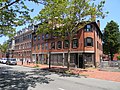
The Moreland Street Historic District is a historic district roughly bounded by Kearsarge, Blue Hill Avenues, and Warren, Waverly, and Winthrop Streets in the Roxbury neighborhood of Boston, Massachusetts. It encompasses 63 acres (25 ha) of predominantly residential urban streetscape, which was developed between about 1840 and 1920. Housing types represent a cross-section of architectural styles from the period, including Second Empire, Italianate, and Queen Anne style. It is a fairly well-preserved grouping in an area where many sections have been negatively affected by urban blight and redevelopment. One notable house is at 130 Warren Street: it is the only house in the district built out of Roxbury puddingstone. That building is currently under study as a pending landmark for the Boston Landmarks Commission.

The Peter and Oliver Tufts House is a historic house in Somerville, Massachusetts. Built about 1714, it is one of the oldest houses in the city's Winter Hill neighborhood, and was owned in the 19th century by members of the Tufts family responsible for developing the city's brickyards. The building was added to the National Register of Historic Places in 1989.

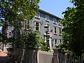
The Spring Hill Historic District is a historic district roughly bounded by Summer, Central, Atherton, and Spring Streets in the Spring Hill area of Somerville, Massachusetts. The district encompasses the city's best-preserved residential subdivision from the mid-19th century, with later infill construction in the late 19th and early 20th centuries. The district was listed on the National Register of Historic Places in 1989.

The Edward's Plain–Dowse's Corner Historic District is a predominantly residential historic district encompassing an area where light industrial activity took place from the late 18th century to the early 20th century. It extends along North Main Street between Eliot and Everett Streets in Sherborn, Massachusetts, and was listed on the National Register of Historic Places in 1986.

The Charles Buck House is a historic house at 68 Pleasant Street in Stoneham, Massachusetts. Built about 1880 for a dealer in hide, this modest Italianate house occupies the site of Stoneham's first meetinghouse and school. It was listed on the National Register of Historic Places in 1984.

Brattle Street in Cambridge, Massachusetts, called the "King's Highway" or "Tory Row" before the American Revolutionary War, is the site of many buildings of historical interest, including the modernist glass-and-concrete building that housed the Design Research store, and a Georgian mansion where George Washington and Henry Wadsworth Longfellow both lived, as well as John Vassall and his seven slaves including Darby Vassall. Samuel Atkins Eliot, writing in 1913 about the seven Colonial mansions of Brattle Street's "Tory Row," called the area "not only one of the most beautiful but also one of the most historic streets in America." "As a fashionable address it is doubtful if any other residential street in this country has enjoyed such long and uninterrupted prestige."

The Charlestown Main Street Historic District encompasses the historic heart of Charlestown, New Hampshire. It is located along Main Street, roughly between Lower Landing Road and Bridge Street, and encapsulates more than two hundred years of the town's history. The district was listed on the National Register of Historic Places in 1987.

The Monument Square Historic District encompasses a city park and its surrounding buildings at the top of Breed's Hill in the Charlestown neighborhood of Boston, Massachusetts. The location is notable as the site of the 1775 Battle of Bunker Hill, early in the American Revolutionary War. Monument Square was laid out in the 19th century, when the Bunker Hill Monument was erected there. The park is framed by predominantly residential buildings built in the mid-19th century.

Fort Hill is a 0.4 square mile neighborhood and historic district of Roxbury, in Boston, Massachusetts. The approximate boundaries of Fort Hill are Malcolm X Boulevard on the north, Washington Street on the southeast, and Columbus Avenue on the southwest.