
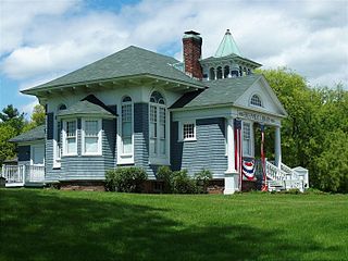
The Ashburnham Center Historic District is a historic district encompassing the core of the village center of Ashburnham, Massachusetts in the United States. It is a well-preserved industrial village that experienced its most significant period of growth in the mid-19th century. The district was added to the National Register of Historic Places in 1999.

The Lunenburg Historic District is a historic district encompassing the historic center of Lunenburg, Massachusetts. The district is centered on a stretch of Main Street which connects two triangular intersections. It includes many of the town's oldest buildings, including the c. 1724 Cushing House, and the c. 1730 Stillman Stone House. Three of the town's most significant institutional buildings were built before 1850: the town hall, the Congregational church, and the Methodist church. The district was added to the National Register of Historic Places in 1988.

The Brewster Old King's Highway Historic District is a historic district encompassing much of Massachusetts Route 6A and portions of some adjacent roads in Brewster, Massachusetts, which was known as the Old King's Highway during colonial times. The center of Brewster grew around the junction of the Old King's Highway and Harwich Road, with its first church built there in 1700, and a nearby burying ground established in 1707. The civic and commercial functions of the town were spread along the Old King's Highway through the 19th and into the early 20th century. This concentration of historic resources extends about 1.5 miles (2.4 km) west of the main junction, and about 1.2 miles (1.9 km) eastward.

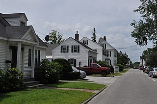
The Old Town Historic District is a historic district in North Attleborough, Massachusetts, which encompasses the historic early town center of Attleboro, which it was originally a part of. It was here that Attleboro's first church was built, and its militia training ground was laid out. The district retains 18th-century vestiges of this early history, and was largely bypassed by 19th-century industrialization. The district was added to the National Register of Historic Places in 1991.

Becket Center Historic District is a historic district encompassing the historic early center of Becket, Massachusetts. Centered at the junction of Massachusetts Route 8 and YMCA Road, this area was the town's civic heart and a center of industry until it was eclipsed in importance by North Becket, which was served by the railroad. Most of the architecture in the district is in the Federal and Greek Revival styles popular in the late 18th to mid 19th centuries. The district was added to the National Register of Historic Places in 1982.

The Ashfield Plain Historic District is a historic district roughly, along Main and South Streets and adjacent parts of Buckland and Norton Hill Roads in Ashfield, Massachusetts. It encompasses the village center of the town, which has acted as a civic and commercial center since the late 18th century. Its architectural heritage dates back to that time, but is now dominated by buildings from the late 19th and early 20th centuries. The district was listed on the National Register of Historic Places in 1991.

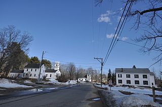
The Charlemont Village Historic District is a historic district on Massachusetts Route 2 between South Street and Harmony Lane, encompassing much of the village center of Charlemont, Massachusetts, United States. The district's properties represent the growth of the village center from its rural origin through a period of 19th century industrialization, including 18th and 19th century farmsteads, Greek Revival buildings of the mid 19th century, and later 19th century Victorian architectural styles. The district was added to the National Register of Historic Places in 1988.

The Bedford Center Historic District encompasses the historic heart of the town of Bedford, Massachusetts. It extends along Great Road between Bacon and Concord Roads, and includes primarily residential areas on adjacent side streets. The area includes the town's main civic buildings, its first cemetery, and a diverse array of residential architecture spanning more than two centuries. The district was listed on the National Register of Historic Places in 1977; its boundaries were adjusted in 2014 and its period of significance extended.

The Marlborough Center Historic District is a historic district encompassing the civic and commercial heart of Marlborough, Massachusetts. It is centered on a stretch of Main Street between Mechanic Street to the west and Bolton Street to the east, and includes properties on adjacent streets. The center is reflective of the city's prosperity as an industrial center from the mid-19th century to the mid-20th century. The district was listed on the National Register of Historic Places in 1998.

The Milton Centre Historic District encompasses the traditional civic heart of Milton, Massachusetts. The district is located on Canton Avenue between Readsdale Road and Thacher and Highland Streets, and includes municipal buildings, churches, and residences, most built in the 18th or 19th century. The district was listed on the National Register of Historic Places in 1988.

The Brookline Town Green Historic District encompasses the historic colonial heart of the town of Brookline, Massachusetts. Centered on a stretch of Walnut Street between Warren and Chestnut Streets, this area is where the town's first colonial meeting house and cemetery were laid out, and was its center of civic life until the early 19th century. The district was listed on the National Register of Historic Places in 1980.

The Hollis Village Historic District encompasses the historic village center of Hollis, New Hampshire. The district is centered on Monument Square, which connects Main Street to Depot Street and Broad Street. It covers about 400 acres (160 ha), and extends along all three of those roads for some distance, and includes properties on Silver Lake Road and Ash Street. Most of the buildings in the district are residential or agricultural in use, and date before the turn of the 20th century; the oldest buildings date to the mid-18th century. The "Always Ready Engine House", which occupies a triangular parcel at the western end of Monument Square, was built in 1859, and is the town's oldest municipal building. Its most architecturally sophisticated building is the town hall, built in 1887 to a design by William M. Butterfield of Manchester. The district represents the growth of a mainly agricultural community over a 200-year period. The district was listed on the National Register of Historic Places in 2001.
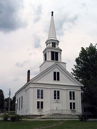
The Somers Historic District encompasses the historic civic and social center of the town of Somers, Connecticut. It stretches along Main Street, with extensions along Springfield Road and Battle Street, and includes a significant number of vernacular Federal and Greek Revival houses. It includes the town's early churches, as well as important civic buildings, including the town hall and library. The district was listed on the National Register of Historic Places in 1982.
The Deerfield Center Historic District encompasses the heart of the rural New Hampshire town of Deerfield. It extends northwest along Church Street from its junction with North Road, Candia Road, and Raymond Road. It includes many of the town's municipal buildings, as well as a church and private residences, most of which were built before about 1920. The district was listed on the National Register of Historic Places in 2002.
The Federal Street Historic District of Brunswick, Maine encompasses a part of the town whose development was influenced by its 18th-century success as a shipping center, and by the presence of Bowdoin College, whose historic central campus is part of the district. In addition to the campus, the district includes a series of relatively high-style Federal and later-period houses along Federal Street and Maine Street, which join the campus to downtown Brunswick. The district was listed on the National Register of Historic Places in 1976.

The Putney Village Historic District encompasses most of the main village and town center of Putney, Vermont. Settled in the 1760s, the village saw its major growth in the late 18th and early 19th century, and includes a cohesive collection with Federal and Greek Revival buildings, with a more modest number of important later additions, including the Italianate town hall. The district was listed on the National Register of Historic Places in 1986.
The Middletown Springs Historic District encompasses most of the village center of Middletown Springs, Vermont. Oriented around the crossroads junction of Vermont Routes 140 and 133, the village has a well-preserved collection of mainly mid-19th century architecture, including a significant number of Italianate buildings. The district was listed on the National Register of Historic Places in 1985.

The Watertown Center Historic District encompasses the historic village center of Watertown, Connecticut. It exhibits architectural and historic changes from the early 1700s into the 20th century. It is roughly bounded by Main, Warren, North, Woodbury, Woodruff, and Academy Hill Roads, and was listed on the National Register of Historic Places in 2001.
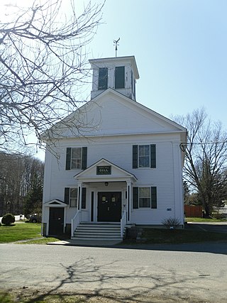
The Gill Center Historic District encompasses the historic 19th-century village center of Gill, Massachusetts. The district is focused on Main Road near its junction with River Road, in the central northern part of the town, and has served as the community's center since its incorporation in 1793. The district was listed on the National Register of Historic Places in 1999; it features a variety of mainly Greek Revival and later Victorian architecture, as well as some 20th-century Colonial Revival buildings.

The Southborough Center Historic District encompasses a historically significant portion of the town center of Southborough, Massachusetts. It extends from the Fay School grounds in the west, along Main Street to the railroad crossing east of Lanisquama Road. The area has been the town center since its founding in 1727, and now houses a diversity of 19th and early 20th-century architecture. The district was added to the National Register of Historic Places in 1990.


