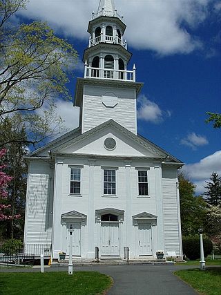
The South Britain Historic District encompasses the core of the unincorporated village of South Britain in Southbury, Connecticut, United States. The village arose in the 18th century as an industrial center serving the surrounding agricultural community, powered by the Pomperaug River, and rivalled the town center of Southbury in importance. The district was listed on the National Register of Historic Places in 1987.

The Hotchkissville Historic District is a historic district in the town of Woodbury, Connecticut, United States that was listed on the National Register of Historic Places in 1995. The district encompasses most of the historic village of Hotchkissville, which is centered at the junction of Washington and Weekeepeemee roads. The village began as a dispersed rural agricultural community, but developed in the 19th century with the arrival of industry, primarily the manufacture of textiles. Despite this, the village has retained a significantly rural character, and includes a broad cross-section of 18th- and 19th-century architectural styles.

The Russells Mills Village Historic District is a historic district on Russells Mills, Rock O' Dundee, Slades Corner, Horseneck and Fisher Roads in Dartmouth, Massachusetts. It encompasses an area that was an early industrial center, flourishing from the 18th century into the early 19th century. The district was added to the National Register of Historic Places in 1985.
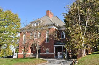
The Baldwinville Village Historic District encompasses the historic elements of the village of Baldwinville, a 19th-century mill village in northern Templeton, Massachusetts. Although its industrial elements have largely been lost, the district retains period housing and civic buildings. It was listed on the National Register of Historic Places in 1986.

Becket Center Historic District is a historic district encompassing the historic early center of Becket, Massachusetts. Centered at the junction of Massachusetts Route 8 and YMCA Road, this area was the town's civic heart and a center of industry until it was eclipsed in importance by North Becket, which was served by the railroad. Most of the architecture in the district is in the Federal and Greek Revival styles popular in the late 18th to mid 19th centuries. The district was added to the National Register of Historic Places in 1982.

Mill River Historic District is a historic district encompassing the traditional center of government and a former industrial mill village along the Konkapot River in the village of Mill River in New Marlborough, Massachusetts. The district is roughly bounded by Main Street and River Church, Southfield, Clayton, School, and Hayes Hill Roads. It encompasses about 425 acres (172 ha), and contains mostly 19th century residential and civic buildings, as well as remnants of 19th century industrial activity.

The South Egremont Village Historic District encompasses most of the village of South Egremont, Massachusetts, a well-preserved village whose architecture has seen relatively little alteration since the 1840s. It is located along Massachusetts Route 23 in the plains east of the Taconic Mountains. The district was listed on the National Register of Historic Places in 1984.

The South Lee Historic District encompasses the historic portion of the village of South Lee in Lee, Massachusetts. Extending mainly along Massachusetts Route 102 between Fairview Street and the Stockbridge town line, the village is a well-preserved 19th-century mill village, with fine Federal and Greek Revival buildings and a later 19th-century paper mill. It was listed on the National Register of Historic Places in 1999.
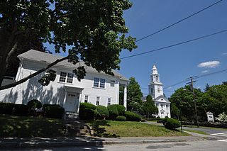
Church Street Historic District is a historic district roughly on Church Street between Park Ave. and Highland St. in Ware, Massachusetts. This mainly residential area includes some of Ware's finest late 19th century houses and a well-preserved collection of Greek Revival houses. The area was developed primarily in response to the growth of industry to the south. The district was listed on the National Register of Historic Places in 1983.

The Williamsburg Center Historic District is a historic district on Massachusetts Route 9 in Williamsburg, Massachusetts. It encompasses the traditional center of the town, which was settled in the 18th century and grew to prosperity in the mid-19th century. It was listed on the National Register of Historic Places in 1980.

The West Chesterfield Historic District is a historic district that encompasses the 19th century industrial and residential heritage of the village of West Chesterfield in the town of Chesterfield, Massachusetts. Centered at the junction of Main Road and Ireland Street, it was one of the town's main industrial sites for many years. The district was listed on the National Register of Historic Places in 2008.

The East Leverett Historic District of Leverett, Massachusetts, encompasses the historic mill village of East Leverett. Centered on the intersection of Cushman Road and Shutesbury Road in the southeastern portion of the rural town, it includes predominantly residential buildings that were built during the height of the area's industrial activity in the first four decades of the 19th century. The architecture is mainly Federal and Greek Revival in style. The district was listed on the National Register of Historic Places in 2014.

The Head of the River Historic District is a historic district encompassing a village area at the head of navigation of the Acushnet River, which separates Acushnet and New Bedford, Massachusetts. The village is centered at the junction of Tarkin Hill Road, River Road, and Mill Road in New Bedford, and Main Street in Acushnet. The area went through two significant periods of development: the first was in the late 18th and early 19th century, and the second was in the early 20th century. The district was listed on the National Register of Historic Places in 2009.

The Moore's Corner Historic District of Leverett, Massachusetts, encompasses the historic rural mill village of Moore's Corner. Centered on the intersection of North Leverett Road with Dudleyville Road, Church Hill Road, and Rattlesnake Gutter Road, it includes 15 houses and several other buildings, mainly from the village's mid-19th century peak as a modest rural village center. The district was listed on the National Register of Historic Places in 2014.
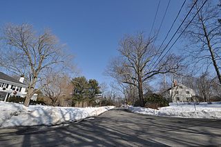
The Jewell Town District of South Hampton, New Hampshire, encompasses a colonial-era industrial village with a history dating to 1687. It is centered at the junction of West Whitehall and Jewell Streets, which is just south of a bend in the Powwow River, the source of the power for the mills that were built here. The area was settled in 1687 by Thomas Jewell, and by the early 19th century included a variety of mills as well as a bog iron works. The district now includes only remnants of its industrial past, and features a collection of 18th and early-19th century residential architecture. The district was listed on the National Register of Historic Places in 1983.

The North Charlestown Historic District encompasses a 19th-century rural village in Charlestown, New Hampshire. Located about 5 miles (8 km) north of the town's center, the district includes a small cluster of buildings along New Hampshire Route 12A that is a remnant portion of a larger agricultural village. First settled in the 1750s, the oldest buildings in the district date to the 1790s, and most of the major buildings were built in the 19th century. Its economy was based on lumber and farming. The village was once considered a much larger, dispersed settlement, but construction of New Hampshire Route 11 in the 1960s separated some of the more remote parts of the village from its nucleus, which was bypassed by that construction.

The Grafton Village Historic District encompasses the historic village center of the town of Grafton, Vermont. The village was developed in the early-to-mid 19th century, and has retained the character of that period better than many small communities in the state. The district was listed on the National Register of Historic Places in 2010.
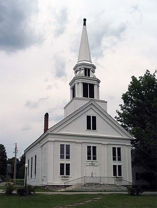
The Middletown Springs Historic District encompasses most of the village center of Middletown Springs, Vermont. Oriented around the crossroads junction of Vermont Routes 140 and 133, the village has a well-preserved collection of mainly mid-19th century architecture, including a significant number of Italianate buildings. The district was listed on the National Register of Historic Places in 1985.

The Warren Village Historic District encompasses the village center of Warren, Vermont, United States. Stretched mainly along Main Street east of the Mad River, it is a well-preserved 19th-century mill village, although most of its period mill infrastructure has been lost. The district has good examples of Greek Revival, Italianate, and Second Empire architecture. It was listed on the National Register of Historic Places in 1992.
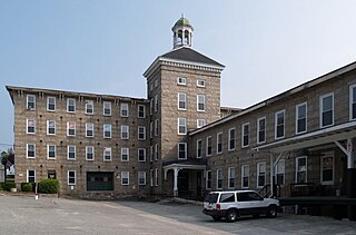
The Manchaug Village Historic District is a historic district encompassing the 19th century industrial village center of Manchaug in Sutton, Massachusetts. Developed in the 1820s around textile mills on the Mumford River, it was the largest industrial area in Sutton, with at least three mill complexes in operation. The district is centered on the junction of Main Street with Manchaug, Putnam Hill, and Whitins Roads.


