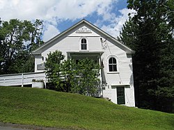
The Lunenburg Historic District is a historic district encompassing the historic center of Lunenburg, Massachusetts. The district is centered on a stretch of Main Street which connects two triangular intersections. It includes many of the town's oldest buildings, including the c. 1724 Cushing House, and the c. 1730 Stillman Stone House. Three of the town's most significant institutional buildings were built before 1850: the town hall, the Congregational church, and the Methodist church. The district was added to the National Register of Historic Places in 1988.

Westminster Village–Academy Hill Historic District encompasses the historic first town center of Westminster, Massachusetts, as well as its later early-19th century commercial core. Centered at the junction Main and South Streets with Academy Hill Road, it contains fine examples of Colonial, Federal, and Greek Revival architecture, including the 1839 town hall. The district was listed on the National Register of Historic Places in 1983.

The North Falmouth Village Historic District encompasses the historic 19th-century village of North Falmouth, Massachusetts, which is a village in the town of Falmouth, Massachusetts. It is a linear district, extending along Old Main Road south from its junction with Massachusetts Route 28A to Winslow Road. This area gradually developed over the 19th century, principally in support of maritime activities centered on Buzzards Bay to the west. The district contains a cross-section of architectural styles popular from the early 19th to early 20th centuries. It was listed on the National Register of Historic Places in 1998.

Becket Center Historic District is a historic district encompassing the historic early center of Becket, Massachusetts. Centered at the junction of Massachusetts Route 8 and YMCA Road, this area was the town's civic heart and a center of industry until it was eclipsed in importance by North Becket, which was served by the railroad. Most of the architecture in the district is in the Federal and Greek Revival styles popular in the late 18th to mid 19th centuries. The district was added to the National Register of Historic Places in 1982.

The Heath Center Historic District encompasses a rural village with predominantly 18th- and 19th-century structures in Heath, a small agricultural town in hills of northwestern Franklin County, Massachusetts, United States. The district is centered on the junction of several roads, around which the center of the town grew. South Road arrives from the south, East Main Street and Bray Road from the east, Ledge Road from the north, and West Main Street from the west.

The Hadley Center Historic District is an expansive, 2,500-acre (1,000 ha) historic district encompassing the village center of Hadley, Massachusetts. When it was first listed on the National Register of Historic Places in 1977, the district encompassed the town green and 17 buildings that faced it, at the junction of Russell Street and Middle Street. The district was expanded significantly in 1994, adding more than 400 buildings representative of the village's growth from colonial days into the first decades of the 20th century. This expansion encompasses the entirety of a tongue of land extending west from East Street and bounded by a bend in the Connecticut River, which separates Hadley from Northampton. Its oldest property, the Samuel Porter House on West Street, was built in 1713.

The Granville Center Historic District is a historic district encompassing the historic center of Granville, Massachusetts. The cluster of buildings in the village center includes the Congregational church, and a number of Federal and Greek Revival residences. The district was listed on the National Register of Historic Places in 1991.

The West Granville Historic District is a historic district encompassing the center of West Granville, Massachusetts. The village is composed mainly of buildings form the late 18th and early 19th centuries, including an 18th-century church and 1830s academy building. The district was listed on the National Register of Historic Places in 1991.

The Canton Corner Historic District is a historic district encompassing the historic town center of Canton, Massachusetts. Centered on the junction of Pleasant and Washington Streets, it includes more than 25 properties and 170 acres (69 ha), whose architectural history spans 250 years of occupation and include the town's major civic buildings. The district was added to the National Register of Historic Places on September 9, 2009.

The Waterville Village Historic District encompasses most of the history 19th and early 20th-century village center of Waterville, Vermont. The village grew from beginnings late in the 18th century to serve as a modest civic, commercial, and residential hub for the rural community. It was added to the National Register of Historic Places in 2007.
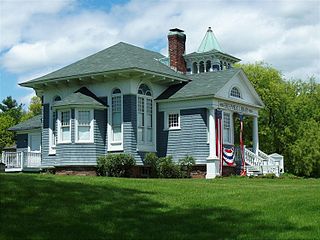
The Somers Historic District encompasses the historic civic and social center of the town of Somers, Connecticut. It stretches along Main Street, with extensions along Springfield Road and Battle Street, and includes a significant number of vernacular Federal and Greek Revival houses. It includes the town's early churches, as well as important civic buildings, including the town hall and library. The district was listed on the National Register of Historic Places in 1982.

The West Chesterfield Historic District is a historic district that encompasses the 19th century industrial and residential heritage of the village of West Chesterfield in the town of Chesterfield, Massachusetts. Centered at the junction of Main Road and Ireland Street, it was one of the town's main industrial sites for many years. The district was listed on the National Register of Historic Places in 2008.
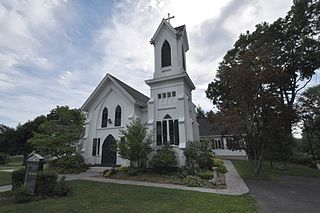
Bridgewater Center Historic District encompasses the traditional town center of Bridgewater, Connecticut. Centered at the junction of Main Street with Clapboard and Hat Shop Hill Roads, it developed in the early 19th century as a civic center, even before the town's 1856 incorporation from New Milford. The architecture of the center is largely reflective of the first half of the 19th century, including Greek Revival and Federal style buildings. It was listed on the National Register of Historic Places in 2000.

The Danby Village Historic District encompasses much of the town center of Danby, Vermont. It is centered on a stretch of Main Street, roughly between Depot Street and Brook Road. The village has a cohesive collection of mid-19th century architecture, mostly residential, with a modest number of later additions. The district was listed on the National Register of Historic Places in 1983.
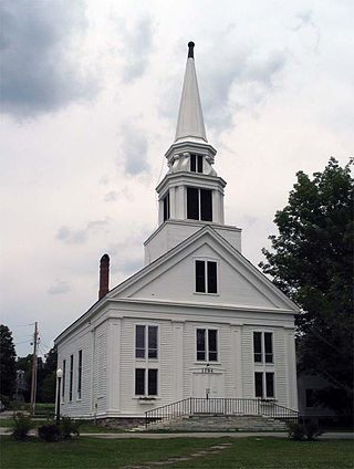
The Middletown Springs Historic District encompasses most of the village center of Middletown Springs, Vermont. Oriented around the crossroads junction of Vermont Routes 140 and 133, the village has a well-preserved collection of mainly mid-19th century architecture, including a significant number of Italianate buildings. The district was listed on the National Register of Historic Places in 1985.
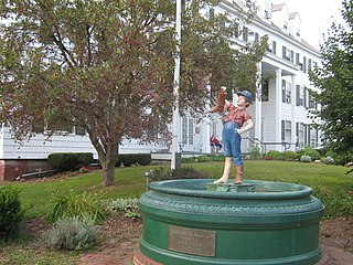
The Wallingford Main Street Historic District encompasses the historic portions of the village of Wallingford, Vermont. An essentially linear district extending along Main Street on either side of School Street, it has a well-preserved array of 19th and early-20th century residential, commercial, and civic buildings. It was listed on the National Register of Historic Places in 1984.
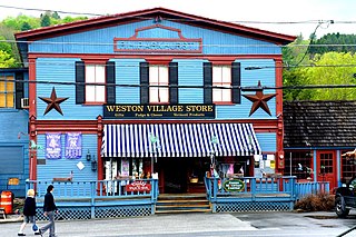
The Weston Village Historic District encompasses the town center and principal village of Weston, Vermont. Centered on Farrar Park, which serves as the town green, it includes a diversity of architectural styles from the late 18th century to about 1935, and includes residential, civic, commercial, industrial and religious buildings. It was listed on the National Register of Historic Places in 1985.
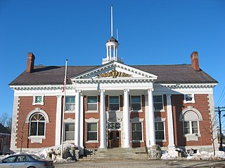
The Stowe Village Historic District encompasses most of the village center of Stowe, Vermont. Since the 19th century, the village has been one of Vermont's major resort centers, and its center is architecturally reflective of this history. It was listed on the National Register of Historic Places in 1978.

The Peacham Corner Historic District encompasses much of the historic village center of Peacham, Vermont. The village's period of greatest growth and importance between the town's founding as a hill town in the late 18th century, and 1860, when significant development effectively ended. As a result, the village lacks Victorian features often found in other rural communities. The district was listed on the National Register of Historic Places in 2003.

Otis Center Historic District is a historic district encompassing the historic village of Otis Center in the Berkshire hill town of Otis, Massachusetts. The village began as a crossroads settlement in the 18th century, and has served as the town's civic center since its incorporation. It features a diversity of architectural styles from the late 18th century to the early 20th. It was listed on the National Register of Historic Places in 2022.
