Vershire, Vermont

Last updated

Vershire, Vermont
Town
2006 library Vershire Vermont 168392674.jpg
Vershire vt highlight.png
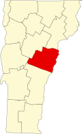
Located in Orange County, Vermont
Usa edcp location map.svg
Red pog.svg
Vershire, Vermont
Location within the U.S.A.
Coordinates: 43°56′54″N72°19′15″W / 43.94833°N 72.32083°W / 43.94833; -72.32083
Country United States
State Vermont
County Orange
Chartered1781
Communities
  • Vershire
  • Mill Village
  • South Vershire
  • Vershire Heights
Area
  Total36.5 sq mi (94.6 km2)
  Land36.5 sq mi (94.5 km2)
  Water0.04 sq mi (0.1 km2)
Elevation
1,200 ft (495 m)
Population
 (2020)
  Total672
  Density18/sq mi (7.1/km2)
  Households
286
  Families
184
Time zone UTC-5 (EST)
  Summer (DST) UTC-4 (EDT)
ZIP code
05079
Area code 802
FIPS code 50-74950 [1]
GNIS feature ID1462235 [2]

Vershire is a town in Orange County, Vermont, United States, created under Vermont Charter of August 3, 1781. The population was 672 at the 2020 census. [3] The name Vershire is a portmanteau of Vermont and New Hampshire. [4]

Contents

History

The town and a village were renamed "Ely" in 1880 after the Ely Mining Company, which mined copper. This changed in 1883, when 200 miners seized the plant demanding back wages. Five companies of the National Guard were called out to suppress the miners. [5] It is the home of The Mountain School of Milton Academy, a selective independent semester program that provides academically motivated high school juniors from across the country the opportunity to live and work on a farm. [6]

Geography

According to the United States Census Bureau, the town has a total area of 36.5 square miles (94.6 km2), of which 36.5 square miles (94.5 km2) is land and 0.04 square mile (0.1 km2) (0.05%) is water. The headwaters of the Ompompanoosuc River are located in the town. [7]

Demographics

Historical population
CensusPop.Note
1790 439
1800 1,031134.9%
1810 1,31127.2%
1820 1,296−1.1%
1830 1,260−2.8%
1840 1,098−12.9%
1850 1,071−2.5%
1860 1,054−1.6%
1870 1,1408.2%
1880 1,87564.5%
1890 754−59.8%
1900 641−15.0%
1910 448−30.1%
1920 410−8.5%
1930 368−10.2%
1940 367−0.3%
1950 284−22.6%
1960 236−16.9%
1970 29926.7%
1980 44247.8%
1990 56026.7%
2000 62912.3%
2010 73016.1%
2020 672−7.9%
U.S. Decennial Census [8]

As of the census [1] of 2000, there were 629 people, 261 households, and 174 families residing in the town. The population density was 17.2 people per square mile (6.7/km2). There were 378 housing units at an average density of 10.4 per square mile (4.0/km2). The racial makeup of the town was 98.25% White, 0.32% African American, 0.16% Native American, 0.32% Asian, 0.48% from other races, and 0.48% from two or more races. Hispanic or Latino of any race were 0.32% of the population.

There were 261 households, out of which 33.3% had children under the age of 18 living with them, 55.2% were couples living together and joined in either marriage or civil union, 8.0% had a female householder with no husband present, and 33.3% were non-families. 26.8% of all households were made up of individuals, and 6.1% had someone living alone who was 65 years of age or older. The average household size was 2.41 and the average family size was 2.94.

In the town, the population was spread out, with 26.6% under the age of 18, 4.8% from 18 to 24, 32.4% from 25 to 44, 25.8% from 45 to 64, and 10.5% who were 65 years of age or older. The median age was 38 years. For every 100 females, there were 97.8 males. For every 100 females age 18 and over, there were 94.1 males.

The median income for a household in the town was $37,132, and the median income for a family was $40,714. Males had a median income of $31,833 versus $25,000 for females. The per capita income for the town was $16,161. About 11.4% of families and 13.4% of the population were below the poverty line, including 18.4% of those under age 18 and 18.6% of those age 65 or over.

Education

Residents are in the Rivendell Interstate School District. [9]

Notable people

Related Research Articles

<span class="mw-page-title-main">Orange County, Vermont</span> County in Vermont, United States

Orange County is a county located in the U.S. state of Vermont. As of the 2020 census, the population was 29,277. Its shire town is the town of Chelsea. Orange County was organized on February 2, 1781, as an original county within the state.

<span class="mw-page-title-main">Montverde, Florida</span> Town in Florida, United States

Montverde is a town in Lake County, Florida, United States. The population was 1,655 at the 2020 census. It is part of the Orlando–Kissimmee–Sanford Metropolitan Statistical Area.

<span class="mw-page-title-main">Dalton, New Hampshire</span> Town in New Hampshire, United States

Dalton is a town in Coös County, New Hampshire, United States. The population was 933 at the 2020 census. It is part of the Berlin, NH-VT Micropolitan Statistical Area.

<span class="mw-page-title-main">Groton, Vermont</span> Town in Vermont, United States

Groton is a town in Caledonia County, Vermont, United States. The population was 984 at the 2020 census. It contains the places Groton Pond, Rickers Mills, Rickers and West Groton. The unincorporated village of Groton in the southeast corner of town is recorded as the Groton census-designated place (CDP), with a population of 419 at the 2020 census.

<span class="mw-page-title-main">Canaan, Vermont</span> Town in Vermont, United States

Canaan is a town in Essex County, Vermont, United States. The population was 896 at the 2020 census. Canaan contains the village of Beecher Falls, located at the confluence of the Connecticut River and Halls Stream. It is part of the Berlin, NH-VT Micropolitan Statistical Area.

<span class="mw-page-title-main">Fairlee, Vermont</span> Town in Vermont, United States

Fairlee is a town in Orange County, Vermont, United States. The population was 988 at the 2020 census. It includes the village of Ely. Fairlee is home to Lake Morey, which claims to have the longest ice skating trail in the United States.

<span class="mw-page-title-main">Topsham, Vermont</span> Town in Vermont, United States

Topsham is a town in Orange County, Vermont, United States. The population was 1,199 at the 2020 census. It contains four villages: East Topsham, Topsham Four Corners, Waits River, and West Topsham.

<span class="mw-page-title-main">West Fairlee, Vermont</span> Town in Vermont, United States

West Fairlee is a town in Orange County, Vermont, United States. The population was 621 at the 2020 census.

<span class="mw-page-title-main">Killington, Vermont</span> Town in Vermont, United States

Killington is a town in Rutland County, Vermont, United States. The population was 1,407 at the 2020 census. Killington Ski Resort and numerous vacation lodges are located here. The town was previously named Sherburne, but was renamed to its original name, "Killington", in 1999.

<span class="mw-page-title-main">Brookline, Vermont</span> Town in Vermont, United States

Brookline is a town in Windham County, Vermont, United States. The population was 540 at the 2020 census.

<span class="mw-page-title-main">Dummerston, Vermont</span> Town in Vermont, United States

Dummerston is a town in Windham County, Vermont, United States. The population was 1,865 at the 2020 census. It is home to the longest covered bridge still in use in Vermont. Its borders include three main villages: Dummerston Center, West Dummerston, and East Dummerston.

<span class="mw-page-title-main">Londonderry, Vermont</span> Town in Vermont, United States

Londonderry is a town in Windham County, Vermont, United States. It is bounded on the north by Landgrove and Weston, on the east by Windham, on the south by Jamaica and on the west by Winhall and Landgrove. The population was 1,919 in the 2020 census. The town contains the villages of Londonderry and South Londonderry.

<span class="mw-page-title-main">Stratton, Vermont</span> Town in Vermont, United States

Stratton is a town in Windham County, Vermont, United States. The population was 440 at the 2020 census.

<span class="mw-page-title-main">Bridgewater, Vermont</span> Town in Vermont, United States

Bridgewater is a town in Windsor County, Vermont, United States. The population was 903 at the 2020 census. Bridgewater contains the hamlets of Bridgewater Village, Bridgewater Corners, West Bridgewater, and Bridgewater Center.

<span class="mw-page-title-main">Hartford, Vermont</span> Town in Vermont, United States

Hartford is a town in Windsor County, Vermont, United States. It is on the New Hampshire border, at the intersection of Interstates 89 and 91. It is the site of the confluence of the White and Connecticut rivers; the Ottauquechee River also flows through the town. The town is composed of five unincorporated villages: Hartford, Quechee, West Hartford, White River Junction and Wilder. As of the 2020 census, the population was 10,686.

<span class="mw-page-title-main">Reading, Vermont</span> Town in Vermont, United States

Reading is a town in Windsor County, Vermont, United States. The population was 687 at the 2020 census.

<span class="mw-page-title-main">West Windsor, Vermont</span> Town in Vermont, United States

West Windsor is a town in Windsor County, Vermont, United States. The population was 1,344 at the 2020 census. It was known for its Ascutney Mountain Resort, which closed in 2010 and was bought by its citizens in 2015.

<span class="mw-page-title-main">Weston, Vermont</span> Town in Vermont, United States

Weston is a town in Windsor County, Vermont, United States. The population was 623 at the 2020 census. Home to the Weston Playhouse Theatre Company, it includes the villages of Weston and The Island.

<span class="mw-page-title-main">West Milford, West Virginia</span> Town in West Virginia, United States

West Milford is a town in Harrison County, West Virginia, United States. The population was 452 at the 2020 census.

<span class="mw-page-title-main">Flemington, West Virginia</span> Town in West Virginia, United States

Flemington is a town in Taylor County, West Virginia, United States. The population was 311 at the 2020 census. Flemington was incorporated in 1922 by the West Virginia Circuit Court, and named for James Fleming, an early settler in the area originally from Hampshire County.

References

  1. 1 2 "U.S. Census website". United States Census Bureau . Retrieved January 31, 2008.
  2. "US Board on Geographic Names". United States Geological Survey. October 25, 2007. Retrieved January 31, 2008.
  3. "Census - Geography Profile: Vershire town, Orange County, Vermont" . Retrieved January 6, 2022.
  4. Temple, Robert D. (2009). Edge Effects: The Border-Name Places. iUniverse. p. 8. ISBN   9781440101465.
  5. Walter Hill Crockett (1921). Vermont The Green Mountain State. University of Virginia. Century history Company, Incorporated.
  6. "The Mountain School". The Mountain School. Retrieved September 7, 2021.
  7. DeLorme (1996). Vermont Atlas & Gazetteer. Yarmouth, Maine: DeLorme. ISBN   0-89933-016-9
  8. "U.S. Decennial Census". United States Census Bureau. Retrieved May 16, 2015.
  9. "Rivendell Interstate SAU Office". New Hampshire Department of Education . Retrieved April 28, 2024.