Allis State Park

Last updated
Allis State Park
AllisSP CCCPicnicPavilion.jpg
Picnic pavilion
Allis State Park
Type State park
Location284 Allis State Park Road
Brookfield, Vermont
Coordinates 44°2′54″N72°38′6″W / 44.04833°N 72.63500°W / 44.04833; -72.63500 Coordinates: 44°2′54″N72°38′6″W / 44.04833°N 72.63500°W / 44.04833; -72.63500
Area625 acres (2.53 km2)
Created1928 (1928)
Operated byVermont Department of Forests, Parks, and Recreation
StatusMemorial Day weekend - Labor Day weekend
Website https://vtstateparks.com/allis.html
Allis State Park
NRHP reference No. 02000280
Added to NRHPMarch 29, 2002

Allis State Park is a state park in Brookfield, Vermont. Established in 1928, Allis State Park was the second state park to be created in Vermont. It is named for Wallace S. Allis, who willed his Bear Mountain Farm to the State of Vermont to be developed as a campground and recreational area. The park was developed by the Civilian Conservation Corps (CCC) beginning in 1932, which built the access roads, constructed a picnic shelter, picnic grounds and a campground. There is a fire/lookout tower on Bear Hill. Limited trash service, hot showers and running water are available. There are picnic tables, grills and fireplaces.

Contents

Location and features

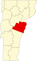
Allis State Park encompasses 625 acres (253 ha) of uplands in the watershed of Vermont's White River in western Brookfield, occupying part of a ridge bounded on the east by Bear Hill Road/Vermont Route 65 and on the west by Vermont Route 12. The park itself is accessed from Bear Hill Road/VT 65, which is one of the last remaining Vermont state highways that is still maintained as a gravel road.

The park's principal feature is the summit of Bear Hill, which is accessed via the park road from Bear Hill Road. The park road rises to the west before bending south, after which it reaches the entrance gate and then subsequently splits. The right-hand road loops around the campground, while the left-hand road serves the day-use area, which includes the picnic area, picnic pavilion, and fire/lookout tower.

The campground loop has 18 tent sites, along with 8 lean-to sites, for a total of 26 campsites. Water is available from faucets throughout the campground, and there is a comfort station with restrooms near the middle of the camping loop where showers are available. There is also a campsite for group camping that is set apart from the rest of the campsites. The day-use area connects to the campground via a short, marked trail.

The Bear Hill Nature Trail is a 3/4 mile hiking loop that connects to the day-use/picnic area at both ends. A horseshoe pit is also located at the picnic area. The fire/lookout tower, at the center of the picnic area, provides 360 degree views of the surrounding mountains of Vermont. The picnic pavilion has handicap-accessible restrooms that serve the day-use area.

As of the 2019 season, Allis State Park has no day-use fee. The standard Vermont State Park camping fees apply to the campsites.

History

The park was created in 1928 when Wallace Allis gifted his farm to the people of Vermont. Prior to making the gift, Allis had allowed area residents to the upper areas of his farm, which provide views over the surrounding countryside. The park facilities were developed in the 1930s by the Civilian Conservation Corps, which constructed the access road, camping loop, and picnic pavilion. [1] The park facilities were listed on the National Register of Historic Places in 2002.

See also

Related Research Articles

Utah Lake State Park

Utah Lake State Park is a state park in west Provo, Utah, United States. The park is located at the west end of Provo Center Street on the east shore of Utah Lake immediately northwest of the Provo Municipal Airport.

Allegany State Park State park in New York state, United States

Allegany State Park is a state park in western New York State, located in Cattaraugus County just north of the Allegheny National Forest in Pennsylvania. The park is divided into two sections: The Red House Area and the Quaker Run Area. It lies within the Allegheny Highlands forests ecoregion.

Conecuh National Forest

The Conecuh National Forest in southern Alabama covers 83,000 acres (340 km2), along the Alabama - Florida line in Covington and Escambia counties. Topography is level to moderately sloping, broad ridges with stream terraces and broad floodplains.

Bewabic State Park Park in Michigan, USA

Bewabic State Park is a public recreation area covering 315 acres (127 ha) on the shore of Fortune Lake, four miles (6.4 km) west of Crystal Falls in Iron County, Michigan. The state park's rich Civilian Conservation Corps history is evidenced by the CCC structures still in use. The park was listed on the National Register of Historic Places for its CCC-related architecture in 2016.

Onaway State Park Park in Michigan, USA

Onaway State Park is a public recreation area covering 158 acres (64 ha) on the southeast shore of Black Lake in North Allis Township, Presque Isle County, Michigan. The state parks sits at the end of M-211 five miles north of Onaway. It contains sand and cobblestone beaches, large rock outcroppings, a campground, and nature trail highlighting a diversity of trees. The park was added to the National Register of Historic Places in 2009.

Hills Creek State Park

Hills Creek State Park is a 407-acre (165 ha) Pennsylvania state park in Charleston Township, Tioga County, Pennsylvania in the United States. Hills Creek Lake, a 137-acre (55 ha) man-made lake, is the focal point of the park. It is open for year-round recreation. Hills Creek State Park is in the Allegheny Plateau region of Pennsylvania, just north of U.S. Route 6 near the boroughs of Wellsboro and Mansfield.

Bald Eagle State Park

Bald Eagle State Park is a 5,900-acre (2,388 ha) Pennsylvania state park in Howard, Liberty, and Marion townships in Centre County, Pennsylvania in the United States. The park includes the Foster Joseph Sayers Reservoir, formed by damming Bald Eagle Creek and other smaller streams and covering 1,730 acres (700 ha). Bald Eagle State Park is at the meeting point of two distinct geologic features. The Allegheny Plateau is to the north and the Ridge and Valley area of Pennsylvania is to the south. The park is in the Bald Eagle Valley off Pennsylvania Route 150 in Howard, between Milesburg and Lock Haven.

Promised Land State Park State park in Pennsylvania, United States

Promised Land State Park is a Pennsylvania state park in Blooming Grove, Greene and Palmyra Townships, Pike County, Pennsylvania, in the United States. The approximately 3,000-acre (1,214 ha) park is mostly surrounded by Delaware State Forest. It is in the Poconos and sits at an elevation of 1,800 feet (549 m). The second growth forests in Promised Land State Park are made up of beech, maple, oak and hemlock trees. There are two lakes within the boundaries of the park. Promised Land State Park is 10 miles (16 km) north of Canadensis on Pennsylvania Route 390.

Hyner Run State Park State Park in Pennsylvania, United States

Hyner Run State Park is a 180-acre (73 ha) Pennsylvania state park in Chapman Township, Clinton County, Pennsylvania in the United States. The park is 6 miles (9.7 km) east of Renovo and 3 miles (5 km) north of Hyner on Pennsylvania Route 120. Hyner Run State Park is surrounded by Sproul State Forest.

Poe Valley State Park Pennsylvania State Park

Poe Valley State Park is a 620-acre (251 ha) Pennsylvania state park in Penn Township, Centre County, Pennsylvania in the United States. The park is surrounded by Bald Eagle State Forest. Poe Paddy State Park is 4 miles (6.4 km) to the east. The forests of the park surround the 25-acre (10 ha) Poe Lake. Poe Valley State Park is in isolated Poe Valley which lies between Potters Mills on U.S. Route 322 and Millheim on Pennsylvania Route 45. The park was closed during the 2008 and 2009 season while the lake was drained for dam repairs and the park facilities were upgraded.

Elmore State Park State park in Lamoille County, Vermont

Elmore State Park is a state park located in Elmore, Vermont, United States. It includes Lake Elmore and Elmore Mountain, and has day-use facilities for picnicking, hiking, and water-based activities, and a 59-site campground. Some of its facilities were developed in the 1930s by the Civilian Conservation Corps; for these, it was listed on the National Register of Historic Places in 2002. The park is open seasonally between Memorial Day and Columbus Day; fees are charged for day use and camping.

Colt Creek State Park

Colt Creek State Park is a Florida State Park in Central Florida, 16 miles (26 km) north of Lakeland off of State Road 471. This 5,067 acre park nestled within the Green Swamp Wilderness Area and named after one of the tributaries that flows through the property was opened to the public on January 20, 2007. Composed mainly of pine flatwoods, cypress domes and open pasture land, this piece of pristine wilderness is home to many animal species including the American bald eagle, Southern fox squirrel, gopher tortoise, white-tailed deer, wild turkey and bobcat.

Brushy Creek State Recreation Area is a state park in Webster County, Iowa in the United States. With an area encompassing over 6,000 acres (24 km2), the facility is one of Iowa's largest public outdoor recreation areas.

Coolidge State Park State park in Windsor County, Vermont

Coolidge State Park is a Vermont State Park located in Plymouth, Vermont, United States. The park is named after Calvin Coolidge, the 30th President of the United States, who was born and raised in Plymouth and is buried there as well. It is the primary recreational center for Calvin Coolidge State Forest, the largest state forest in Vermont. The park's facilities, built by the Civilian Conservation Corps (CCC) in the 1930s, are listed on the National Register of Historic Places.

The Little North Santiam River is a 27-mile (43 km) tributary of the North Santiam River in western Oregon in the United States. It drains 113 square miles (290 km2) of the Cascade Range on the eastern side of the Willamette Valley east of Salem.

Blackwoods Campground United States historic place

Blackwoods Campground is located on the east side of Mount Desert Island, off Maine State Route 3 in Acadia National Park. Construction on the site was begun by the Civilian Conservation Corps (CCC) in 1935, and reaching its present appearance around 1961, with the completion of Loop B. The campground has 306 individual campsites, several group campsites, and offers only limited amenities, which include potable water and restrooms, but not showers or electrical hookups. Campsites may be reserved up to six months in advance. The portion of the campground built by the CCC, which includes its core and Loop A, was listed on the National Register of Historic Places in 2007.

Gifford Woods State Park United States historic place and State Park in Rutland County, Vermont

Gifford Woods State Park is a state park located at the base of Pico Peak in Killington, Vermont. The wooded park provides camping, picnic, and fishing facilities, and has hiking trails, including a portion of the Appalachian Trail. It preserves an area of old-growth forest that has been designated a National Natural Landmark, and is accessible via an interpretive trail. The park was established in 1931. Part of it is listed on the National Register of Historic Places, for facilities developed by the Civilian Conservation Corps in the 1930s.

Stillwater State Park State park in Caledonia County, Vermont

Stillwater State Park is a state park located on Lake Groton in Groton, Vermont. The park is located in Groton State Forest close to the Groton Nature Center, Boulder Beach State Park and Big Deer State Park. The park offers camping, picnicking, and access to water-related activities on Lake Groton. The park was developed in the 1930s by crews of the Civilian Conservation Corps (CCC). It is open to the public between Memorial Day weekend and Columbus Day weekend; fees are charged for day use and camping.

New Discovery State Park State park in Caledonia County, Vermont

New Discovery State Park is a state park near Marshfield, Vermont in the United States. It is one of seven state parks located in Groton State Forest. The park is on Vermont Route 232, offering camping, picnicking, and access to forest trails. The park was developed in the 1930s by the Civilian Conservation Corps; its major CCC-built facilities, located mainly in western Peacham, were listed on the National Register of Historic Places in 2002.

Molly Stark State Park State park in Bennington County, Vermont

Molly Stark State Park is a 148-acre state park in Wilmington, Vermont. The park is named for Molly Stark, the famous wife of General John Stark of the American Revolutionary War, and is located along the Molly Stark Byway.

References

  1. "Allis State Park brochure" (PDF). State of Vermont. Archived from the original (PDF) on 2016-08-28. Retrieved 2016-07-23.