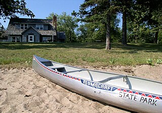
First opened as a picnic and swimming area in 1953, Lake St. Catherine State Park is a 117-acre (0.5 km2) state park located in Poultney, Vermont on the northern end of Lake Saint Catherine.
Glendalough State Park is a state park of Minnesota, USA, in Otter Tail County near Battle Lake close to Minnesota State Highway 78. It is named after Glendalough in Ireland. The park was once used as a resort and game farm by the owners of Cowles Media Company, owner of what is today the Star Tribune newspaper. The park contains 1,931 acres (7.81 km2) on land and 1,000 acres (4.0 km2) on the water. Cowles Media Company transferred title to Glendalough to the Nature Conservancy in 1990, and the Nature Conservancy transferred title to the State of Minnesota in 1992. Glendalough was officially declared a state park with a celebration on Earth Day, April 22, 1992.

Molly Stark, née Elizabeth Page was the wife of General John Stark, made famous by his battle cry during the American Revolutionary War. Described as "mother of 11 children, homemaker, patriot, and defender of the household", there are locations and landmarks named for her in at least four states.

Vermont Route 9 is a state highway in the U.S. state of Vermont. The highway runs 46.957 miles (75.570 km) from the New York state line in Bennington, where it continues west as New York State Route 7, to the New Hampshire state line at the Connecticut River in Brattleboro, where the highway continues as New Hampshire Route 9. VT 9 is the primary east–west highway of Bennington and Windham counties in southern Vermont. The highway connects Southern Vermont's primary towns of Bennington and Brattleboro via its crossing of the Green Mountains. VT 9 also connects those towns with Troy, New York, and Keene, New Hampshire, via the connecting highways in those states. The highway also intersects three major north–south routes: U.S. Route 7 in Bennington and Interstate 91 (I-91) and US 5 in Brattleboro.

Elmore State Park is a state park located in Elmore, Vermont, United States. It includes Lake Elmore and Elmore Mountain, and has day-use facilities for picnicking, hiking, and water-based activities, and a 59-site campground. Some of its facilities were developed in the 1930s by the Civilian Conservation Corps; for these, it was listed on the National Register of Historic Places in 2002. The park is open seasonally between Memorial Day and Columbus Day; fees are charged for day use and camping.
Lake Carmi State Park is a day-use state park near Enosburg Falls, Vermont in the United States. Located on Vermont Route 236, the park includes over two miles of frontage on the south and east shore of Lake Carmi.
The Quechee State Park is located on US Route 4 in Quechee, Vermont. The park land is owned by the US Army Corps of Engineers and leased from by the State of Vermont. The park contains the Quechee Gorge, a popular Vermont tourist stop. The land was originally the site of the Dewey wool mill which ceased operation in 1952 and relocated to Enfield, New Hampshire. Shortly after the closing of the Mill the US Army Corps of Engineers acquired the property as part of its regional flood control plan. A hydroelectric dam sits at the north end of the gorge.
Bomoseen State Park is a 3,576-acre state park in the towns of Castleton, Fair Haven, Hubbarton and Benson, Vermont. The park is located in the Taconic Mountains on the western shore of Lake Bomoseen.

Half Moon Pond State Park, also known as Half Moon State Park, is a wooded campground state park located within the 3,576-acre Bomoseen State Park in the town of Hubbardton, Vermont. The campsites are located on Half Moon Pond.

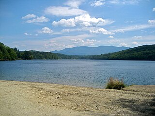
Branbury State Park is a 69-acre state park in the towns of Salisbury and Leicester, Vermont. The park is located on the eastern shore of Lake Dunmore at the base of Mt. Moosalamoo. It is divided by Vermont Route 53.

Brighton State Park is a state park in Island Pond, Vermont. The park features a campground on the 102-acre Spectacle Pond, which is mostly undeveloped. There is also a day use beach and bathhouse located on 600-acre Island Pond just a half mile from the campground.
Button Bay State Park is a 253-acre state park in Ferrisburgh, Vermont on the shore of Lake Champlain.

Grand Isle State Park is a 226-acre state park in Grand Isle, Vermont on the shore of Lake Champlain.
Woodford State Park is a 398-acre state park surrounding Adams Reservoir in Woodford, Vermont. The park is at an elevation of 2400 feet in the Green Mountain National Forest. It is located along the Molly Stark Byway. It was designated a state park in 1963.
Little River State Park is a campground state park on the 850-acre Waterbury Reservoir in Waterbury, Vermont. It is located in Mount Mansfield State Forest.

Underhill State Park is a state park in Underhill, Vermont. It is situated on the west slope of 4,300 feet Mount Mansfield, in the 39,837-acre Mount Mansfield State Forest. Activities includes hiking, camping, mountain biking, stream fishing, wildlife watching, and picnicking. Facilities include group and individual camping areas, a picnic shelter, and hiking trails. The park is formally open between Memorial Day weekend and Columbus Day weekend, but is accessible for periods outside those times; fees are charged. Much of the park's infrastructure was built by the Civilian Conservation Corps (CCC) in the 1930s; these facilities were listed on the National Register of Historic Places in 2002.

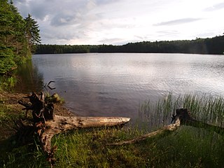
Maidstone State Park is a state park in the U.S. state of Vermont. The park is located in the town of Maidstone in Essex County in Vermont's Northeast Kingdom. One of the state's most remote parks, it provides public access to the 796-acre (322 ha) glacial Maidstone Lake in Maidstone State Forest. The park was developed by the Civilian Conservation Corps and opened in 1938. Activities include fishing, hiking, camping, boating, wildlife watching, and picnicking. The park is open from Memorial Day weekend to Columbus Day weekend; fees are charged for day use and camping.
Kingsland Bay State Park is a 264-acre state park in Ferrisburgh, Vermont, on the shore of Lake Champlain.

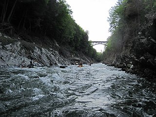
Jamaica State Park is a 772-acre state park in Jamaica, Vermont, on the shore of the West River.
Stark Mountain is a mountain in the Green Mountains in the U.S. state of Vermont. Located in the town of Fayston in Washington County, the mountain summit is 3,662 feet (1,116 m) in elevation. Stark Mountain is named after General John Stark, hero of the Battle of Bennington fought in 1777.

