The Conecuh National Forest in southern Alabama covers 83,000 acres (340 km2), along the Alabama - Florida line in Covington and Escambia counties. Topography is level to moderately sloping, broad ridges with stream terraces and broad floodplains.

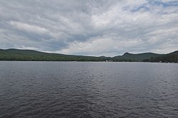
Bewabic State Park is a public recreation area covering 315 acres (127 ha) on the shore of Fortune Lake, four miles (6.4 km) west of Crystal Falls in Iron County, Michigan. The state park's rich Civilian Conservation Corps history is evidenced by the CCC structures still in use. The park was listed on the National Register of Historic Places for its CCC-related architecture in 2016.

P. H. Hoeft State Park is a public recreation area on the shores of Lake Huron, four miles (6.4 km) northwest of Rogers City on US 23 in Presque Isle County, Michigan. The park was added to the National Register of Historic Places in 2009.

Onaway State Park is a public recreation area covering 158 acres (64 ha) on the southeast shore of Black Lake in North Allis Township, Presque Isle County, Michigan. The state parks sits at the end of M-211 five miles north of Onaway. It contains sand and cobblestone beaches, large rock outcroppings, a campground, and nature trail highlighting a diversity of trees. The park was added to the National Register of Historic Places in 2009.

Wilgus State Park is a state park in Ascutney, Vermont. The park offers canoeing along the Connecticut River and hiking up the Pinnacle Trail. The park has tent and lean-to sites and is quite close to Mount Ascutney and the Saint-Gaudens National Historic Site. The park was originally constructed by the Civilian Conservation Corps (CCC) and is now administered by the Vermont Department of Forests, Parks, and Recreation as part of the Vermont state park system. It is named after William J. Wilgus, who donated the land for the park in 1933. The park is listed on the National Register of Historic Places for its well-preserved CCC infrastructure.

Elmore State Park is a state park located in Elmore, Vermont, United States. It includes Lake Elmore and Elmore Mountain, and has day-use facilities for picnicking, hiking, and water-based activities, and a 59-site campground. Some of its facilities were developed in the 1930s by the Civilian Conservation Corps; for these, it was listed on the National Register of Historic Places in 2002. The park is open seasonally between Memorial Day and Columbus Day; fees are charged for day use and camping.

The Black Moshannon State Park Historic Districts are three separate historic districts on the National Register of Historic Places (NRHP) at Black Moshannon State Park in Rush Township, Centre County, Pennsylvania in the United States. The structures in the historic districts were constructed in the 1930s during the Great Depression by the Civilian Conservation Corps (CCC). The three districts are: the Beach and Day Use District, with 18 contributing structures, including 11 different picnic pavilions, concession building, bathhouse, museum, and four open pit latrines; the Family Cabin District with 16 contributing properties, including 13 cabins, one lodge and two latrines; and the Maintenance District with four contributing properties, including a storage building, three-bay garage, gas pump house, and ranger's residence.

Coolidge State Park is a Vermont State Park located in Plymouth, Vermont, United States. The park is named after Calvin Coolidge, the 30th President of the United States, who was born and raised in Plymouth and is buried there as well. It is the primary recreational center for Calvin Coolidge State Forest, the largest state forest in Vermont. The park's facilities, built by the Civilian Conservation Corps (CCC) in the 1930s, are listed on the National Register of Historic Places.

Shady Lake Recreation Area is a campground and public recreation area in southwestern Ouachita National Forest, southwest of Mena, Arkansas and west of Glenwood, Arkansas. The area is oriented around Shady Lake, a body of water on the South Fork Saline River impounded by a dam built c. 1940 by the Civilian Conservation Corps (CCC). The area is administered by the United States Forest Service (USFS).

Townshend State Park is a state park in Townshend, Vermont. Embedded within Townshend State Forest, the park provides a camping facility and hiking trails for accessing Bald Mountain. The park's facilities were developed by the Civilian Conservation Corps in the 1930s, and are listed on the National Register of Historic Places for their well-preserved state.

Gifford Woods State Park is a state park located at the base of Pico Peak in Killington, Vermont. The wooded park provides camping, picnic, and fishing facilities, and has hiking trails, including a portion of the Appalachian Trail. It preserves an area of old-growth forest that has been designated a National Natural Landmark, and is accessible via an interpretive trail. The park was established in 1931. Part of it is listed on the National Register of Historic Places, for facilities developed by the Civilian Conservation Corps in the 1930s.

Allis State Park is a state park in Brookfield, Vermont. Established in 1928, Allis State Park was the second state park to be created in Vermont. It is named for Wallace Allis, who willed his Bear Mountain Farm to the State of Vermont to be developed as a campground and recreational area. The park was developed by the Civilian Conservation Corps (CCC) beginning in 1932, which built the access roads, constructed a picnic shelter, picnic grounds and a campground. There is a fire/lookout tower on Bear Hill. Limited trash service, hot showers and running water are available. There are picnic tables, grills and fireplaces.
Big Deer State Park is a state park in Groton, Vermont. The park is a campground located in Groton State Forest close to the Groton Nature Center, Boulder Beach State Park and Stillwater State Park.
Boulder Beach State Park is a state park in Groton, Vermont located on the western shore of Lake Groton. The park is located in Groton State Forest close to the Groton Nature Center, Big Deer State Park and Stillwater State Park.

Groton State Forest covers 26,164 acres (105.88 km2) in Danville, Groton, Marshfield, Orange, Peacham, Plainfield, Topsham, Vermont. The forest covers areas in Caledonia, Orange, and Washington Counties. Major roads through the forest are U.S. Route 302 and Vermont Route 232.

New Discovery State Park is a state park near Marshfield, Vermont in the United States. It is one of seven state parks located in Groton State Forest. The park is on Vermont Route 232, offering camping, picnicking, and access to forest trails. The park was developed in the 1930s by the Civilian Conservation Corps; its major CCC-built facilities, located mainly in western Peacham, were listed on the National Register of Historic Places in 2002.
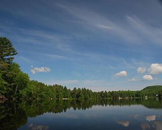
Ricker Pond State Park is a state park in Groton, Vermont in the United States. It is one of seven state parks located in Groton State Forest. The park is just off Vermont Route 232. The park provides public access to Ricker Pond, a 95-acre (38 ha) lake in central Groton, and was developed in the 1930s by crews of the Civilian Conservation Corps. Activities includes camping, motor boating, waterskiing, fishing, swimming, paddling, horseback riding, hiking, mountain biking, snowshoeing and cross-country skiing. The park is open between the Memorial Day and Columbus Day weekends; fees are charged for day use and camping.

Underhill State Park is a state park in Underhill, Vermont. It is situated on the west slope of 4,300 feet Mount Mansfield, in the 39,837-acre Mount Mansfield State Forest. Activities includes hiking, camping, mountain biking, stream fishing, wildlife watching, and picnicking. Facilities include group and individual camping areas, a picnic shelter, and hiking trails. The park is formally open between Memorial Day weekend and Columbus Day weekend, but is accessible for periods outside those times; fees are charged. Much of the park's infrastructure was built by the Civilian Conservation Corps (CCC) in the 1930s; these facilities were listed on the National Register of Historic Places in 2002.
Thetford Hill State Park is a state park in Thetford, Vermont. It is a day-use park within the southern tract of Thetford Hill State Forest. The park includes paths for hiking and the 5-km Woods Hill Trail, a world-class cross-country running and skiing trail. Activities includes hiking, cross-country running and cross-country skiing. The park was listed on the National Register of Historic Places in 2002 for its historic facilities, some of which were developed by the Civilian Conservation Corps. It is currently under the care of Thetford Academy.

Maidstone State Park is a state park in the U.S. state of Vermont. The park is located in the town of Maidstone in Essex County in Vermont's Northeast Kingdom. One of the state's most remote parks, it provides public access to the 796-acre (322 ha) glacial Maidstone Lake in Maidstone State Forest. The park was developed by the Civilian Conservation Corps and opened in 1938. Activities include fishing, hiking, camping, boating, wildlife watching, and picnicking. The park is open from Memorial Day weekend to Columbus Day weekend; fees are charged for day use and camping.