St. Johnsbury Federal Fish Culture Station

Last updated

St. Johnsbury Federal Fish Culture Station
StJohnsburyVT FormerFederalFishCultureStation.jpg
USA Vermont location map.svg
Red pog.svg
Usa edcp location map.svg
Red pog.svg
Location374 Emerson Falls Rd., St. Johnsbury, Vermont
Coordinates 44°25′59″N72°2′15″W / 44.43306°N 72.03750°W / 44.43306; -72.03750
Area12.2 acres (4.9 ha)
Built1895 (1895)
Architectvon Bayer, Hector; Packard, Lambert
Architectural styleShingle Style, Colonial Revival
MPS Fish Culture Resources of Vermont MPS
NRHP reference No. 05000189 [1]
Added to NRHPMarch 18, 2005

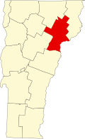
The St. Johnsbury Federal Fish Culture Station, also known as the St. Johnsbury Federal Fish Hatchery, was a United States government-funded fish hatchery on Emerson Falls Road in St. Johnsbury, Vermont. The hatchery operated from 1895 to 1960, producing fish stock for headwater tributaries of the Connecticut River and St. Lawrence River in northern New England and New York. The surviving facilities of the hatchery, now adaptively reused for other purposes and in private ownership, were listed on the National Register of Historic Places in 2005. [1]

Contents

History

The St. Johnsbury Federal Fish Culture Station was established by an Act of Congress in 1891, to establish and propagate populations of lake trout and salmon in upland tributaries of the Connecticut and St. Lawrence Rivers in northern New England and New York. A site was selected on the west bank of the Sleepers River, a tributary of the Passumpsic River on the outskirts of St. Johnsbury, Vermont, and the facility began production in 1895. The property included water rights on the river, and a freshwater spring that over time proved inadequate to meet the facility's needs. [2]

The facility was nearly closed due to budget cuts in 1934, but remained open due to a cooperative arrangement between federal and state governments. Issues with the high summertime water temperature of the Sleepers River (which affected production of stock requiring lower temperatures) and the inadequacy of its cold-water springs, prompted the decision to close the facility in 1959. It ceased production in 1960, and was sold into private ownership in 1961. Most of its rearing ponds have been filled in, although subsurface plumbing survives, as does its dam, about 0.5 miles (0.80 km) upriver from the remaining buildings. Those buildings underwent restoration in 2001-02 and have been put to other uses. [2]

Surviving facilities

The station facilities are located about 2.5 miles (4.0 km) northwest of downtown St. Johnsbury, and are sandwiched between the Sleepers River and United States Route 2, just north of the latter's junction with Interstate 91. They are at the southern end of Emerson Falls Road. The main hatchery building is a particularly fine example of Shingle style architecture, designed by Herbert Von Bayer, an architect working for the US Fish and Wildlife Service. It is two stories in height, and has a prominent pyramidal turret at one corner, with an arched porte-cochere adjacent. Located nearby is the former superintendent's residence, built in 1898 to a design by local architect Lambert Packard. Behind the house stands a c. 1900 carriage barn. The grounds in the area also include filled or partially-filled ponds and raceways for managing waterflow through the facility, as well as subsurface plumbing. [2]

See also

Related Research Articles

<span class="mw-page-title-main">Caledonia County, Vermont</span> County in Vermont, United States

Caledonia County is a county located in the northeastern part of the U.S. state of Vermont. As of the 2020 census, the population was 30,233. Its shire town is the town of St. Johnsbury. The county was created in 1792 and organized in 1796. It was given the Latin name for Scotland, in honor of the many settlers who claimed ancestry there.

<span class="mw-page-title-main">Wells River, Vermont</span> Village in Vermont, United States

Wells River is a village in the town of Newbury in Orange County, Vermont, United States. The population was 431 at the 2020 census. The village center is located at the junction of U.S. Routes 5 and 302.

<span class="mw-page-title-main">Cowlitz River</span> River in Washington, United States

The Cowlitz River is a river in the state of Washington in the United States, a tributary of the Columbia River. Its tributaries drain a large region including the slopes of Mount Rainier, Mount Adams, and Mount St. Helens.

<span class="mw-page-title-main">St. Johnsbury, Vermont</span> Town in Vermont, United States

St. Johnsbury is the shire town of Caledonia County, Vermont, United States. As of the 2020 census, the population was 7,364. St. Johnsbury is situated on the Passumpsic River and is located approximately six miles northwest of the Connecticut River and 48 miles (77 km) south of the Canada–U.S. border.

The Northeast Kingdom is the northeast corner of the U.S. state of Vermont, approximately comprising Essex, Orleans, and Caledonia counties and with a population of 64,764 at the 2010 census. The term "Northeast Kingdom" is attributed to George D. Aiken, former Governor of Vermont and a U.S. senator, who first used the term in a 1949 speech.

<span class="mw-page-title-main">Farmington River</span> River in the United States of America

The Farmington River is a river, 46.7 miles (75.2 km) in length along its main stem, located in northwest Connecticut with major tributaries extending into southwest Massachusetts. The longest route of the river, from the origin of its West Branch, is 80.4 miles (129.4 km) long, making it the Connecticut River's longest tributary by 2.3 miles (3.7 km) over the major river directly to its north, the Westfield River. The Farmington River's watershed covers 609 square miles (1,580 km2). Historically, the river played an important role in small-scale manufacturing in towns along its course, but it is now mainly used for recreation and drinking water.

<span class="mw-page-title-main">Passumpsic River</span> River in Vermont, United States

The Passumpsic River is a 22.7-mile-long (36.5 km) tributary of the Connecticut River, in Vermont. Though primarily a Caledonia County river, it is the only river to flow through all three counties of the Northeast Kingdom.

<span class="mw-page-title-main">Ascutney Mill Dam</span> Dam in Windsor, Vermont

Ascutney Mill Dam, also known as the Windsor Upper Dam and the Mill Pond Dam, is an arch-gravity dam which is one of the oldest and among the earliest storage dams in the United States. It is made of cut granite and is located in Windsor, Vermont in Windsor County near the Connecticut River, where it functioned as a source of hydropower and, later, hydroelectric power. It is on the ASCE list of historic civil engineering landmarks since 1970 and is listed on the National Register of Historic Places since January 09, 2007.

<span class="mw-page-title-main">Old McKenzie Fish Hatchery</span> United States historic place

The Old McKenzie Fish Hatchery was used to raise trout and salmon for release into the McKenzie River in western Oregon in the United States. It is located near the unincorporated community of Vida in Lane County. The hatchery is closed, however, the historic site is now a county park. It is also listed on the National Register of Historic Places.

<span class="mw-page-title-main">White River National Fish Hatchery</span> American fish production facility

The White River National Fish Hatchery is a U.S. Fish and Wildlife Service coldwater fish production facility located near Bethel, Vermont. Hatchery staff works to support both the Connecticut River Atlantic Salmon Restoration Program and the Lower Great Lakes Lake Trout Restoration Program. The White River National Fish Hatchery is one of four offices in the Western New England Complex.

<span class="mw-page-title-main">Sharpe's Trout Hatchery Site</span> Archaeological site in Connecticut, United States

Sharpe's Trout Hatchery Site is a 1-acre (0.40 ha) site of a former fish hatchery in Vernon, Connecticut. The hatchery was established in 1871 by Christian Sharps, and was abandoned after his death in 1874. The site was listed on the National Register of Historic Places in 1997. Its surviving remnants are located in Vernon's Valley Falls Park, about one mile south of the mill pond.

<span class="mw-page-title-main">Lambert Packard</span> American architect

Lambert Packard (1832-1906) was an American architect from St. Johnsbury, Vermont.

<span class="mw-page-title-main">Bennington Fish Hatchery</span> United States historic place

The Bennington Fish Hatchery, also known as the Bennington Fish Culture Station, is a state-operated fish hatchery at 110 Hatchery Road in Bennington, Vermont, USA. The station, the state's largest, produces a variety of trout, which are used to stock the state's water resources. Its facilities, dating to 1916, are listed on the National Register of Historic Places. The station has a visitors' center that is open daily.

<span class="mw-page-title-main">Lansing Fisheries Building</span> United States historic place

Lansing Fisheries Building, also known as the Lansing Fish Hatchery/Lansing Fish Rescue Station, is a historic building located in Lansing, Iowa, United States. Lansing was long associated with fish rescue work along the Mississippi River. Fish would get caught in the backwaters and would suffocate when the water levels dropped or froze to death in the shallow waters in winter. Rescued fish would either be redeposited in the river or transported inland to stock streams and lakes by the State Fish and Game Warden.

<span class="mw-page-title-main">Salisbury Fish Hatchery</span> United States historic place

The Salisbury Fish Hatchery is a state-operated fish hatchery on Vermont Route 53 in Salisbury, Vermont. Established in 1931, it produces broodstock trout for distribution to the other hatcheries in the state. Its facilities were listed on the National Register of Historic Places in 1994. The facility may be toured by arrangement, but there is no visitors center.

<span class="mw-page-title-main">Guttenberg National Fish Hatchery and Aquarium Historic District</span> Historic district in Iowa, United States

The Guttenberg National Fish Hatchery and Aquarium Historic District is a nationally recognized historic district located in Guttenberg, Iowa, United States. It was listed on the National Register of Historic Places in 1991. At the time of its nomination the district consisted of four resources, all of which are contributing buildings. This district also contributes to the Front Street Historic District. The U.S. Fish and Wildlife Service had a long history of involvement with wildlife conservation in Iowa, especially fisheries. They established fish rescue program along the Mississippi River in 1903 and a research station at Fairport in 1910. The development of the lock and dam system in the 1930s brought the fish rescue operations to an end because they eliminated of the backwaters that trapped them. The fish hatchery was developed at that time.

<span class="mw-page-title-main">Roxbury Fish Hatchery</span> United States historic place

The Roxbury Fish Hatchery, established in 1891, is the oldest state-run fish hatchery in Vermont. It is located on Vermont Route 12A in Roxbury, adjacent to Flint Brook, a tributary of the White River. Its early buildings and landscape were listed on the National Register of Historic Places in 1994. It is generally open to visitors, but has been closed to visitation since its facilities were damaged by Hurricane Irene.

<span class="mw-page-title-main">St. Johnsbury Historic District</span> Historic district in Vermont, United States

The St. Johnsbury Historic District encompasses much of the historic civic and commercial center of St. Johnsbury, Vermont. Representing a significant expansion of the Railroad Street Historic District and the St. Johnsbury Main Street Historic District, it captures the historical tension and competition between Main Street and Railroad Street for primacy as the town's most important civic and commercial areas. The district was listed on the National Register of Historic Places in 1980.

<span class="mw-page-title-main">Lester River Fish Hatchery</span> Building

The Lester River Fish Hatchery was a federal fish hatchery in Duluth, Minnesota, United States. It was built at the mouth of the Lester River in the 1880s to propagate fish for the Lake Superior commercial fishery. The hatchery closed in 1946 and the facility was sold to the University of Minnesota Duluth, which used it as its Limnological Research Station. The surviving four buildings are noted for their Stick and Shingle Style architecture, forming a distinctive landmark to local residents as well as tourists heading to Superior's North Shore.

References

  1. 1 2 "National Register Information System". National Register of Historic Places . National Park Service. July 9, 2010.
  2. 1 2 3 Ann Cousins (2004). "NRHP nomination for St. Johnsbury Federal Fish Culture Station". National Park Service . Retrieved January 11, 2017. with photos from 2004