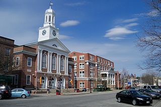
Lebanon is a city in Grafton County, New Hampshire, United States. The population was 14,282 at the 2020 census, up from 13,151 at the 2010 census. Lebanon is in western New Hampshire, south of Hanover, near the Connecticut River. It is the home to Dartmouth–Hitchcock Medical Center and Dartmouth College's Geisel School of Medicine, together comprising the largest medical facility between Boston, Massachusetts, and Burlington, Vermont.

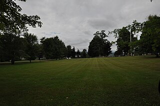
The Green is a grass-covered field and common space at the center of Dartmouth College, an Ivy League university located in Hanover, New Hampshire, United States. It was among the first parcels of land obtained by the College upon its founding in 1769, and is the only creation of the 18th century remaining at the center of the campus. After being cleared of pine trees, it initially served as a pasture and later as an athletic field for College sporting events. Today, it is a central location for rallies, celebrations, and demonstrations, and serves as a general, all-purpose recreation area. The College describes the Green as "historic" and as the "emotional center" of the institution.

The Northside Village Historic District encompasses a rural village center on Stafford Road in northern Charlton, Massachusetts. Located at the junction of Stafford Road with Northside and Cemetery Roads is a small cluster of residential buildings, developed beginning in 1735 around a small tanning business, and later as a stagecoach stop. The district was listed on the National Register of Historic Places in 1977.

The Sutton Center Historic District is a historic district encompassing the center of the village of Sutton, Massachusetts. The district, which covers 435 acres (176 ha), is centered on the junction of Boston Road, Singletary Avenue, and Uxbridge Road. Boston Road is a major east-west route through the town, and the other two roads run north-south through the village center. A typically rural village center, its civic and institutional buildings are clustered near the intersection on its south side, in the general area of the town common. The town common and cemetery were laid out in 1719, after settlement of the township began in 1716. There are a few surviving houses that date to the middle of the 18th century or earlier; exact dates for most are uncertain. There are only a few institutional buildings: the 1829 Congregational Church, the 1983 Town Hall, built on the site of the town's first purpose-built town hall (1885), and Rufus Putnam Hall, an 1824 school building and Masonic lodge that now houses the local history museum. Only one commercial structure the 1839 Brick Block, stands in the village. There is also a historic animal pound, a rectangular stone structure used to pen stray livestock, which dates to the early days of the town.

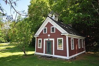
The Hancock Village Historic District encompasses the town center of Hancock, New Hampshire. It extends the length of Hancock's Main Street, from Pine Ridge Cemetery and the common to the west, and the junction of Bennington, Norway Hill, and Forest roads to the east. It then extends a short way up Bennington Road. The common was laid out in 1785, and the village developed nearby over the next 100+ years. The district was listed on the National Register of Historic Places in 1988.
Vermont Route 122 (VT 122) is a state highway in the U.S. state of Vermont. The highway runs 15.215 miles (24.486 km) from U.S. Route 5 and VT 114 in Lyndon north to VT 16 in Glover. VT 122 connects Lynch and the towns of Wheelock and Sheffield in Caledonia County with Glover in Orleans County. The highway has an alternate route in Lyndon that provides access to Lyndon State College.
The Middletown Rural Historic District encompasses an area that was once the town center of Grafton, Vermont. Located northwest of Grafton Village along Middletown Road and adjacent roads, it includes nine well-preserved 19th-century properties, as well as the town's first cemetery and animal pound. The district was listed on the National Register of Historic Places in 2011.

The Rockingham Village Historic District encompasses the traditional village center of the town of Rockingham, Vermont. Settled in the 18th century, the district, located mainly on Meeting House Road off Vermont Route 103, includes a variety of 18th and 19th-century houses, and has been little altered since a fire in 1908. It notably includes the 18th-century National Historic Landmark Rockingham Meeting House. The district was listed on the National Register of Historic Places in 2008.

The West Brattleboro Green Historic Districts encompasses the historic core of the village of West Brattleboro, Vermont. Centered in the triangular green at South Street and Western Avenue, it includes a modest collection of buildings constructed between about 1800 and 1910. It was listed on the National Register of Historic Places in 2002.
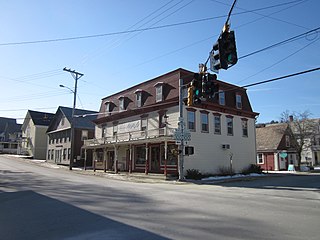
The Wilmington Village Historic District encompasses a significant portion of the village center of Wilmington, Vermont. The village grew as a crossroads industrial center through the mid-19th century, and experienced relatively little growth afterward. The district was listed on the National Register of Historic Places in 1980.

The Middletown Springs Historic District encompasses most of the village center of Middletown Springs, Vermont. Oriented around the crossroads junction of Vermont Routes 140 and 133, the village has a well-preserved collection of mainly mid-19th century architecture, including a significant number of Italianate buildings. The district was listed on the National Register of Historic Places in 1985.
The Christian Street Rural Historic District encompasses the surviving elements of an early settlement village in the town of Hartford, Vermont. Centered on the junction of Christian Street and Jericho Street in northeastern Hartford, the area includes a modest number of 18th and 19th-century houses, as well as two farms that have been in the same families since the 18th century. The district was listed on the National Register of Historic Places in 2003.

The Thetford Hill Historic District encompasses the well-preserved 19th-century village center of Thetford Hill in Thetford, Vermont. Developed between 1792 and about 1860 and located at what is now the junction of Vermont Route 113 and Academy Road, it includes mainly residential buildings, as well as several buildings of Thetford Academy and the 1785-88 Thetford Meetinghouse, one of the state's oldest churches in continuous use. The district was listed on the National Register of Historic Places in 1988.

The Kents Corner Historic District encompasses a well-preserved 19th-century crossroads hamlet in Calais, Vermont. Centered on the junction of Kent Hill Road, Old West Church Road, and Robinson Cemetery Road, it developed as a stagecoach stop with a small industrial presence. It was listed on the National Register of Historic Places in 1973, and substantially enlarged in 2006.
The Waitsfield Common Historic District encompasses the original town center settlement of Waitsfield, Vermont, at the junction of Joslin Hill, Common, East, and North Roads. Located about 1 mile (1.6 km) from the town's present main village and center, it was laid out in 1793, and includes the triangular town common, a cemetery, and a number of houses built mainly between 1793 and 1841. The district was listed on the National Register of Historic Places in 2001.

The Warren Village Historic District encompasses the village center of Warren, Vermont. Stretched mainly along Main Street east of the Mad River, it is a well-preserved 19th-century mill village, although most of its period mill infrastructure has been lost. The district has good examples of Greek Revival, Italianate, and Second Empire architecture. It was listed on the National Register of Historic Places in 1992.

Woodbury Town Hall is center of town government of Woodbury, Vermont. It is located on the west side of Vermont Route 14 in the town's village center. Built in 1842, it is a well-preserved example of a vernacular Greek Revival municipal building. It was listed on the National Register of Historic Places in 1995.

The Peacham Corner Historic District encompasses much of the historic village center of Peacham, Vermont. The village's period of greatest growth and importance between the town's founding as a hill town in the late 18th century, and 1860, when significant development effectively ended. As a result, the village lacks Victorian features often found in other rural communities. The district was listed on the National Register of Historic Places in 2003.

The Norwich Mid-Century Modern Historic District encompasses a concentrated collection of Mid-Century Modern houses in Norwich, Vermont. Located on parts of Hopson, Pine Tree, and Spring Pond Roads, it is one of best collections of this type in the state. It was listed in the National Register of Historic Places in 2018.
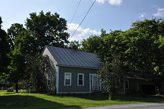
The Walter and Sylvia Stockmayer House is a historic house at 48 Overlook Drive in Norwich, Vermont. Built in 1961 to a design by Allan Gelbin, it is one of the town's finer examplers of Usonian Mid-Century Modern architecture, a style espoused by Frank Lloyd Wright that is also relatively rare in the state. It was listed in the National Register of Historic Places in 2020.


