
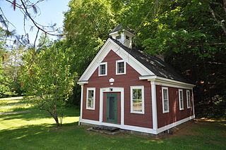
Peacham is a town in Caledonia County, Vermont, United States. The population was 715 at the 2020 census.

Cabot is a six-mile-square New England town located in the northeast corner of Washington County, Vermont, United States. The population was 1,443 at the 2020 census. It contains the unincorporated villages of Cabot Village, Cabot Plain, South Cabot (Hookerville), East Cabot, Lower Cabot, and West Hill. There was also a community known as Petersville until property owners there sold a total of 100 acres to Molly’s Falls Electric Light and Power Company, and in 1925 a large dam was constructed on Molly’s Brook, that completely flooded the area that had been farms and homes to create what is now known as Molly’s Falls Reservoir, or sometimes “Marshfield Dam,” which is located close to the Cabot/Marshfield town line.

The Clinton Village Historic District encompasses the historic portion of the town center of Clinton, Connecticut. It is roughly linear and extends along East Main Street from the Indian River in the west to Old Post Road in the east. The area represents a well-preserved mid-19th century town center, with architecture dating from the late 17th to mid-20th centuries. The district was listed on the National Register of Historic Places in 1994.

The Norwich Village Historic District encompasses the compact village center of Norwich, Vermont. The village was developed mainly in the first half of the 19th century, benefiting in importance from the 1820 founding of what is now Norwich University. The district has well-preserved examples of architecture ranging from the late 18th century to the early 20th century. It was listed on the National Register of Historic Places in 1991.

The Waterville Village Historic District encompasses most of the history 19th and early 20th-century village center of Waterville, Vermont. The village grew from beginnings late in the 18th century to serve as a modest civic, commercial, and residential hub for the rural community. It was added to the National Register of Historic Places in 2007.
The Middletown Rural Historic District encompasses an area that was once the town center of Grafton, Vermont. Located northwest of Grafton Village along Middletown Road and adjacent roads, it includes nine well-preserved 19th-century properties, as well as the town's first cemetery and animal pound. The district was listed on the National Register of Historic Places in 2011.

The Rockingham Village Historic District encompasses the traditional village center of the town of Rockingham, Vermont. Settled in the 18th century, the district, located mainly on Meeting House Road off Vermont Route 103, includes a variety of 18th and 19th-century houses, and has been little altered since a fire in 1908. It notably includes the 18th-century National Historic Landmark Rockingham Meeting House. The district was listed on the National Register of Historic Places in 2008.

The West Brattleboro Green Historic Districts encompasses the historic core of the village of West Brattleboro, Vermont. Centered in the triangular green at South Street and Western Avenue, it includes a modest collection of buildings constructed between about 1800 and 1910. It was listed on the National Register of Historic Places in 2002.

The Dorset Village Historic District encompasses a significant portion of the village center of Dorset, Vermont. Centered at the junction of Church Street, Kent Hill Road, and Vermont Route 30, the village was developed between the late 18th and early 20th centuries, and has a number of well-preserved unusual features, including sidewalks of marble from local quarries. The district was listed on the National Register of Historic Places in 1985, and was enlarged to the west in 1997.

The Danby Village Historic District encompasses much of the town center of Danby, Vermont. It is centered on a stretch of Main Street, roughly between Depot Street and Brook Road. The village has a cohesive collection of mid-19th century architecture, mostly residential, with a modest number of later additions. The district was listed on the National Register of Historic Places in 1983.
The Middletown Springs Historic District encompasses most of the village center of Middletown Springs, Vermont. Oriented around the crossroads junction of Vermont Routes 140 and 133, the village has a well-preserved collection of mainly mid-19th century architecture, including a significant number of Italianate buildings. The district was listed on the National Register of Historic Places in 1985.
The Christian Street Rural Historic District encompasses the surviving elements of an early settlement village in the town of Hartford, Vermont. Centered on the junction of Christian Street and Jericho Street in northeastern Hartford, the area includes a modest number of 18th and 19th-century houses, as well as two farms that have been in the same families since the 18th century. The district was listed on the National Register of Historic Places in 2003.

The Bayley Historic District encompasses a small cluster of buildings in Newbury, Vermont, a number of which are associated with the historically prominent Bayley family. It includes some of the town's oldest buildings, and is where the founder of the town, Jacob Bayley, first settled and later died. The district is oriented along Oxbow Road west of United States Route 5 and north of the town's main village. It was listed on the National Register of Historic Places in 1983.

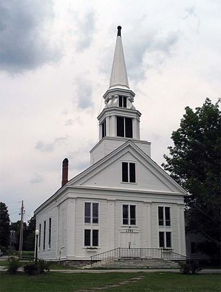
The Thetford Hill Historic District encompasses the well-preserved 19th-century village center of Thetford Hill in Thetford, Vermont. Developed between 1792 and about 1860 and located at what is now the junction of Vermont Route 113 and Academy Road, it includes mainly residential buildings, as well as several buildings of Thetford Academy and the 1785-88 Thetford Meetinghouse, one of the state's oldest churches in continuous use. The district was listed on the National Register of Historic Places in 1988.
The Charlotte Center Historic District encompasses the historic 19th-century town center of Charlotte, Vermont. Settled c. 1790 and developed mainly in the mid-19th century, the village, stretched along Church Hill Road west of Hinesburg Road, retains a well-preserved 19th-century atmosphere of residential, civic, and commercial buildings. The district was listed on the National Register of Historic Places in 1984.

The Kents Corner Historic District encompasses a well-preserved 19th-century crossroads hamlet in Calais, Vermont. Centered on the junction of Kent Hill Road, Old West Church Road, and Robinson Cemetery Road, it developed as a stagecoach stop with a small industrial presence. It was listed on the National Register of Historic Places in 1973, and substantially enlarged in 2006.

The Elkins Tavern is a historic house on Bayley-Hazen Road in Peacham, Vermont. Built in 1787 by one of Peacham's first settlers, it has one of the best-preserved 18th-century interiors in the state of Vermont. It was listed on the National Register of Historic Places in 1978.

The Hardwick Street Historic District encompasses the earliest settlement area of Hardwick, Vermont. Extending along Hardwick Street and Bayley-Hazen Road in a rural area of eastern Hardwick, it includes eight farm properties dating to the early 19th century. It was listed on the National Register of Historic Places in 1979.

The Josiah and Lydia Shedd Farmstead is a historic farm property at 1721 Bayley-Hazen Road in Peacham, Vermont. Established in 1816, the property evokes a typical 19th-century Vermont hill farm. Its oldest surviving buildings, the main house and two barns, survive from the second quarter of the 19th century. The property was listed on the National Register of Historic Places in 2005.
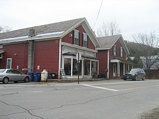
East Hardwick is an unincorporated village in the town of Hardwick, Vermont, United States. It is part of what is known as the Northeast Kingdom (NEK) of Vermont. The community is located on the Lamoille River and along Vermont Route 16, 16 miles (26 km) west-northwest of St. Johnsbury. East Hardwick has a post office with ZIP code 05836, which opened on October 10, 1810. According to a 1937 WPA Federal Writers Project Guidebook, East Hardwick is a "side hill village spilling from the level of a plateau down a sharp incline in the valley of the Lamoille. It is surrounded by rich farm lands, Maple groves and forests."


