
Camel's Hump is a mountain in the Green Mountains in the U.S. state of Vermont. The north slope of the mountain borders the Winooski River, which has carved through the Green Mountains over eons. At 4,083 ft (1,244 m), it is tied with Mount Ellen for the third-highest mountain in Vermont. Surmounted by 10 acres (4 ha) of alpine tundra, the mountain is the most significant feature in Camel's Hump State Park. Because of its distinctive profile, it is perhaps the state's most recognized mountain, featured on the state quarter.

The Mountains-to-Sea State Trail (MST) is a long-distance trail in the USA for hiking and backpacking, that traverses North Carolina from the Great Smoky Mountains to the Outer Banks. Its western endpoint is at Clingman's Dome, where it connects to the Appalachian Trail in the Great Smoky Mountains National Park. Its eastern endpoint is in Jockey's Ridge State Park on the tallest sand dune on the east coast. The trail is envisioned as a scenic backbone of an interconnected trail system spanning the state. As such, its route attempts to connect as many trail systems and natural scenic areas as practicable. A little over half of the trail is complete in multiple segments across the state.
Taconic State Park is located in Columbia and Dutchess County, New York abutting Massachusetts and Connecticut within the Taconic Mountains. The state park is located off New York State Route 344 south of Interstate 90 and 110 miles (180 km) north of New York City. It features camping, hiking, bicycling, hunting, cross county skiing and other recreational opportunities.
Holly River State Park is a state park located in Webster County, West Virginia. Situated on the Left Fork of the Holly River near the town of Hacker Valley, it is the second largest park in the West Virginia state park system with a total of 8,294 acres (3,356 ha). The park features over 42 miles (68 km) of hiking trails, ten vacation cabins, an 88-unit campground, and many recreation and picnic areas.

Watoga State Park is a state park located near Seebert in Pocahontas County, West Virginia. The largest of West Virginia's state parks, it covers slightly over 10,100 acres (41 km2). Nearby parks include the Greenbrier River Trail, which is adjacent to the park, Beartown State Park, and Droop Mountain Battlefield State Park. Also immediately adjacent to the park is the 9,482-acre Calvin Price State Forest. It is one of the darkest night skies of all of West Virginia State Parks.

Patapsco Valley State Park is a Maryland state park extending along 32 miles (51 km) of the Patapsco River south and west of the city of Baltimore, Maryland. The park encompasses multiple developed areas on over 14,000 acres (5,700 ha) acres of land, making it Maryland's largest state park. In 2006, it was officially celebrated as Maryland's first state park, its first formation being in 1906. Patapsco Valley State Park is managed by the Maryland Department of Natural Resources.

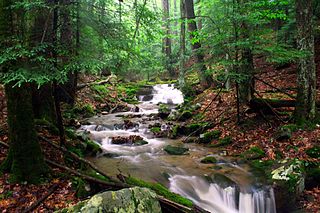
Camel's Hump State Park is a state park in the U.S. state of Vermont. The park straddles the northern Green Mountains in an area bounded by Vermont Route 17 on the south and the Winooski River on the north. As of 2017, the park covered a total of 21,224 acres (8,589 ha), making it the largest state park in Vermont.

Townshend State Park is a state park in Townshend, Vermont. Embedded within Townshend State Forest, the park provides a camping facility and hiking trails for accessing Bald Mountain. The park's facilities were developed by the Civilian Conservation Corps in the 1930s, and are listed on the National Register of Historic Places for their well-preserved state.

Gifford Woods State Park is a state park located at the base of Pico Peak in Killington, Vermont. The wooded park provides camping, picnic, and fishing facilities, and has hiking trails, including a portion of the Appalachian Trail. It preserves an area of old-growth forest that has been designated a National Natural Landmark, and is accessible via an interpretive trail. The park was established in 1931. Part of it is listed on the National Register of Historic Places, for facilities developed by the Civilian Conservation Corps in the 1930s.
Stillwater State Park is a state park located on Lake Groton in Groton, Vermont. The park is located in Groton State Forest close to the Groton Nature Center, Boulder Beach State Park and Big Deer State Park. The park offers camping, picnicking, and access to water-related activities on Lake Groton. The park was developed in the 1930s by crews of the Civilian Conservation Corps (CCC). It is open to the public between Memorial Day weekend and Columbus Day weekend; fees are charged for day use and camping.

Groton State Forest covers 26,164 acres (105.88 km2) in Danville, Groton, Marshfield, Orange, Peacham, Plainfield, Topsham, Vermont. The forest covers areas in Caledonia, Orange, and Washington Counties. Major roads through the forest are U.S. Route 302 and Vermont Route 232.
Bomoseen State Park is a 3,576-acre state park in the towns of Castleton, Fair Haven, Hubbarton and Benson, Vermont. The park is located in the Taconic Mountains on the western shore of Lake Bomoseen.

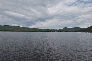
Brighton State Park is a state park in Island Pond, Vermont. The park features a campground on the 102-acre Spectacle Pond, which is mostly undeveloped. There is also a day use beach and bathhouse located on 600-acre Island Pond just a half mile from the campground.
Button Bay State Park is a 253-acre state park in Ferrisburgh, Vermont on the shore of Lake Champlain.

Underhill State Park is a state park in Underhill, Vermont. It is situated on the west slope of 4,300 feet Mount Mansfield, in the 39,837-acre Mount Mansfield State Forest. Activities includes hiking, camping, mountain biking, stream fishing, wildlife watching, and picnicking. Facilities include group and individual camping areas, a picnic shelter, and hiking trails. The park is formally open between Memorial Day weekend and Columbus Day weekend, but is accessible for periods outside those times; fees are charged. Much of the park's infrastructure was built by the Civilian Conservation Corps (CCC) in the 1930s; these facilities were listed on the National Register of Historic Places in 2002.
Aitken State Forest covers 918 acres (3.72 km2) in Mendon, Vermont in Rutland County. The forest is managed by the Vermont Department of Forests, Parks, and Recreation for timber resources, wildlife habitat, and recreational activities.
Calvin Coolidge State Forest, also known as Coolidge State Forest, covers 22,564 acres (91.31 km2) in two parts in Rutland and Windsor counties in Vermont. The West portion cover 17,259 acres (69.84 km2) in Killington, Mendon, Plymouth and Shrewsbury in both counties. The East portion cover 5,305 acres (21.47 km2) in Bridgewater, Plymouth, Reading, and Woodstock in Windsor County.
Putnam State Forest, officially known as C.C. Putnam State Forest, covers 13,633 acres (55.17 km2) in Lamoille and Washington County in Vermont. The forest is managed by the Vermont Department of Forests, Parks, and Recreation in parts of Stowe, Elmore, Waterbury, Worcester and Middlesex.

Willoughby State Forest covers 7,682 acres (31.09 km2) in Newark, Sutton and Westmore in Caledonia and Orleans counties in Vermont. The forest is managed by the Vermont Department of Forests, Parks, and Recreation. Activities include hiking, primitive camping, cross country skiing, snowshoeing, hunting and fishing.

Mount Mansfield State Forest covers 44,444 acres (179.86 km2) in seven towns in Chittenden, Lamoille and Washington counties in Vermont. The towns are Bolton and Underhill in Chittenden County, Cambridge, Johnson, Morristown and Stowe in Lamoille County, and Waterbury in Washington County. Mt. Mansfield State Forest is the largest contiguous landholding owned by the Vermont Department of Forests, Parks and Recreation.

