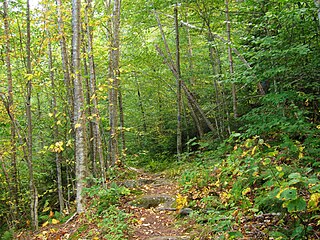
Groton State Forest covers 26,164 acres (105.88 km2) in Danville, Groton, Marshfield, Orange, Peacham, Plainfield, Topsham, Vermont. The forest covers areas in Caledonia, Orange, and Washington Counties. Major roads through the forest are U.S. Route 302 and Vermont Route 232.

Mount Ascutney State Park is a state park in the U.S. state of Vermont. The park entrance is located along Vermont Route 44-A near the town of Windsor in Windsor County. Operated by the Vermont Department of Forests, Parks and Recreation, a significant portion of the park is listed on the National Register of Historic Places.
Calvin Coolidge State Forest, also known as Coolidge State Forest, covers 22,564 acres (91.31 km2) in two parts in Rutland and Windsor counties in Vermont. The West portion cover 17,259 acres (69.84 km2) in Killington, Mendon, Plymouth and Shrewsbury in both counties. The East portion cover 5,305 acres (21.47 km2) in Bridgewater, Plymouth, Reading, and Woodstock in Windsor County.
Arlington State Forest covers 225 acres (0.91 km2) in Arlington, Vermont in Bennington County. The forest is managed by the Vermont Department of Forests, Parks, and Recreation for timber resources and wildlife habitat.
Camel's Hump State Forest covers a total of 2,323 acres (9.40 km2) in two blocks in the U.S. state of Vermont. Stevens Block comprises 1,680 acres (6.8 km2) in Buels Gore, Fayston, and Starksboro in Chittenden, Washington, and Addison counties, respectively. Howe Block covers 643 acres (2.60 km2) in Waitsfield and Fayston, both in Washington county. The forest is managed by the Vermont Department of Forests, Parks and Recreation.
Dorand State Forest, also known as John Dorand State Forest, covers 531 acres (2.15 km2) in Grafton and Rockingham in Windham County, Vermont. The forest is managed by the Vermont Department of Forests, Parks, and Recreation.
Hapgood State Forest covers 118 acres (0.48 km2) in Peru, Vermont in Bennington County. The forest is managed by the Vermont Department of Forests, Parks, and Recreation and surrounds the summit of 3,260-foot Bromley Mountain.

Willoughby State Forest covers 7,682 acres (31.09 km2) in Newark, Sutton and Westmore in Caledonia and Orleans counties in Vermont. The forest is managed by the Vermont Department of Forests, Parks, and Recreation. Activities include hiking, primitive camping, cross country skiing, snowshoeing, hunting and fishing.
Williams River State Forest covers 108 acres (0.44 km2) in Chester in Windham County, Vermont. The forest is managed by the Vermont Department of Forests, Parks, and Recreation.
William C. Putnam State Forest covers 146 acres (0.59 km2) in Grafton in Windham County, Vermont. The forest is managed by the Vermont Department of Forests, Parks, and Recreation.
West Rutland State Forest covers 344 acres (1.39 km2) in West Rutland, Vermont in Rutland County. The forest is managed by the Vermont Department of Forests, Parks, and Recreation.
Townshend State Forest covers 1,106 acres (4.48 km2) in Townshend, Vermont in Windham County. The forest is managed by the Vermont Department of Forests, Parks, and Recreation and surrounds 18-acre Townshend State Park, which hosts trails and camping facilities.
Roxbury State Forest covers 5,509 acres (22.29 km2) in 3 blocks in Roxbury, Vermont in Washington County. The forest is managed by the Vermont Department of Forests, Parks, and Recreation for timber management, dispersed recreation, and wildlife habitat protection.
Proctor Piper State Forest covers 1,513 acres (6.12 km2) in Cavendish, Vermont in Windsor County. The forest is managed by the Vermont Department of Forests, Parks, and Recreation.
Okemo State Forest covers 7,466 acres (30.21 km2) in Andover, Ludlow, Mount Holly and Weston, Vermont in Windsor and Rutland Counties. Okemo Mountain Resort is located in the forest. The forest is managed by the Vermont Department of Forests, Parks, and Recreation.
Mount Cushman State Forest covers 16 acres (0.065 km2) in Rochester, Vermont in Windsor County. The forest is managed by the Vermont Department of Forests, Parks, and Recreation. It is landlocked and there is no legal public access to the forest.
Lord State Forest, also known as Albert C. Lord State Forest, covers 64 acres (0.26 km2) in Cavendish, Vermont in Windsor County. The forest is managed by the Vermont Department of Forests, Parks, and Recreation.

Mount Mansfield State Forest covers 44,444 acres (179.86 km2) in seven towns in Chittenden, Lamoille and Washington counties in Vermont. The towns are Bolton and Underhill in Chittenden County, Cambridge, Johnson, Morristown and Stowe in Lamoille County, and Waterbury in Washington County. Mt. Mansfield State Forest is the largest contiguous landholding owned by the Vermont Department of Forests, Parks and Recreation.


