External links
Montpelier (capital) | |
| Regions | |
| Counties | |
| Cities | |
| Towns (pop. >5000) | |
| Festivals | |
| Topics | |
| Society | |
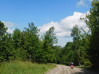
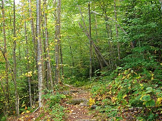
Big Falls of the Missisquoi Natural Area is an Orleans County, Vermont recreation area for swimming, fishing, and sight-seeing. The area also has a lot of old-growth hemlock plants and pine trees. Currently an undeveloped site near the small rural town of Troy, the falls is composed of 16 acres (6.5 ha) on both sides of the Missisquoi River, 2,400 feet (730 m) of which is frontage. Classified as a Vermont Natural Area protected site, the area is managed by the Vermont Department of Forests, Parks and Recreation. [1]
Originating from its headwaters in Lowell, the falls have an estimated 100-foot (30 m) drop. The somewhat isolated acreage has always been a popular picnic and recreation spot for local residents. In the 1950s, the water rights were held by an out-of-state entity, when purchased by the Vermont Citizens Utilities Company, following an assessment by the United States Army Corps of Engineers that the falls held potential as a substantive source of output from an on-site hydroelectric plant. [2] The area was subsequently deeded back to the state in 1996 after the utilities company abandoned its plans. [3]
Montpelier (capital) | |
| Regions | |
| Counties | |
| Cities | |
| Towns (pop. >5000) | |
| Festivals | |
| Topics | |
| Society | |
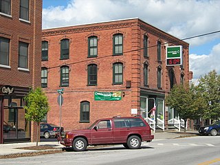
Enosburg Falls is a village in the town of Enosburgh in Franklin County, Vermont, in the United States. The population was 1,356 at the 2020 census.

Richford is a town in Franklin County, Vermont, United States, located along the Canada–United States border. The population was 2,346 at the 2020 census.

Swanton is a town in Franklin County, Vermont, United States. The population was 6,701 at the 2020 census. The town includes the village of Swanton.

The Big South Fork of the Cumberland River is a 76-mile-long (122 km) river in the U.S. states of Tennessee and Kentucky. It is a major drainage feature of the Cumberland Plateau, a major tributary of the Cumberland River system, and the major feature of the Big South Fork National River and Recreation Area.

Potton is a township municipality of about 2,010 people in the Memphrémagog Regional County Municipality. It is located on the western shore of Lake Memphremagog in the Estrie region of Quebec, and is one of the municipalities in Brome County. Potton is located about 125 kilometres (78 mi) southeast of Montreal, 30 kilometres (19 mi) to the southwest of the city of Magog, and next to the United States border, north of North Troy, Vermont.

Missisquoi National Wildlife Refuge is a National Wildlife Refuge located in the eastern shore of Lake Champlain in the U.S. state of Vermont. The refuge is in Franklin County in the northwest corner of the state near the International Boundary with Canada. It is the only National Wildlife Refuge located entirely in Vermont, and is administered by the United States Fish and Wildlife Service.

The Sheltowee Trace Trail is a 343-mile (552.00 km) National Recreation Trail that was created in 1979 and stretches from the Burnt Mill Bridge Trail Head in the Big South Fork National River and Recreation Area in Tennessee to northern Rowan County, Kentucky. The trail is named after Daniel Boone, who was given the name Sheltowee when he was adopted as the son of the great warrior Chief Blackfish of the Shawnee tribe.

The Missisquoi River is a transboundary river of the east shore of Lake Champlain, approximately 80 miles (130 km) long, in northern Vermont in the United States and southern Quebec in Canada.
The Potomac Highlands of West Virginia centers on five West Virginian counties in the upper Potomac River watershed in the western portion of the state's Eastern Panhandle, bordering Maryland and Virginia. Because of geographical proximity, similar topography and landscapes, and shared culture and history, the Potomac Highlands region also includes Pocahontas, Randolph, and Tucker counties, even though they are in the Monongahela River or New River watersheds and not that of the Potomac River.

Island Falls is a hydroelectric power station operated by SaskPower, a Saskatchewan crown corporation. It is located on the Churchill River, about 97 km (60 mi) northwest of Flin Flon, Manitoba, Canada.

Big Bog State Recreation Area, a recent addition to the Minnesota state park system, is located on Minnesota State Highway 72, north of Waskish, Minnesota. It covers 9,459 acres (38.3 km2), primarily swamps, bogs, and upland "islands".
The Northern Forest Canoe Trail (NFCT) is a 740-mile (1,190 km) marked canoeing trail in the northeastern United States and Canada, extending from Old Forge in the Adirondacks of New York to Fort Kent, Maine. Along the way, the trail also passes through the states and provinces of Vermont, Quebec, and New Hampshire. The trail was opened on June 3, 2006.
Hazen's Notch is a mountain pass in Westfield, in the northern Green Mountains of Vermont. Hazen's Notch was named after Moses Hazen, who in 1779 led the construction of the Bayley Hazen Military Road. The road was planned to extend from Newbury, Vermont, to Saint-Jean-sur-Richelieu, Quebec, not far from Montreal, to facilitate an invasion of Canada during the American Revolutionary War; it had reached this point when construction stopped.
Mount Ascutney State Park is a state park in the U.S. state of Vermont. The park entrance is located along Vermont Route 44-A near the town of Windsor in Windsor County. Operated by the Vermont Department of Forests, Parks and Recreation, a significant portion of the park is listed on the National Register of Historic Places.

Bridge 9 is a historic Parker through truss bridge, carrying Shawville Road across the Missisquoi River in Sheldon, Vermont. Built in 1928 after Vermont's devastating 1927 floods, it is one of the few surviving Parker truss bridges on the Missisquoi. It was listed on the National Register of Historic Places in 2007.

Bridge 12 is a historic Parker through truss bridge, carrying Boston Post Road across the Missisquoi River in Enosburg, Vermont. Built in 1929 in the wake of Vermont's devastating 1927 floods, it is one a shrinking number of surviving truss bridges on the river. It was listed on the National Register of Historic Places in 2007.

The Mississquoi River Bridge is a steel truss bridge, spanning the Missisquoi River between Richford, Vermont and Sutton, Quebec on the Canada–United States border. It connects Chemin de la Vallée Missisquoi in Sutton with Vermont Route 105A in Richford, between the border stations of the East Richford–Glen Sutton Border Crossing. The bridge was built by the state of Vermont in 1929, and is one of two in the state built by the Pittsburgh-Des Moines Steel Company. It was listed on the United States National Register of Historic Places in 1990.
Camel's Hump Forest Reserve is a protected area in the U.S. state of Vermont. The area is bounded by Vermont Route 17 on the south, the Winooski River on the north, the Mad River on the east, and the Huntington River on the west. The Forest Reserve covers a total of 127.68 square miles (330.7 km2) or 81,715 acres (33,069 ha) of both public and privately-owned land, one of the largest blocks of core forest in the state.