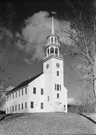
Strafford is a town in Orange County, Vermont, United States. The population was 1,094 at the 2020 census. The town of Strafford was created on August 12, 1761 by way of a royal charter which King George III of Great Britain issued to Governor Benning Wentworth of New Hampshire. The town was named after the Earl of Strafford. Its town house is one of the most famous in Vermont, sitting atop a hill in the historic town square.

Justin Smith Morrill was an American politician and entrepreneur who represented Vermont in the United States House of Representatives (1855–1867) and United States Senate (1867–1898). He is most widely remembered for the Morrill Land-Grant Acts that provided federal funding for establishing many of the United States' public colleges and universities. Originally a Whig, after that party became defunct Morrill was one of the founders of the Republican Party.

The Justin Smith Morrill Homestead is the historic Carpenter Gothic home of United States Senator Justin Smith Morrill (1810–98) in Strafford, Vermont, and was one of the first declared National Historic Landmarks, in 1960. It is located at 214 Justin Morrill Highway, south of the village green of Strafford. The homestead is a Vermont State Historic Site owned by the Vermont Division for Historic Preservation, a state agency, and is open for tours from May to October.

Becket Center Historic District is a historic district encompassing the historic early center of Becket, Massachusetts. Centered at the junction of Massachusetts Route 8 and YMCA Road, this area was the town's civic heart and a center of industry until it was eclipsed in importance by North Becket, which was served by the railroad. Most of the architecture in the district is in the Federal and Greek Revival styles popular in the late 18th to mid 19th centuries. The district was added to the National Register of Historic Places in 1982.

North Becket Village Historic District is a historic district encompassing the historic village of North Becket in the Berkshire hill town of Becket, Massachusetts. The village developed rapidly as the main economic and civic center of the town in a 20-year period beginning in 1841 with the arrival of the Western Railroad, and retains many fine examples of Greek Revival architecture. It was listed on the National Register of Historic Places in 1988.

The Wayland Center Historic District encompasses the predominantly 19th-century village center of Wayland, Massachusetts. Located at the junction of United States Route 20 and Cochituate Road, it includes fifteen well-preserved 19th-century buildings that form one of the best-preserved village centers of that period near Boston. It was added to the National Register of Historic Places in 1974.

The Dover Religious Society of Friends Meetinghouse is a historic Quaker meeting house at 141 Central Avenue in Dover, Strafford County, New Hampshire. Built in 1768 for a congregation established in the 17th century, it is the only surviving 18th-century Quaker meetinghouse in the state. The building was listed on the National Register of Historic Places in 1980.

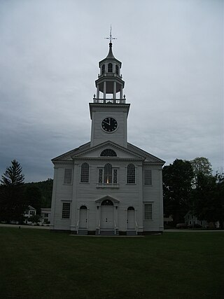
The First Congregational Church and Meetinghouse, also known as the Church of Christ and the Townshend Church, is a historic church at 34 Common Road in Townshend, Vermont. Built in 1790 and restyled in 1840, it is one of the oldest church buildings in continuous use in the state. The building was listed on the National Register of Historic Places in 2002; the congregation was established in 1777, and is affiliated with the United Church of Christ.

The Union Meetinghouse or Universalist Church is a historic church building at 97 Amesbury Road in Kensington, New Hampshire. Built in 1839–40, it is a well-preserved and little-altered example of a mid-19th century Greek Revival rural church. It was listed on the National Register of Historic Places in 2013, and continues to be used for summer services.

The Putney Village Historic District encompasses most of the main village and town center of Putney, Vermont. Settled in the 1760s, the village saw its major growth in the late 18th and early 19th century, and includes a cohesive collection with Federal and Greek Revival buildings, with a more modest number of important later additions, including the Italianate town hall. The district was listed on the National Register of Historic Places in 1986.

The Whitingham Village Historic District encompasses much of the current village center of Whitingham, Vermont. It was developed mainly in the second half of the 19th century around industries powered by local water sources, and includes well-preserved architecture from that period. It was listed on the National Register of Historic Places in 2006.

Benson Village is the village center of the rural town of Benson, Vermont. The central portion of the village, stretching along Stage Road from Lake Road to Hulett Hill Road, is a historic district listed on the National Register of Historic Places as a well-preserved 19th-century village center.

The Danby Village Historic District encompasses much of the town center of Danby, Vermont. It is centered on a stretch of Main Street, roughly between Depot Street and Brook Road. The village has a cohesive collection of mid-19th century architecture, mostly residential, with a modest number of later additions. The district was listed on the National Register of Historic Places in 1983.

The East Poultney Historic District encompasses the historic center of the rural village of East Poultney, Vermont. The district is centered on the triangular green at the center of the village, and was developed mainly from the late 18th through mid-19th centuries, producing a village with strong Federal and Greek Revival architecture. It was listed on the National Register of Historic Places in 1978.

The Chelsea Village Historic District encompasses the historic village center of Chelsea, Vermont, the shire town of Orange County. Developed in the first half of the 19th century as a regional service and transportation hub, the village exhibits a significant number of Greek Revival buildings, augmented with primarily later civic and commercial buildings. It was listed on the National Register of Historic Places in 1983.

The South Royalton Historic District encompasses the central portion of the village of South Royalton, Vermont. Now the town of Royalton's principal commercial center, it developed in the second half of the 19th century around the depot of the Vermont Central Railroad. The district includes fine examples of Greek Revival and Victorian architecture, and is home to the Vermont Law School. It was listed on the National Register of Historic Places in 1976.

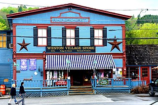
The Weston Village Historic District encompasses the town center and principal village of Weston, Vermont. Centered on Farrar Park, which serves as the town green, it includes a diversity of architectural styles from the late 18th century to about 1935, and includes residential, civic, commercial, industrial and religious buildings. It was listed on the National Register of Historic Places in 1985.

The Thetford Hill Historic District encompasses the well-preserved 19th-century village center of Thetford Hill in Thetford, Vermont. Developed between 1792 and about 1860 and located at what is now the junction of Vermont Route 113 and Academy Road, it includes mainly residential buildings, as well as several buildings of Thetford Academy and the 1785-88 Thetford Meetinghouse, one of the state's oldest churches in continuous use. The district was listed on the National Register of Historic Places in 1988.

The Tunbridge Village Historic District encompasses the early 19th-century village center of Tunbridge, Vermont. Stretched linearly along Vermont Route 110, the largely agricultural village reached its peak population around 1820, and was bypassed by the railroads, limiting later development. It was listed on the National Register of Historic Places in 1994.
East Calais is an unincorporated village in the town of Calais, Washington County, Vermont, United States. The community is located along Vermont Route 14, 10.3 miles (16.6 km) northeast of Montpelier. East Calais has a post office with ZIP code 05650, which opened on April 12, 1830. The heart of the village forms the East Calais Historic District, listed on the National Register of Historic Places in 2020.


