
Brookfield is a town in Orange County, Vermont, United States. It was created by Vermont charter on August 5, 1781. The population was 1,244 at the 2020 census. Brookfield is best known for its floating bridge which spans Sunset Lake buoyed by pontoons. The bridge, which is the only floating bridge east of the Mississippi River, was originally built in 1820 by Luther Adams and his neighbors. Sunset Lake is also the site of an annual ice harvesting festival. Brookfield boasts that it has Vermont's oldest continually operating library dating back to 1791. In 2006, Brookfield was one of the first American towns to have its citizens pass a resolution endorsing the impeachment of President George W. Bush. As of September 2010, the floating bridge was closed for repairs. Work began in 2014, and was completed May 2015. There was a celebration from May 23–24, 2015, to memorialize the event. Governor Peter Shumlin attended, and cadets from Norwich University provided traffic control.

Vermont Route 65 (VT 65) is a 5.222-mile-long (8.404 km) east–west state highway within the town of Brookfield in Orange County, Vermont, United States. The western terminus of the route is at VT 12 in Brookfield. Its eastern terminus is at VT 14 in the village of East Brookfield. VT 65 traverses the Sunset Lake Floating Bridge and provides access to Allis State Park.

The Taftsville Historic District encompasses a historic 19th-century industrial village that is mostly in Woodstock, Vermont. Flanking the Ottauquechee River and extending up Happy Valley Road, the area developed around a metal tool factory established by members of the Taft family in 1793. Important elements from its early history include the Taftsville Store, built by the Taft family in 1840, and the Taftsville Covered Bridge, built in 1836. The district was listed on the National Register of Historic Places in 2001.

The Waterville Village Historic District encompasses most of the history 19th and early 20th-century village center of Waterville, Vermont. The village grew from beginnings late in the 18th century to serve as a modest civic, commercial, and residential hub for the rural community. It was added to the National Register of Historic Places in 2007.
The Windham Village Historic District is one of two historic districts in Windham, Vermont, encompassing the dispersed rural village near the town's geographic center. The area was principally developed in the early decades of the 19th century, and has had only modest alterations since then. It was listed on the National Register of Historic Places in 1984.
The Dublin Village Historic District encompasses the historic village center of Dublin, New Hampshire. Dublin's center developed in the 19th century after its original village center was abandoned due to harsher winter conditions nearer Dublin Pond. The district extends along Main Street from its junction with Lake Street in the west to the junction with Old County Road in the east, and includes sections of Old Common Road, Harrisville Road, and Church Street. The district was listed on the National Register of Historic Places in 1983.

The Grafton Village Historic District encompasses the historic village center of the town of Grafton, Vermont. The village was developed in the early-to-mid 19th century, and has retained the character of that period better than many small communities in the state. The district was listed on the National Register of Historic Places in 2010.

The Mechanicsville Historic District encompasses a cluster of residential properties that are all that remain of one of the early industrial areas of Grafton, Vermont. Located a short way east of Grafton Village on Vermont Route 121, it includes ten well-preserved 19th-century properties, some located on properties where early mills once stood. The district was listed on the National Register of Historic Places in 2010.

The Whitingham Village Historic District encompasses much of the current village center of Whitingham, Vermont. It was developed mainly in the second half of the 19th century around industries powered by local water sources, and includes well-preserved architecture from that period. It was listed on the National Register of Historic Places in 2006.

The Dorset Village Historic District encompasses a significant portion of the village center of Dorset, Vermont. Centered at the junction of Church Street, Kent Hill Road, and Vermont Route 30, the village was developed between the late 18th and early 20th centuries, and has a number of well-preserved unusual features, including sidewalks of marble from local quarries. The district was listed on the National Register of Historic Places in 1985, and was enlarged to the west in 1997.

The East Arlington Village Historic District encompasses the historic core of a 19th-century village in Arlington and Sunderland, Vermont, United States. It is centered on Old Mill Road, and developed as a mill village beginning in the 18th century. It was listed on the National Register of Historic Places in 1996.

Benson Village is the village center of the rural town of Benson, Vermont. The central portion of the village, stretching along Stage Road from Lake Road to Hulett Hill Road, is a historic district listed on the National Register of Historic Places as a well-preserved 19th-century village center.
The East Poultney Historic District encompasses the historic center of the rural village of East Poultney, Vermont. The district is centered on the triangular green at the center of the village, and was developed mainly from the late 18th through mid-19th centuries, producing a village with strong Federal and Greek Revival architecture. It was listed on the National Register of Historic Places in 1978.

The Thetford Center Historic District encompasses the village of Thetford Center in Thetford, Vermont. The village contains a well-preserved collection of early to mid-19th century architecture, a legacy of its period of greatest prosperity as an agricultural and industrial center. It was listed on the National Register of Historic Places in 1998.

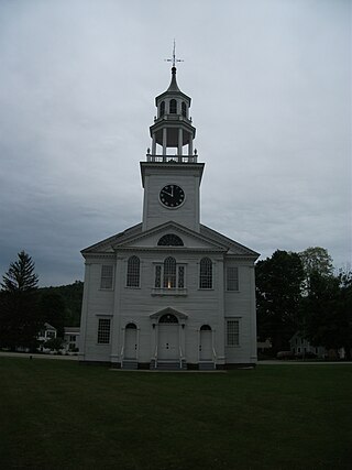
The Thetford Hill Historic District encompasses the well-preserved 19th-century village center of Thetford Hill in Thetford, Vermont. Developed between 1792 and about 1860 and located at what is now the junction of Vermont Route 113 and Academy Road, it includes mainly residential buildings, as well as several buildings of Thetford Academy and the 1785-88 Thetford Meetinghouse, one of the state's oldest churches in continuous use. The district was listed on the National Register of Historic Places in 1988.

The Tunbridge Village Historic District encompasses the early 19th-century village center of Tunbridge, Vermont. Stretched linearly along Vermont Route 110, the largely agricultural village reached its peak population around 1820, and was bypassed by the railroads, limiting later development. It was listed on the National Register of Historic Places in 1994.
The North Calais Village Historic District encompasses a linear 19th-century mill village in Calais, Vermont. It extends mainly along North Calais Road, paralleling Pekin Brook below Mirror Lake, where ruins of its former industrial past are still evident. It was listed on the National Register of Historic Places in 2010.

The Plainfield Village Historic District encompasses a significant portion of the village of Plainfield, Vermont. Located in northernmost Plainfield on United States Route 2, the village grew in the 19th century as a mill town and service community for the surround agricultural areas, and has a well-preserved collection of Greek Revival and Italianate architecture. It was listed on the National Register of Historic Places in 1983.

The Warren Village Historic District encompasses the village center of Warren, Vermont, United States. Stretched mainly along Main Street east of the Mad River, it is a well-preserved 19th-century mill village, although most of its period mill infrastructure has been lost. The district has good examples of Greek Revival, Italianate, and Second Empire architecture. It was listed on the National Register of Historic Places in 1992.

The Newport Downtown Historic District encompasses most of the historic downtown area of the city of Newport, Vermont. The city developed as a transit hub and tourist area in the second half of the 19th century, spurred by the construction of a railroad to the area. The district, roughly bounded by Third Street, Coventry Street, and Lake Memphremagog, was listed on the National Register of Historic Places in 2006.


