
The Waterville Village Historic District encompasses most of the history 19th and early 20th-century village center of Waterville, Vermont. The village grew from beginnings late in the 18th century to serve as a modest civic, commercial, and residential hub for the rural community. It was added to the National Register of Historic Places in 2007.
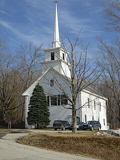
The Windham Village Historic District is one of two historic districts in Windham, Vermont, encompassing the dispersed rural village near the town's geographic center. The area was principally developed in the early decades of the 19th century, and has had only modest alterations since then. It was listed on the National Register of Historic Places in 1984.

West Dover is a village in the central part of Dover, Vermont. The village center, located on Vermont Route 100 at Cross Town and Valley View Roads, was listed on the National Register of Historic Places in 1985 as the West Dover Historic District. The village is a major service point for the nearby Mount Snow ski area.

The Houghtonville Historic District encompasses a cluster of residential properties that are all that remain of one of the early industrial areas of Grafton, Vermont. Located west of Grafton Village on Houghtonville Road, it includes ten well-preserved 19th-century houses, some located on properties where early mills once stood. The district was listed on the National Register of Historic Places in 2015.

The Parker Hill Rural Historic District encompasses a large rural agricultural landscape in eastern Windham and Windsor counties in the US state of Vermont. Roughly centered on Parker Hill Road in northern Rockingham and southern Springfield, the district exhibits a history of 200 years of farming, including a collection of Federal period farm housing. The district was listed on the National Register of Historic Places in 1993.
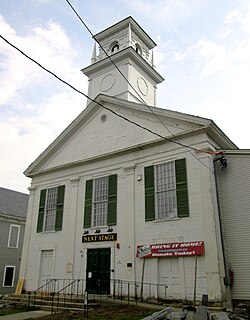
The Putney Village Historic District encompasses most of the main village and town center of Putney, Vermont. Settled in the 1760s, the village saw its major growth in the late 18th and early 19th century, and includes a cohesive collection with Federal and Greek Revival buildings, with a more modest number of important later additions, including the Italianate town hall. The district was listed on the National Register of Historic Places in 1986.

The West Brattleboro Green Historic Districts encompasses the historic core of the village of West Brattleboro, Vermont. Centered in the triangular green at South Street and Western Avenue, it includes a modest collection of buildings constructed between about 1800 and 1910. It was listed on the National Register of Historic Places in 2002.

The Middletown Springs Historic District encompasses most of the village center of Middletown Springs, Vermont. Oriented around the crossroads junction of Vermont Routes 140 and 133, the village has a well-preserved collection of mainly mid-19th century architecture, including a significant number of Italianate buildings. The district was listed on the National Register of Historic Places in 1985.
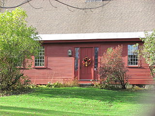
The Atherton Farmstead is a historic farm property at 31 Greenbush Road in Cavendish, Vermont. The farmhouse, built in 1785, is one of the oldest in the rural community, and is its oldest known surviving tavern house. It was listed on the National Register of Historic Places in 2002.
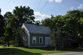
The Christian Street Rural Historic District encompasses the surviving elements of an early settlement village in the town of Hartford, Vermont. Centered on the junction of Christian Street and Jericho Street in northeastern Hartford, the area includes a modest number of 18th and 19th-century houses, as well as two farms that have been in the same families since the 18th century. The district was listed on the National Register of Historic Places in 2003.
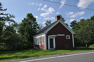
The Jericho Rural Historic District encompasses a rural agricultural landscape of northern Hartford, Vermont, extending slightly into neighboring Norwich. The area covers 774 acres (313 ha) of mainly agricultural and formerly agricultural lands, as well as associated woodlots, and includes nine historically significant farm complexes. It was listed on the National Register of Historic Places in 2001.

The Bayley Historic District encompasses a small cluster of buildings in Newbury, Vermont, a number of which are associated with the historically prominent Bayley family. It includes some of the town's oldest buildings, and is where the founder of the town, Jacob Bayley, first settled and later died. The district is oriented along Oxbow Road west of United States Route 5 and north of the town's main village. It was listed on the National Register of Historic Places in 1983.

The Brock Hill Schoolhouse is a historic one-room schoolhouse on North Road in rural Newbury, Vermont. Built in 1850, it is a well-preserved example of a mid-19th century schoolhouse with Greek Revival styling. It was listed on the National Register of Historic Places in 2003.

The Oxbow Historic District encompasses a well-preserved rural agricultural area on United States Route 5 in northern Newbury, Vermont. It was one of the first areas to be settled in the town, and includes seven agricultural properties, with six farmhouses built before 1835 and a number of surviving 19th-century farm outbuildings. It was listed on the National Register of Historic Places in 1983.

The South Newbury Village Historic District encompasses the surviving elements of a small industrial village in southern Newbury, Vermont. It includes five residences and several outbuildings, most of which are agricultural in character, representing the area's shift in use in the 20th century. The district was listed on the National Register of Historic Places in 1983.
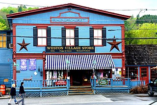
The Weston Village Historic District encompasses the town center and principal village of Weston, Vermont. Centered on Farrar Park, which serves as the town green, it includes a diversity of architectural styles from the late 18th century to about 1935, and includes residential, civic, commercial, industrial and religious buildings. It was listed on the National Register of Historic Places in 1985.

The Peacham Corner Historic District encompasses much of the historic village center of Peacham, Vermont. The village's period of greatest growth and importance between the town's founding as a hill town in the late 18th century, and 1860, when significant development effectively ended. As a result, the village lacks Victorian features often found in other rural communities. The district was listed on the National Register of Historic Places in 2003.
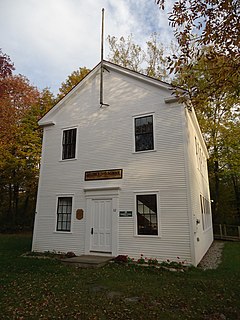
The District No. 5 Schoolhouse is a historic district school building at 32 Pleasant Valley Road in Underhill, Vermont. Built in 1861, it served the town as a school until it was damaged by fire in 1951, but remains a community landmark. It is now owned by the local historical society. It was listed on the National Register of Historic Places in 2018.
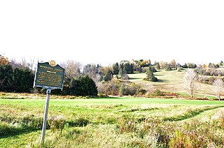
Gilbert's Hill, also known more recently as the Appel Farm, is a historic farm property and former ski area at 1362 Barnard Road in Woodstock, Vermont. Developed as a farm in the mid 19th century, it was developed as a downhill ski area in the early 20th century, and is the location of the first rope tow in the northeastern United States. It was listed on the National Register of Historic Places in 2019. The property is privately owned, but is open to the public via conservation and historic preservation easements.
The Goodrich Four Corners Historic District encompasses a rural 19th-century village center in rural northern Norwich, Vermont. The village arose in the late 18th century, settled by the son of one of Norwich's early proprietors. The district has well-preserved examples of architecture ranging from the late 18th century to the early 20th century. It was listed on the National Register of Historic Places in 2019.


