Hopkinton is a town in Merrimack County, New Hampshire, United States. The population was 5,914 at the 2020 census. The town has three distinct communities: Hopkinton village, mainly a residential area in the center of the town; Contoocook, the town's business hub, located in the north; and West Hopkinton, within the more agricultural portion of the town. The town is home to the Hopkinton State Fair, adjacent to Contoocook village, and to the historic Contoocook Railroad Depot and the Contoocook Railroad Bridge, the oldest covered railroad bridge in the United States.

White River Junction is an unincorporated village and census-designated place (CDP) in the town of Hartford in Windsor County, Vermont, United States. The population was 2,528 at the 2020 census, up from 2,286 in 2010, making it the largest community within the town of Hartford.

Northfield is a town in Franklin County, Massachusetts, United States. Northfield was first settled in 1673. The population was 2,866 at the 2020 census. It is part of the Springfield, Massachusetts Metropolitan Statistical Area. The Connecticut River runs through the town, dividing West Northfield from East Northfield and the village of Northfield, where the town hall is located.

The Walloomsac River from the Native American name, Wal-loom-sac is a 16.8-mile-long (27.0 km) tributary of the Hoosic River in the northeastern United States. It rises in southwestern Vermont, in the Green Mountains east of the town of Bennington in Woodford Hollow at the confluence of Bolles Brook and City Stream where it is labeled Walloomsac Brook on maps but is locally known as "The Roaring Branch". The river then flows west toward Bennington and passes the downtown area to the north. For many years this section was intermittent due to the water having been diverted to power mills in town. This divergence gave the name Walloomsac to a portion of the river flowing through town on the present course of South Stream. The combined Walloomsac / South Stream joins the Roaring Branch northwest of town. From here the river flows westward as the Walloomsac River and joins the Hoosic River below Hoosick Falls, New York.

The Hoosic River, also known as the Hoosac, the Hoosick and the Hoosuck, is a 76.3-mile-long (122.8 km) tributary of the Hudson River in the northeastern United States. The different spellings are the result of varying transliterations of the river's original Algonquian name. It can be translated either as "the beyond place" or as "the stony place".

The Hoosac Tunnel is a 4.75-mile (7.64 km) active railroad tunnel in western Massachusetts that passes through the Hoosac Range, an extension of Vermont's Green Mountains. It runs in a straight line from its east portal, along the Deerfield River in the town of Florida, to its west portal, in the city of North Adams.

The Boston and Lowell Railroad was a railroad that operated in Massachusetts in the United States. It was one of the first railroads in North America and the first major one in the state. The line later operated as part of the Boston and Maine Railroad's Southern Division.

The Ohio and Erie Canal was a canal constructed during the 1820s and early 1830s in Ohio. It connected Akron with the Cuyahoga River near its outlet on Lake Erie in Cleveland, and a few years later, with the Ohio River near Portsmouth. It also had connections to other canal systems in Pennsylvania.

The Fitchburg Railroad is a former railroad company, which built a railroad line across northern Massachusetts, United States, leading to and through the Hoosac Tunnel. The Fitchburg was leased to the Boston and Maine Railroad in 1900. The main line from Boston to Fitchburg is now operated as the MBTA Fitchburg Line; Pan Am Railways runs freight service on some other portions.

New Hampshire Route 119 is a state highway in the U.S. state of New Hampshire. The highway begins in Hinsdale at the Connecticut River, across which the highway continues into Brattleboro, Vermont, as Vermont Route 119 for 0.080 miles (0.129 km) to its terminus at VT 142. NH 119 heads east 39.908 miles (64.226 km) to the Massachusetts state line in New Ipswich, where the highway continues as Massachusetts Route 119. The state highway is the main east–west highway of southern Cheshire County, where it connects the towns of Hinsdale, Winchester, Richmond, Fitzwilliam, and Rindge.

The Northern Virginia trolleys were the network of electric streetcars that moved people around the Northern Virginia suburbs of Washington, D.C., from 1892 to 1941. At its peak, the network consisted of six lines that connected Rosslyn, Great Falls, Bluemont, Mount Vernon, Fairfax, Camp Humphries, and Nauck, with two of the lines crossing the Potomac River into Washington, D.C.

The Great Falls and Old Dominion Railroad (GF&OD) was an interurban trolley line that ran in Northern Virginia during the early 20th century.

Alvah Crocker was an American manufacturer and railroad promoter. He served in the Massachusetts General Court and was a U.S. Representative from Massachusetts.

A three-span deck-truss railroad bridge crosses the Connecticut River between Deerfield and Montague in Franklin County, Massachusetts.

U.S. Route 2 (US 2) is a part of the United States Numbered Highway System that is split into two segments, one between Washington and Michigan and the other between New York and Maine. In New Hampshire, US 2 runs 35.437 miles (57.030 km) from the Vermont state line at the Connecticut River in Lancaster east to the Maine state line in Shelburne. US 2 is the main highway through the White Mountains across southern Coös County, where it also passes through Jefferson, Randolph, and Gorham. US 2 is the main connection between the Coös county seat of Lancaster, where the highway intersects US 3, and the county's largest city, Berlin, via its connection with New Hampshire Route 16 (NH 16) in Gorham.

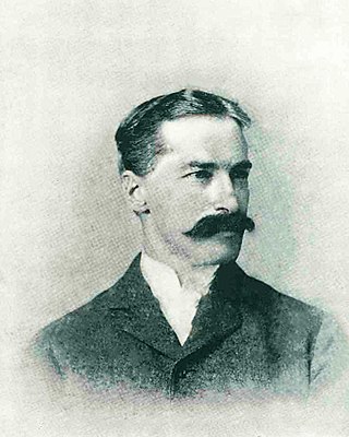
Richard Urquhart Goode was an American geographer and topographer with the United States Geological Survey (USGS) Northern Transcontinental Railroad Survey, and the Panama Canal Company. Goode was in charge of the Western Division of the USGS. which included all lands west of the Mississippi River, and worked on the boundary between the United States and Canada.

The United States Geological Survey (USGS), founded as the Geological Survey, is an agency of the U.S. Department of the Interior whose work spans the disciplines of biology, geography, geology, and hydrology. The agency was founded on March 3, 1879, to study the landscape of the United States, its natural resources, and the natural hazards that threaten it. The agency also makes maps of extraterrestrial planets and moons based on data from U.S. space probes.

The geology of New Hampshire is similar to that of the rest of New England in comprising a series of metamorphosed sedimentary and volcanic rocks of Late Proterozoic to Devonian age, intruded by many plutons and dikes ranging in age from Late Proterozoic to early Cretaceous. New Hampshire is known as "the Granite State", but less than half is underlain by granite; much of it is schist or gneiss, both of which are metamorphic rocks.

Hell for Sure Lake is an Alpine lake located in the John Muir Wilderness, which is part of the Sierra Nevada mountain range. The lake is at an elevation of 10,768 feet (3,282 m), has a few small rocky islands and is between Red Mountain to the north and Mount Hutton to the south. The Hell for Sure trail and Hell for Sure Pass both are named after this lake with the region being known for its rough terrain. The rocks the surround Hell for Sure Lake and its nearby mountains are estimated to be over 100 million years old.

Disappointment Lake is an Alpine lake located in the John Muir Wilderness, which is part of the Sierra Nevada mountain range. The lake is found by following the Hell for Sure Trail which continues up to Hell for Sure Lake and Hell for Sure Pass. Mount Hutton can be found approximately 1.35 mi (2.17 km) to the south east and Red Mountain can be found approximately 1.13 mi (1.82 km) to the northeast.


