An 1845 account said, "Pugwash Bay is one of the finest harbours in the county; the shore is so bold that vessels of 500 tons burthen may lie at all times in safety within twenty yards of it: above the channel, which is not more than a quarter of a mile wide, it becomes a beautiful basin, into which the Pugwash river discharges itself.[1]
According to Sailing Directions for Nova Scotia, Bay of Fundy, and South Shore of Gulf of St. Lawrence (1891), "Pugwash Harbor, at the head of the bay and entrance of the river of the same name, is small but quite secure, and has more than sufficient depth of water for any vessel that can pass the bar, on which the depth is 14 feet at low water, in ordinary spring tides. The bar is about 1⁄2 mile within the entrance of the bay, and a crooked channel, from 100 to 200 yards wide, and through flats of sand and weeds, for the distance of one mile, leads from it to the harbor's mouth. No directions would avail for this channel, and the assistance of one of the able pilots of the place is indispensable, and will be readily obtained in answer to the usual signal.[2]
The "schoolhouse" design Pugwash Lighthouse was built in 1871 on Fishing Point at the entrance to Pugwash Harbour. The last keeper left in 1959, and by 2017 the building was in severe disrepair.[3]
The Port of Pugwash is visited several times per year by bulk carriers used to transport product from the local salt mine.[4][5][6]
Village
The village of Pugwash (Pagwe'ak in the Mi'kmaq language) was settled in the later part of the 1700s by settlers from New England who were given land grants by the Nova Scotia government, and later by United Empire Loyalists from the newly independent United States of America. It thrived on shipbuilding and export of lumber to Europe.[7] The 1891 Sailing Directions says, "The town of Pugwash, with its wharves and small wooden English church, stands on the east side of the entrance of the harbor. Immediately within there is a fine little land-locked basin, with a depth of nearly 7 fathoms, in which vessels lie moored in security, to take in cargoes of lumber that are brought down the river."[2] The Canadian Salt Mine Company opened an underground mine in November 1959, with most of the shafts running under the river near the village. As of 2010 the mine was still in operation, although there were doubts about its long-term future.[8]
Thinker's Lodge, at the mouth of the Pugwash river, where the first Pugwash Conferences were held
Pugwash is known as the location of the first of the Pugwash Conferences on Science and World Affairs, where Bertrand Russell invited nuclear scientists from the US, USSR and other countries to discuss world peace in July 1957. The conference was held at the Thinker's Lodge, built in the 1830s and owned by the millionaire Cyrus S. Eaton, who was born in Pugwash.[9]
Estuary
The 1891 Sailing Directions says, "Pugwash River, immediately within the harbor, expands into a small lake, 11⁄2 miles long and one mile wide. On the western side the narrow channel of Lime Creek leads to quarries of limestone, unfit for building, but which supply Prince Edward Island as well as the neighboring country with lime. The river continues navigable for small vessels about 2 miles above the lake, and for boats to a distance of 7 miles from its entrance. [2] The Pugwash River Estuary is the largest estuary along Nova Scotia's Northumberland Strait shore. The shoreline is largely unspoilt, although there is some threat of vacation cottage development. The waters are unusually warm.[10]
The Pugwash river originates in various brooks that run down from the thickly forested Cobequid Mountains, which run east and west along the Cobequid Isthmus and rise to an elevation of about 1,000 feet (300m).[12] The river rises just south of Highway 104, to the southeast of Oxford. It runs in a northeast direction to Pugwash, a distance of 20 kilometres (12mi) as the crow flies. The river flows past Birchwood, Hansford and East Hansford, where it receives the outflow from McPherson Lake. It starts to broaden out near Conns Mill, and turns north, then east, then north again before entering Pugwash Basin to the south of Pugwash village.[13]
An October 1881 report said that large shoals of alewife herring (gaspereaux) had been seen in the tideway the previous spring. However, 5 miles (8.0km) up the river, just at the tideway, the river was dammed for McPherson's saw mill. There was no ladder or other way for fish to get up the river past the 8 feet (2.4m) dam.[14] It went on, "There are 8 miles of good water between this point and McArthur's saw mill at the foot of McArthur's Lake, but at present, denied both to salmon and gaspereaux. Large shoals of the latter, I am told, were seen in the tide-way last spring. I cannot think they could spawn below the mill, for the water, when I saw it, was thick with sawdust and buckwheat shells. McArthur's dam is without a ladder."[14]
In 1891 the Pugwash fisheries overseer A.M. Wills reported that the smelt fishery in his division was almost a failure. The run was abundant but the fish were too small for market.[15] His report noted, "The main abuses to the fisheries were caused by mill refuse, old trees and sawdust. All the oysters taken in this division were caught in Pugwash River. and men who were raking there reported acres of grounds in the river so covered with sawdust they could not get their rakes down. There are three fish-ways in this division—one at Doyle's mills, and two on the Shinimicas. That at Somer's mills is in good order, but the one in McPherson's mills is choked. A fishway is required in Comer's mill-dam, on the Pugwash River."[16]
Zwicker, Gwen; Veinotte, Cheryl; Marlin, Amanda (September 2010), Pugwash and Area Community Master Plan, Mount Allison University, retrieved 2018-06-07
The Bay of Fundy is a bay between the Canadian provinces of New Brunswick and Nova Scotia, with a small portion touching the U.S. state of Maine. Its extremely high tidal range is the highest in the world. The name is likely a corruption of the French word fendu, meaning 'split'.
The Charles River is an 80-mile-long (129 km) river in eastern Massachusetts. It flows northeast from Hopkinton to Boston along a highly meandering route, that doubles back on itself several times and travels through 23 cities and towns before reaching the Atlantic Ocean. The native Massachusett tribe named it Quinobequin, meaning "meandering".
Cumberland County is a county in the Canadian province of Nova Scotia.
Pugwash is an incorporated village in Cumberland County, Nova Scotia, Canada, located on the Northumberland Strait at the mouth of the Pugwash River. It had a population of 746 as of the 2021 census. The name Pugwash is derived from the Mi'kmaq word, Pakwesk meaning "a shoal", in reference to a reef near the mouth of the harbour.
Springhill is a community located in central Cumberland County, Nova Scotia, Canada.
The Minas Basin is an inlet of the Bay of Fundy and a sub-basin of the Fundy Basin located in Nova Scotia, Canada. It is known for its extremely high tides.
Cobequid Bay is an inlet of the Bay of Fundy and the easternmost part of the Minas Basin, located in the Canadian province of Nova Scotia. The bay was carved by rivers flowing into the eastern end of the Bay of Fundy.
Great Village is a rural community of approximately 500 people located along Trunk 2 and the north shore of Cobequid Bay in Colchester County, Nova Scotia. It is considered locally to incorporate the areas of Highland Village to the west and Scrabble Hill to the north northwest.
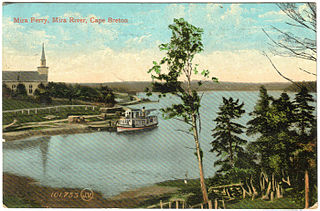
The Mira River is a Canadian river located in eastern Cape Breton Island, Nova Scotia.
The Chignecto-Central Regional Centre for Education is a Canadian public school district in Nova Scotia.
Theodore Tugboat is a Canadian children's television series about a tugboat named Theodore who lives in the Big Harbour with all of his friends. The show originated in Halifax, Nova Scotia, Canada as a co-production between the CBC, and the now defunct Cochran Entertainment, and was filmed on a model set using radio controlled tugboats, ships, and machinery. Production of the show ended in 2001, and its distribution rights were later sold to Classic Media. The show premiered in Canada on CBC Television, then went to PBS, was on Qubo in the United States, and has appeared in eighty different countries.
The Glooscap Trail is a scenic roadway in the Canadian province of Nova Scotia.
River John is a river in Nova Scotia. Draining the extreme western part of Pictou County, it flows into Amet Sound on the Northumberland Strait at River John, a village which takes its name from the river. The Miꞌkmaq name is Kajeboogwek. An early name was Deception River. Its present name is believed to derive from Rivière Jaune, an Acadian name, though it may also derive from nearby Cap Jean. DesBarres called it River John in his Atlantic Neptune.
The Sheepscot River is a 66-mile-long (106 km) river in the U.S. state of Maine. Its lower portion is a complex island estuary with connections to the Kennebec River downstream of Merrymeeting Bay.
The Digby Gut is a narrow channel connecting the Bay of Fundy with the Annapolis Basin. The town of Digby, Nova Scotia is located on the inner portion of the western side of the Gut. The eastern entrance is marked by the Point Prim Lighthouse. Strong tidal currents, numerous rocky ledges, frequent fogs and unpredictable winds make it a dangerous passage requiring a pilot or local knowledge. Tide flows create 5 knot tidal currents and create numerous whirlpools and eddies. The gut is about a half nautical mile in width and bordered by high rocky cliffs. It marks a break in the North Mountain ridge along the Annapolis Valley and is the eastern end of Digby Neck. Digby Gut had its origins as the northern terminus of the ancient Bear River, part of which is now a drowned river valley.
The Bay of Fundy campaign occurred during the French and Indian War when the British ordered the Expulsion of the Acadians from Acadia after the Battle of Fort Beauséjour (1755). The campaign started at Chignecto and then quickly moved to Grand-Pré, Rivière-aux-Canards, Pisiguit, Cobequid, and finally Annapolis Royal. Approximately 7,000 Acadians were deported to the New England colonies.
Wilkie Sugar Loaf is a Canadian peak in the Cape Breton Highlands near the community of Sugar Loaf in the province of Nova Scotia.
The Gaspereau River is a river in Kings County, Nova Scotia, Canada.
Pictou Harbour is a natural harbour in Nova Scotia on the Northumberland Strait.
This page is based on this Wikipedia article Text is available under the CC BY-SA 4.0 license; additional terms may apply. Images, videos and audio are available under their respective licenses.