
Wallace is a rural community in Cumberland County, Nova Scotia, Canada.

St. Mary's Cathedral Basilica is a Gothic Revival Catholic cathedral located in downtown Halifax, Nova Scotia, Canada. It is the cathedral church of the Archdiocese of Halifax and is the largest Catholic church in the Archdiocese. Consecrated on October 19, 1899, it was made a basilica in 1950 by Pope Pius XII. The St. Mary's Cathedral Basilica boasts the tallest granite spire in North America.

The Annapolis River is a Canadian river located in Nova Scotia's Annapolis Valley.

The Diocese of Nova Scotia and Prince Edward Island is a diocese of the Ecclesiastical Province of Canada of the Anglican Church of Canada. It encompasses the provinces of Nova Scotia and Prince Edward Island and has two cathedrals: All Saints' in Halifax and St. Peter's in Charlottetown. It is the oldest Anglican diocese outside the British Islands. Its de facto see city is Halifax, and its roughly 24 400 Anglicans distributed in 239 congregations are served by approximately 153 clergy and 330 lay readers according to the last available data. According to the 2001 census, 120,315 Nova Scotians identified themselves as Anglicans, while 6525 Prince Edward Islanders did the same.

The Shubenacadie River is a river in Nova Scotia, Canada. It has a meander length of approximately 72 km from its source at Shubenacadie Grand Lake to its mouth at the historic seaport village of Maitland on Cobequid Bay, site of the building of the William D. Lawrence, the largest wooden ship ever built in Canada. In 2009, the I Backpack Canada blog named the Shubenacadie one of the top five whitewater rivers in Canada. The lower 30 km of the river is tidal and the river experiences a tidal bore twice daily, with some bores reaching up to 3 m in height at certain points along the river. Local tourism operators offer adventure seekers a chance to ride with the bore on high-horse power Zodiac Hurricanes. Tidal Bore Rafting was invented at the Tidal Bore Rafting Resort by H. Knoll. It is also a popular surfing spot for experienced Sea Kayakers.
Route 301 is a collector road in the Canadian province of Nova Scotia.
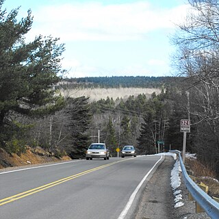
Route 321 is a collector road in the Canadian province of Nova Scotia.
Westphal is an unincorporated suburban and rural community located in Dartmouth, Nova Scotia and outside of Dartmouth, Nova Scotia. Some of Westphal is considered part of Dartmouth, Nova Scotia and some of it is considered separate from Dartmouth, Nova Scotia. The area is bound by Port Wallace in the north, Waverley Road in the west, Lake Major Road in the east and Main Street in the south. The area also includes the watershed and water filtration plant for the Halifax Regional Water Commission that supplies drinking water for the residents of Dartmouth and surrounding communities east of Halifax Harbour. It is named after two Westphal brothers who became admirals in the British navy and who hailed from this part of Nova Scotia - George Augustus Westphal and his younger brother Philip. Their surname is of German origin.
Little Sackville River is a river in Halifax Regional Municipality, Nova Scotia, Canada.
West Branch River John is a community in the Canadian province of Nova Scotia, located in Pictou County.
Port Howe is a community in the Canadian province of Nova Scotia, located in Cumberland County. The community is named after William Howe, 5th Viscount Howe.
Little River is a community in the Canadian province of Nova Scotia, located in Cumberland County.
North River is a community in the Canadian province of Nova Scotia, located in Colchester County.
Port Philip is a community in the Canadian province of Nova Scotia, located in Cumberland County.
Kolbec is a community in the Canadian province of Nova Scotia, located in Cumberland County. Most of the community lies on Route 301.
There are various Black Lakes in Nova Scotia, Canada. They vary widely in size, depth and usability. Many counties, such as Cumberland, Halifax, Inverness, and Pictou Counties have more than one Black Lake so named, while other counties mentioned in this article have only one named Black Lake.

The Stewiacke River is a river in the Canadian province of Nova Scotia that starts at Round Lake in Pictou County and flows into the Shubenacadie River in Colchester County running through the Stewiacke Valley.
Baie Verte is a 770 km2 (300 sq mi) Canadian bay located on the north shore of Nova Scotia and eastern shore of New Brunswick. It is a sub-basin of the Northumberland Strait.


