
The Hjortspring boat is a vessel designed as a large canoe, from the Scandinavian Pre-Roman Iron Age. It was built circa 400–300 BC. The hull and remains were rediscovered and excavated in 1921–1922 from the bog of Hjortspring Mose on the island of Als in Sønderjylland, southern Denmark. The boat is the oldest find of a wooden plank ship in Scandinavia and it closely resembles the thousands of petroglyph images of Nordic Bronze Age ships found throughout Scandinavia. The vessel is a clinker-built wooden boat of more than 19 metres length overall, 13.6 metres long inside, and 2 metres wide. Ten thwarts that could have served as seats, span the boat with room for two persons each; this suggests space for a crew of at least 20 who propelled the boat with paddles. The boat would have weighed an estimated 530 kilograms, making it easily portable by its crew.

De Meern is an urbanized village in the Dutch province of Utrecht. It is a part of the municipality of Utrecht, and is located at 6 km west of the inner city of this town. Before 2001 the villages De Meern, Vleuten and Haarzuilens formed a municipality called Vleuten-De Meern. On 1 January 2001, it was incorporated in the municipality of Utrecht. Since 1999 the number of inhabitants of De Meern has increased from about 11,000 to almost 22,000 in 2020.

Leidsche Rijn is a new construction site and neighborhood in Utrecht, the capital of the Dutch province of Utrecht. The area is located west of the Amsterdam–Rhine Canal and its name is derived from the Leidse Rijn canal, which runs through it. At the time of its inception in the 1990s and in the decades that followed, Leidsche Rijn was the largest Vinex location in the Netherlands. Most of this location was on the territory of the former municipality of Vleuten-De Meern, located west of the city of Utrecht. A smaller part of this location, namely the area of Hoge and Lage Weide, was located in the municipality of Utrecht.

Porolissum was an ancient Roman city in Dacia. Established as a military fort in 106 during Trajan's Dacian Wars, the city quickly grew through trade with the native Dacians and became the capital of the province Dacia Porolissensis in 124. It is one of the largest and best-preserved archaeological sites in modern-day Romania from the Roman Era. It is 8 km away from the modern city of Zalău, in Moigrad-Porolissum village, Mirsid Commune, Sălaj County.
Edgerton Alvord Throckmorton, known as Peter Throckmorton, was an American photojournalist and a pioneer underwater archaeologist.

Anglo-Saxon glass has been found across England during archaeological excavations of both settlement and cemetery sites. Glass in the Anglo-Saxon period was used in the manufacture of a range of objects including vessels, beads, windows and was even used in jewellery. In the 5th century AD with the Roman departure from Britain, there were also considerable changes in the usage of glass. Excavation of Romano-British sites have revealed plentiful amounts of glass but, in contrast, the amount recovered from 5th century and later Anglo-Saxon sites is minuscule.

A dolium is a large earthenware vase or vessel used in ancient Roman times for storage or transportation of goods. They are similar to kvevri, large Georgian vessels used to ferment wine.

Fectio, known as Vechten in Old Dutch, was a Roman castellum in the province Germania Inferior established in the year 4 or 5 AD. It was located at the place where the river Vecht (Fectio) branched off from the Rhine, leading to Lake Flevo, which was later to become the Zuiderzee. This was near the modern hamlet of Vechten in the municipality Bunnik, Utrecht, Netherlands.
Diana Fort is a Roman fort located near the hamlet of Karataš, 8 km northwest of Kladovo, in eastern Serbia in the Karataš archaeological site. It is located on cliffs of the Đerdap, above the Danube, on a strategic location overlooking the Danube frontier. It has been extensively excavated, is one of the best explored forts of the Moesian Limes, and can be visited today.

Dalheim Ricciacum is the site of a Gallo-Roman vicus at Dalheim in south eastern Grand Duchy of Luxembourg. Founded during the reign of the Emperor Augustus, the site was at a strategic point on the Via Agrippa, the main Roman road from the Mediterranean to the Rhine. The well-preserved theatre dating from the 2nd century AD could accommodate 3,500 people.
Praetorium Agrippinae was a Roman settlement in the province of Lower Germania, in the area of the Cananefates, located in modern-day Valkenburg, Netherlands. It was an army encampment on the Old Rhine, on the northern border of the Roman Empire, the limes. Praetorium Agrippinae is mentioned on the Tabula Peutingeriana between the castella of Matilo in the east and Lugdunum Batavorum to the west.
Albaniana was the name the ancient Romans gave a settlement on the southern banks of Rhine river, some 40 kilometers from its mouth in the North Sea, known as Alfen and modern-day Alphen aan den Rijn, Netherlands. They did build a military fort there, as part of a range strategically built encampments, to protect and guard the river, frontier (limes) of the Roman empire and main transport route of goods and troops. The historical map Tabula Peutingeriana situates the settlement in between Matilo (Leiden) and Praetorium Agrippinae (Valkenburg) downstream and Nigrum Pullum (Zwammerdam) and Fectio (Vechten) upstream. The village was mentioned in Antoninus' register of roads Itinerarium Antonini from the 3rd century. The fortress must have been surrounded by a wall of ground and wooden poles, with gates and watch towers.

Arles Rhône 3 is an ancient Roman boat discovered in 2004, with parts of it only 13 feet (3.96 m) below the surface in the Rhône River of Arles, France. In the 1st century AD, it had been a 102 feet (31.09 m) long river trading vessel. It has been displayed since 2013 at the Musée départemental Arles antique. A marble Neptune was also discovered in the river, and divers recovered many amphorae. The boat's flat bottom was made of oak planks.
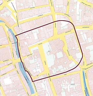
Traiectum was a Roman fort, on the frontier of the Roman Empire in Germania Inferior. The remains of the fort are in the center of Utrecht, Netherlands, which takes its name from the fort.
The following is a timeline of the history of the municipality of Utrecht, Netherlands.

Archaeology is promoted in Jersey by the Société Jersiaise and by Jersey Heritage. Promotion in the Bailiwick of Guernsey being undertaken by La Société Guernesiaise, Guernsey Museums, the Alderney Society with World War II work also undertaken by Festung Guernsey.
Fleur Kemmers is the Lichtenberg Professor for Coinage and Money in the Graeco-Roman World at Goethe University, Frankfurt.

The Marsala Punic shipwreck is a third-century-BC shipwreck of two Punic ships. The wreck was discovered in 1969, off the shore of Isola Lunga, not far from Marsala on the western coast of Sicily. It was excavated from 1971 onwards. The excavation, led by Honor Frost and her team, lasted four years and revealed a substantial portion of the hull structure.

Ancient Rome had a variety of ships that played crucial roles in its military, trade, and transportation activities. Rome was preceded in the use of the sea by other ancient, seafaring civilizations of the Mediterranean. The galley was a long, narrow, highly maneuverable ship powered by oarsmen, sometimes stacked in multiple levels such as biremes or triremes, and many of which also had sails. Initial efforts of the Romans to construct a war fleet were based on copies of Carthaginian warships. In the Punic wars in the mid-third century BCE, the Romans were at first outclassed by Carthage at sea, but by 256 BCE had drawn even and fought the wars to a stalemate. In 55 BCE Julius Caesar used warships and transport ships to invade Britain. Numerous types of transport ships were used to carry foodstuffs or other trade goods around the Mediterranean, many of which did double duty and were pressed into service as warships or troop transports in time of war.


