Cross sea

Last updated
Cross swell at Ile de Re, France. The waves themselves are examples of cnoidal waves. Ile de re.JPG
Cross swell at Île de Ré, France. The waves themselves are examples of cnoidal waves.
Cross sea near Lisbon, Portugal. Cross sea near Lisbon, Portugal - April 2019.jpg
Cross sea near Lisbon, Portugal.

A cross sea (also referred to as a squared sea or square waves [lower-alpha 1] ) is a sea state of wind-generated ocean waves that form nonparallel wave systems. Cross seas have a large amount of directional spreading. [1] This may occur when water waves from one weather system continue despite a shift in wind. Waves generated by the new wind run at an angle to the old.

Two weather systems that are far from each other may create a cross sea when the waves from the systems meet at a place far from either weather system. Until the older waves have dissipated, they can present a perilous sea hazard. [2]

This sea state is fairly common and a large percentage of ship accidents have been found to occur in this state. [3] Vessels fare better against large waves when sailing directly perpendicular to oncoming surf. In a cross sea scenario, that becomes impossible as sailing into one set of waves necessitates sailing parallel to the other. [4]
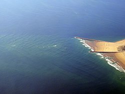
A cross swell is generated when the wave systems are longer-period swells, rather than short-period wind-generated waves. [5]

Notes

  1. Not to be confused with square wave, a waveform.

Related Research Articles

<span class="mw-page-title-main">Sailing</span> Propulsion of a vehicle by wind power

Sailing employs the wind—acting on sails, wingsails or kites—to propel a craft on the surface of the water, on ice (iceboat) or on land over a chosen course, which is often part of a larger plan of navigation.

<span class="mw-page-title-main">Tsunami</span> Series of water waves caused by the displacement of a large volume of a body of water

A tsunami is a series of waves in a water body caused by the displacement of a large volume of water, generally in an ocean or a large lake. Earthquakes, volcanic eruptions and other underwater explosions above or below water all have the potential to generate a tsunami. Unlike normal ocean waves, which are generated by wind, or tides, which are in turn generated by the gravitational pull of the Moon and the Sun, a tsunami is generated by the displacement of water from a large event.

<span class="mw-page-title-main">Low-pressure area</span> Area with air pressures lower than adjacent areas

In meteorology, a low-pressure area, low area or low is a region where the atmospheric pressure is lower than that of surrounding locations. Low-pressure areas are commonly associated with inclement weather, while high-pressure areas are associated with lighter winds and clear skies. Winds circle anti-clockwise around lows in the northern hemisphere, and clockwise in the southern hemisphere, due to opposing Coriolis forces. Low-pressure systems form under areas of wind divergence that occur in the upper levels of the atmosphere (aloft). The formation process of a low-pressure area is known as cyclogenesis. In meteorology, atmospheric divergence aloft occurs in two kinds of places:

<span class="mw-page-title-main">Trade winds</span> Equatorial east-to-west prevailing winds

The trade winds or easterlies are permanent east-to-west prevailing winds that flow in the Earth's equatorial region. The trade winds blow mainly from the northeast in the Northern Hemisphere and from the southeast in the Southern Hemisphere, strengthening during the winter and when the Arctic oscillation is in its warm phase. Trade winds have been used by captains of sailing ships to cross the world's oceans for centuries. They enabled European colonization of the Americas, and trade routes to become established across the Atlantic Ocean and the Pacific Ocean.

<span class="mw-page-title-main">Wind wave</span> Surface waves generated by wind on open water

In fluid dynamics, a wind wave, or wind-generated water wave, is a surface wave that occurs on the free surface of bodies of water as a result of the wind blowing over the water's surface. The contact distance in the direction of the wind is known as the fetch. Waves in the oceans can travel thousands of kilometers before reaching land. Wind waves on Earth range in size from small ripples to waves over 30 m (100 ft) high, being limited by wind speed, duration, fetch, and water depth.

<span class="mw-page-title-main">Sea state</span> The general condition of the free surface on a large body of water

In oceanography, sea state is the general condition of the free surface on a large body of water—with respect to wind waves and swell—at a certain location and moment. A sea state is characterized by statistics, including the wave height, period, and spectrum. The sea state varies with time, as the wind and swell conditions change. The sea state can be assessed either by an experienced observer or by using instruments like weather buoys, wave radar or remote sensing satellites.

This article describes severe weather terminology used by the National Weather Service (NWS) in the United States. The NWS, a government agency operating as an arm of the National Oceanic and Atmospheric Administration (NOAA) branch of the United States Department of Commerce (DoC), defines precise meanings for nearly all of its weather terms.

<span class="mw-page-title-main">Tehuantepecer</span> Violent mountain-gap wind traveling through Chivela Pass

Tehuantepecer, or Tehuano wind, is a violent mountain-gap wind that travels through the Chivela Pass in southern Mexico, across the Isthmus of Tehuantepec. It is most common between October and February, with a summer minimum in July. It originates from eastern Mexico and the Bay of Campeche as a post-frontal northerly wind, accelerated southward by cold air damming, that crosses the isthmus and blows through the gap between the Mexican and Guatemalan mountains. The term dates back to at least 1929. This wind can reach gale, storm, even hurricane force. The leading edge of its outflow may form rope cloud over the Gulf of Tehuantepec. These winds can be observed on satellite pictures such as scatterometer wind measurements, they influence waves which then propagate as swell and are sometimes observed 1,600 km (1,000 mi) away. These strong winds bring cooler sub-surface waters to the surface of the tropical eastern Pacific Ocean and may last from a few hours to 6 days.

<span class="mw-page-title-main">Mesoscale convective system</span> Complex of thunderstorms organized on a larger scale

A mesoscale convective system (MCS) is a complex of thunderstorms that becomes organized on a scale larger than the individual thunderstorms but smaller than extratropical cyclones, and normally persists for several hours or more. A mesoscale convective system's overall cloud and precipitation pattern may be round or linear in shape, and include weather systems such as tropical cyclones, squall lines, lake-effect snow events, polar lows, and mesoscale convective complexes (MCCs), and generally forms near weather fronts. The type that forms during the warm season over land has been noted across North and South America, Europe, and Asia, with a maximum in activity noted during the late afternoon and evening hours.

<span class="mw-page-title-main">Swell (ocean)</span> Series of waves generated by distant weather systems

A swell, also sometimes referred to as ground swell, in the context of an ocean, sea or lake, is a series of mechanical waves that propagate along the interface between water and air under the predominating influence of gravity, and thus are often referred to as surface gravity waves. These surface gravity waves have their origin as wind waves, but are the consequence of dispersion of wind waves from distant weather systems, where wind blows for a duration of time over a fetch of water, and these waves move out from the source area at speeds that are a function of wave period and length. More generally, a swell consists of wind-generated waves that are not greatly affected by the local wind at that time. Swell waves often have a relatively long wavelength, as short wavelength waves carry less energy and dissipate faster, but this varies due to the size, strength, and duration of the weather system responsible for the swell and the size of the water body, and varies from event to event, and from the same event, over time. Occasionally, swells that are longer than 700m occur as a result of the most severe storms.

<span class="mw-page-title-main">Rock fishing</span>

Rock fishing is fishing from rocky outcrops into the sea. It is a popular pastime in Australia and New Zealand. It can be dangerous and many people have died. This may improve as more people who are rock fishing are beginning to wear life jackets.

In physical oceanography, the significant wave height (SWH, HTSGW or Hs) is defined traditionally as the mean wave height (trough to crest) of the highest third of the waves (H1/3). It is usually defined as four times the standard deviation of the surface elevation – or equivalently as four times the square root of the zeroth-order moment (area) of the wave spectrum. The symbol Hm0 is usually used for that latter definition. The significant wave height (Hs) may thus refer to Hm0 or H1/3; the difference in magnitude between the two definitions is only a few percent. SWH is used to characterize sea state, including winds and swell.

<span class="mw-page-title-main">Severe weather</span> Any dangerous meteorological phenomenon

Severe weather is any dangerous meteorological phenomenon with the potential to cause damage, serious social disruption, or loss of human life. Types of severe weather phenomena vary, depending on the latitude, altitude, topography, and atmospheric conditions. High winds, hail, excessive precipitation, and wildfires are forms and effects of severe weather, as are thunderstorms, downbursts, tornadoes, waterspouts, tropical cyclones, and extratropical cyclones. Regional and seasonal severe weather phenomena include blizzards (snowstorms), ice storms, and duststorms.

<span class="mw-page-title-main">Surface weather observation</span> Fundamental data used for weather forecasts

Surface weather observations are the fundamental data used for safety as well as climatological reasons to forecast weather and issue warnings worldwide. They can be taken manually, by a weather observer, by computer through the use of automated weather stations, or in a hybrid scheme using weather observers to augment the otherwise automated weather station. The ICAO defines the International Standard Atmosphere (ISA), which is the model of the standard variation of pressure, temperature, density, and viscosity with altitude in the Earth's atmosphere, and is used to reduce a station pressure to sea level pressure. Airport observations can be transmitted worldwide through the use of the METAR observing code. Personal weather stations taking automated observations can transmit their data to the United States mesonet through the Citizen Weather Observer Program (CWOP), the UK Met Office through their Weather Observations Website (WOW), or internationally through the Weather Underground Internet site. A thirty-year average of a location's weather observations is traditionally used to determine the station's climate. In the US a network of Cooperative Observers make a daily record of summary weather and sometimes water level information.

<span class="mw-page-title-main">Wind</span> Natural movement of air or other gases relative to a planets surface

Wind is the natural movement of air or other gases relative to a planet's surface. Winds occur on a range of scales, from thunderstorm flows lasting tens of minutes, to local breezes generated by heating of land surfaces and lasting a few hours, to global winds resulting from the difference in absorption of solar energy between the climate zones on Earth. The two main causes of large-scale atmospheric circulation are the differential heating between the equator and the poles, and the rotation of the planet. Within the tropics and subtropics, thermal low circulations over terrain and high plateaus can drive monsoon circulations. In coastal areas the sea breeze/land breeze cycle can define local winds; in areas that have variable terrain, mountain and valley breezes can prevail.

<span class="mw-page-title-main">Shipwrecking</span> Event causing a ship to wreck

Shipwrecking is an event that causes a shipwreck, such as a ship striking something that causes the ship to sink; the stranding of a ship on rocks, land or shoal; poor maintenance, resulting in a lack of seaworthiness; or the destruction of a ship either intentionally or by violent weather.

Kallakadal/Swell surge are flash flood events that take place without any noticeable advance change in local winds or any other apparent signature in the coastal environment. It is derived from a Malayalam word literally meaning 'sea-thief'. Kallakkadal event is considered as one of the major societal problems along the Indian coasts and these are caused by high swell waves, without any sign in the local winds, sometimes cause severe flooding.

<span class="mw-page-title-main">Marine weather forecasting</span> Forecasts of weather conditions at sea

Marine weather forecasting is the process by which mariners and meteorological organizations attempt to forecast future weather conditions over the Earth's oceans. Mariners have had rules of thumb regarding the navigation around tropical cyclones for many years, dividing a storm into halves and sailing through the normally weaker and more navigable half of their circulation. Marine weather forecasts by various weather organizations can be traced back to the sinking of the Royal Charter in 1859 and the RMS Titanic in 1912.

<span class="mw-page-title-main">Cyclone Sose</span> Category 2 South Pacific cyclone in 2001

Tropical Cyclone Sose was a moderate storm system that chiefly impacted the island nation of Vanuatu in early April 2001. The developing cyclone was first detected on April 3, while situated well to the northeast of Vanuatu. As atmospheric conditions became more conducive to intensification, the disturbance gradually consolidated as it drifted toward the west-southwest. After receiving the name Sose on April 5, the cyclone was driven southeastward, passing just west of Espiritu Santo and neighboring islands. Although it never made landfall, Sose was particularly expansive, producing a wide area of gale-force winds. The cyclone peaked in strength between April 7 and 8 with maximum 10-minute sustained winds of 110 km/h (68 mph) and 1-minute sustained winds of 130 km/h (81 mph), placing it at Category 2 intensity on the Australian tropical cyclone intensity scale. Ultimately, stronger wind shear and an increasingly hostile upper-air pattern took their toll on the cyclone as it progressed due south; Sose lost tropical characteristics to the northeast of Norfolk Island by April 12. The extratropical remnants of Sose continued into the Tasman Sea.

<span class="mw-page-title-main">Glossary of meteorology</span> List of definitions of terms and concepts commonly used in meteorology

This glossary of meteorology is a list of terms and concepts relevant to meteorology and atmospheric science, their sub-disciplines, and related fields.

References

  1. "Cross Sea". Glossary of Meteorology. American Meteorological Society . Retrieved 4 Feb 2019.
  2. "Is the Cross Sea Dangerous?". earth.esa.int. Archived from the original on 2017-08-24. Retrieved 2020-09-07.
  3. Toffoli, A.; Lefevre, J. M.; Bitner-Gregersen, E.; Monbaliu, J. (2005). "Towards the identification of warning criteria: Analysis of a ship accident database". Applied Ocean Research. 27 (6): 281–291. doi:10.1016/j.apor.2006.03.003.
  4. Xiaoming Li. "Is the Cross Sea Dangerous?". Wayback machine. Archived from the original on 2014-05-03. Retrieved 10 February 2019.
  5. Bowditch, Nathaniel (1995). "Glossary C" (PDF). The American Practical Navigator. Bethesda, MD: National Imagery and Mapping Agency. p. 758. ISBN   0-403-09895-5. Archived from the original (PDF) on 2011-07-16. Retrieved 2007-11-29.