Internal tide

Last updated

Internal tides are generated as the surface tides move stratified water up and down sloping topography, which produces a wave in the ocean interior. So internal tides are internal waves at a tidal frequency. The other major source of internal waves is the wind which produces internal waves near the inertial frequency. When a small water parcel is displaced from its equilibrium position, it will return either downwards due to gravity or upwards due to buoyancy. The water parcel will overshoot its original equilibrium position and this disturbance will set off an internal gravity wave. Munk (1981) notes, "Gravity waves in the ocean's interior are as common as waves at the sea surface-perhaps even more so, for no one has ever reported an interior calm." [1]

Contents

Simple explanation

Figure 1: Water parcels in the whole water column move together with the surface tide (top), while shallow and deep waters move in opposite directions in an internal tide (bottom). The surface displacement and interface displacement are the same for a surface wave (top), while for an internal wave the surface displacements are very small, while the interface displacements are large (bottom). This figure is a modified version of one appearing in Gill (1982). Interfacial.jpg
Figure 1: Water parcels in the whole water column move together with the surface tide (top), while shallow and deep waters move in opposite directions in an internal tide (bottom). The surface displacement and interface displacement are the same for a surface wave (top), while for an internal wave the surface displacements are very small, while the interface displacements are large (bottom). This figure is a modified version of one appearing in Gill (1982).

The surface tide propagates as a wave in which water parcels in the whole water column oscillate in the same direction at a given phase (i.e., in the trough or at the crest, Fig. 1, top). This means that while the form of the surface wave itself may propagate across the surface of the water, the fluid particles themselves are restricted to a relatively small neighborhood. Fluid moves upwards as the crest of the surface wave is passing and downwards as the trough passes. Lateral motion only serves to make up for the height difference in the water column between the crest and trough of the wave: as the surface rises at the top of the water column, water moves laterally inward from adjacent downwards-moving water columns to make up for the change in volume of the water column. While this explanation focuses on the motion of the ocean water, the phenomenon being described is in nature an interfacial wave, with mirroring processes happening on either side of the interface between two fluids: ocean water and air. At the simplest level, an internal wave can be thought of as an interfacial wave (Fig. 1, bottom) at the interface of two layers of the oceans differentiated by a change in the water's properties, such as a warm surface layer and cold deep layer separated by a thermocline. As the surface tide propagates between these two fluid layers at the ocean surface, a homologous internal wave mimics it below, forming the internal tide. The interfacial movement between two layers of ocean is large compared to surface movement because although as with surface waves, the restoring force for internal waves and tides is still gravity, its effect is reduced because the densities of the two layers are relatively similar compared to the large density difference at the air-sea interface. Thus larger displacements are possible inside the ocean than are possible at the sea surface.

Tides occur mainly at diurnal and semidiurnal periods. The principal lunar semidiurnal constituent is known as M2 and generally has the largest amplitudes. (See external links for more information.)

Location

The largest internal tides are generated at steep, midocean topography such as the Hawaiian Ridge, Tahiti, the Macquarie Ridge, and submarine ridges in the Luzon Strait. [3] Continental slopes such as the Australian North West Shelf also generate large internal tides. [4] These internal tide may propagate onshore and dissipate much like surface waves. Or internal tides may propagate away from the topography into the open ocean. For tall, steep, midocean topography, such as the Hawaiian Ridge, it is estimated that about 85% of the energy in the internal tide propagates away into the deep ocean with about 15% of its energy being lost within about 50 km of the generation site. The lost energy contributes to turbulence and mixing near the generation sites. [5] [6] It is not clear where the energy that leaves the generation site is dissipated, but there are 3 possible processes: 1) the internal tides scatter and/or break at distant midocean topography, 2) interactions with other internal waves remove energy from the internal tide, or 3) the internal tides shoal and break on continental shelves.

Propagation and dissipation

Figure 2: The internal tide sea surface elevation that is in phase with the surface tide (i.e., crests occur in a certain spot at a certain time that are both the same relative to the surface tide) can be detected by satellite (top). (The satellite track is repeated about every 10 days and so M2 tidal signals are shifted to longer periods due to aliasing.) The longest internal tide wavelengths are about 150 km near Hawaii and the next longest waves are about 75 km long. The surface displacements due to the internal tide are plotted as wiggly red lines with amplitudes plotted perpendicular to the satellite groundtracks (black lines). Figure is adapted from Johnston et al. (2003). Tpelev.jpg
Figure 2: The internal tide sea surface elevation that is in phase with the surface tide (i.e., crests occur in a certain spot at a certain time that are both the same relative to the surface tide) can be detected by satellite (top). (The satellite track is repeated about every 10 days and so M2 tidal signals are shifted to longer periods due to aliasing.) The longest internal tide wavelengths are about 150 km near Hawaii and the next longest waves are about 75 km long. The surface displacements due to the internal tide are plotted as wiggly red lines with amplitudes plotted perpendicular to the satellite groundtracks (black lines). Figure is adapted from Johnston et al. (2003).

Briscoe (1975)noted that “We cannot yet answer satisfactorily the questions: ‘where does the internal wave energy come from, where does it go, and what happens to it along the way?’” [7] Although technological advances in instrumentation and modeling have produced greater knowledge of internal tide and near-inertial wave generation, Garrett and Kunze (2007) observed 33 years later that “The fate of the radiated [large-scale internal tides] is still uncertain. They may scatter into [smaller scale waves] on further encounter with islands [8] [9] or the rough seafloor [10] , or transfer their energy to smaller-scale internal waves in the ocean interior [11] ” or “break on distant continental slopes [12] ”. [13] It is now known that most of the internal tide energy generated at tall, steep midocean topography radiates away as large-scale internal waves. This radiated internal tide energy is one of the main sources of energy into the deep ocean, roughly half of the wind energy input . [14] Broader interest in internal tides is spurred by their impact on the magnitude and spatial inhomogeneity of mixing, which in turn has first order effect on the meridional overturning circulation [3] [14] . [15]

The internal tidal energy in one tidal period going through an area perpendicular to the direction of propagation is called the energy flux and is measured in Watts/m. The energy flux at one point can be summed over depth- this is the depth-integrated energy flux and is measured in Watts/m. The Hawaiian Ridge produces depth-integrated energy fluxes as large as 10 kW/m. The longest wavelength waves are the fastest and thus carry most of the energy flux. Near Hawaii, the typical wavelength of the longest internal tide is about 150 km while the next longest is about 75 km. These waves are called mode 1 and mode 2, respectively. Although Fig. 1 shows there is no sea surface expression of the internal tide, there actually is a displacement of a few centimeters. These sea surface expressions of the internal tide at different wavelengths can be detected with the Topex/Poseidon or Jason-1 satellites (Fig. 2). [9] Near 15 N, 175 W on the Line Islands Ridge, the mode-1 internal tides scatter off the topography, possibly creating turbulence and mixing, and producing smaller wavelength mode 2 internal tides. [9]

The inescapable conclusion is that energy is lost from the surface tide to the internal tide at midocean topography and continental shelves, but the energy in the internal tide is not necessarily lost in the same place. Internal tides may propagate thousands of kilometers or more before breaking and mixing the abyssal ocean.

Abyssal mixing and meridional overturning circulation

The importance of internal tides and internal waves in general relates to their breaking, energy dissipation, and mixing of the deep ocean. If there were no mixing in the ocean, the deep ocean would be a cold stagnant pool with a thin warm surface layer. [16] While the meridional overturning circulation (also referred to as the thermohaline circulation) redistributes about 2 PW of heat from the tropics to polar regions, the energy source for this flow is the interior mixing which is comparatively much smaller- about 2 TW. [14] Sandstrom (1908) showed a fluid which is both heated and cooled at its surface cannot develop a deep overturning circulation. [17] Most global models have incorporated uniform mixing throughout the ocean because they do not include or resolve internal tidal flows.

However, models are now beginning to include spatially variable mixing related to internal tides and the rough topography where they are generated and distant topography where they may break. Wunsch and Ferrari (2004) describe the global impact of spatially inhomogeneous mixing near midocean topography: “A number of lines of evidence, none complete, suggest that the oceanic general circulation, far from being a heat engine, is almost wholly governed by the forcing of the wind field and secondarily by deep water tides... The now inescapable conclusion that over most of the ocean significant ‘vertical’ mixing is confined to topographically complex boundary areas implies a potentially radically different interior circulation than is possible with uniform mixing. Whether ocean circulation models... neither explicitly accounting for the energy input into the system nor providing for spatial variability in the mixing, have any physical relevance under changed climate conditions is at issue.” There is a limited understanding of “the sources controlling the internal wave energy in the ocean and the rate at which it is dissipated” and are only now developing some “parameterizations of the mixing generated by the interaction of internal waves, mesoscale eddies, high-frequency barotropic fluctuations, and other motions over sloping topography.”

Internal tides at the beach

Figure 3: The internal tide produces large vertical differences in temperature at the research pier at the Scripps Institution of Oceanography. The black line shows the surface tide elevation relative to mean lower low water (MLLW). Figure provided by Eric Terrill, Scripps Institution of Oceanography with funding from the U.S. Office of Naval Research Scripps internal wave T.jpg
Figure 3: The internal tide produces large vertical differences in temperature at the research pier at the Scripps Institution of Oceanography. The black line shows the surface tide elevation relative to mean lower low water (MLLW). Figure provided by Eric Terrill, Scripps Institution of Oceanography with funding from the U.S. Office of Naval Research

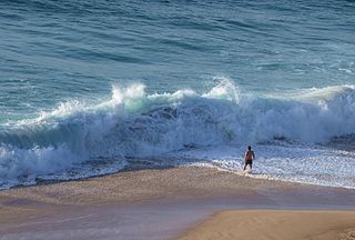
Internal tides may also dissipate on continental slopes and shelves [12] or even reach within 100 m of the beach (Fig. 3). Internal tides bring pulses of cold water shoreward and produce large vertical temperature differences. When surface waves break, the cold water is mixed upwards, making the water cold for surfers, swimmers, and other beachgoers. Surface waters in the surf zone can change by about 10 °C in about an hour.

Internal tides, internal mixing, and biological enhancement

Internal tides generated by tidal semidiurnal currents impinging on steep submarine ridges in island passages, ex: Mona Passage, or near the shelf edge, can enhance turbulent dissipation and internal mixing near the generation site. The development of Kelvin-Helmholtz instability during the breaking of the internal tide can explain the formation of high diffusivity patches that generate a vertical flux of nitrate (NO3) into the photic zone and can sustain new production locally. [18] [19] Another mechanism for higher nitrate flux at spring tides results from pulses of strong turbulent dissipation associated with high frequency internal soliton packets. [20] Some internal soliton packets are the result of the nonlinear evolution of the internal tide.

See also

Related Research Articles

<span class="mw-page-title-main">Drake Passage</span> Body of water between South America and the South Shetland Islands of Antarctica

The Drake Passage is the body of water between South America's Cape Horn, Chile, Argentina and the South Shetland Islands of Antarctica. It connects the southwestern part of the Atlantic Ocean with the southeastern part of the Pacific Ocean and extends into the Southern Ocean. The passage is named after the 16th-century English explorer and privateer Sir Francis Drake.

<span class="mw-page-title-main">Amphidromic point</span> Location at which there is little or no tide

An amphidromic point, also called a tidal node, is a geographical location which has zero tidal amplitude for one harmonic constituent of the tide. The tidal range for that harmonic constituent increases with distance from this point, though not uniformly. As such, the concept of amphidromic points is crucial to understanding tidal behaviour. The term derives from the Greek words amphi ("around") and dromos ("running"), referring to the rotary tides which circulate around amphidromic points. It was first discovered by William Whewell, who extrapolated the cotidal lines from the coast of the North Sea and found that the lines must meet at some point.
<span class="mw-page-title-main">Physical oceanography</span> Study of physical conditions and processes within the ocean

Physical oceanography is the study of physical conditions and physical processes within the ocean, especially the motions and physical properties of ocean waters.

<span class="mw-page-title-main">Thermohaline circulation</span> Part of large-scale ocean circulation

Thermohaline circulation (THC) is a part of the large-scale ocean circulation that is driven by global density gradients created by surface heat and freshwater fluxes. The adjective thermohaline derives from thermo- referring to temperature and -haline referring to salt content, factors which together determine the density of sea water. Wind-driven surface currents travel polewards from the equatorial Atlantic Ocean, cooling en route, and eventually sinking at high latitudes. This dense water then flows into the ocean basins. While the bulk of it upwells in the Southern Ocean, the oldest waters upwell in the North Pacific. Extensive mixing therefore takes place between the ocean basins, reducing differences between them and making the Earth's oceans a global system. The water in these circuits transport both energy and mass around the globe. As such, the state of the circulation has a large impact on the climate of the Earth.

<span class="mw-page-title-main">Indonesian Throughflow</span> Ocean current

The Indonesian Throughflow is an ocean current with importance for global climate as is the low-latitude movement of warm, relative freshwater from the north Pacific to the Indian Ocean. It thus serves as a main upper branch of the global heat/salt conveyor belt.

<span class="mw-page-title-main">Wind wave</span> Surface waves generated by wind on open water

In fluid dynamics, a wind wave, or wind-generated water wave, is a surface wave that occurs on the free surface of bodies of water as a result of the wind blowing over the water's surface. The contact distance in the direction of the wind is known as the fetch. Waves in the oceans can travel thousands of kilometers before reaching land. Wind waves on Earth range in size from small ripples to waves over 30 m (100 ft) high, being limited by wind speed, duration, fetch, and water depth.
<span class="mw-page-title-main">Internal wave</span> Type of gravity waves that oscillate within a fluid medium

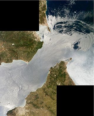
Internal waves are gravity waves that oscillate within a fluid medium, rather than on its surface. To exist, the fluid must be stratified: the density must change with depth/height due to changes, for example, in temperature and/or salinity. If the density changes over a small vertical distance, the waves propagate horizontally like surface waves, but do so at slower speeds as determined by the density difference of the fluid below and above the interface. If the density changes continuously, the waves can propagate vertically as well as horizontally through the fluid.

<span class="mw-page-title-main">Mona Passage</span> Strait that connects the Atlantic Ocean and Caribbean Sea

The Mona Passage is a strait that separates the islands of Hispaniola and Puerto Rico. The Mona Passage connects the Atlantic Ocean to the Caribbean Sea and is an important shipping route between the Atlantic and the Panama Canal.

<span class="mw-page-title-main">Walter Munk</span> American oceanographer (1917–2019)

Walter Heinrich Munk was an American physical oceanographer. He was one of the first scientists to bring statistical methods to the analysis of oceanographic data. Munk worked on a wide range of topics, including surface waves, geophysical implications of variations in the Earth's rotation, tides, internal waves, deep-ocean drilling into the sea floor, acoustical measurements of ocean properties, sea level rise, and climate change. His work won awards including the National Medal of Science, the Kyoto Prize, and induction to the French Legion of Honour.

Atmospheric tides are global-scale periodic oscillations of the atmosphere. In many ways they are analogous to ocean tides. Atmospheric tides can be excited by:

<span class="mw-page-title-main">Langmuir circulation</span> Series of shallow, slow, counter-rotating vortices at the oceans surface aligned with the wind

In physical oceanography, Langmuir circulation consists of a series of shallow, slow, counter-rotating vortices at the ocean's surface aligned with the wind. These circulations are developed when wind blows steadily over the sea surface. Irving Langmuir discovered this phenomenon after observing windrows of seaweed in the Sargasso Sea in 1927. Langmuir circulations circulate within the mixed layer; however, it is not yet so clear how strongly they can cause mixing at the base of the mixed layer.

<span class="mw-page-title-main">Outline of oceanography</span> Hierarchical outline list of articles related to oceanography

The following outline is provided as an overview of and introduction to Oceanography.
<span class="mw-page-title-main">Ocean</span> Body of salt water covering the majority of Earth

The ocean is a body of salt water that covers approximately 70.8% of the Earth and contains 97% of Earth's water. The term ocean also refers to any of the large bodies of water into which the world ocean is conventionally divided. Distinct names are used to identify five different areas of the ocean: Pacific, Atlantic, Indian, Antarctic/Southern, and Arctic. Seawater covers approximately 361,000,000 km2 (139,000,000 sq mi) of the planet. The ocean is the primary component of the Earth's hydrosphere, and thus essential to life on Earth. The ocean influences climate and weather patterns, the carbon cycle, and the water cycle by acting as a huge heat reservoir.

In seismology, a microseism is defined as a faint earth tremor caused by natural phenomena. Sometimes referred to as a "hum", it should not be confused with the anomalous acoustic phenomenon of the same name. The term is most commonly used to refer to the dominant background seismic and electromagnetic noise signals on Earth, which are caused by water waves in the oceans and lakes. Characteristics of microseism are discussed by Bhatt. Because the ocean wave oscillations are statistically homogenous over several hours, the microseism signal is a long-continuing oscillation of the ground. The most energetic seismic waves that make up the microseismic field are Rayleigh waves, but Love waves can make up a significant fraction of the wave field, and body waves are also easily detected with arrays. Because the conversion from the ocean waves to the seismic waves is very weak, the amplitude of ground motions associated to microseisms does not generally exceed 10 micrometers.
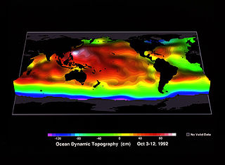
<span class="mw-page-title-main">Ocean surface topography</span> Shape of the ocean surface relative to the geoid

Ocean surface topography or sea surface topography, also called ocean dynamic topography, are highs and lows on the ocean surface, similar to the hills and valleys of Earth's land surface depicted on a topographic map. These variations are expressed in terms of average sea surface height (SSH) relative to Earth's geoid. The main purpose of measuring ocean surface topography is to understand the large-scale ocean circulation.

<span class="mw-page-title-main">Infragravity wave</span> Surface gravity waves with frequencies lower than the wind waves

Infragravity waves are surface gravity waves with frequencies lower than the wind waves – consisting of both wind sea and swell – thus corresponding with the part of the wave spectrum lower than the frequencies directly generated by forcing through the wind.

Ocean general circulation models (OGCMs) are a particular kind of general circulation model to describe physical and thermodynamical processes in oceans. The oceanic general circulation is defined as the horizontal space scale and time scale larger than mesoscale. They depict oceans using a three-dimensional grid that include active thermodynamics and hence are most directly applicable to climate studies. They are the most advanced tools currently available for simulating the response of the global ocean system to increasing greenhouse gas concentrations. A hierarchy of OGCMs have been developed that include varying degrees of spatial coverage, resolution, geographical realism, process detail, etc.

<span class="mw-page-title-main">Mediterranean outflow</span>

The Mediterranean Outflow is a current flowing from the Mediterranean Sea towards the Atlantic Ocean through the Strait of Gibraltar. Once it has reached the western side of the Strait of Gibraltar, it divides into two branches, one flowing westward following the Iberian continental slope, and another returning to the Strait of Gibraltar circulating cyclonically. In the Strait of Gibraltar and in the Gulf of Cádiz, the Mediterranean Outflow core has a width of a few tens of km. Through its nonlinear interactions with tides and topography, as it flows out of the Mediterranean basin it undergoes such strong mixing that the water masses composing this current become indistinguishable upon reaching the western side of the strait.

Tides in marginal seas are tides affected by their location in semi-enclosed areas along the margins of continents and differ from tides in the open oceans. Tides are water level variations caused by the gravitational interaction between the Moon, the Sun and the Earth. The resulting tidal force is a secondary effect of gravity: it is the difference between the actual gravitational force and the centrifugal force. While the centrifugal force is constant across the Earth, the gravitational force is dependent on the distance between the two bodies and is therefore not constant across the Earth. The tidal force is thus the difference between these two forces on each location on the Earth.

<span class="mw-page-title-main">Internal wave breaking</span> Fluid dynamics process driving mixing in the oceans

Internal wave breaking is a process during which internal gravity waves attain a large amplitude compared to their length scale, become nonlinearly unstable and finally break. This process is accompanied by turbulent dissipation and mixing. As internal gravity waves carry energy and momentum from the environment of their inception, breaking and subsequent turbulent mixing affects the fluid characteristics in locations of breaking. Consequently, internal wave breaking influences even the large scale flows and composition in both the ocean and the atmosphere. In the atmosphere, momentum deposition by internal wave breaking plays a key role in atmospheric phenomena such as the Quasi-Biennial Oscillation and the Brewer-Dobson Circulation. In the deep ocean, mixing induced by internal wave breaking is an important driver of the meridional overturning circulation. On smaller scales, breaking-induced mixing is important for sediment transport and for nutrient supply to the photic zone. Most breaking of oceanic internal waves occurs in continental shelves, well below the ocean surface, which makes it a difficult phenomenon to observe.

References

  1. Munk, W. (1981). B. A. Warren; C. Wunsch (eds.). "Internal Waves and Small-Scale Processes". Evolution of Physical Oceanography. MIT Press: 264–291.
  2. Gill, A. E. (1982). Atmosphere-ocean dynamics. Academic. pp.  662. ISBN   978-0-12-283522-3.
  3. 1 2 Simmons, H. L.; B. K. Arbic & R. W. Hallberg (2004). "Internal wave generation in a global baroclinic tide model". Deep-Sea Research Part II. 51 (25–26): 3043–3068. Bibcode:2004DSRII..51.3043S. CiteSeerX   10.1.1.143.5083 . doi:10.1016/j.dsr2.2004.09.015.
  4. Holloway, P. E. (2001). "A regional model of the semidiurnal tide on the Australian North West Shelf". J. Geophys. Res. 106 (C9): 19, 625–19, 638. Bibcode:2001JGR...10619625H. doi: 10.1029/2000jc000675 .
  5. Carter, G. S.; Y. L. Firing; M. A. Merrifield; J. M. Becker; K. Katsumata; M. C. Gregg; D. S. Luther; M. D. Levine & T. J. Boyd (2008). "Energetics of M2 Barotropic-to-Baroclinic Tidal Conversion at the Hawaiian Islands". J. Phys. Oceanogr. 38 (10): 2205–2223. Bibcode:2008JPO....38.2205C. doi: 10.1175/2008JPO3860.1 .
  6. Klymak, J. M.; M. C. Gregg; J. N. Moum; J. D. Nash; E. Kunze; J. B. Girton; G. S. Carter; C. M. Lee & T. B. Sanford (2006). "An Estimate of Tidal Energy Lost to Turbulence at the Hawaiian Ridge". J. Phys. Oceanogr. 36 (6): 1148–1164. Bibcode:2006JPO....36.1148K. doi: 10.1175/JPO2885.1 .
  7. Briscoe, M. (1975). "Introduction to a collection of papers on oceanographic internal waves". J. Geophys. Res. 80 (3): 289–290. Bibcode:1975JGR....80..289B. doi:10.1029/JC080i003p00289.
  8. Johnston, T. M. S.; M. A. Merrifield (2003). "Internal tide scattering at seamounts, ridges and islands". J. Geophys. Res. 108. (C6) 3126 (C6): 3180. Bibcode:2003JGRC..108.3180J. doi: 10.1029/2002JC001528 .
  9. 1 2 3 Johnston, T. M. S.; P. E. Holloway & M. A. Merrifield (2003). "Internal tide scattering at the Line Islands Ridge". J. Geophys. Res. 108. (C11) 3365 (C11): 3365. Bibcode:2003JGRC..108.3365J. doi: 10.1029/2003JC001844 .
  10. St. Laurent; L. C.; C. Garrett (2002). "The Role of Internal Tides in Mixing the Deep Ocean". J. Phys. Oceanogr. 32 (10): 2882–2899. Bibcode:2002JPO....32.2882S. doi: 10.1175/1520-0485(2002)032<2882:TROITI>2.0.CO;2 . ISSN   1520-0485.
  11. MacKinnon, J. A.; K. B. Winters (2005). "Subtropical catastrophe: Significant loss of low-mode tidal energy at 28.9 degrees". Geophys. Res. Lett. 32 (15): L15605. Bibcode:2005GeoRL..3215605M. doi: 10.1029/2005GL023376 . S2CID   54573466.
  12. 1 2 Nash, J. D.; R.W. Schmitt; E. Kunze & J.M. Toole (2004). "Internal tide reflection and turbulent mixing on the continental slope". J. Phys. Oceanogr. 34 (5): 1117–1134. Bibcode:2004JPO....34.1117N. doi: 10.1175/1520-0485(2004)034<1117:ITRATM>2.0.CO;2 . ISSN   1520-0485.
  13. Garrett, C.; E. Kunze (2007). "Internal tide generation in the deep ocean". Annu. Rev. Fluid Mech. 39 (1): 57–87. Bibcode:2007AnRFM..39...57G. doi:10.1146/annurev.fluid.39.050905.110227.
  14. 1 2 3 Wunsch, C.; R. Ferrari (2004). "Vertical mixing, energy, and the general circulation of the ocean". Annu. Rev. Fluid Mech. 36 (1): 281–314. Bibcode:2004AnRFM..36..281W. CiteSeerX   10.1.1.394.8352 . doi:10.1146/annurev.fluid.36.050802.122121.
  15. Munk, W.; Wunsch, C. (1998). "Abyssal recipes II: Energetics of tidal and wind mixing". Deep-Sea Research. 45 (12): 1977–2010. Bibcode:1998DSRI...45.1977M. doi:10.1016/S0967-0637(98)00070-3.
  16. Munk, W. (1966). "Abyssal recipes". Deep-Sea Research. 13 (4): 707–730. Bibcode:1966DSRA...13..707M. doi:10.1016/0011-7471(66)90602-4.
  17. Sandstrom, J. W. (1908). "Dynamische Versuche mit Meerwasser". Ann. Hydrodyn. Marine Meteorology: 6.
  18. Alfonso-Sosa, E. (2002). Variabilidad temporal de la producción primaria fitoplanctonica en la estación CaTS (Caribbean Time-Series Station): Con énfasis en el impacto de la marea interna semidiurna sobre la producción (PDF). Ph. D. Dissertation. Department of Marine Sciences, University of Puerto Rico, Mayagüez, Puerto Rico. UMI publication AAT 3042382. p. 407. Retrieved 2014-08-25.
  19. Alfonso-Sosa, E.; J. Morell; J. M. Lopez; J. E. Capella & A. Dieppa (2002). "Internal Tide-induced Variations in Primary Productivity and Optical Properties in the Mona Passage, Puerto Rico" (PDF). Retrieved 2015-01-01.
  20. Sharples, J.; V. Krivtsov; J. F. Tweddle; J. A. M. Green; M. R. Palmer; Y. Kim; A. E. Hickman; P. M. Holligan; C. M. Moore; T. P. Rippeth & J. H. Simpson (2007). "Spring–neap modulation of internal tide mixing and vertical nitrate fluxes at a shelf edge in summer". Limnol. Oceanogr. 52 (5): 1735–1747. Bibcode:2007LimOc..52.1735S. doi: 10.4319/lo.2007.52.5.1735 .