Windward Islands Bovenwindse Eilanden (Dutch) | |
---|---|
Geography | |
Location | Leeward Islands Lesser Antilles Caribbean Sea |
Coordinates | 18°01′00″N63°02′00″W / 18.0167°N 63.0333°W |
Total islands | 3 |
Major islands | Saba Saint Martin Sint Eustatius |
Demographics | |
Population | ~50.000 (2024 estimate) |
Languages |
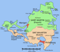
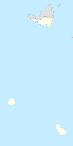
The SSS islands (Dutch : SSS-eilanden), locally also known as the Windward Islands (Bovenwindse Eilanden or Bovenwinden), is a collective term for the three territories of the Dutch Caribbean (formerly the Netherlands Antilles) that are located within the Leeward Islands group of the Lesser Antilles in the Caribbean Sea. [1] [2] [3] In order of population size, they are: Sint Maarten, Sint Eustatius, and Saba. In some contexts, the term is also used to refer to the entire island of Saint Martin (which also includes the Collectivity of Saint Martin), alongside Sint Eustatius and Saba.
The SSS islands were island territories of the Netherlands Antilles, until its dissolution in 2010. Since then, Sint Maarten is a constituent country of the Kingdom of the Netherlands, while Sint Eustatius and Saba are special municipalities of the Netherlands. "SSS" is an acronym of the islands' names, and is analogous to the ABC, CAS, and BES islands, which are other commonly used subdivisions of the Dutch Caribbean.
The island of Saint Martin was split between France and the Netherlands in 1648. [4] The Dutch part, together with Sint Eustatius and Saba, became a single Dutch colony in 1815 as Sint Eustatius and Dependencies (Sint Eustatius en Onderhorigheden). [5] In 1828, this colony was merged with the colonies Curaçao and Dependencies (the ABC islands) and Surinam, with Paramaribo as its capital. [6] When this merger was partly reversed in 1845, the Dutch part of the SSS islands became part of Curaçao and Dependencies, with Willemstad as its capital. [7] This colony became the Netherlands Antilles in 1954.
As part of the Netherlands Antilles, the SSS islands initially formed a single island territory (eilandgebied) as the Windward Islands. [8] In 1983, it was split up into three separate island territories, each with a separate island council. [8] After the dissolution of the Netherlands Antilles on 10 October 2010, Sint Eustatius and Saba became special municipalities of the Netherlands, while Sint Maarten became an independent country within the Kingdom of the Netherlands. [9]
Flag | Territory | Political status | Capital | Area | Population (Jan 2019) | Population density |
---|---|---|---|---|---|---|
Saba | Special municipality of the Netherlands | The Bottom | 13 km2 (5.0 sq mi) | 1,915 | 148/km2 (380/sq mi) | |
Sint Eustatius | Special municipality of the Netherlands | Oranjestad | 21 km2 (8.1 sq mi) | 3,138 | 150/km2 (390/sq mi) | |
Sint Maarten | Constituent country of the Kingdom of the Netherlands | Philipsburg | 34 km2 (13 sq mi) | 41,486 | 1,221/km2 (3,160/sq mi) | |
Total | 68 km2 (26 sq mi) | 46,539 | 684/km2 (1,770/sq mi) |
Map | Island | Country | Largest town | Area | Population (Jan 2019) | Population density |
---|---|---|---|---|---|---|
Saba | Netherlands | The Bottom | 13 km2 (5.0 sq mi) | 1,915 | 148/km2 (380/sq mi) | |
Saint Martin | France (north) Sint Maarten (south) | Lower Prince's Quarter | 87 km2 (34 sq mi) | 73,666 | 847/km2 (2,190/sq mi) | |
Sint Eustatius | Netherlands | Oranjestad | 21 km2 (8.1 sq mi) | 3,138 | 150/km2 (390/sq mi) | |
Total | 121 km2 (47 sq mi) | 78,719 | 651/km2 (1,690/sq mi) |
The Netherlands Antilles, also known as the Dutch Antilles, was a constituent Caribbean country of the Kingdom of the Netherlands consisting of the islands of Saba, Sint Eustatius, and Sint Maarten in the Lesser Antilles, and Aruba, Curaçao, and Bonaire in the Leeward Antilles. The country came into being in 1954 as the autonomous successor of the Dutch colony of Curaçao and Dependencies, and it was dissolved in 2010, when like Aruba in 1986, Sint Maarten and Curaçao gained status of constituent countries within the Kingdom of the Netherlands, and Saba, Sint Eustatius, and Bonaire gained status of special municipality of Netherlands as the Caribbean Netherlands. The neighboring Dutch colony of Surinam in continental South America, did not become part of the Netherlands Antilles but became a separate autonomous country in 1954. All the territories that belonged to the Netherlands Antilles remain part of the kingdom today, although the legal status of each differs. As a group they are still commonly called the Dutch Caribbean, regardless of their legal status. People from this former territory continue to be called Antilleans in the Netherlands.
The Netherlands Antilles was a constituent country in the Caribbean Sea. It consisted of two island groups, the ABC islands Curaçao, Bonaire and Aruba just north of Venezuela, and the SSS islands east of the Virgin Islands.
The Antilles is an archipelago bordered by the Caribbean Sea to the south and west, the Gulf of Mexico to the northwest, and the Atlantic Ocean to the north and east.
The Leeward Islands are a group of islands situated where the northeastern Caribbean Sea meets the western Atlantic Ocean. Starting with the Virgin Islands east of Puerto Rico, they extend southeast to Guadeloupe and its dependencies. In English, the term Leeward Islands refers to the northern islands of the Lesser Antilles chain. The more southerly part of this chain, starting with Dominica, is called the Windward Islands. Dominica was initially considered a part of the Leeward Islands but was transferred from the British Leeward Islands to the British Windward Islands in 1940.
Sint Eustatius, known locally as Statia, is an island in the Caribbean. It is a special municipality of the Netherlands.
The ABC islands is the physical group of Aruba, Bonaire, and Curaçao, the three westernmost islands of the Leeward Antilles in the Caribbean Sea. These islands have a shared political history and a status of Dutch underlying ownership, since the Anglo-Dutch Treaty of 1814 ceded them back to the Kingdom of the Netherlands, as Curaçao and Dependencies from 1815. They are a short distance north of the Falcón State, Venezuela. Aruba and Curaçao are autonomous, self governing constituent countries of the Kingdom of the Netherlands, while Bonaire is a special municipality of the Netherlands. Territories of the Kingdom of the Netherlands, the countries, and its special municipalities, are outside the European Union; citizens have Dutch nationality and the former colonial power benefits from preferential trade, mineral and natural resource rights, particularly offshore.
This is a survey of the postage stamps and postal history of the postal areas Netherlands Antilles as well as its predecessor Curaçao. The area consisted of the islands Bonaire, Saba and Sint Eustatius as well as Sint Maarten, Curaçao and Aruba.
Sint Maarten is a constituent country of the Kingdom of the Netherlands located in the Caribbean region of North America. With a population of 58,477 as of June 2023 on an area of 34 km2 (13 sq mi), it encompasses the southern 44% of the divided island of Saint Martin, while the northern 56% of the island constitutes the French overseas collectivity of Saint Martin. Sint Maarten's capital is Philipsburg. Collectively, Sint Maarten and the other Dutch islands in the Caribbean are often called the Dutch Caribbean.
The Netherlands Antilles was an autonomous Caribbean country within the Kingdom of the Netherlands. It was dissolved on 10 October 2010.
The Netherlands Antilles participated at the Olympic Games from 1952 until 2008. As a constituent country of the Kingdom of the Netherlands, it supported the Netherlands' boycott of the 1956 Games and also joined the American-led boycott of the 1980 Summer Olympics. The Netherlands Antilles participated in the Winter Olympic Games twice.
The Joint Court of Justice of Aruba, Curaçao, Sint Maarten, and of Bonaire, Sint Eustatius and Saba serves the three Caribbean countries of the Kingdom of the Netherlands and the three Caribbean special municipalities of the Netherlands. The court primarily hears disputes in first instance and on appeal of these six islands, and is on the same level as similar courts in the Netherlands. Since 2012, the court has also been authorized to hear inquiry procedures originated on Curaçao, of a type that would be heard in the Netherlands by the Enterprise Chamber in Amsterdam.
The Kingdom of the Netherlands, commonly known simply as the Netherlands, is a sovereign state consisting of a collection of constituent territories united under the monarch of the Netherlands, who functions as head of state. The realm is not a federation; it is a unitary monarchy with its largest subdivision, the eponymous Netherlands, predominantly located in Northwestern Europe and with several smaller island territories located in the Caribbean.
The following is an alphabetical list of topics related to the former nation of the Netherlands Antilles.
The Caribbean Netherlands is a geographic region of the Netherlands located outside of Europe, in the Caribbean, consisting of three special municipalities. These are the islands of Bonaire, Sint Eustatius, and Saba, as they are also known in legislation, or the BES islands for short. The islands are officially classified as public bodies in the Netherlands and as overseas territories of the European Union; as such, European Union law does not automatically apply to them.
A common visa exists since the end of 2010 for the territories of Aruba, Curaçao, Sint Maarten and the Caribbean Netherlands which form together the territory of the Kingdom of the Netherlands in the Caribbean. The visa is not valid for the European part of the Netherlands, which is part of the Schengen Area.
The Dutch Caribbean are the New World territories, colonies, and countries of the Dutch Empire and the Kingdom of the Netherlands located in the Caribbean Sea, mainly the northern and southwestern regions of the Lesser Antilles archipelago.
An island council was the governing body of an island territory, an administrative level of the Netherlands Antilles until its dissolution.
Same-sex marriage has been legal in Bonaire, Sint Eustatius and Saba since 10 October 2012, the effective date of legislation passed by the States General of the Netherlands enabling same-sex couples to marry. The Caribbean Netherlands was the first jurisdiction in the Caribbean to legalise same-sex marriage, and was followed a few months later by French territories, including Guadeloupe and Martinique, in May 2013.
Island council elections were held in the Netherlands Antilles on 29 April and 6 May 1983 to elect the members of the island councils of its six island territories. The election was won by the People's Electoral Movement in Aruba, the Bonaire Democratic Party in Bonaire, the New Antilles Movement in Curaçao, the Windward Islands People's Movement in Saba, the Democratic Party Statia in Sint Eustatius, and the Democratic Party in Sint Maarten.
The plantations of Sint Eustatius were primarily set up in the seventeenth and eighteenth centuries by European settlers. Workers on the plantations were obtained from human trafficking, and the proceeds primarily went back to the mother country. In the second half of the eighteenth century, trade became more of a priority to Sint Eustatius rather than the plantation economy.
The islands that are situated in the Leeward Islands are Saba, Sint Eustatius, and Sint Maarten. These islands are collectively referred to as the "SSS Islands"
With reference to the Netherlands Antilles, 'Windward Islands' (Bovenwindse Eilanden) means the north-eastern islands of Sint Maarten, Saba and Sint Eustatius, as opposed to the south-western islands of Aruba (which seceded from the Netherlands Antilles in 1986), Bonaire and Curaçao. Note that, confusingly, the Dutch 'Windward Islands' are considered to be part of the Leeward Island group, not the Windward Island group, in British English usage.
Together with Saba and St. Eustatius, St. Maarten forms a cluster referred to as the Dutch Windward Islands (or "SSS" islands).