Departments of Colombia

Last updated
Capital district and Colombian regions
Distrito Capital y los Departamentos de Colombia (Spanish)
Departments of colombia.svg
Category Unitary state
Location Republic of Colombia
Number32 Departments
1 Capital District
Populations48,932 (Vaupés) – 8,906,342 (Capital District)
Areas50 km2 (19.3 sq mi) (San Andrés) – 109,665.0 km2 (42,341.89 sq mi) (Amazonas)
Government
Subdivisions

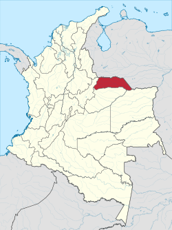
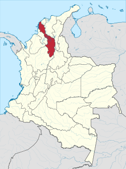
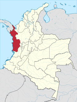
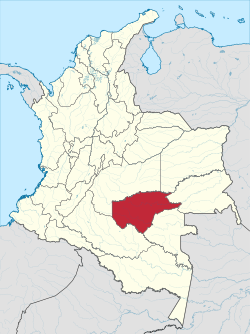
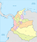
Colombia is a unitary republic made up of thirty-two administrative divisions referred to as departments (Spanish: departamentos, sing. departamento ) and one Capital District ( Distrito Capital ). [1] Departments are country subdivisions and are granted a certain degree of autonomy. Each department has a governor (gobernador) and an Assembly (Asamblea Departamental), elected by popular vote for a four-year period. The governor cannot be re-elected in consecutive periods.

Contents

Departments are formed by a grouping of municipalities (municipios, sing. municipio ). Municipal government is headed by mayor (alcalde) and administered by a municipal council (concejo municipal), both of which are elected by popular vote for four-year periods.

Some departments have subdivisions above the level of municipalities, commonly known as provinces.

Current departments

Departments of Colombia
IDRegion Capital Area (km2)Population (December 2022) [2] Density per
km2
Established as a departmentFlag Code Governor (2024–2027) [3] Party or Coalition [3]
00 Capital District Bogotá 1,5878,906,3424670.801861 Flag of Bogota.svg DC Carlos Fernando Galán New Liberalism
01 Amazonas Leticia 109,66582,0680.71991 Flag of Amazonas (Colombia).svg AMÓscar Enrique Sánchez Guerrero Historic Pact for Colombia
02 Antioquia Medellín 63,6126,887,306100.721886 Flag of Antioquia Department.svg ANAndrés Julián Rendón CardonaPor Antioquia Firme
03 Arauca Arauca 23,818304,97811.011991 Flag of Arauca.svg ARManuel Alexander Pérez Rueda Democratic Center
04 Atlántico Barranquilla 3,3882,804,025748.381910 Flag of Atlantico.svg AT Eduardo Verano de la Rosa Colombian Liberal Party
05 Bolívar Cartagena 25,9782,236,60379.691886 Flag of Bolivar (Colombia).svg BLYamil Hernando Arana PadauiBolivar Mejor
06 Boyacá Tunja 23,1891,259,60152.501824 Flag of Boyaca Department.svg BYCarlos Andrés Amaya RodriguezBoyacá Grande
07 Caldas Manizales 7,8881,036,455126.551905 Flag of Caldas.svg CLHenry Gutiérrez AngelPor El Caldas Que Quiere La Gente
08 Caquetá Florencia 88,965419,2754.521981 Flag of Caqueta.svg CQLuis Francisco Ruiz AguilarCoalición Revive Caqueta
09 Casanare Yopal 44,640442,0689.421991 Flag of Casanare Department.svg CSCésar Augusto Ortiz ZorroCoalición Por Casanare
10 Cauca Popayán 29,3081,516,01849.971824 Flag of Cauca Department.svg CAJorge Octavio Guzmán GutiérrezLa Fuerza Del Pueblo
11 Cesar Valledupar 22,9051,341,69752.421967 Flag of Cesar.svg CEElvia Milena Sanjuán DávilaEl Cesar En Marcha
12 Chocó Quibdó 46,530553,51911.491947 Flag of Choco.svg CHNubia Carolina Córdoba Curi Colombian Liberal Party
13 Córdoba Montería 25,0201,856,49671.331951 Flag of Cordoba Department.svg COErasmo Elías Zuleta BecharaCordoba Pr1mero
14 Cundinamarca Bogotá 24,2102,473,634120.571824 Flag of Cundinamarca.svg CUJorge Emilio Rey ÁngelCaminando, Escuchando, Gobernando
15 Guainía Inirida 72,23852,0610.671991 Flag of Guainia.svg GNArnulfo Rivera NaranjoCoalición Trabajemos Guainía
16 Guaviare San José del Guaviare   53,46090,3571.551991 Flag of Guaviare.svg GVYeison Ferney Rojas MartínezGuaviare Seguimos Avanzando
17 Huila Neiva 19,8901,140,93255.321910 Flag of Huila.svg HURodrigo Villaba MosqueraPor Un Huila Grande
18 La Guajira Riohacha 20,8481,002,39442.241965 Flag of La Guajira.svg LGJairo Alfonso Aguilar Deluque Union Party for the People, Radical Change, Independent Social Alliance, La Fuerza de la Paz and Partido Demócrata
19 Magdalena Santa Marta 23,1881,463,42757.861824 Flag of Magdalena.svg MARafael Alejandro MartínezFuerza Ciudadana
20 Meta Villavicencio 82,8051,080,70612.141959 Flag of Meta.svg MERafaela Cortés ZambranoCoalición Fe y Firmeza
21 Nariño Pasto 33,2681,629,18149.011910 Flag of Narino.svg NALuis Alfonso Escobar Jaramillo Historic Pact for Colombia
22 Norte de Santander Cúcuta 21,6581,651,27868.871910 Flag of Norte de Santander.svg NSWilliam Villamizar LaguadoCoalición Por Amor A Nuestra Gente Del Norte
23 Putumayo Mocoa 24,885369,06413.991991 Flag of Putumayo.svg PUCarlos Andrés Marroquín LunaCoalición Somos La Fuerza De La Gente
24 Quindío Armenia 1,845569,569292.631966 Flag of Quindio Department.svg QDJuan Miguel Galvis BedoyaCreemos Colombia
25 Risaralda Pereira 4,140977,829227.871966 Flag of Risaralda.svg RIJuan Diego Patiño Ochoa Colombian Liberal Party
26 San Andrés y Providencia    San Andrés 5265,2281178.461991 Flag of San Andres y Providencia.svg SANicolas Iván Gallardo VásquezCoalición Avanzar es Posible
27 Santander Bucaramanga 30,5372,324,09071.551886 Flag of Santander Department.svg STJuvenal Díaz MateusCoalición Es Tiempo Juvenal Gobernador
28 Sucre Sincelejo 10,917972,35082.891966 Flag of Sucre (Colombia).svg SULucy Inés García MontesCoalición Mujer de Resultados
29 Tolima Ibagué 23,5621,346,93556.451886 Flag of Tolima Department.svg TOAdriana Magali Matiz VargasCoalición Con Seguridad en el Territorio
30 Valle del Cauca Cali 22,1404,589,278202.161910 Flag of Valle del Cauca.svg VCDilian Francisca Toro TorresCoalición Unidos por el Valle
31 Vaupés Mitú 54,13548,9320.751991 Flag of Vaupes.svg VPLuis Alfredo Gutiérrez GarcíaGente en Movimiento
32 Vichada Puerto Carreño 100,242115,7781.081991 Flag of Vichada Department.svg VDHecson Alexys Benito Castro Union Party for the People

Indigenous territories

The indigenous territories are at the third level of administrative division in Colombia, as are the municipalities. Indigenous territories are created by agreement between the government and indigenous communities. In cases where indigenous territories cover more than one department or municipality, local governments jointly administer them with the indigenous councils, as set out in Articles 329 and 330 of the Colombian Constitution of 1991. Also indigenous territories may achieve local autonomy if they meet the requirements of the law.

Article 329 of the 1991 constitution recognizes the collective indigenous ownership of indigenous territories and repeats that are inalienable. Law 160 of 1994 created the National System of Agrarian Reform and Rural Development Campesino, and replaced Law 135 of 1961 on Agrarian Social Reform; it establishes and sets out the functions of INCORA, one of the most important being to declare which territories will acquire the status of indigenous protection and what extension of existing ones will be allowed. Decree 2164 of 1995 interprets Law 160 of 1994, providing, among other things, a legal definition of indigenous territories. [4]

Indigenous territories in Colombia are mostly in the departments of Amazonas, Cauca, La Guajira, Guaviare, and Vaupés. [1]

History

Historical predecessors of current departments

Evolution of Colombian departments
Colombia in 1824.svg
1824
Colombia in 1886.svg
1886
Colombia in 1905.svg
1905
Colombia in 1908.svg
1908
Colombia in 1912.svg
1912
Colombia in 1916.svg
1916
Colombia in 1928.svg
1928
Colombia in 1942.svg
1942
Colombia in 1958.svg
1958
Colombia in 1966.svg
1966
Colombia in 1990.svg
1990
Colombia in 2000.svg
Present day
Current name and flagEstablished as a departmentName at time of establishmentEstablishment of earliest territorial predecessorSovereign State that established the earliest territorial predecessor
Flag of Amazonas (Colombia).svg  Amazonas 1991Intendancy of Amazonas1931Flag of Colombia.svg  Republic of Colombia
Flag of Antioquia Department.svg  Antioquia 1886Province of Antioquia1576Royal Banner of the Crown of Castille (Habsburg Style).svg  Crown of Castile
Flag of Arauca.svg  Arauca 1991Commissary of Arauca1911Flag of Colombia.svg  Republic of Colombia
Flag of Atlantico.svg  Atlántico 1910Province of Sabanilla1852Flag of New Granada.svg  Republic of New Granada
Flag of Bogota.svg  Bogotá 1861Federal District of Bogotá1861Flag of New Granada.svg  Granadine Confederation
Flag of Bolivar Department.svg  Bolívar 1886Province of Cartagena1533Royal Banner of the Crown of Castille (Habsburg Style).svg  Crown of Castile
Flag of Boyaca Department.svg  Boyacá 1824Province of Tunja1539Royal Banner of the Crown of Castille (Habsburg Style).svg  Crown of Castile
Flag of Caldas.svg  Caldas 1905Department of Caldas1905Flag of Colombia.svg  Republic of Colombia
Flag of Caqueta.svg  Caquetá 1981Intendancy of Caquetá1905Flag of Colombia.svg  Republic of Colombia
Flag of Casanare Department.svg  Casanare 1991Province of Casanare1660Royal Banner of the Crown of Castille (Habsburg Style).svg  Crown of Castile
Flag of Cauca.svg  Cauca 1824Province of Popayán1537Royal Banner of the Crown of Castille (Habsburg Style).svg  Crown of Castile
Flag of Cesar.svg  Cesar 1967Department of Cesar1967Flag of Colombia.svg  Republic of Colombia
Flag of Choco.svg  Chocó 1947Province of Chocó1726Bandera de Espana 1701-1748.svg  Kingdom of Spain
Flag of Cordoba.svg  Córdoba 1951Department of Córdoba1951Flag of Colombia.svg  Republic of Colombia
Flag of Cundinamarca.svg  Cundinamarca 1824Province of Santafé de Bogotá1550Royal Banner of the Crown of Castille (Habsburg Style).svg  Crown of Castile
Flag of Guainia.svg  Guainía 1991Commissary of Guainía1963Flag of Colombia.svg  Republic of Colombia
Flag of Guaviare.svg  Guaviare 1991Commissary of Guaviare1977Flag of Colombia.svg  Republic of Colombia
Flag of Huila.svg  Huila 1910Province of Neiva1610Royal Banner of the Crown of Castille (Habsburg Style).svg  Crown of Castile
Flag of La Guajira.svg  La Guajira 1965Province of Riohacha1789Flag of Spain (1785-1873, 1875-1931).svg  Kingdom of Spain
Flag of Magdalena.svg  Magdalena 1824Province of Santa Marta1533Royal Banner of the Crown of Castille (Habsburg Style).svg  Crown of Castile
Flag of Meta.svg  Meta 1959Intendancy of Meta1905Flag of Colombia.svg  Republic of Colombia
Flag of Narino.svg  Nariño 1910Province of Pasto1823Flag of Gran Colombia.svg  Republic of Colombia
Flag of Norte de Santander.svg  Norte de Santander 1910Province of Pamplona1555Royal Banner of the Crown of Castille (Habsburg Style).svg  Crown of Castile
Flag of Putumayo.svg  Putumayo 1991Commissary of Putumayo1912Flag of Colombia.svg  Republic of Colombia
Flag of Quindio.svg  Quindío 1966Department of Quindío1966Flag of Colombia.svg  Republic of Colombia
Flag of Risaralda.svg  Risaralda 1966Department of Risaralda1966Flag of Colombia.svg  Republic of Colombia
Flag of San Andres y Providencia.svg  San Andrés y Providencia 1991Providence Island Colony1630Flag of England.svg  Kingdom of England
Flag of Santander Department.svg  Santander 1886Province of Socorro1795Flag of Spain (1785-1873, 1875-1931).svg  Kingdom of Spain
Flag of Sucre Department.svg  Sucre 1966Department of Sucre1966Flag of Colombia.svg  Republic of Colombia
Flag of Tolima.svg  Tolima 1886Province of Mariquita1550Royal Banner of the Crown of Castille (Habsburg Style).svg  Crown of Castile
Flag of Valle del Cauca.svg  Valle del Cauca 1910Province of Cauca1835Flag of New Granada.svg  Republic of New Granada
Flag of Vaupes.svg  Vaupés 1991Commissary of Vaupés1910Flag of Colombia.svg  Republic of Colombia
Flag of Vichada.svg  Vichada 1991Commissary of Vichada1913Flag of Colombia.svg  Republic of Colombia

The Republic of Gran Colombia

When it was first established in 1819, The Republic of Gran Colombia had three departments. Venezuela, Cundinamarca (now Colombia) and Quito (now Ecuador). [5] In 1824, the Distrito del Centro (which became Colombia) was divided into five departments and further divided into seventeen provinces. One department, Isthmus Department, consisting of two provinces, later became the sovereign country of Panama. [6]

Republic of New Granada

With the dissolution of Gran Colombia in 1826 by the Revolution of the Morrocoyes (La Cosiata), New Granada kept its 17 provinces. In 1832 the provinces of Vélez and Barbacoas were created, and in 1835 those of Buenaventura and Pasto were added. In 1843 those of Cauca, Mompós and Túquerres were created. At this time the cantons (cantones) and parish districts were created, which provided the basis for the present-day municipalities. [6] [7]

By 1853 the number of provinces had increased to thirty-six, namely:Antioquia, Azuero, Barbacoas, Bogotá, Buenaventura, Cartagena, Casanare, Cauca, Chiriquí, Chocó, Córdova, Cundinamarca, García Rovira, Mariquita, Medellín, Mompós, Neiva, Ocaña, Pamplona, Panamá, Pasto, Popayán, Riohacha, Sabanilla, Santa Marta, Santander, Socorro, Soto, Tequendama, Tunja, Tundama, Túquerres, Valle de Upar, Veraguas, Vélez and Zipaquirá. [7] However, the new constitution of 1853 introduced federalism, which lead to the consolidation of provinces into states. By 1858 this process was complete, with a resulting eight federal states: Panamá was formed in 1855, Antioquia in 1856, Santander in May 1857, and Bolívar, Boyacá, Cauca, Cundinamarca and Magdalena were formed in June 1858. 1861 saw the creation of the final federal state of Tolima. [8]

Republic of Colombia

The Colombian Constitution of 1886 converted the states of Colombia into departments, with the state presidents renamed as governors. The states formed the following original departments:

See also

References

  1. 1 2 "Division Política de Colombia" (in Spanish). Portal ColombiaYA.com. Archived from the original on 10 March 2009.
  2. "Archive copy". Archived from the original on 2011-05-17.{{cite web}}: CS1 maint: archived copy as title (link)
  3. 1 2 "Elecciones Territoriales 2023 - Resultados Electorales". La República (in Spanish). Retrieved 2024-01-15.
  4. Decree 2164 of 1995 provides "Reserva Indígena. Es un globo de terreno baldío ocupado por una o varias comunidades indígenas que fué delimitado y legalmente asignado por el INCORA a aquellas para que ejerzan en él los derechos de uso y usufructo con exclusión de terceros. Las reservas indígenas constituyen tierras comunales de grupos étnicos, para los fines previstos en el artículo 63 de la Constitución Política y la ley 21 de 1991. [...] Territorios Indígenas. Son las áreas poseidas en forma regular y permanente por una comunidad, parcialidad o grupo indígena y aquellas que, aunque no se encuentren poseidas en esa forma, constituyen el ámbito tradicional de sus actividades sociales, económicas y culturales. " Art. 21: "Los resguardos son una institución legal y sociopolítica de carácter especial, conformada por una o más comunidades indígenas, que con un título de propiedad colectiva que goza de las garantías de la propiedad privada, poseen su territorio y se rigen para el manejo de éste y su vida interna por una organización autónoma amparada por el fuero indígena y su sistema normativo propio."
  5. Guhl Nannetti, Ernesto (1991). "Capítulo XII: División Política de la Gran Colombia". Las fronteras políticas y los límites naturales: escritos geograficos[Political Boundaries and Their Natural Limits: Geographic writings] (in Spanish). Bogotá: Fondo FEN. ISBN   978-958-9129-22-7.
  6. 1 2 Aguilera Peña, Mario (January 2002). "División política administrativa de Colombia". Credential Historia (in Spanish). Bogotá: Banco de la República. Archived from the original on 16 February 2011.
  7. 1 2 Oficina Nacional de Estadística (Office of National Statistics) (1876). "Estadística de Colombia" [Colombian Statistics](PDF) (in Spanish). Bogotá: Oficina Nacional de Estadística. Retrieved 23 November 2016.[ permanent dead link ]
  8. Domínguez, Camilo; Chaparro, Jeffer; Gómez, Carla (2006). "Construcción y deconstrucción territorial del Caribe Colombiano durante el siglo XIX". Scripta Nova (Revista Electrónica de Geografía y Ciencias Sociales). 10 (218 (75)).